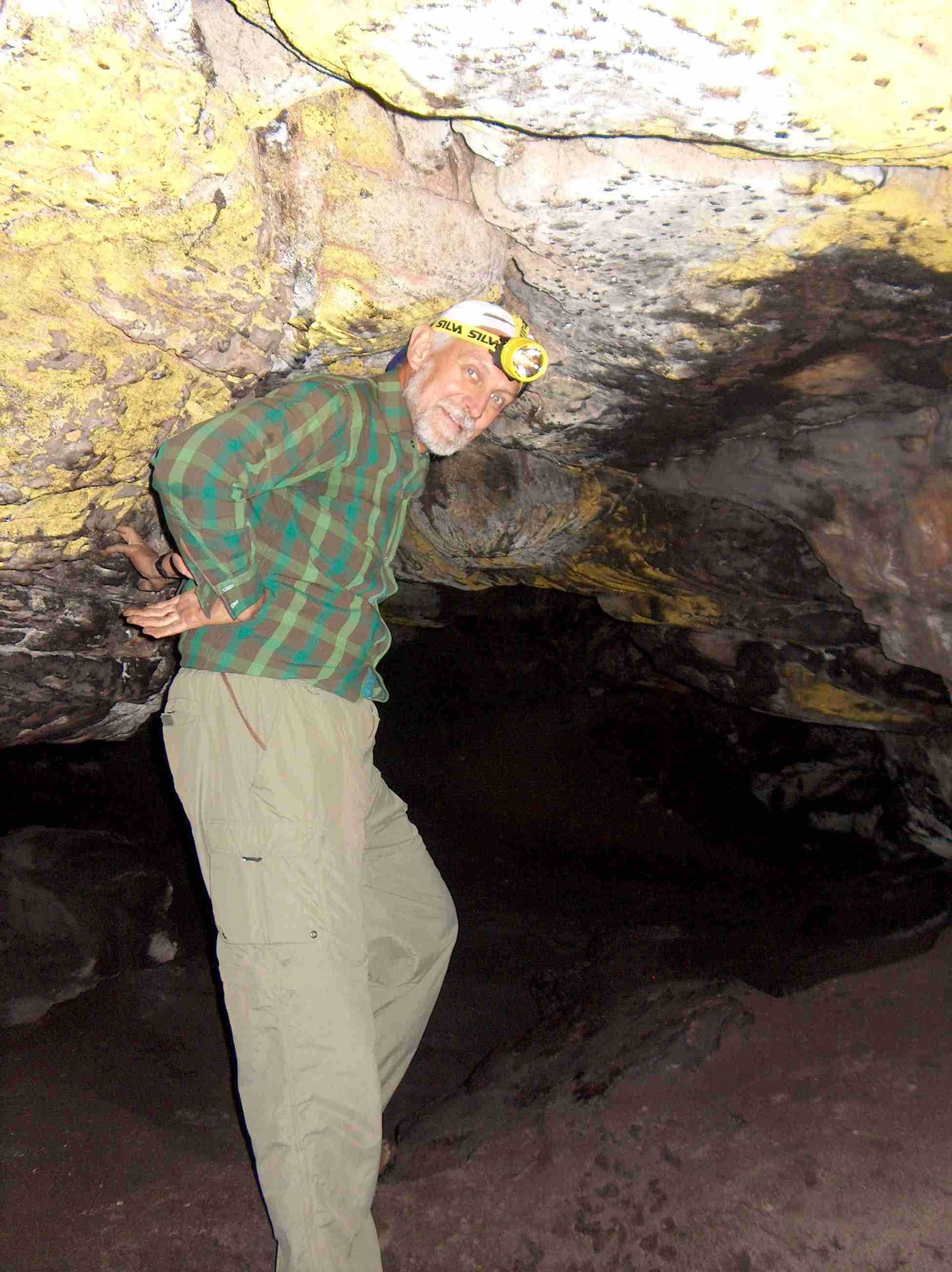
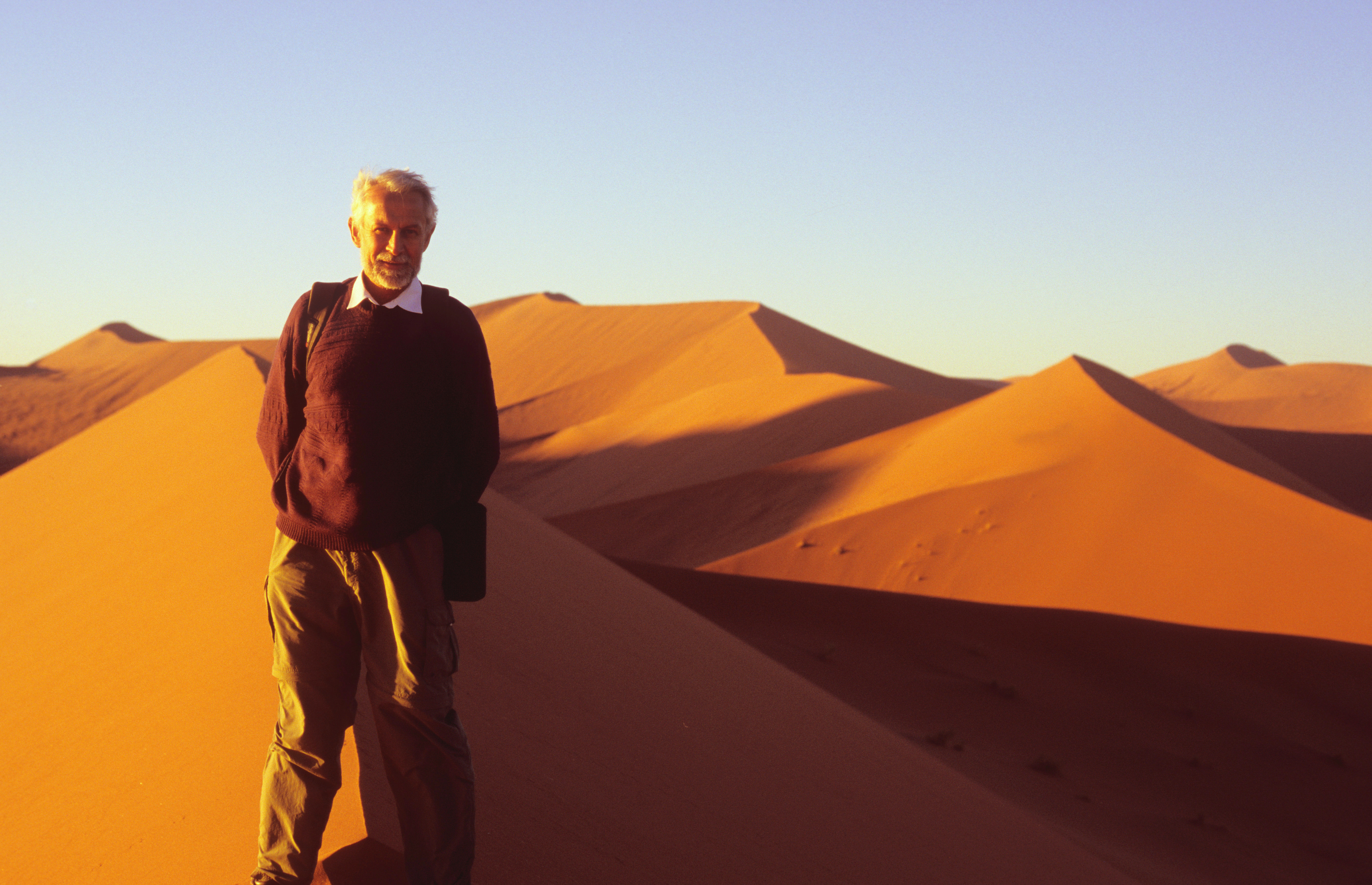
 , in 2004 during a hike in sandstone caves between Cape Town and the Cape of Good Hope (photo by Charles Hellaby).
It is only at the initial stage of creation. It will contain more information later .
This is me as a traveller , in 2004 during a hike in sandstone caves between Cape Town and the Cape of Good Hope (photo by Charles Hellaby).
My professional career included several working visits abroad and trips to scientific meetings. Some of those visits gave me opportunities to see places of outstanding beauty. This page contains images from a few of my favourite places.
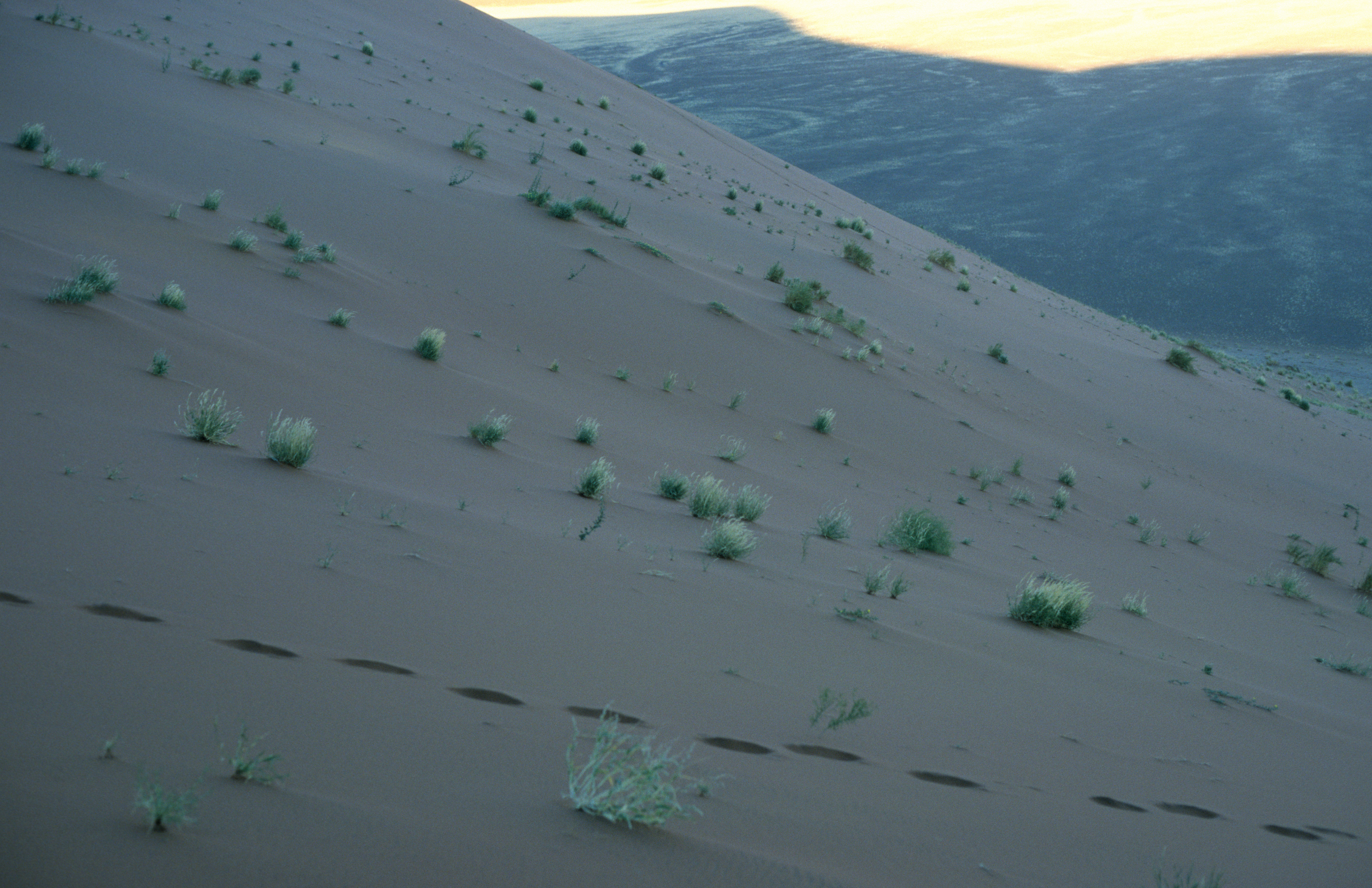
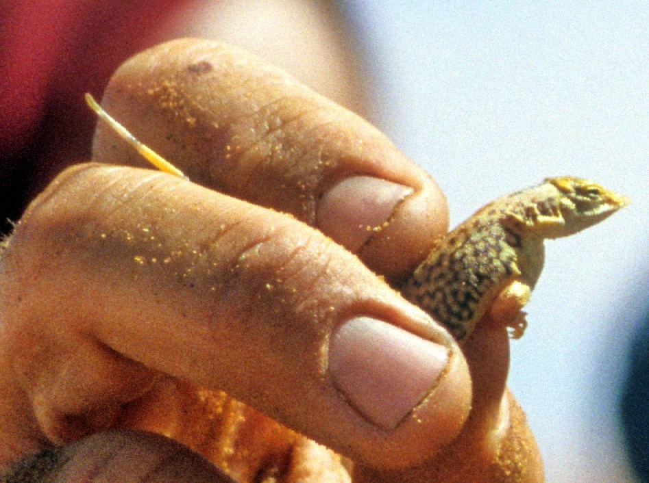
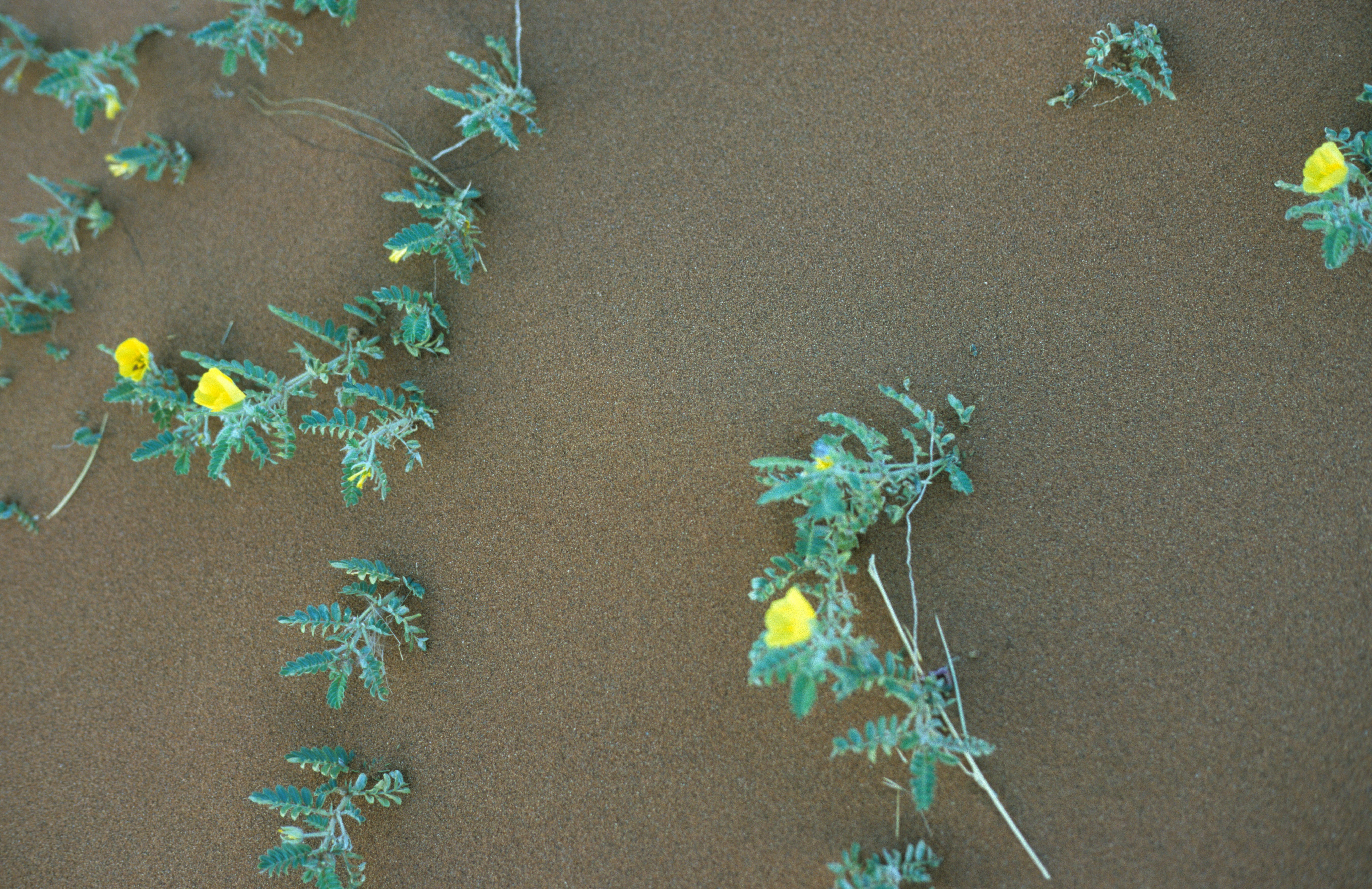
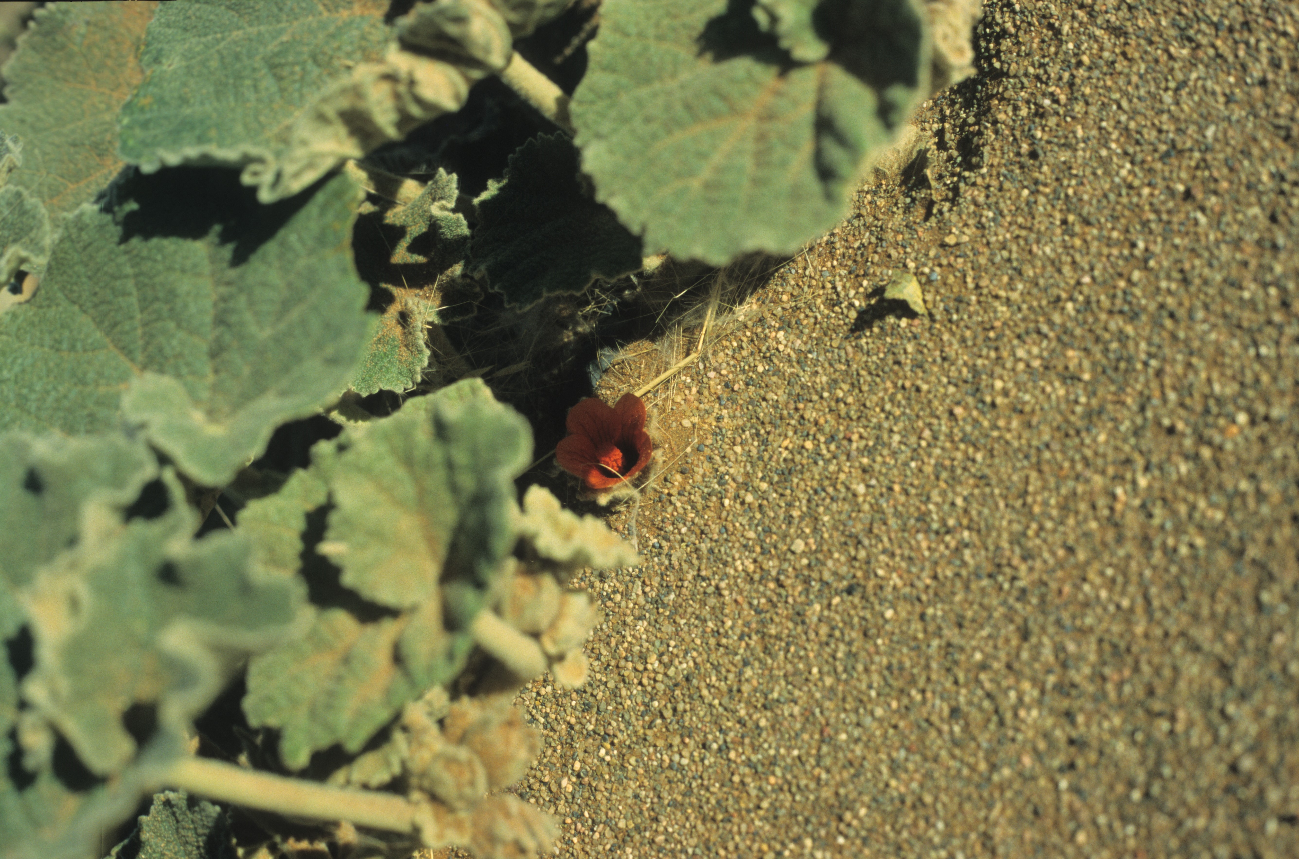
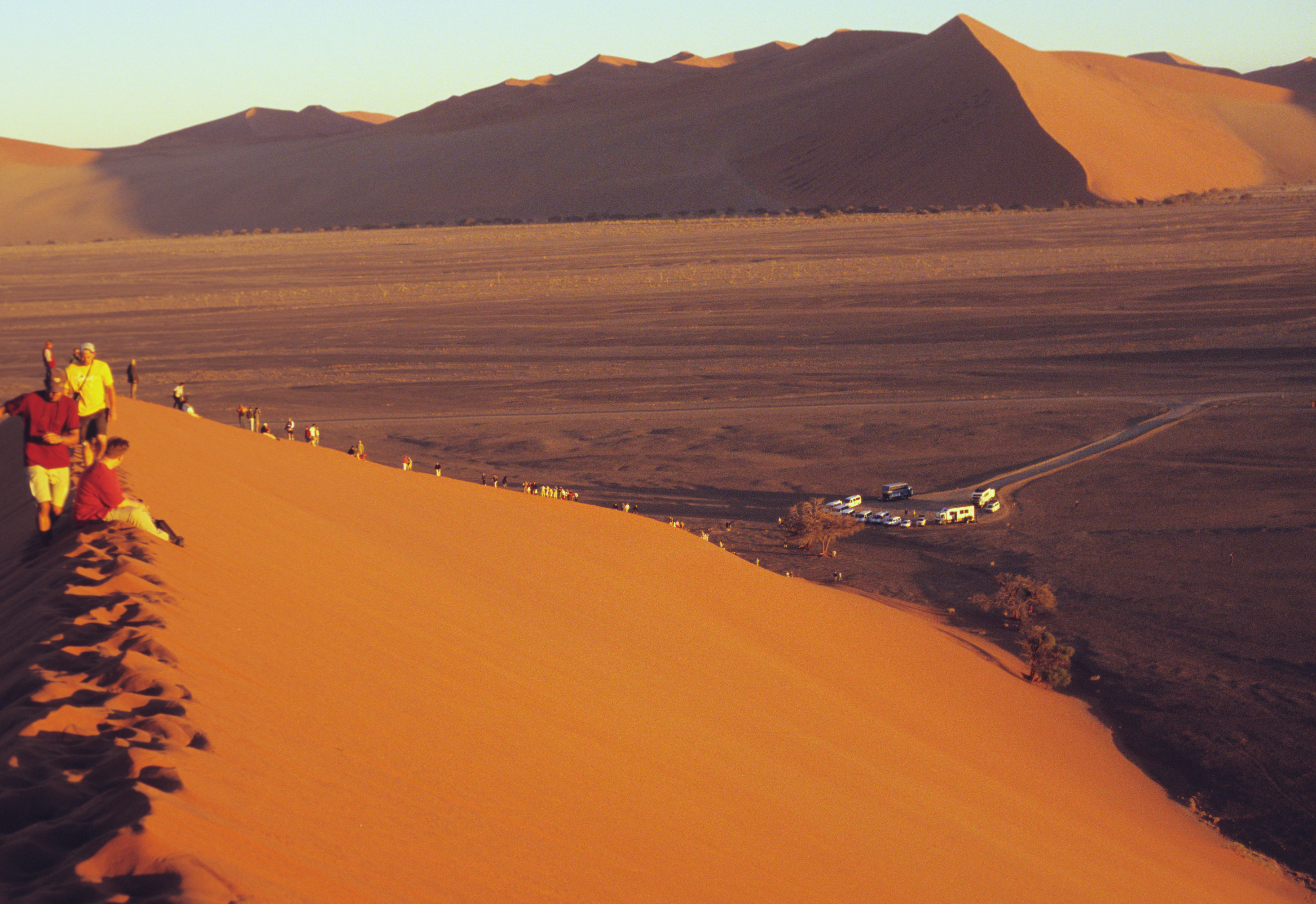
The most unusual of the places I have seen was the Namib desert 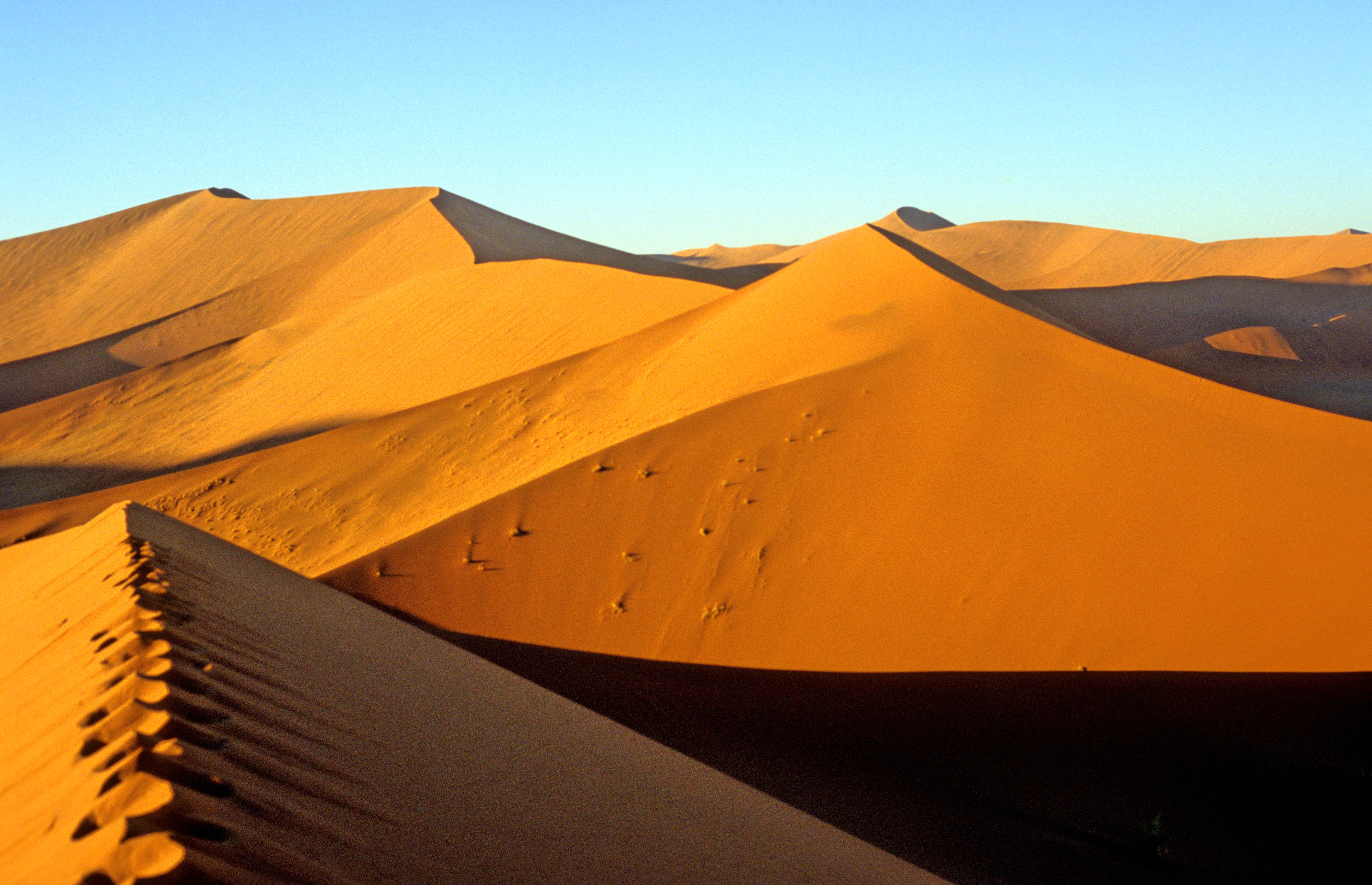 in southern Africa, in the country of Namibia. Its sand is indeed as intensive orange as in the pictures, because of the iron oxide it contains. The sand gets hot at noon, but is delightfully cool at sunrise. Although the desert is very dry, the coolness of the night brings light fog with it, and the fog contains enough water to feed a number of plant and animal species. The plants in the picture anchor the dunes so that they grow upwards rather than wander with the wind. The highest dune is some 300 meters high, the Dune 45 is about 150 meters high. The lizard in the second picture is remarkable for the speed with which it can bury itself in the sand. When in danger, it disappears in a fraction of a second. On rare occasions when it rains there, for the next few days the desert displays lots of colourful flowers, some of them yellow , some red . Even some large plants are able to survive under such conditions - for example, in front of the Dune 45, ascended at sunrise by all visitors , a tree lives on (there are more trees there than you would expect, in some places they form long shady alleys).
Most of Namibian territory is occupied by deserts and has murderously hot climate. Still, the country is exceptionally beautiful and its inhabitants make respectable efforts to make it attractive and comfortable for tourists. Tourism is Namibia`s best chance for future prosperity - as the plentiful natural resources cannot be properly used by the feeble national economy and mostly enrich alien powers. The best time for a visit is the southern hemisphere winter, July to September - by then, cool days can occur even in the middle of a desert.
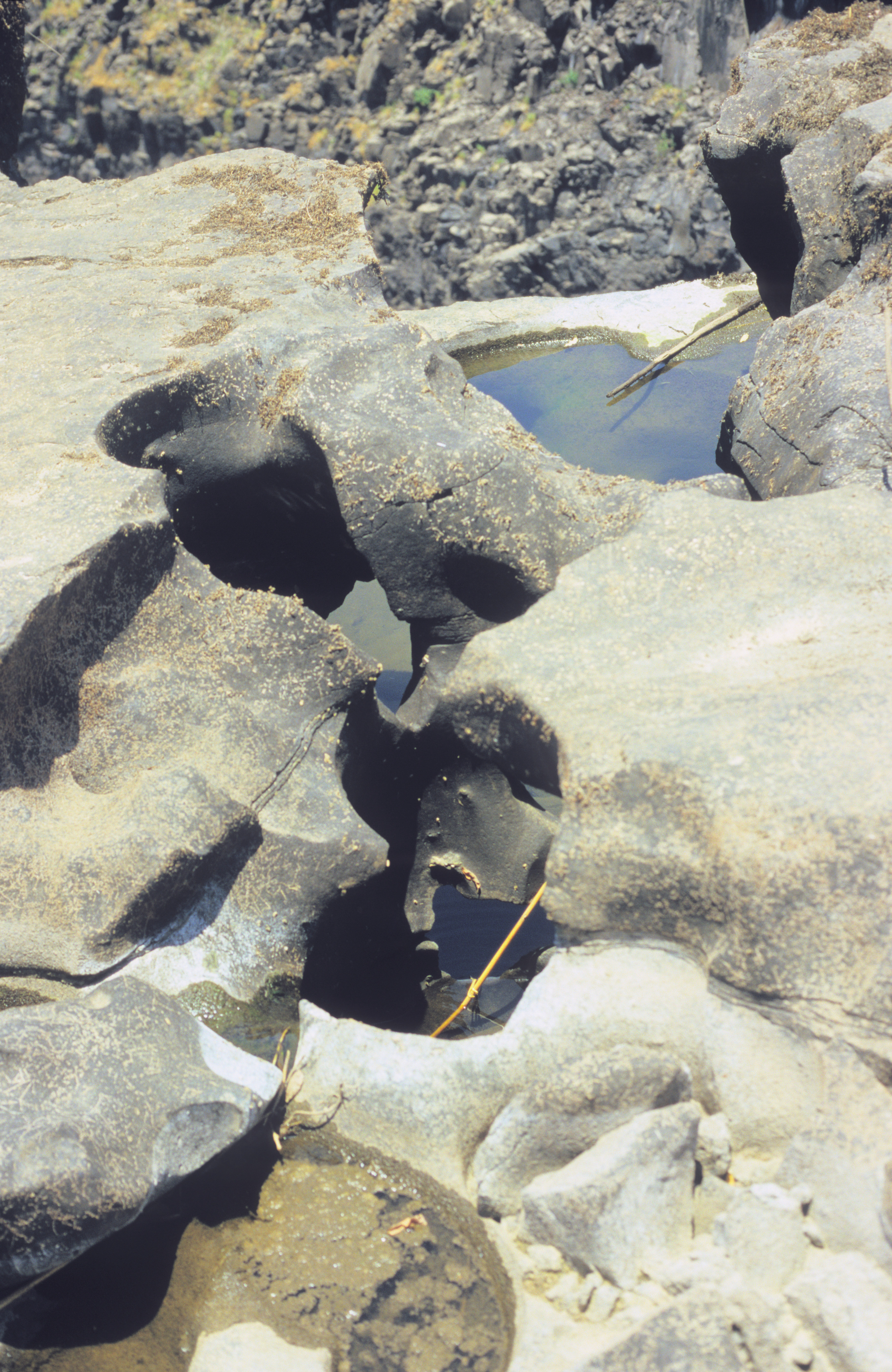
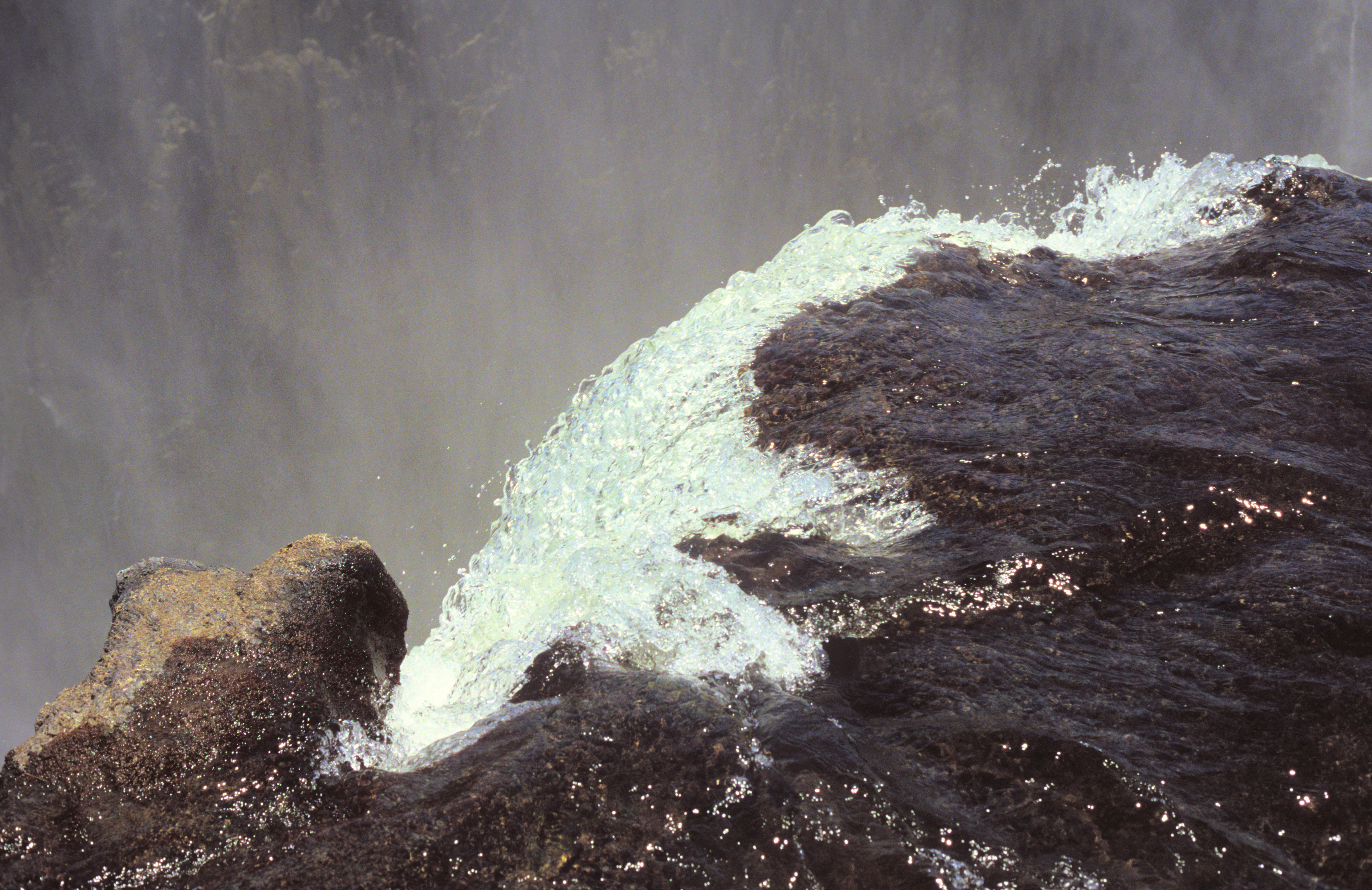
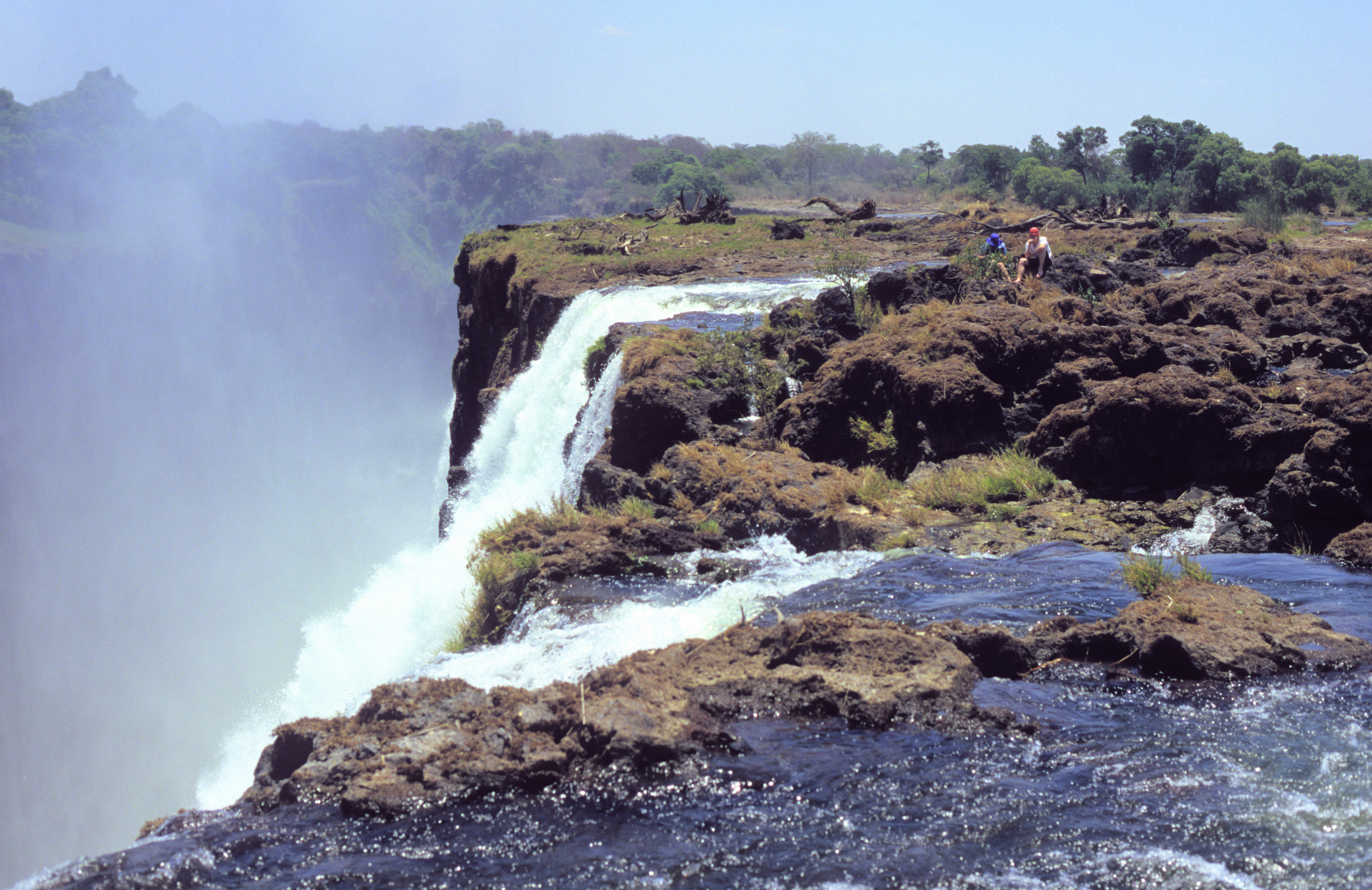
Speaking about southern Africa, another of its wonders are the Victoria Falls 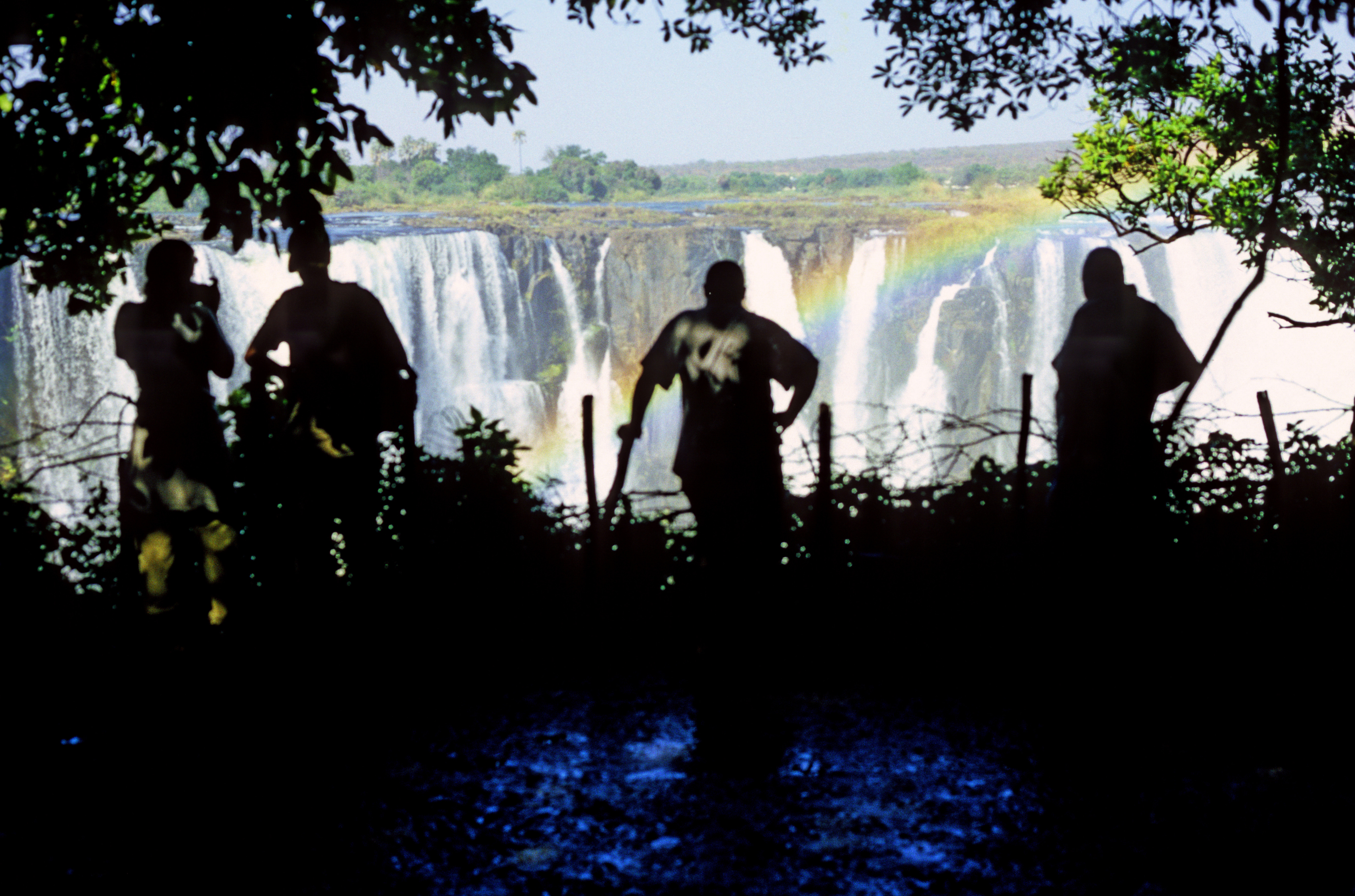 on the Zambezi river, on the border between Zambia and Zimbabwe. The sharply visible rainbow is almost always there, as the huge watermass gets split into tiny droplets. In consequence, the whole neighbourhood gets a gentle spray all the time. With plenty of sunlight and warmth (oh! - it was horribly hot when I was there in November 2004), this creates wonderful conditions for plants , of which there are numerous species. The Falls look most impressive during the wet season (April - May). In the dry season the river width is about 1/3 of the maximum. Unluckily for me, this is when I visited the place. But that gave me two unique opportunities. One was to see the rocky riverbed , which is normally hidden under flowing water. The rock is eroded into structures that remind of a magnified sponge, with winding tunnels of complicated shapes. The other was the possibility to look into the canyon from a place close to the waterfall edge, also hidden under water during the wet season. The view from above on several river channels taking a jump into the abyss is scary and mesmerising.
Zimbabwe has the bad fame of one of the last communist countries in the world, governed by a ruthless dictator. Actually, its people, although desperately poor and unhappy about it, are very friendly, and this includes, surprisingly, also the border guards, who are relaxed and helpful. The crossover to Zambia goes smoothly and fast, and there is no problem with it even if you have a one-entry visa of Zimbabwe - this does not count as leaving Zimbabwe. Zambian side offers a different, interesting perspective on the Falls (the riverbed picture was taken there), and, at least in the dry season, allows you to look into the gorge from above the edge of the 100-meter abyss.
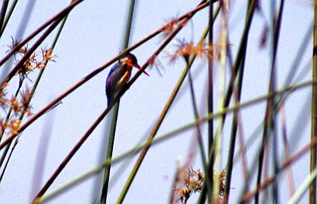
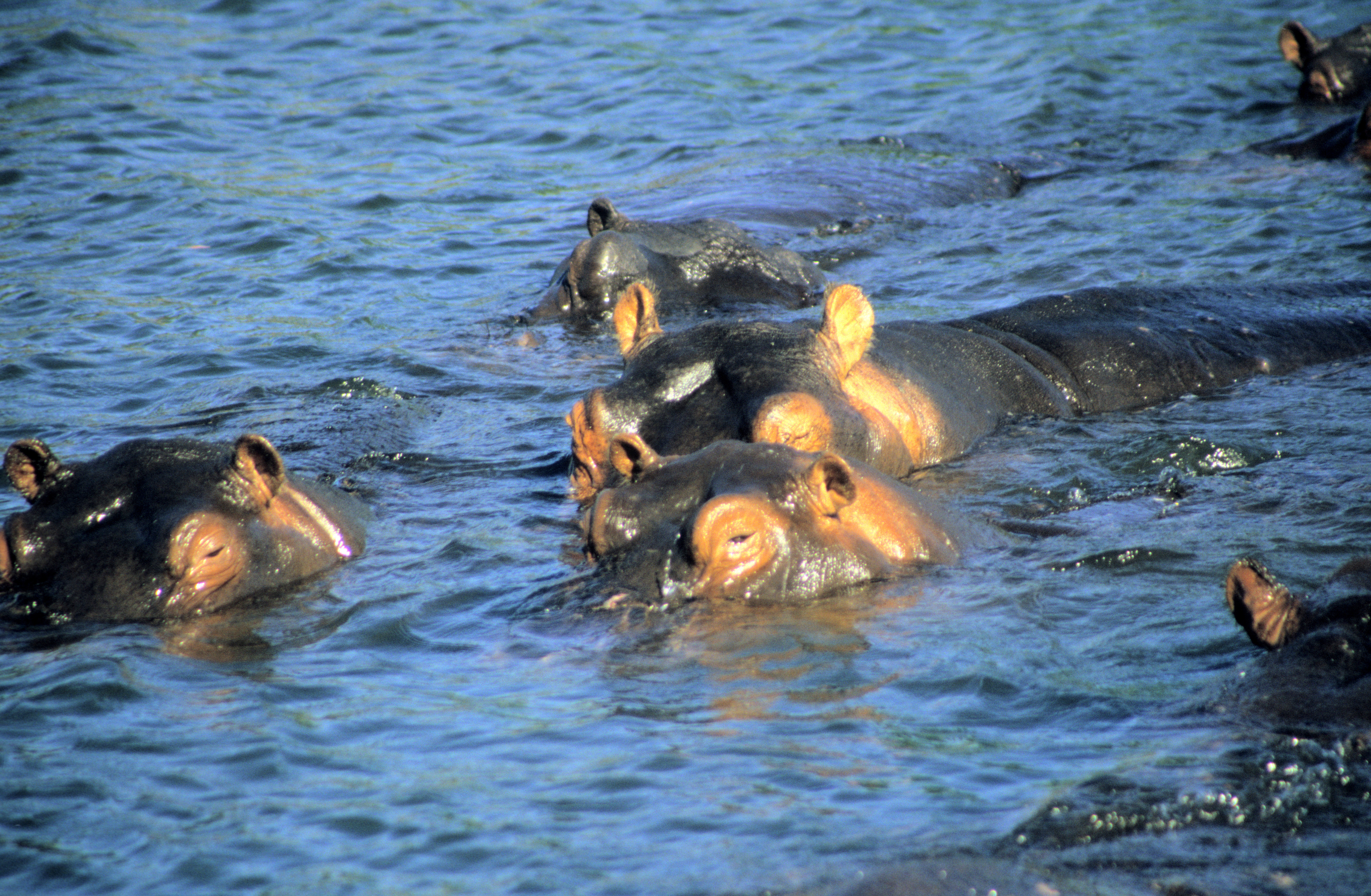
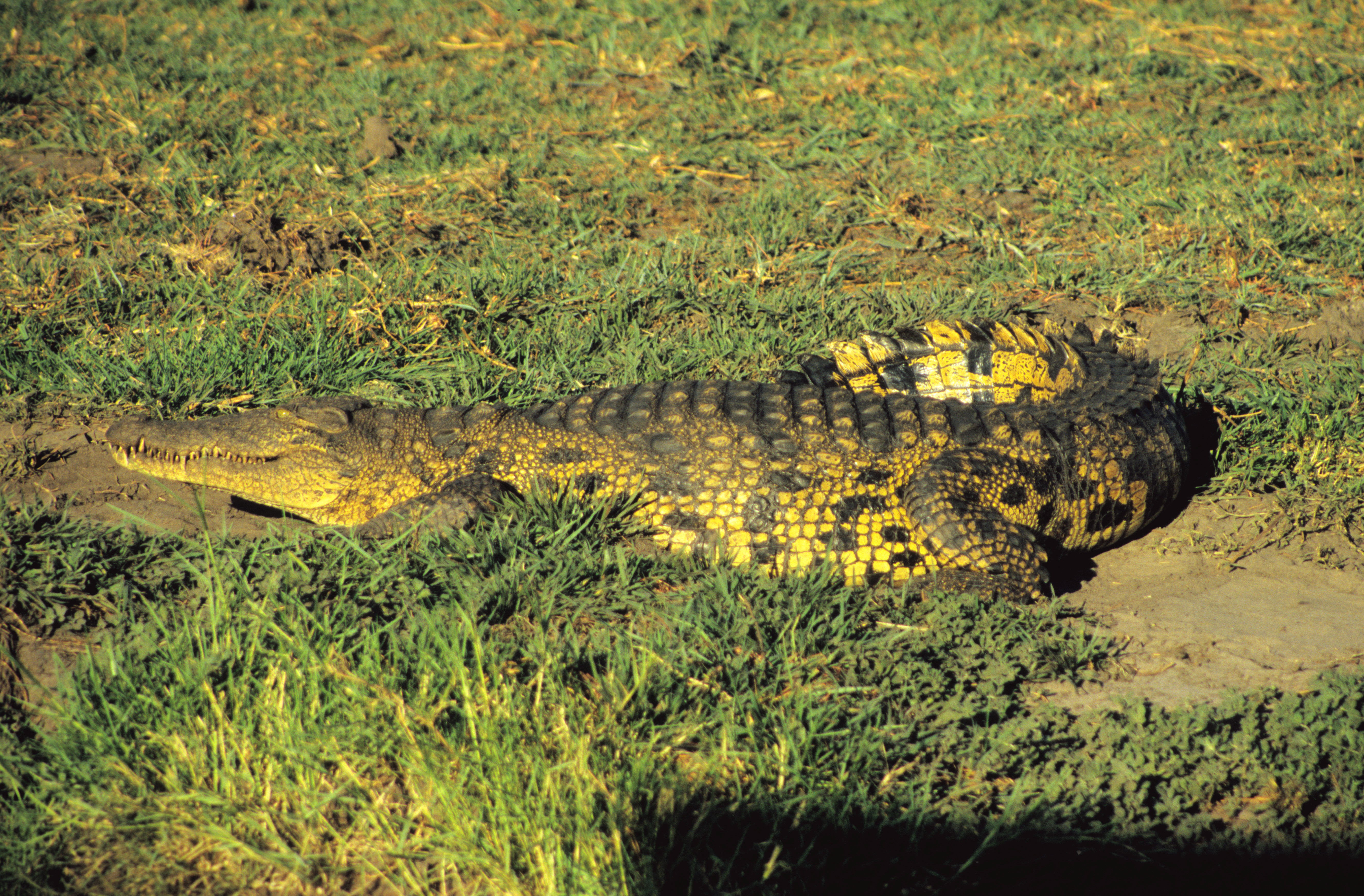
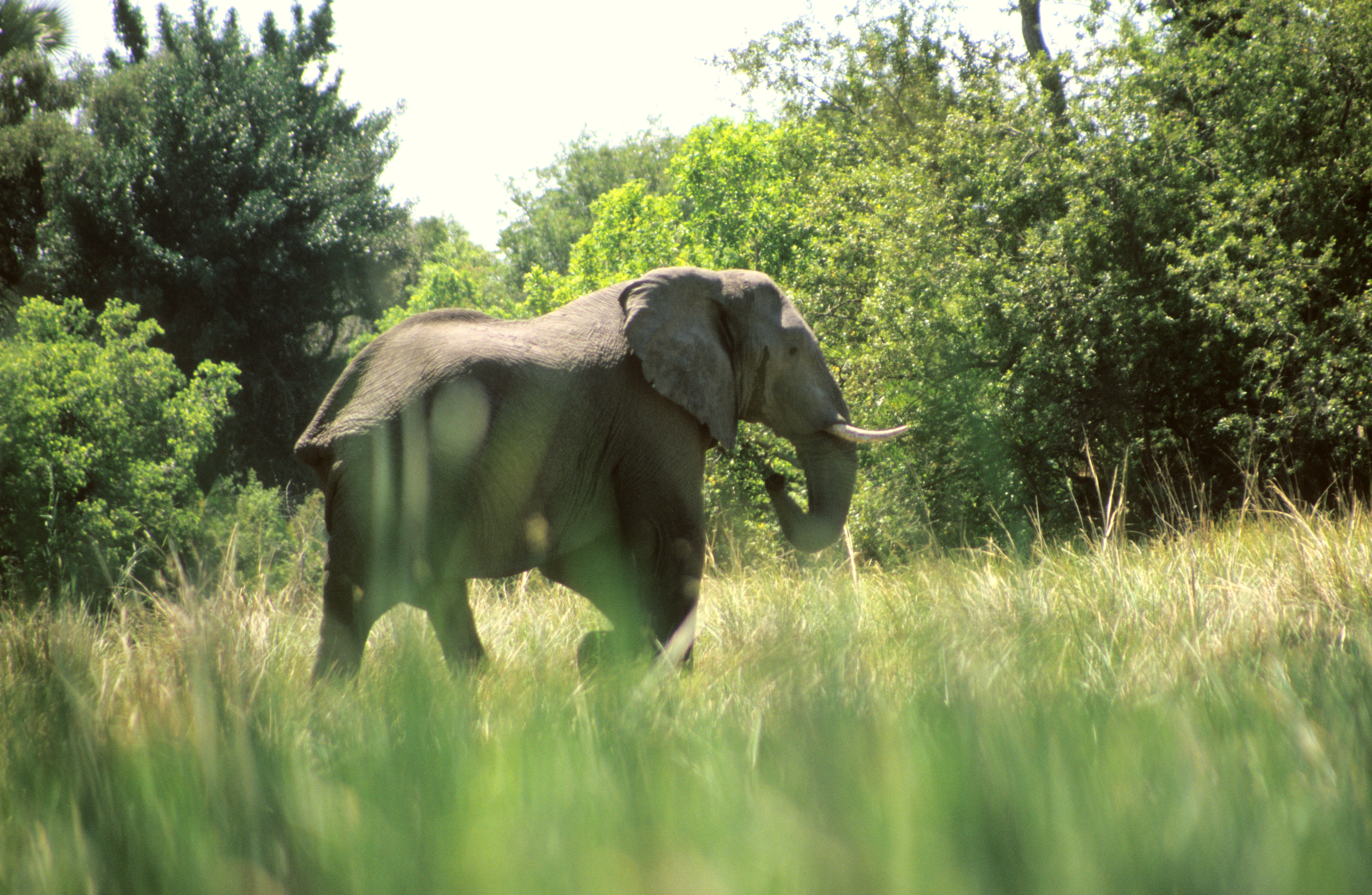
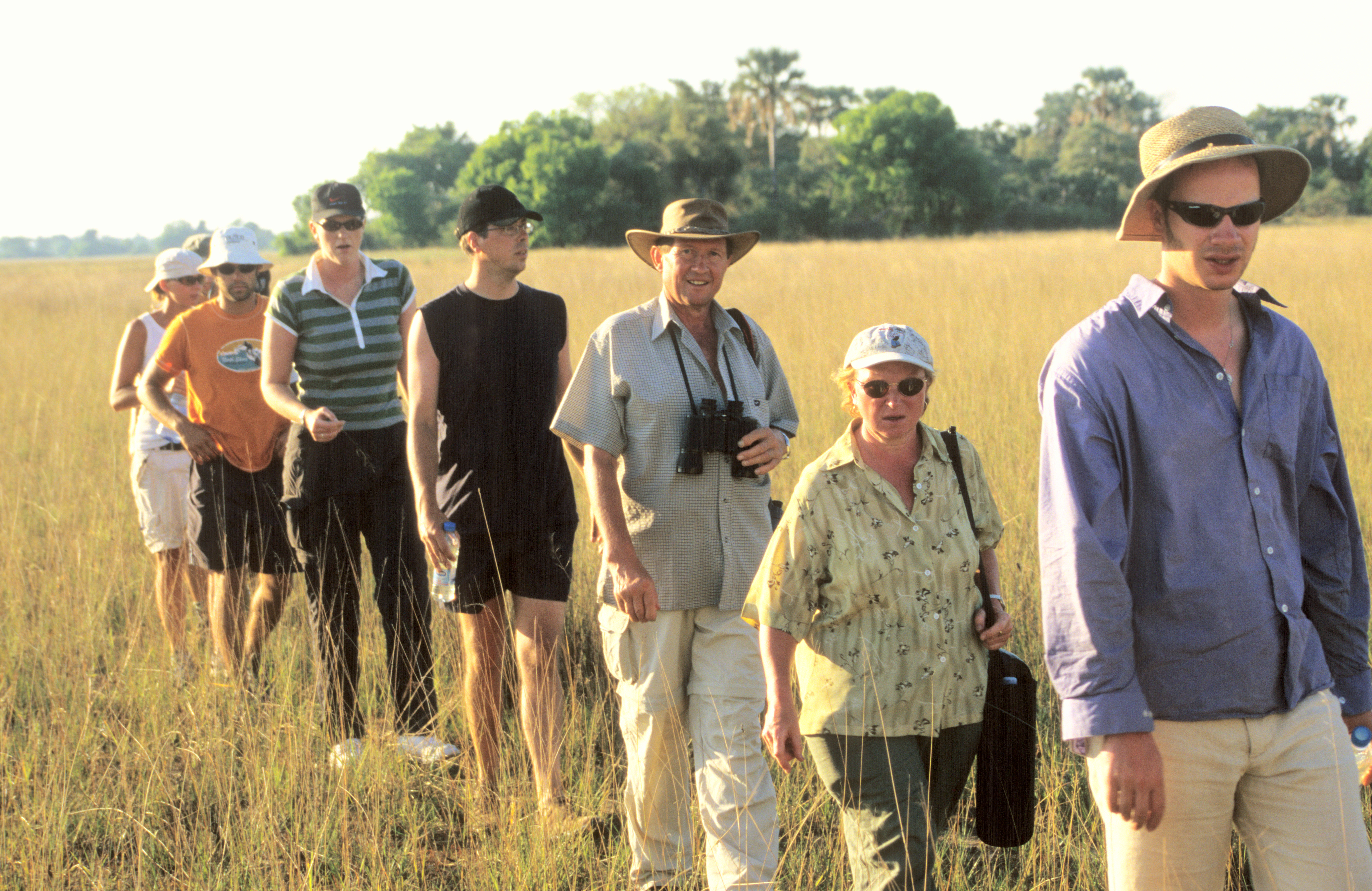
Not far from there is another wonder: the Okavango delta 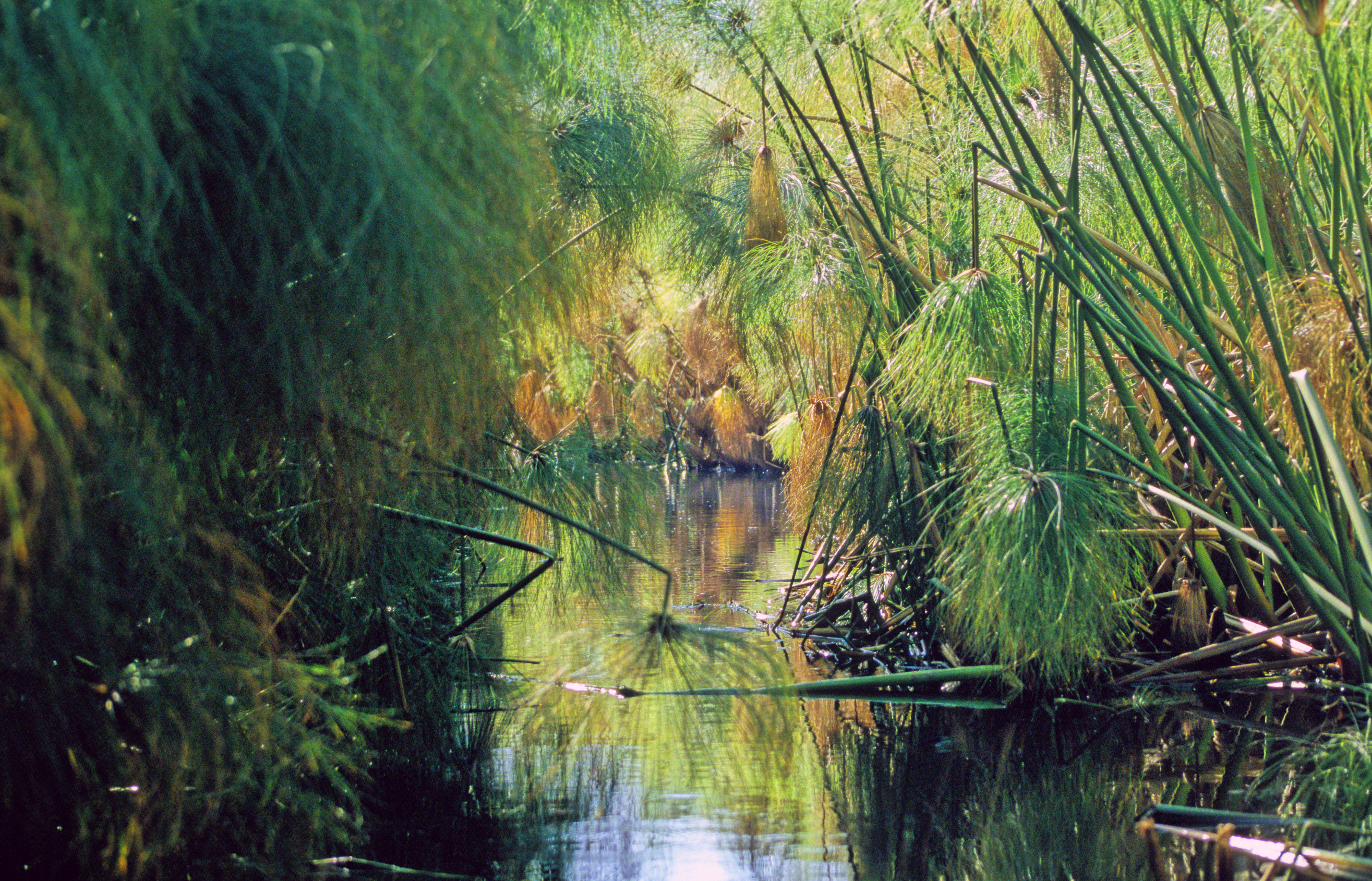 , situated in the north-west of Botswana. The picture shows a sight of one of the access channels, travelled by motorboats, that wind among papyrus bushes 3 to 4 meters high. It is a huge river delta of the same type that usually forms where a river flows into a sea, except that there is no sea for hundreds of kilometers. The Okavango river flows into the Kalahari desert, disperses into tens of separate channels, and all of them just disappear in the sand. But before they do, they support a magnificent ecosystem with lots of animals, among them beautiful birds like African jacana and sunbird , and dense plant vegetation. (The sunbird is so tiny that automatic focus in the camera just does not see it!) The sightseeing is done with little dugout (oh, well... today they are made of fiber glass) canoes called mokoro . The polers are local people who are convinced that their real names are too difficult to pronounce for the foreigners (we never learned those names), so they use nicknames that are abstract notions, like "Collection". The poler seen in the boat with me had the nickname "Action". It is quite exciting so see a hippo or a crocodile from close up (to be honest, the pictures of the hippos and of the crocodile were taken on the Chobe river, not far from Okavango). One can walk on the grassy plains between the river arms, and there is a good chance of meeting an elephant , with no protective barrier between you and him. Elephants are moody, and quite dangerous when in bad mood, so walking is allowed only in large groups accompanied by a local guide. The guides know efficient ways od discouraging the elephants from attacking - some people in our tour group experienced that. The guides can also tell one species of birds from another from such a distance that you yourself would not tell a bird from an antelope. The trip is straining because of scorching heat and lack of good-quality water -- the river water is yellow and looks dirty, although it is said to be drinkable. The proximity of water does not make the heat more tolerable. On the contrary, the glaring reflection of sunlight from water, together with the windshield provided by the papyrus and cane bushes, intensify the heat. I got burns on my fingers, exposed to the sunlight because I kept my camera ready to shoot almost all the time. But the positive impressions definitely prevail. Do you know that elephants walk so gently that you cannot hear them at all, unless they happen to walk through water or through a swamp?
-----------------------------------------------------------------
Southern Africa has many more wonders, but after all this is not a guidebook, so I have to stop at some point. Among the other wonders let me only mention the windy fields of the Cape of Good Hope, the whale sightings in the Hermanus bay east of Cape Town, the penguin colony in Boulders Beach south of Cape Town, the magnificent old diamond mine in Kimberley, the second largest canyon in the world - the Fish River Canyon in southern Namibia, the Kruger National Park in the east of South Africa, where you can see all of the African animals living in freedom... Well, if you can go there, do not hesitate.
North America - for someone interested in natural wonders that is first of all the national parks of the U. S. A. (Mexico has also many wonders of Nature, but while I was there, I was most keen to climb the high mountains - see the mountaineering section of this page. Other than that, I visited only the buildings and ruins of the ancient Mexican civilisations, which was very interesting, but this is not really my area of expertise, so I would rather not discuss that subject.)
It is fashionable to snipe at the USA, so let me begin with a snipe. I was astonished that even educated Americans are convinced that the European architectural styles of yore are just a question of shape - so you can build a Gothic cathedral even today. Consequently, they say in earnest that the campus of the University of Colorado at Boulder, built in the 1950s, is in the Italian Renaissance style, that the University of Chicago campus, built around 1930, is in the Gothic style, and that a Gothic cathedral was in the course of construction in 1989 in Washington, D.C.
With the sniping done, let us discuss the positive impressions. Together with my wife Krystyna, daughter Julia (then aged 12) and son Antoni (then 14), in a rented car, I did a 2-month tour of the national parks in the western part of the USA in July-August 1989. We traveled some 13 000 miles (some 21 000 kilometers), visited 35 national parks, and this was the longest and most magnificent journey of my life. Then, in 2004, together with Krystyna, we visited Antoni, who had in the meantime settled for good in the USA. By then, we dropped by two of our favourite places (the Grand Canyon and the Petrified Forest), and visited some more interesting places in California and Arizona. A short selection of the most remarkable memories from both travels:
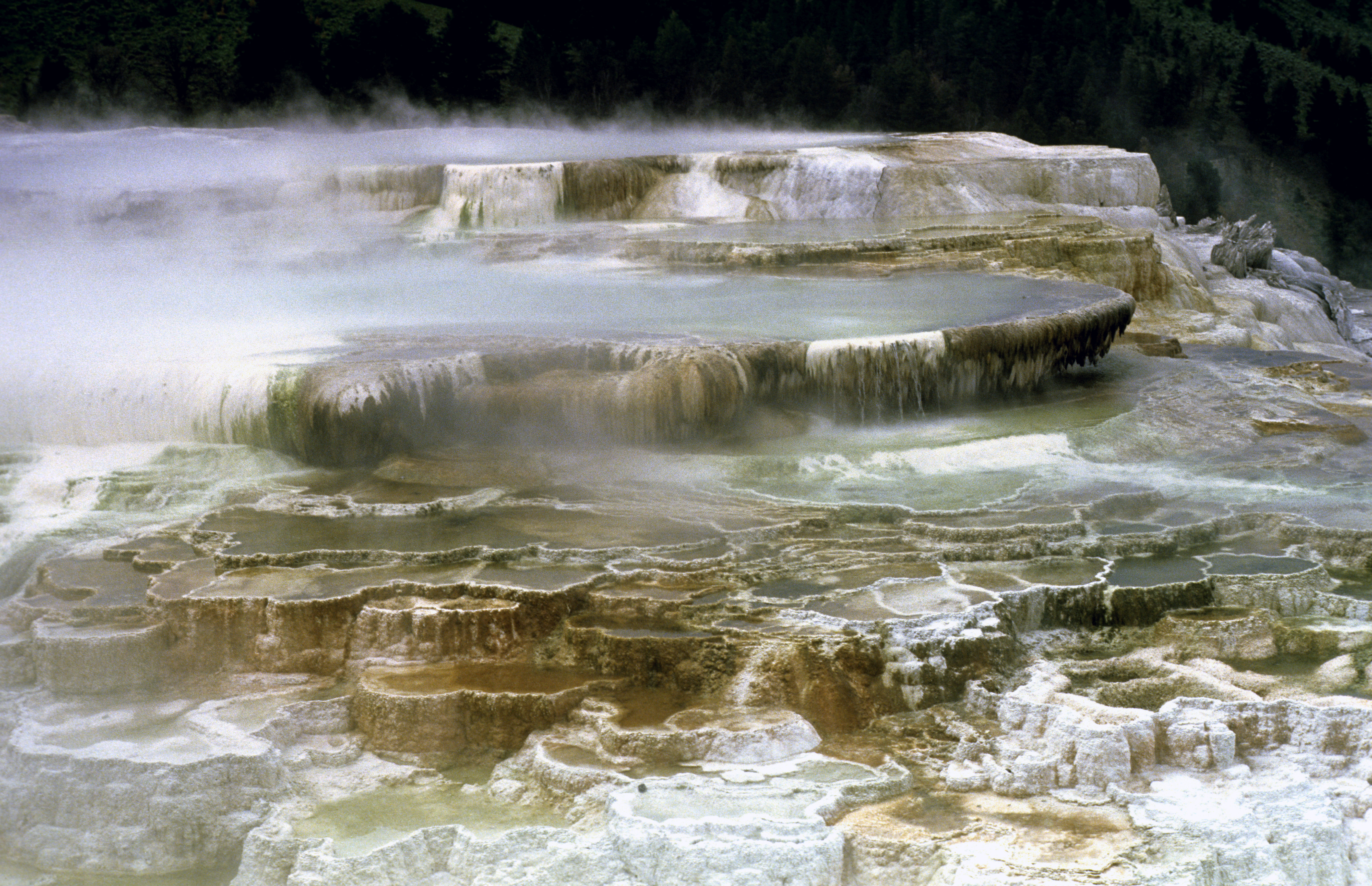
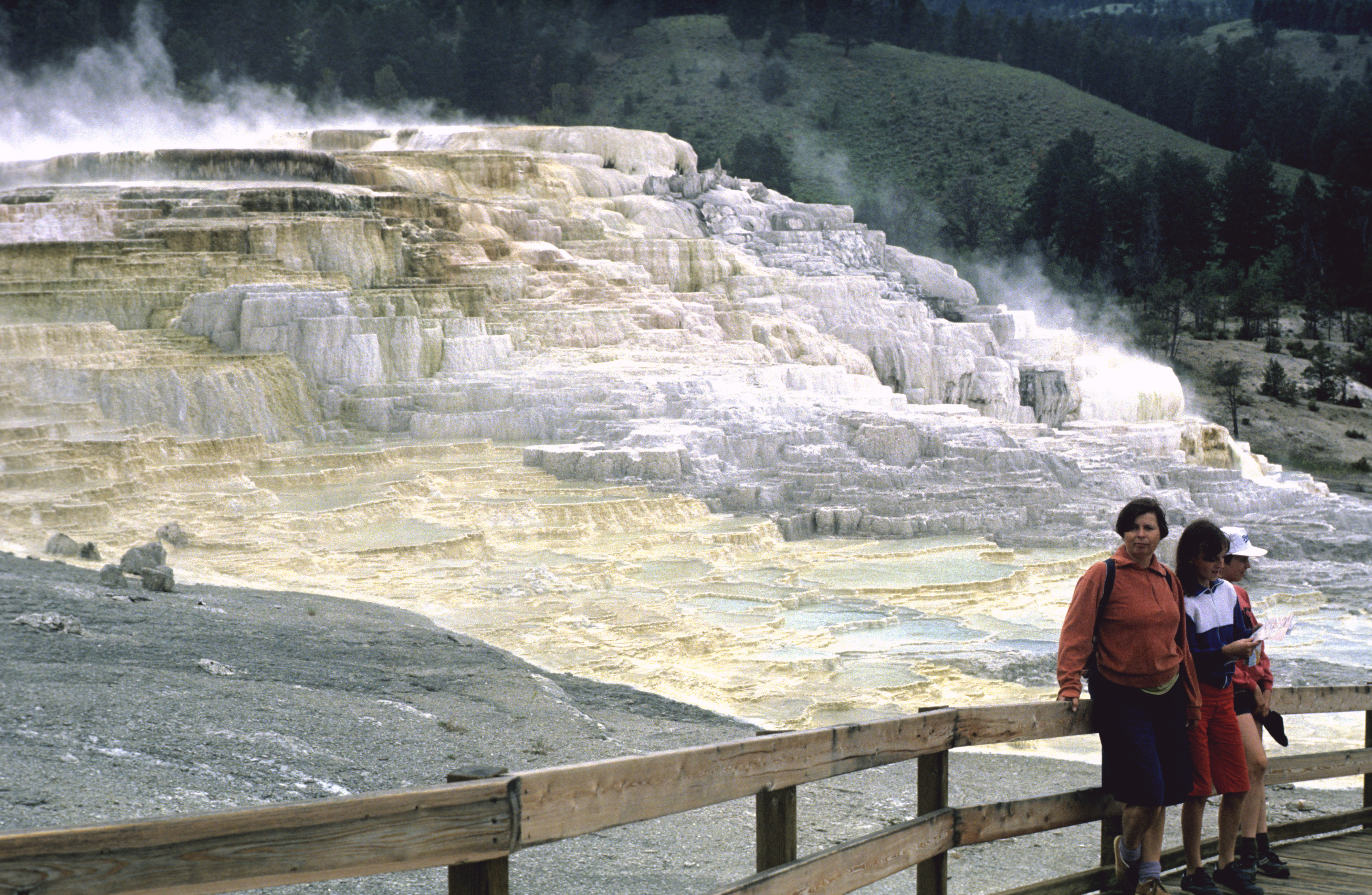
Yellowstone  was, of course, a must. We were a bit disappointed with the most famous geyser, the Old Faithful. It is no longer hot and the eruptions no longer shoot so high up, its sound reminds of an ordinary shower. But there are many other impressive geysers that still erupt with extremely hot water under high pressure and with fearsome sound, like the Clepsydra seen here. In the neighbourhood of geysers, walking is allowed only on wooden bridges - the ground is often just a thin crust that covers a basin with superhot water. It could break under the weight of a tourist, with disastrous results. Another Yellowstone landmark are the Mammoth Hot Springs , where hot water, saturated with minerals, flows out of cracks in a rock and deposits the minerals that form colourful basins. Here is an overall view of the area.
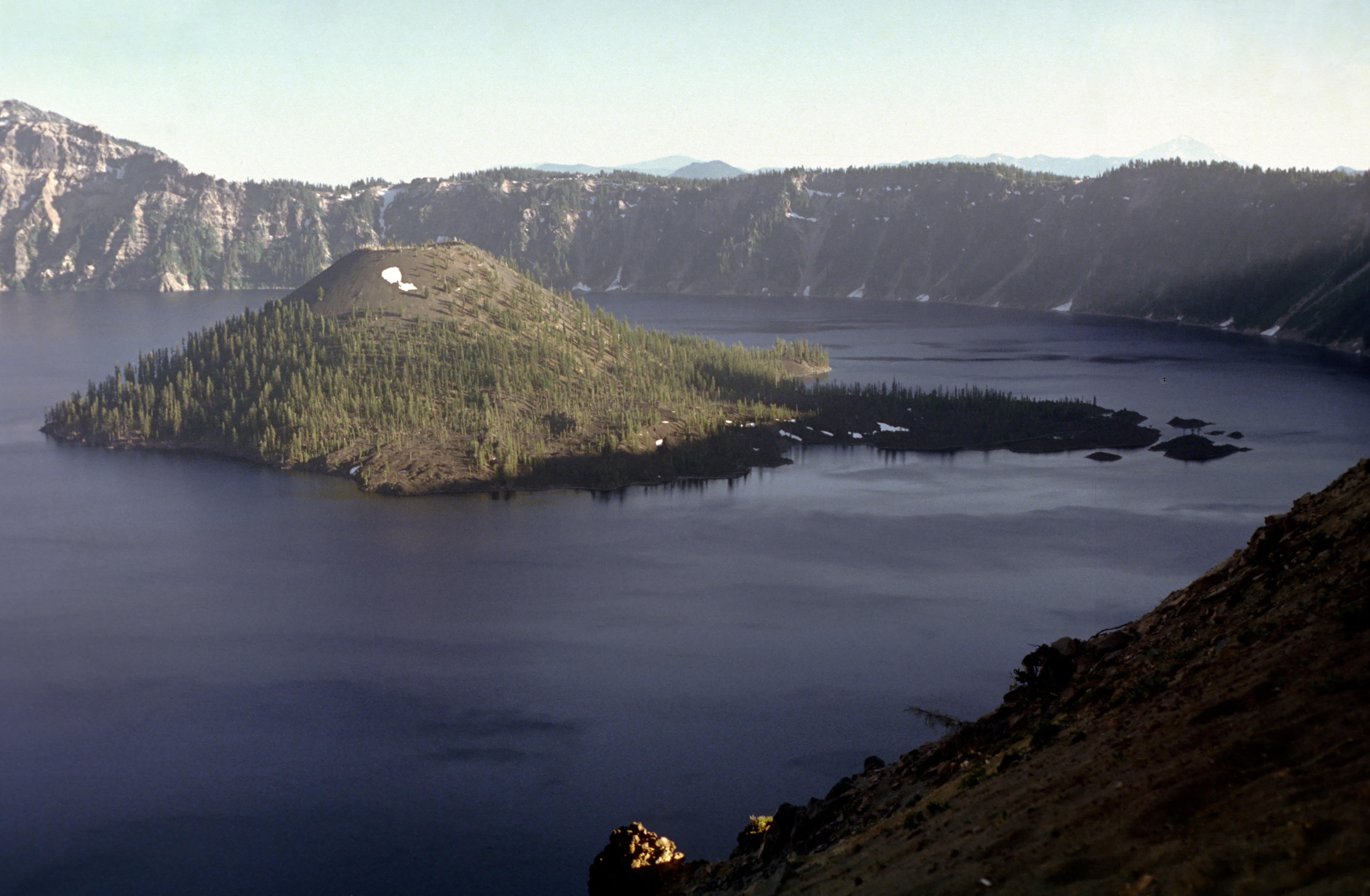
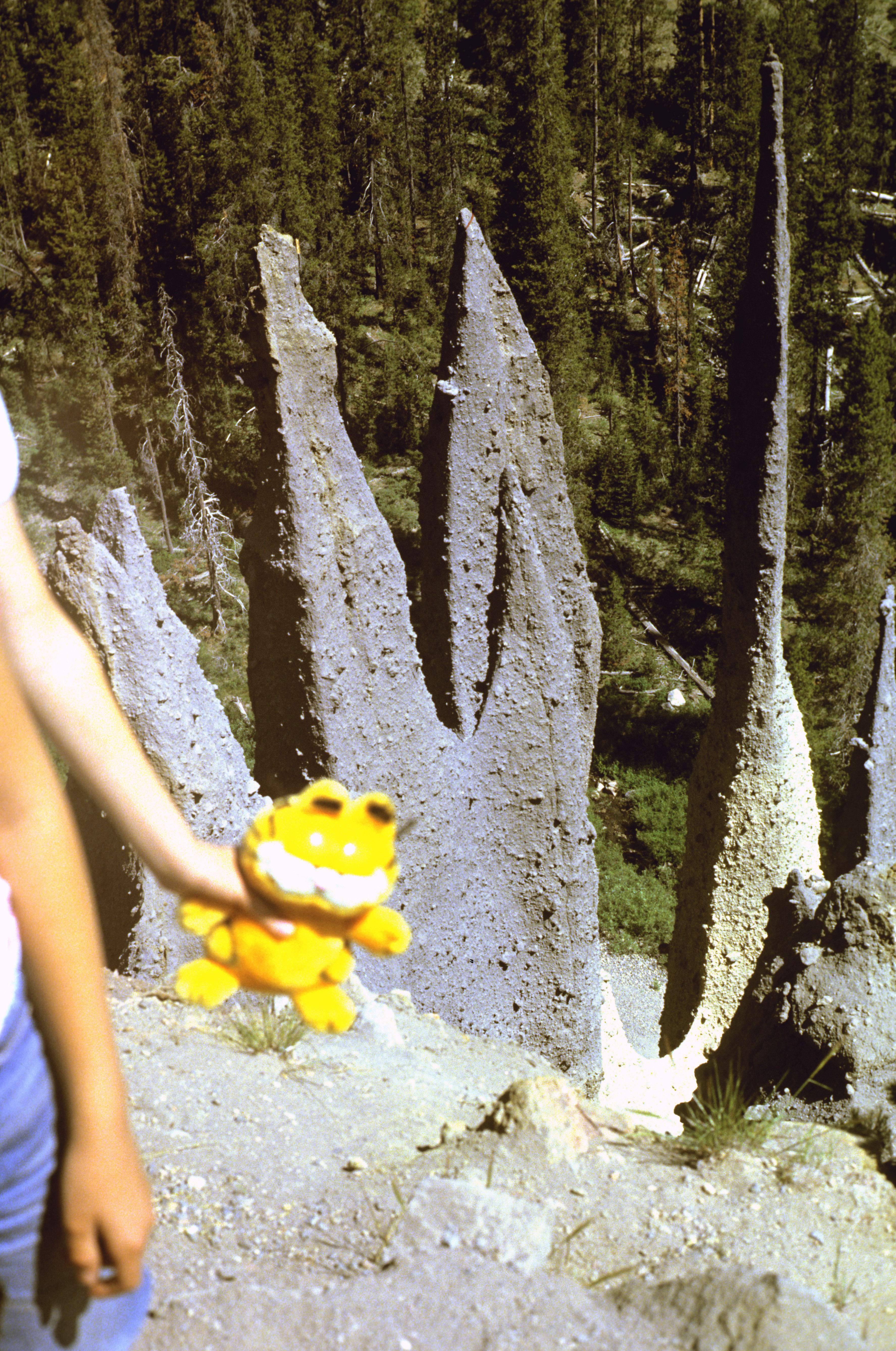
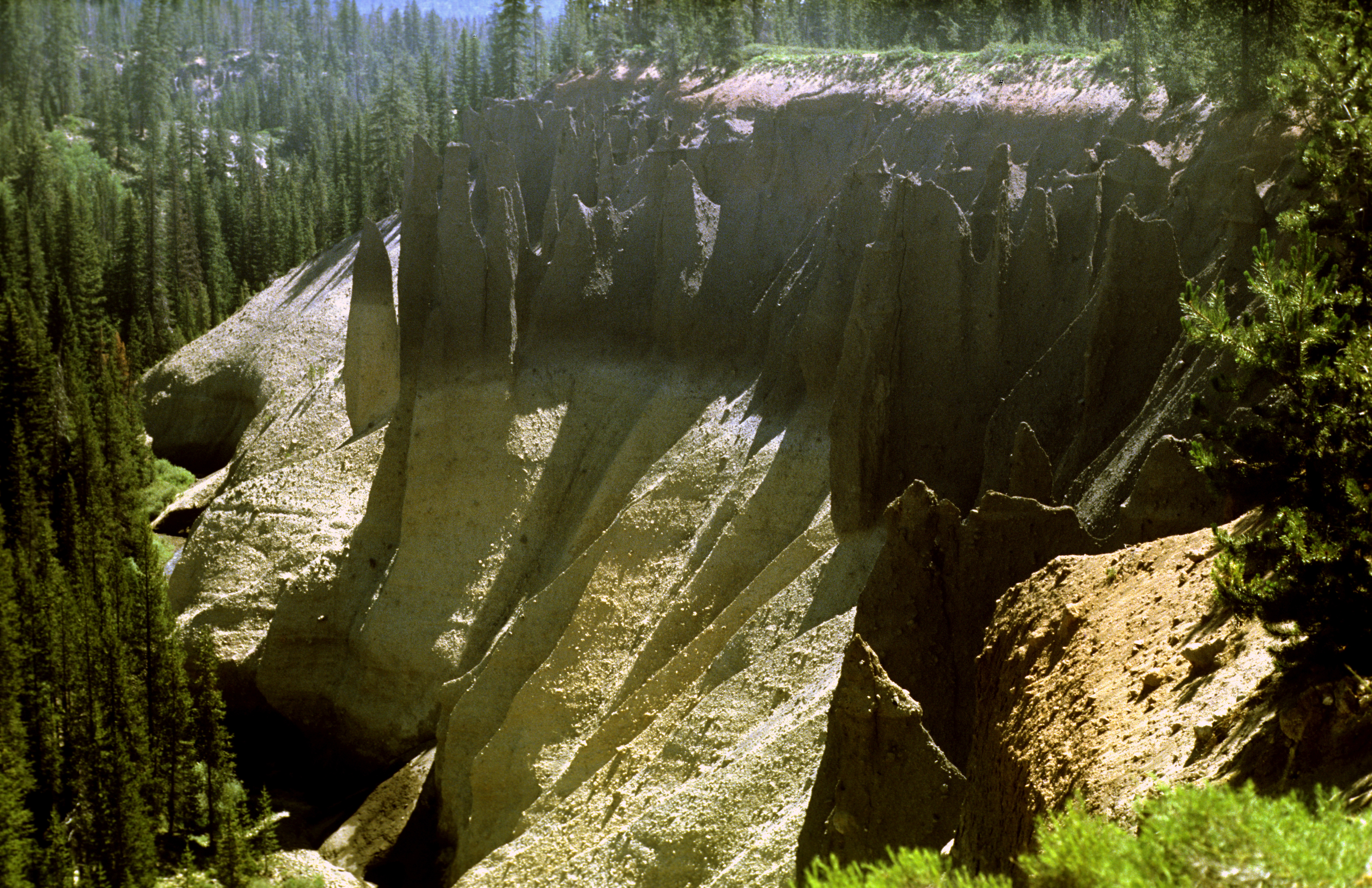
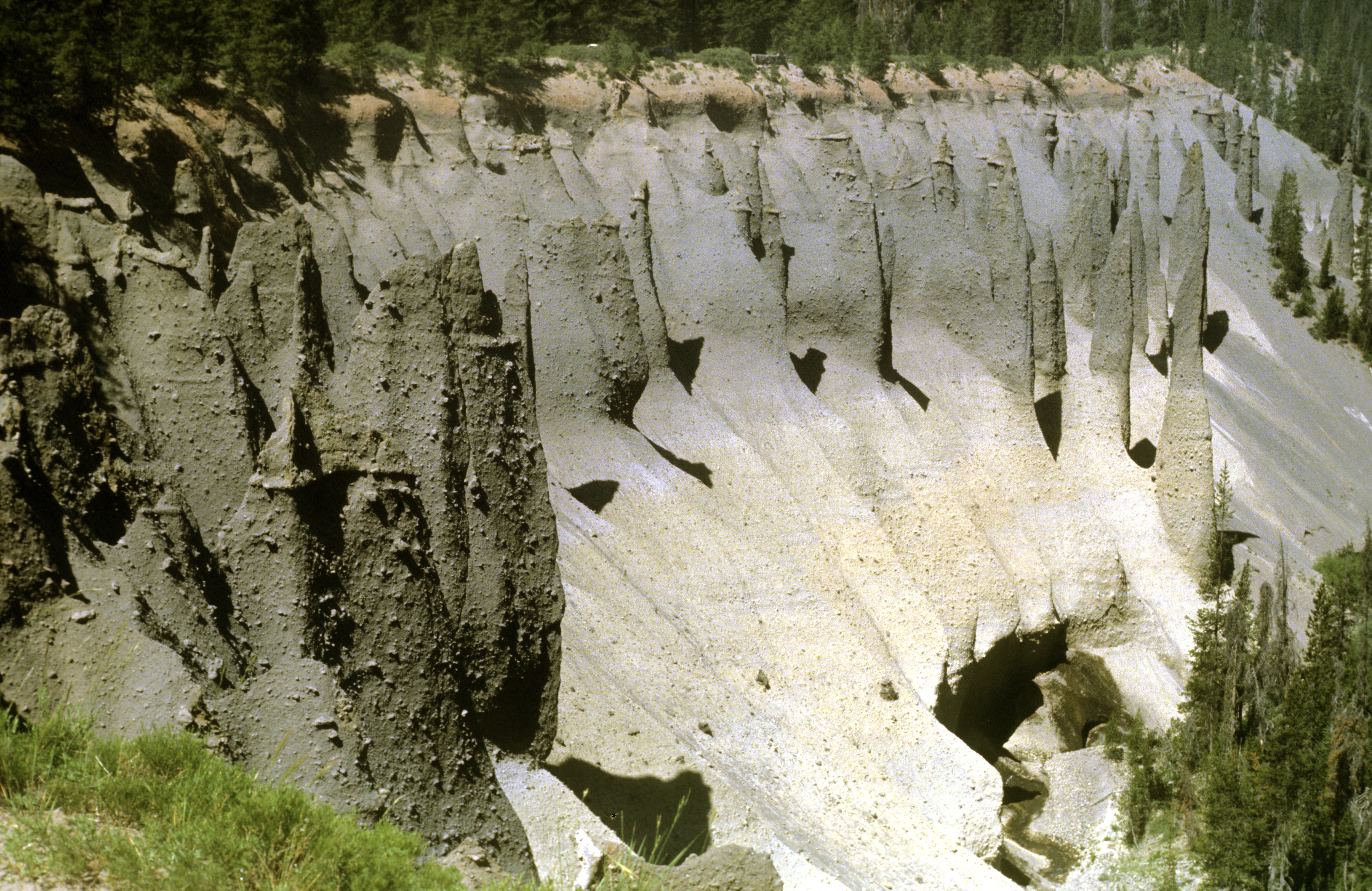
Further down our route was the Crater Lake national park. It is most famous for the lake that fills a very large old volcanic crater; its water has a beautiful, uniform navy blue colour. However, what impressed us most were the Pinnacles on the far outer slopes of the volcanic cone. Long ago, the Pinnacles were born as vents for hot underground water making its way to the surface through thick layers of volcanic ash. The ash got eroded away, but the vents, hardened by hot water, got thereby exposed and remained above the ground. The first photo shows a closeup view of three spires (in the foreground is Julia`s hand holding Garfield, her then-favourite toy-cat). The other two photographs show horizontal overall views of the area toward the Sun and with the Sun shining from behind the photographer . The pictures do not faithfully show the size of the spires because there are no objects of known size anywhere near them. They are huge! - by my estimate 20 to 30 meters high.
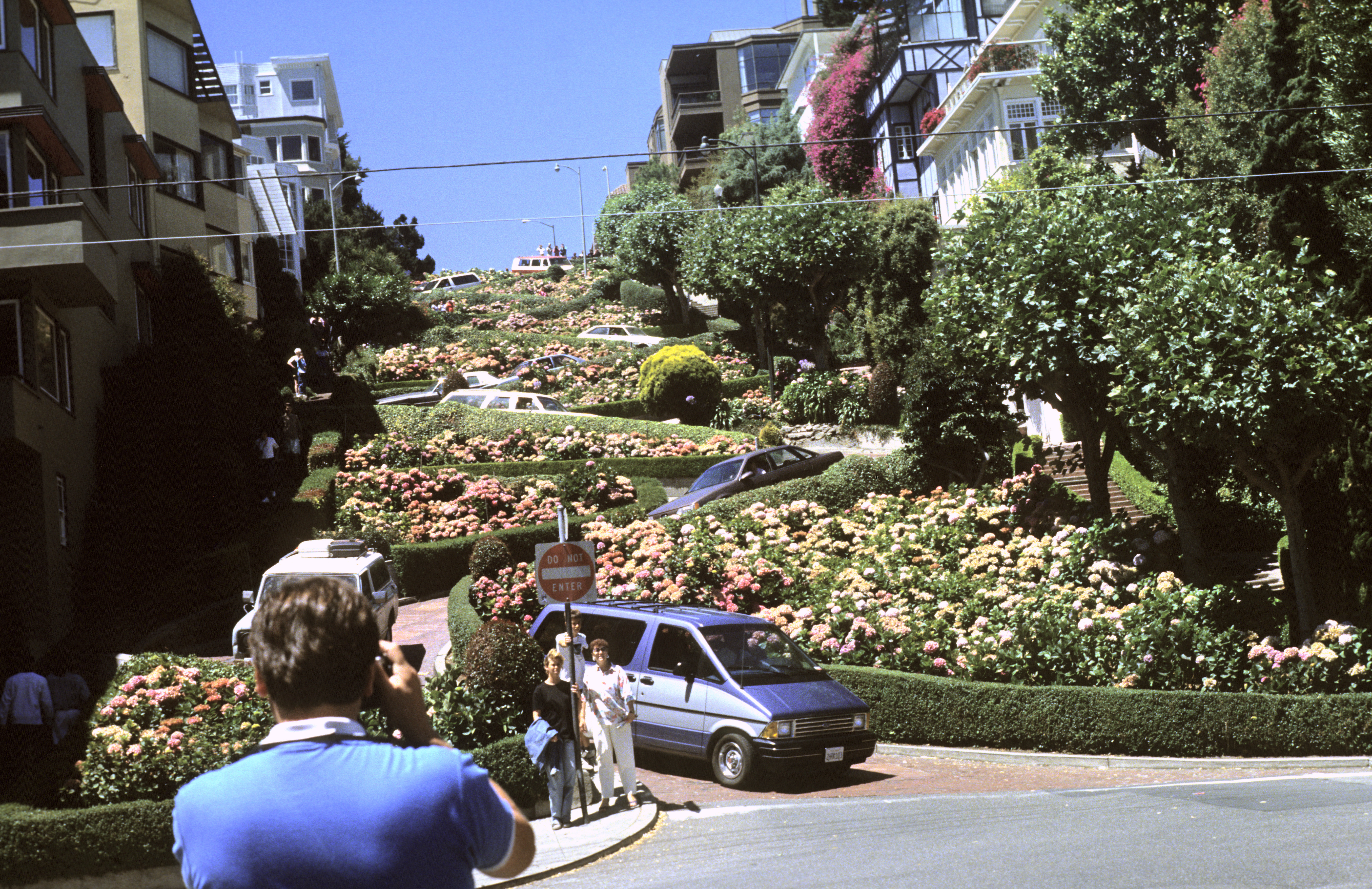
As a rule, we avoided big cities, but we made an exception for two of them. One was San Francisco 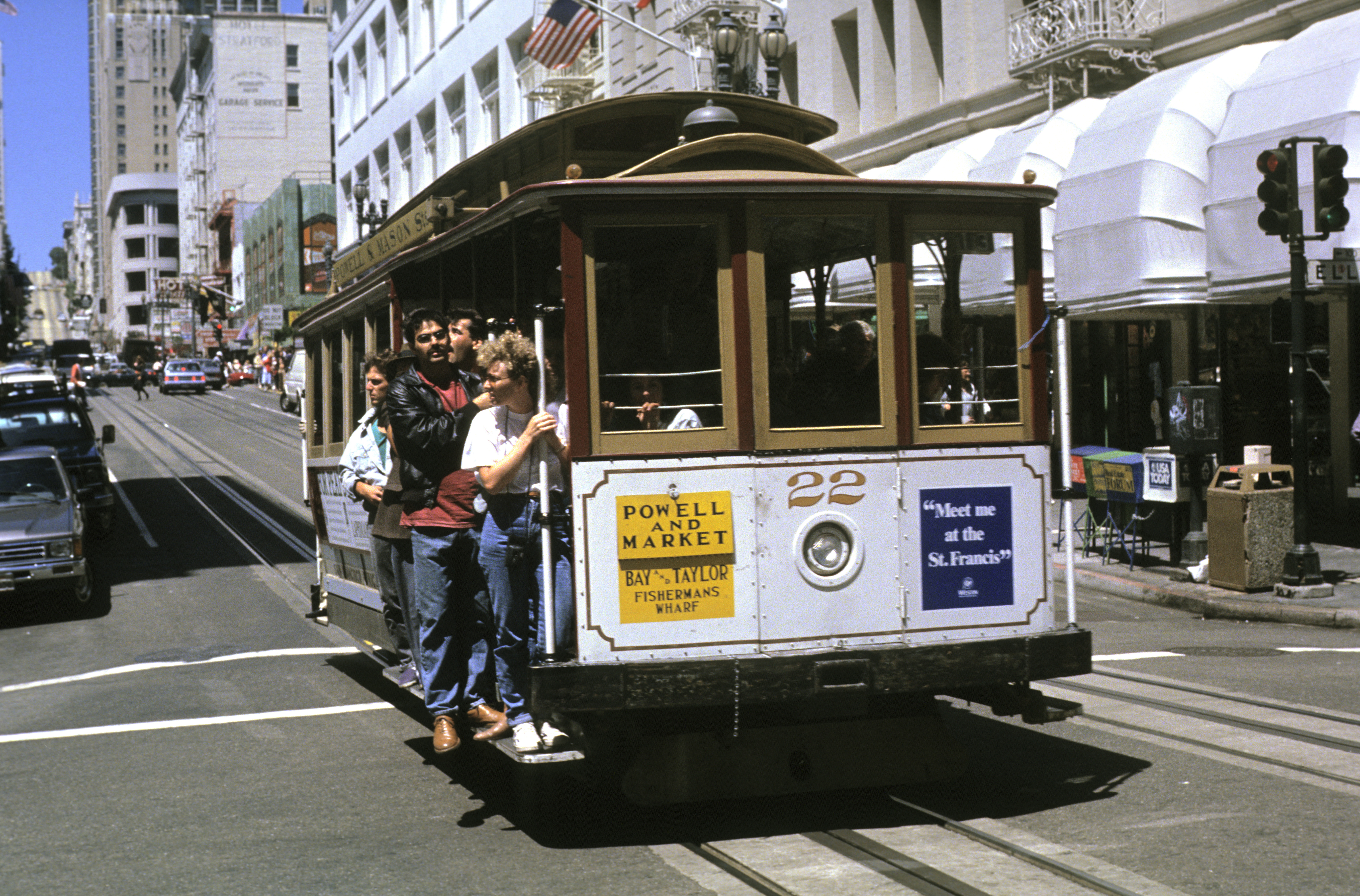 , which is a memorable sight indeed. OK, I will allow myself one more snipe. US architecture and urban planning are not very imaginative. Most houses look like boxes of different sizes, and the streets always form rectangular grids running north-south & east-west, occasionally with one district rotated by 45 degrees with respect to the rest. Yet San Francisco is so characteristic that it is enough to see it once, even on a photograph, and you will instantly recognise it in every other picture or movie. Why, among such dull urban landscapes, suddenly such an individuality? I understood when I was there. The rigidity in urban planning caused that. San Francisco lies on high and steep hills, yet its streets run on straight lines north-south and east-west, disregarding the steep slopes. Some of the streets are so steep that the tires of cars screech, on the verge of slipping, when you drive up. One hill was, however, too steep to be climbed directly up by any car, so the street going up there (the Lombard Street ) winds in several bends. With a typically American exaggeration, guidebooks call it "the crookedest street in the world". Of course, every visitor feels an urge to drive along this winding segment, even though he usually has no business driving there. Thus, in front of the neat luxurious (and probably very expensive) houses that stand there, a never-ending river of cars drives by day and night (end of the snipe). (The other big town for which we made an exception was Los Angeles. We dropped by there to see the Universal Studios and the Disneyland - a must for the children, but these two places are famous enough and need no more advertising.)
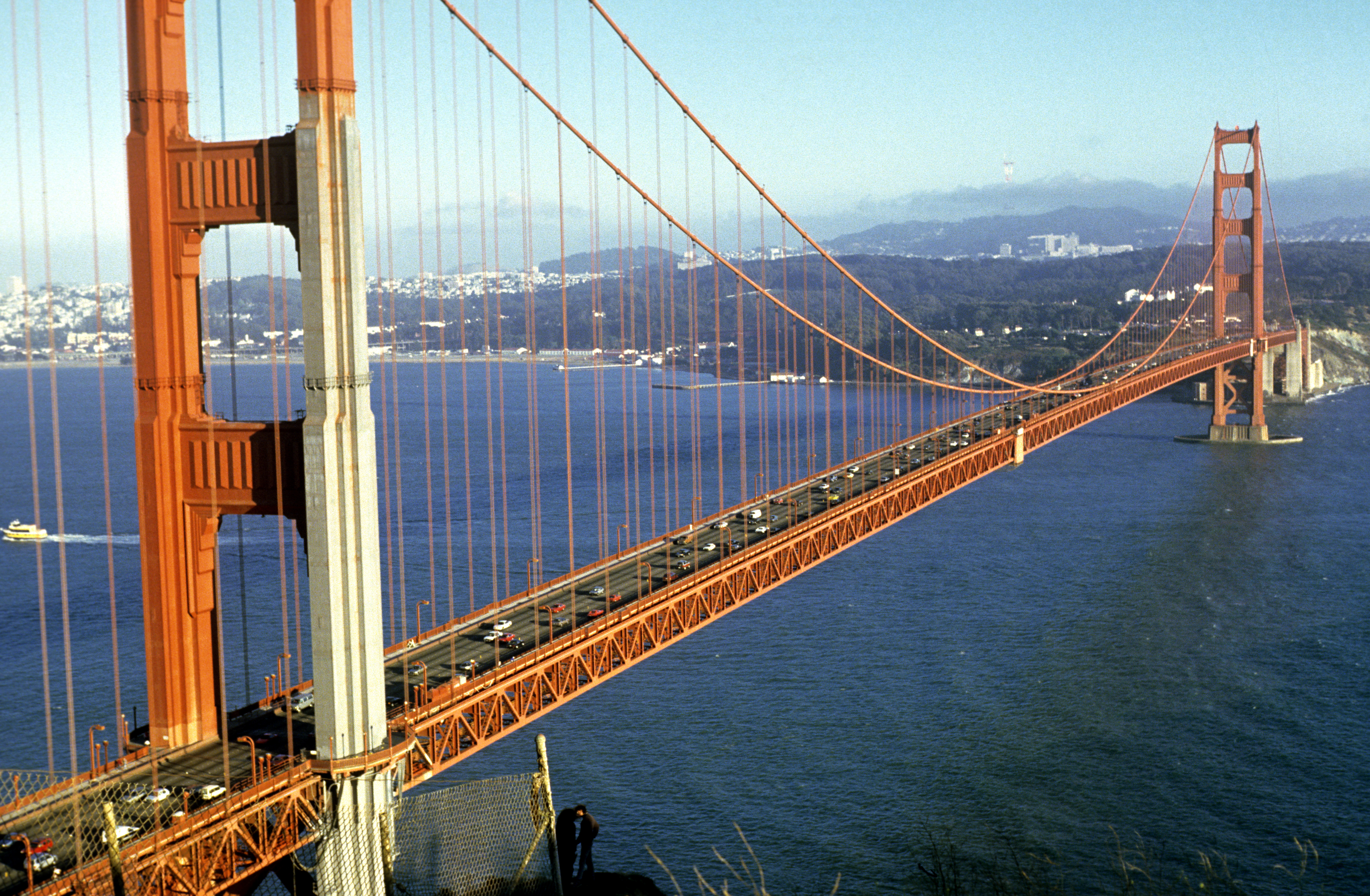
This picture shows one of the famous streetcars that are propelled by attaching a claw to a steel rope that runs in a slot between the rails. Another memorable San Franciscan sight is the Golden Gate bridge. It is so high that clouds often form beneath it, but this I saw only on other people`s pictures.
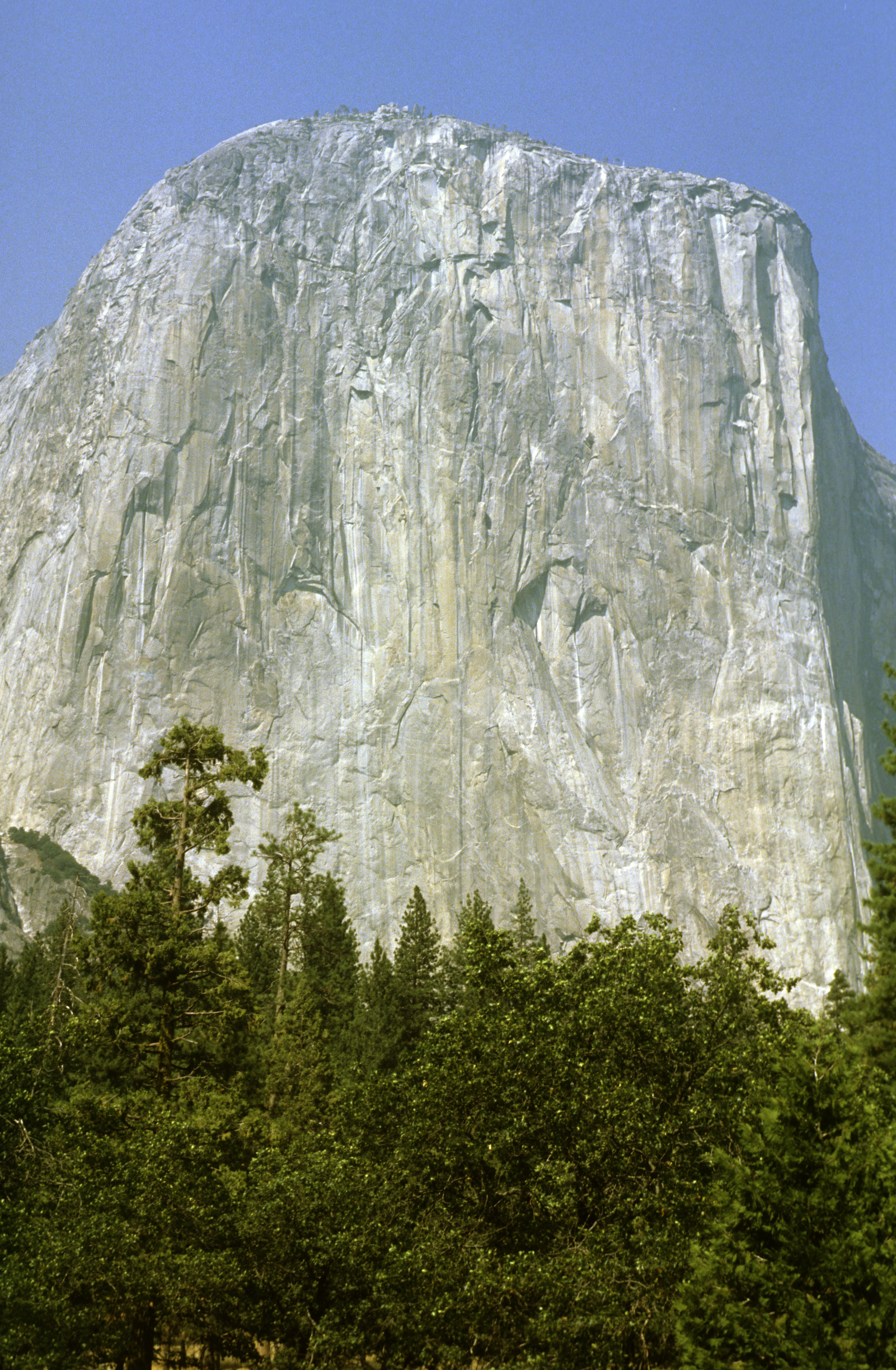
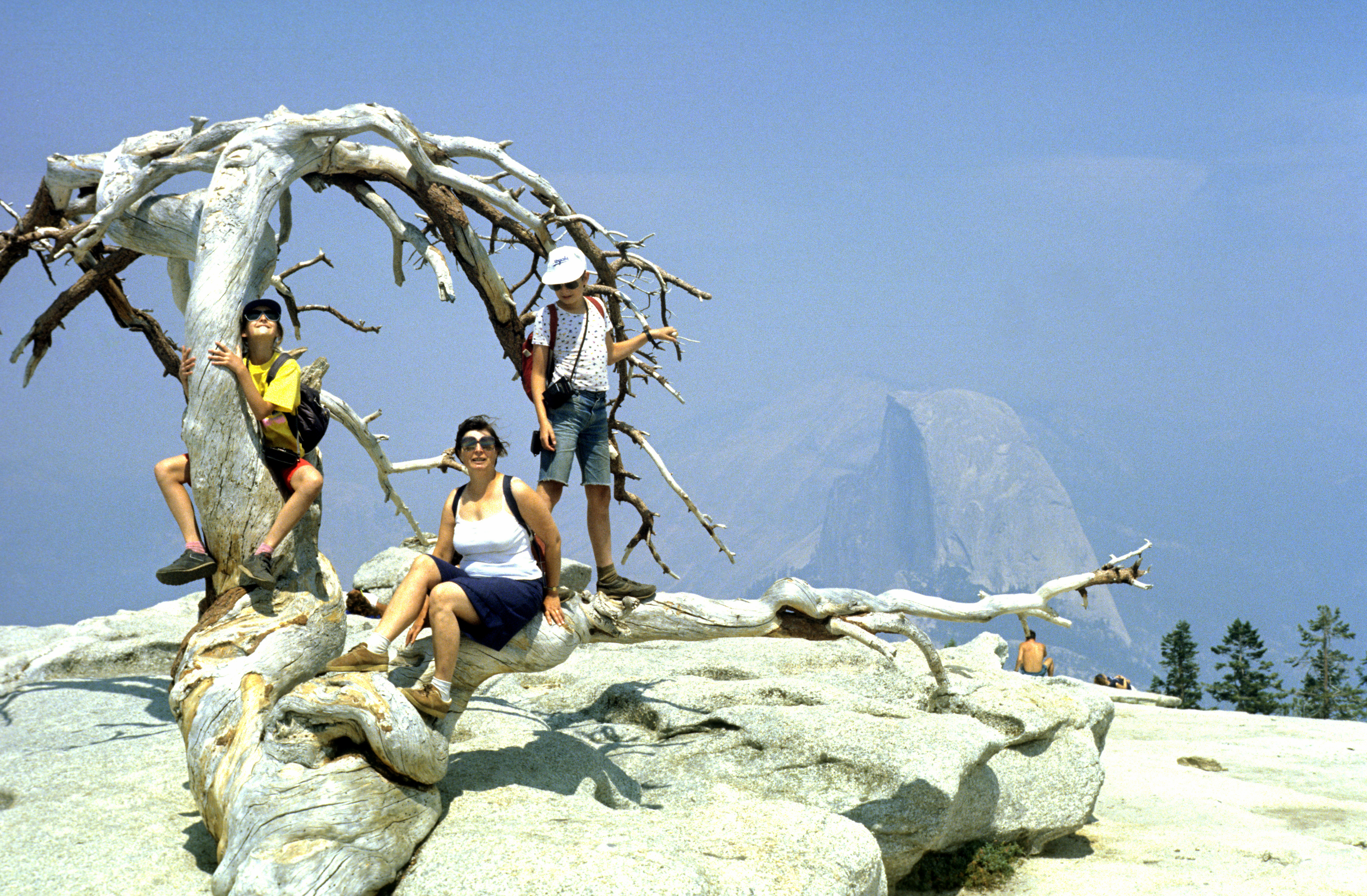
Not very far from San Francisco is the Yosemite 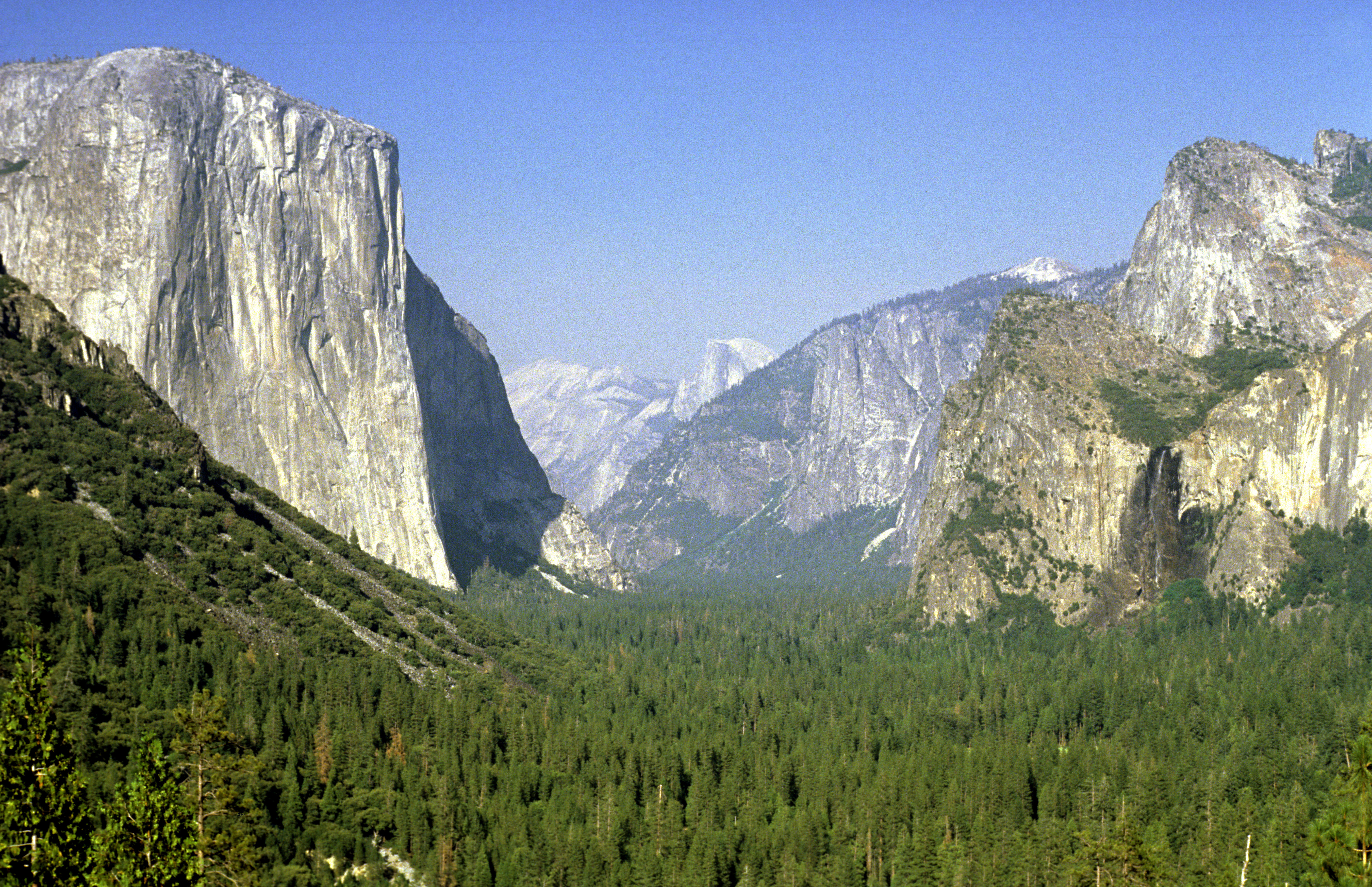 national park. It is not really for tourists like us, but rather for extreme climbers. The first picture shows the view into the Yosemite valley, the main attraction of the park. On the left is the famous El Capitan face, the climbers` world-favourite. Far in the background, in the center is Half Dome, another famous mountain. The dry and rather warm climate causes that the granite rock weathers in a different way than in the Alps. The erosion leaves unusually smooth faces with very strong rock and no loose stones, like the El Capitan face. A nice viewing point is the Sentinel Dome (my family in the forefront, the Half Dome in the background).
A little farther to the south is the Sequoia 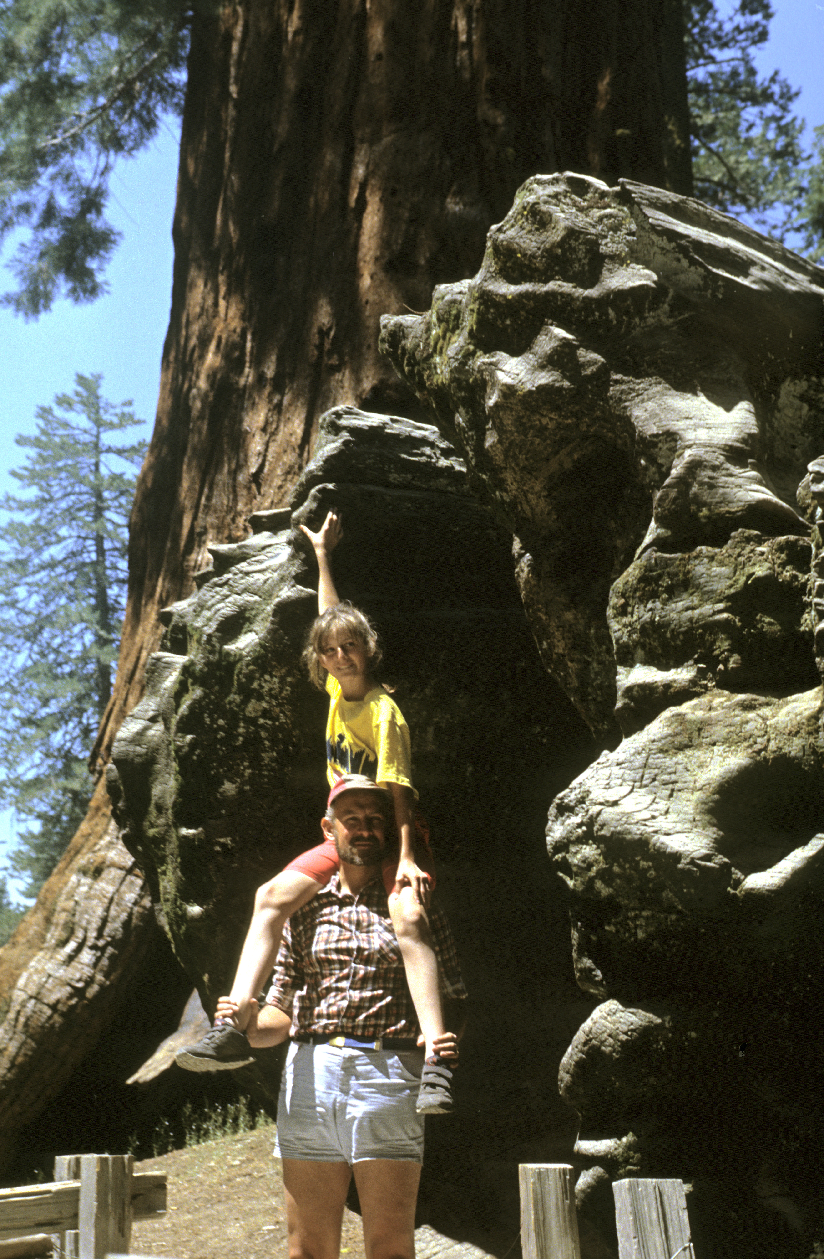 national park, where one can admire giant sequoias. They are neither the highest nor the longest-living trees in the world, but achieve respectable results in both these fields (around 100 meters in height and living up to 2000 years). Americans like to say that they achieve the largest volume among all organisms living on the Earth. The photo shows the impressive diameter of the base of a fallen sequoia (me and my daughter Julia in front of it, in August 1989). [For completeness: the highest trees are the redwoods, close relatives of sequoias, to be seen in the Redwood National Park in northern California; for the longest-living trees see below.] The giant cones lying everywhere on the ground belong to another pine species, the sugar pine.
In southern Arizona, on the Mexican border, there is the Organ Pipe Cactus national park. Organ Pipe Cactus is the name of one of cactus species that grows there. However, the most impressive are the saguaro cacti, one of which is shown here with my son for comparison of the height.
The Grand Canyon 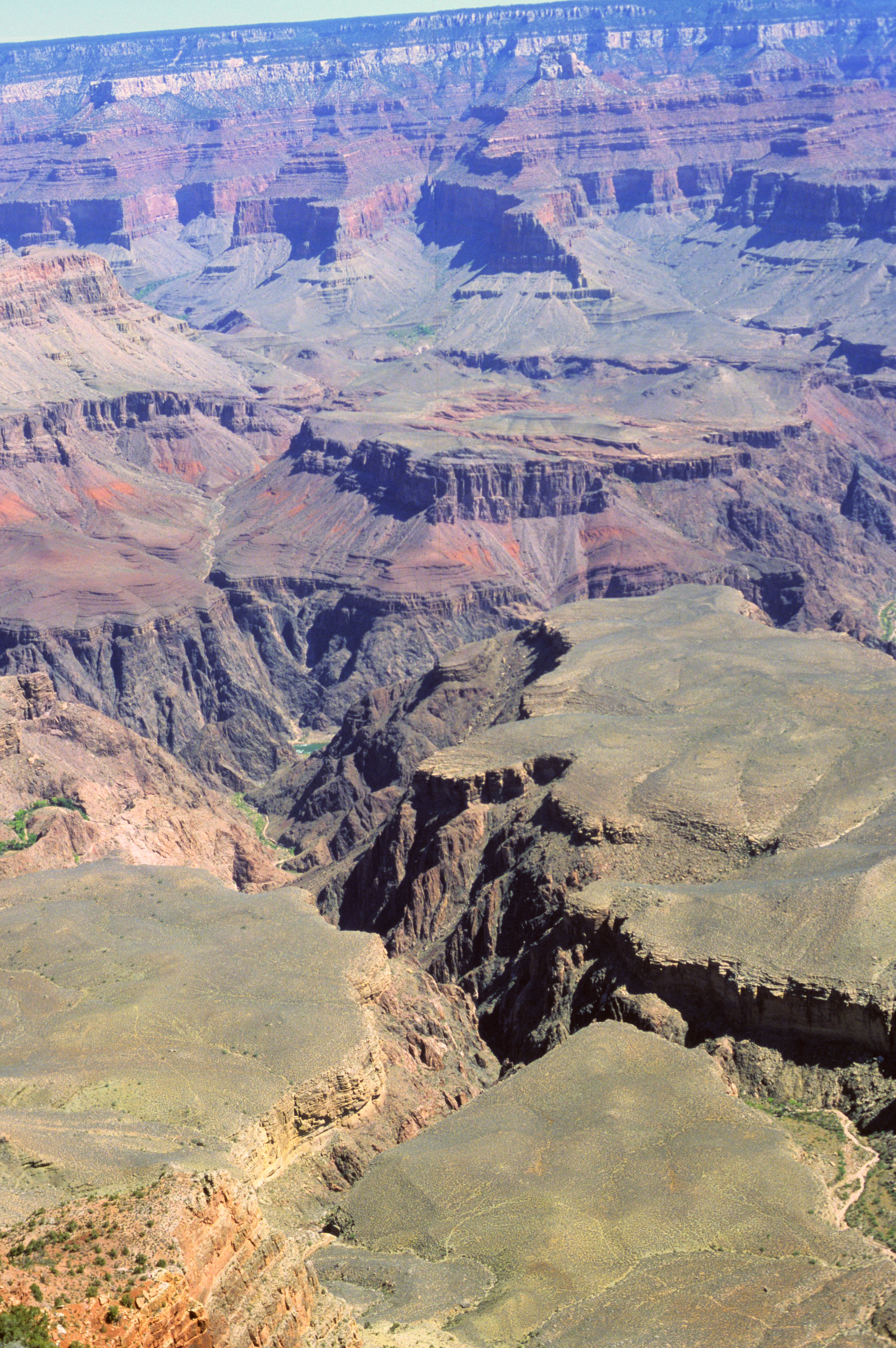 needs no advertising, so I only note that we were there, and were duly impressed. Here is a selection of views into the depths of the canyon from its rim: Grand Canyon 3
 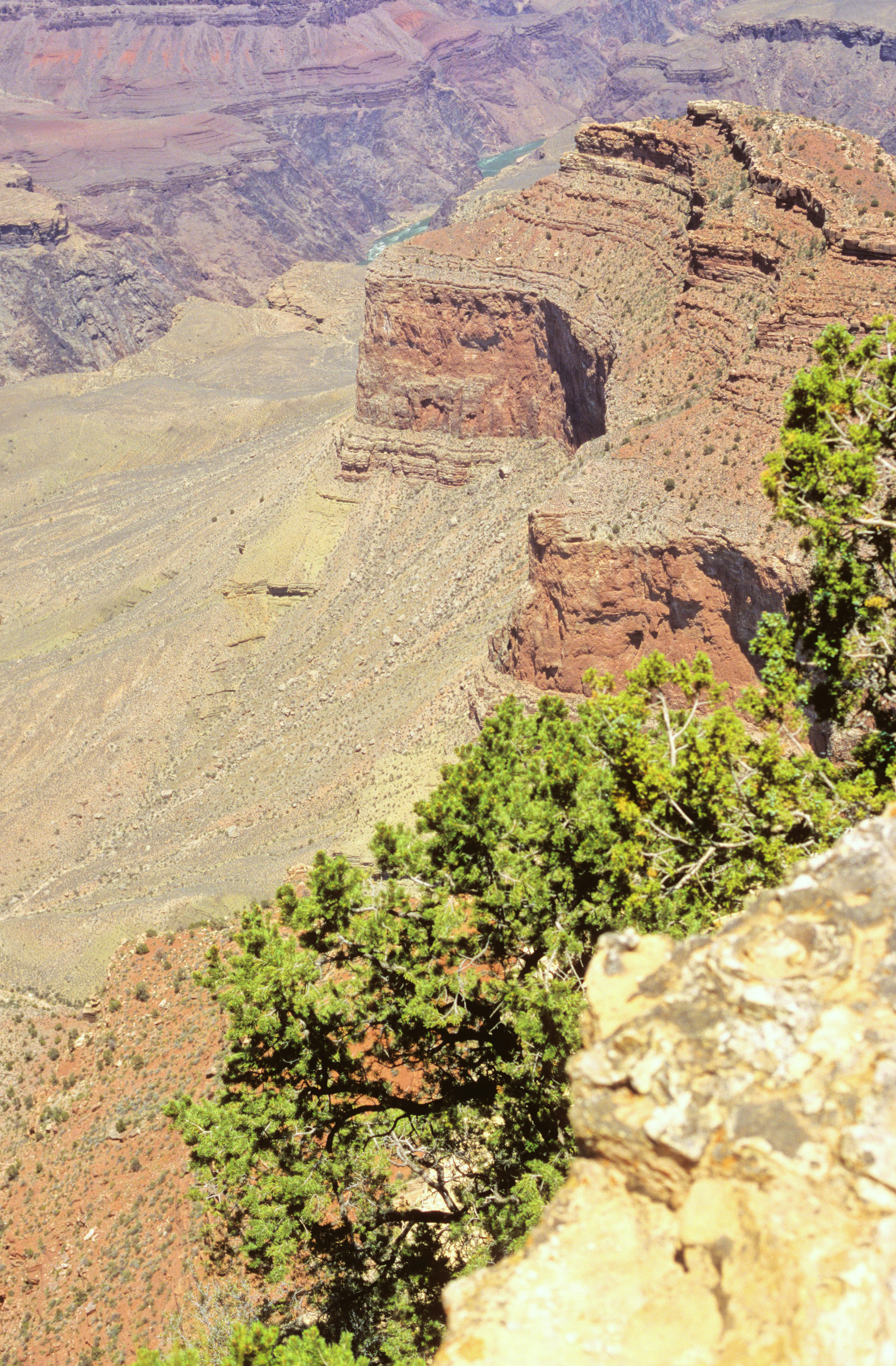 Grand Canyon 4
 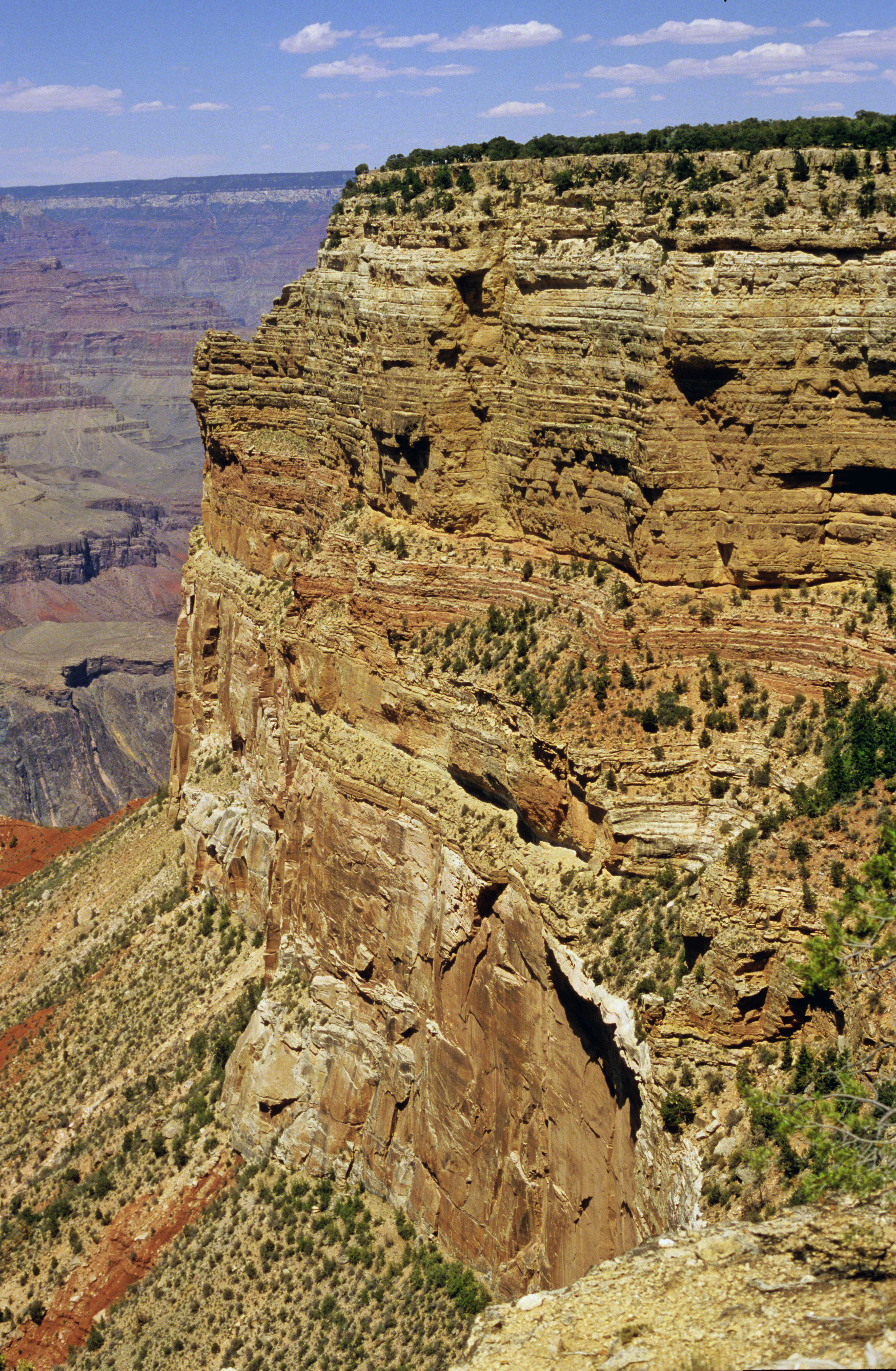 Grand Canyon 6
  Grand Canyon 7
  Grand Canyon 9
 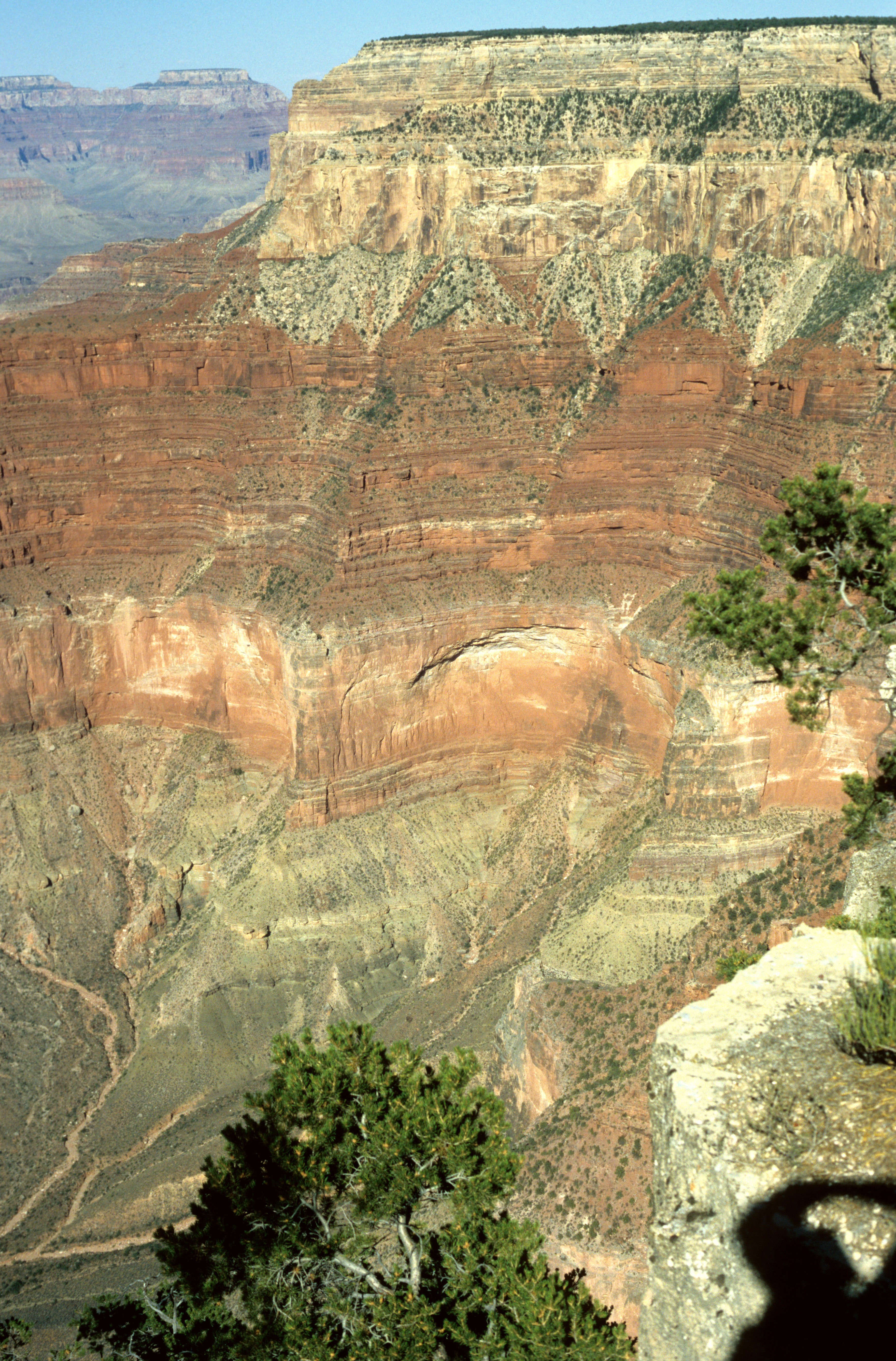 Short segments of the Colorado river are seen in some of the pictures at the bottom of the canyon, 1.5 km below the spectator and several kilometers away. In some of those segments, one can see white rapids (see picture 3). On quiet days, with attention properly concentrated, one can hear the soft sough of the rapids even on the rim of the canyon.
Most tourists visit only the southern rim of the Grand Canyon and never get to see the place where the road crosses the Colorado River. To arrive by car from the southern rim to the opposite point on the northern rim, some 20 kilometers away in straight line, one has to travel more than 100 kilometers to reach the bridge across the Marble Canyon 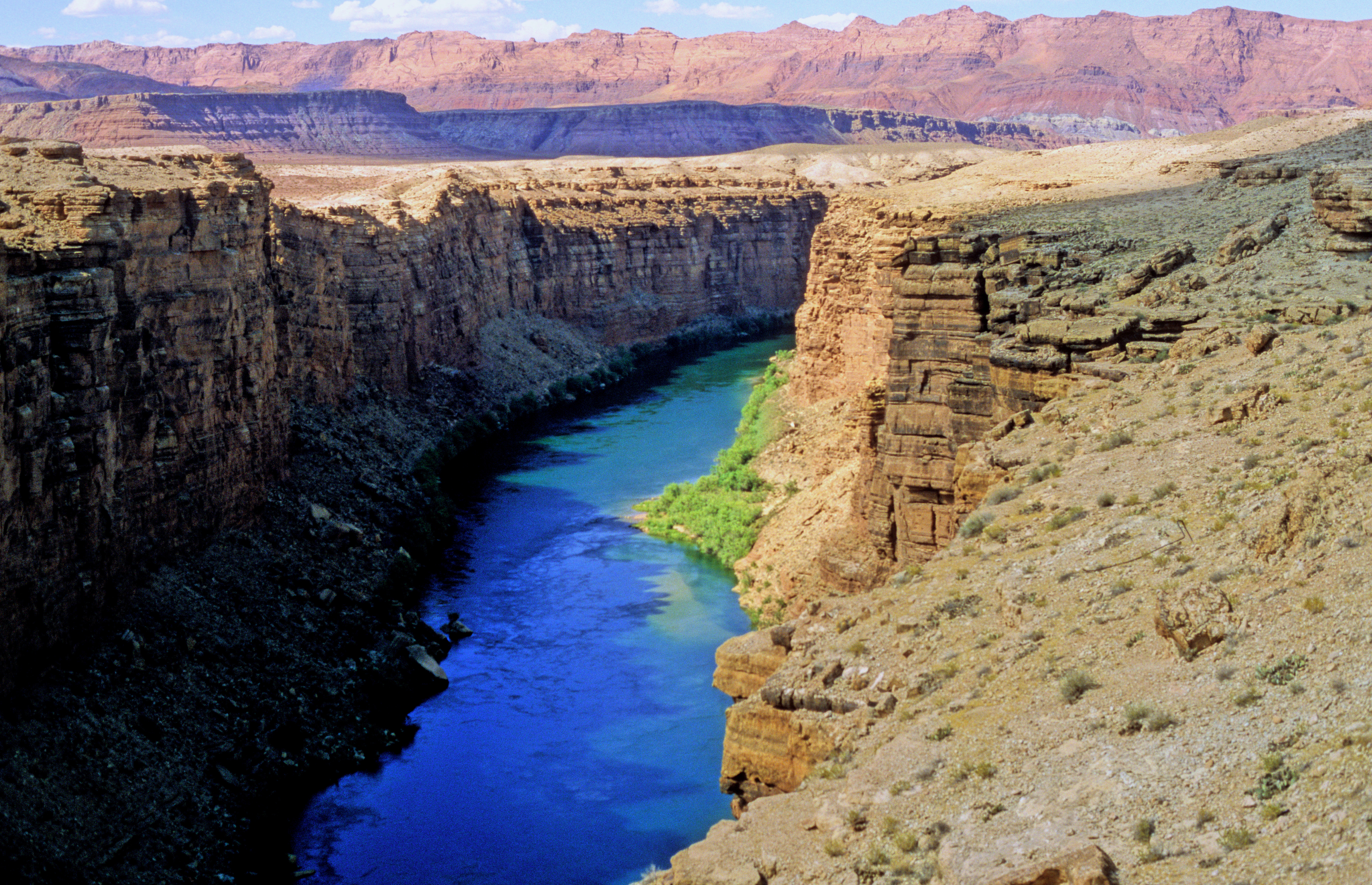 , and then again 100 kilometers on the other side. The canyon is only about 100 meters deep at the bridge, but the view is truly impressive.
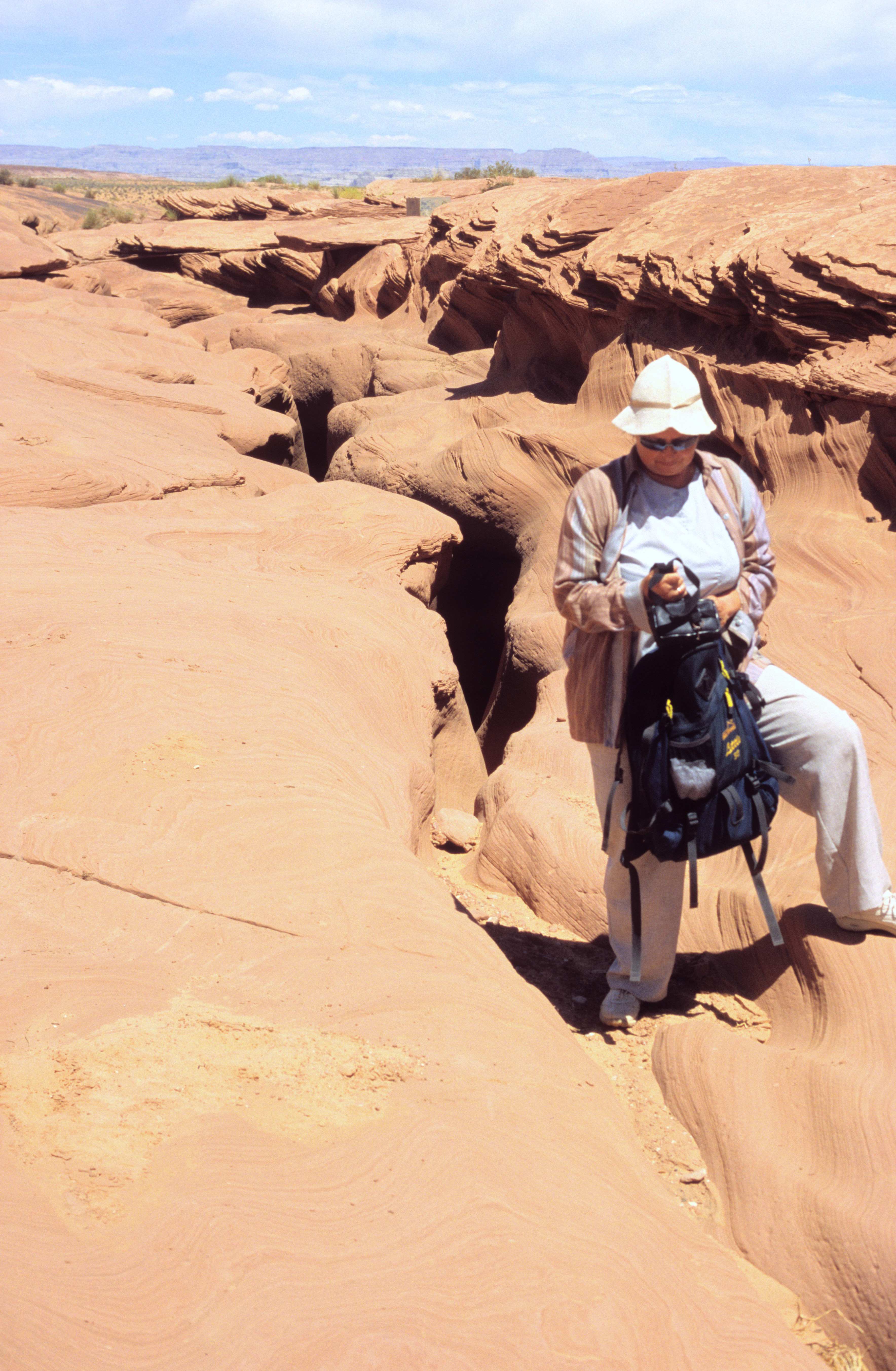
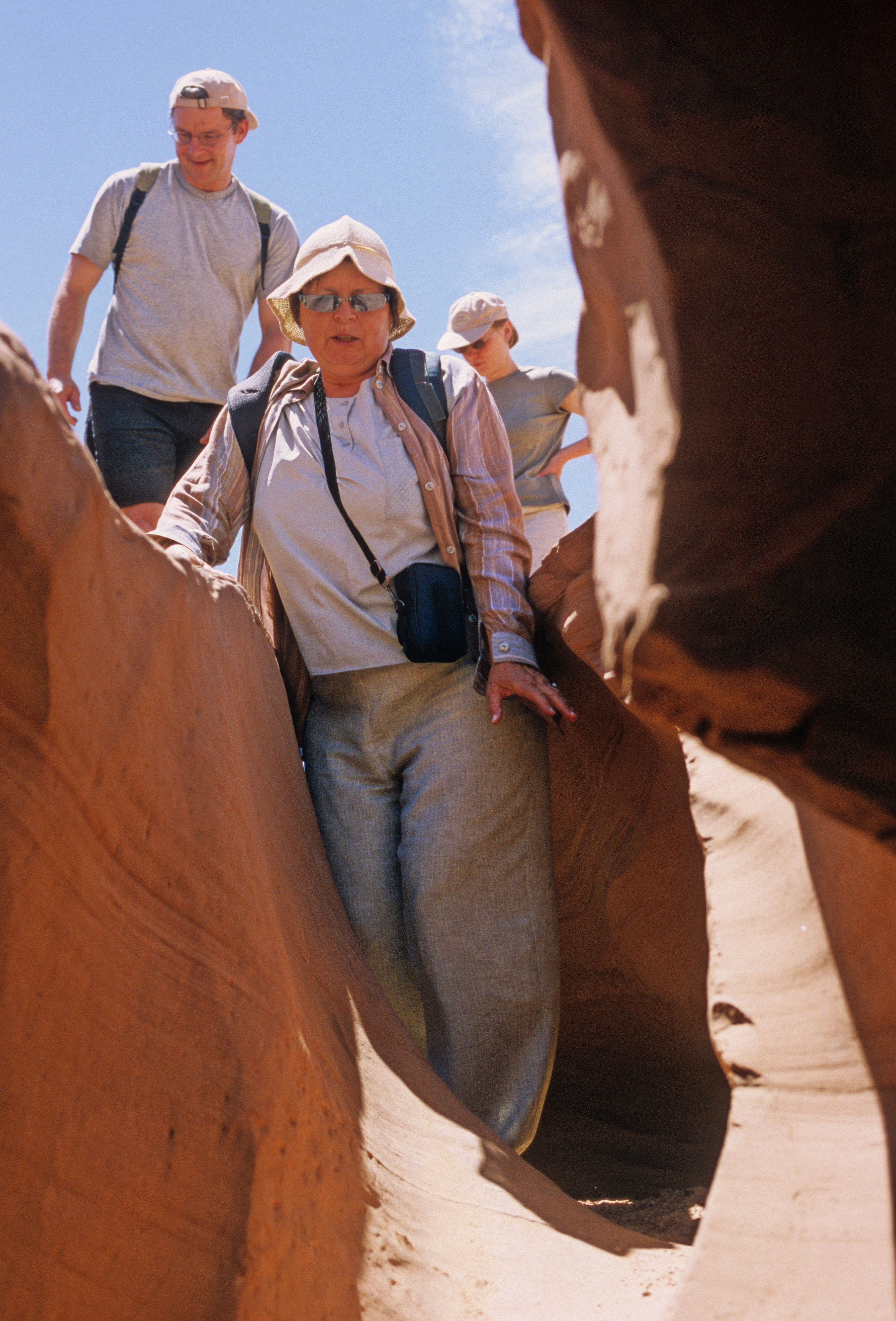
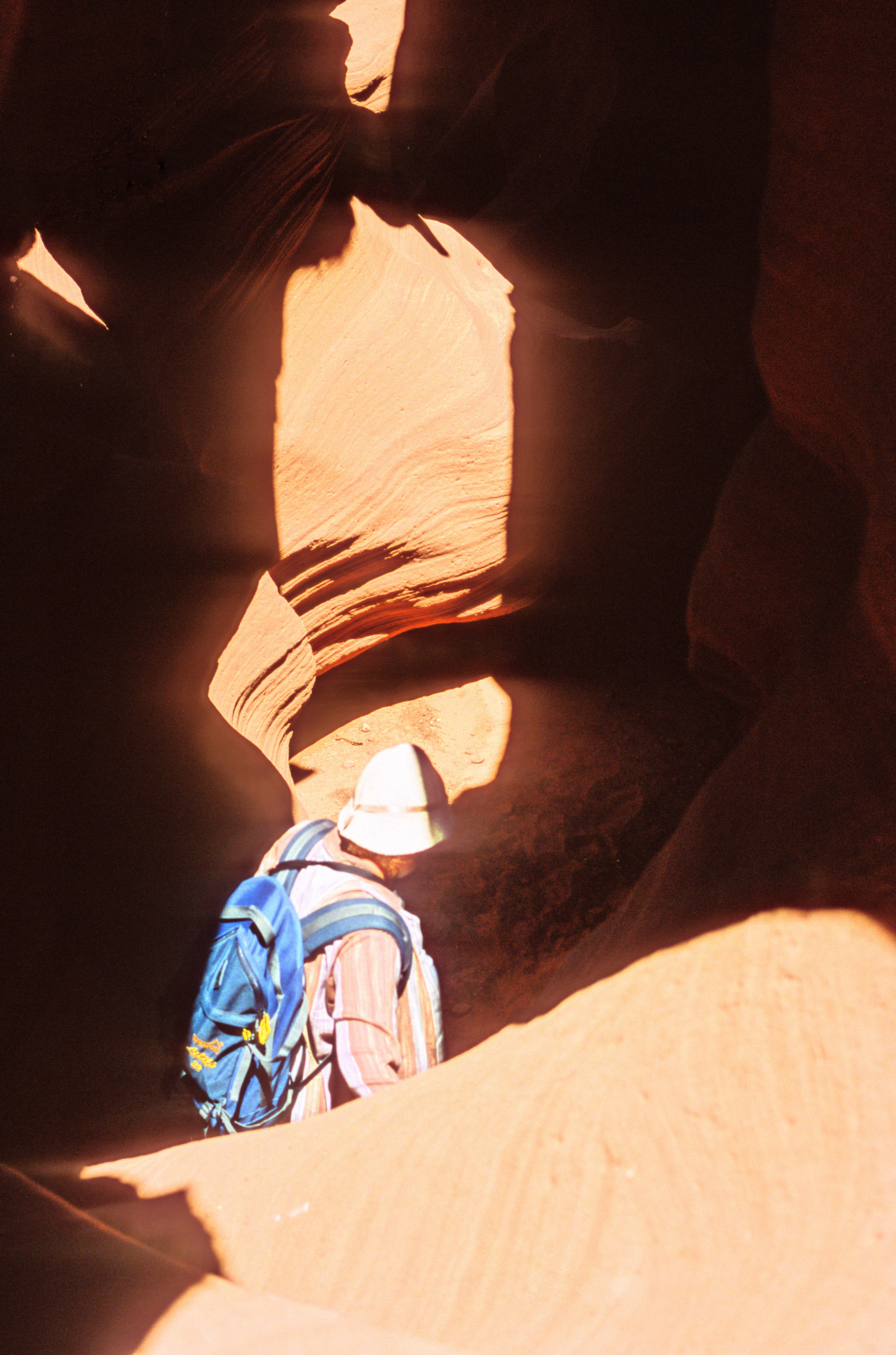
Not far from the Marble Canyon is a natural wonder almost unknown to ordinary tourists, the Antelope Canyon 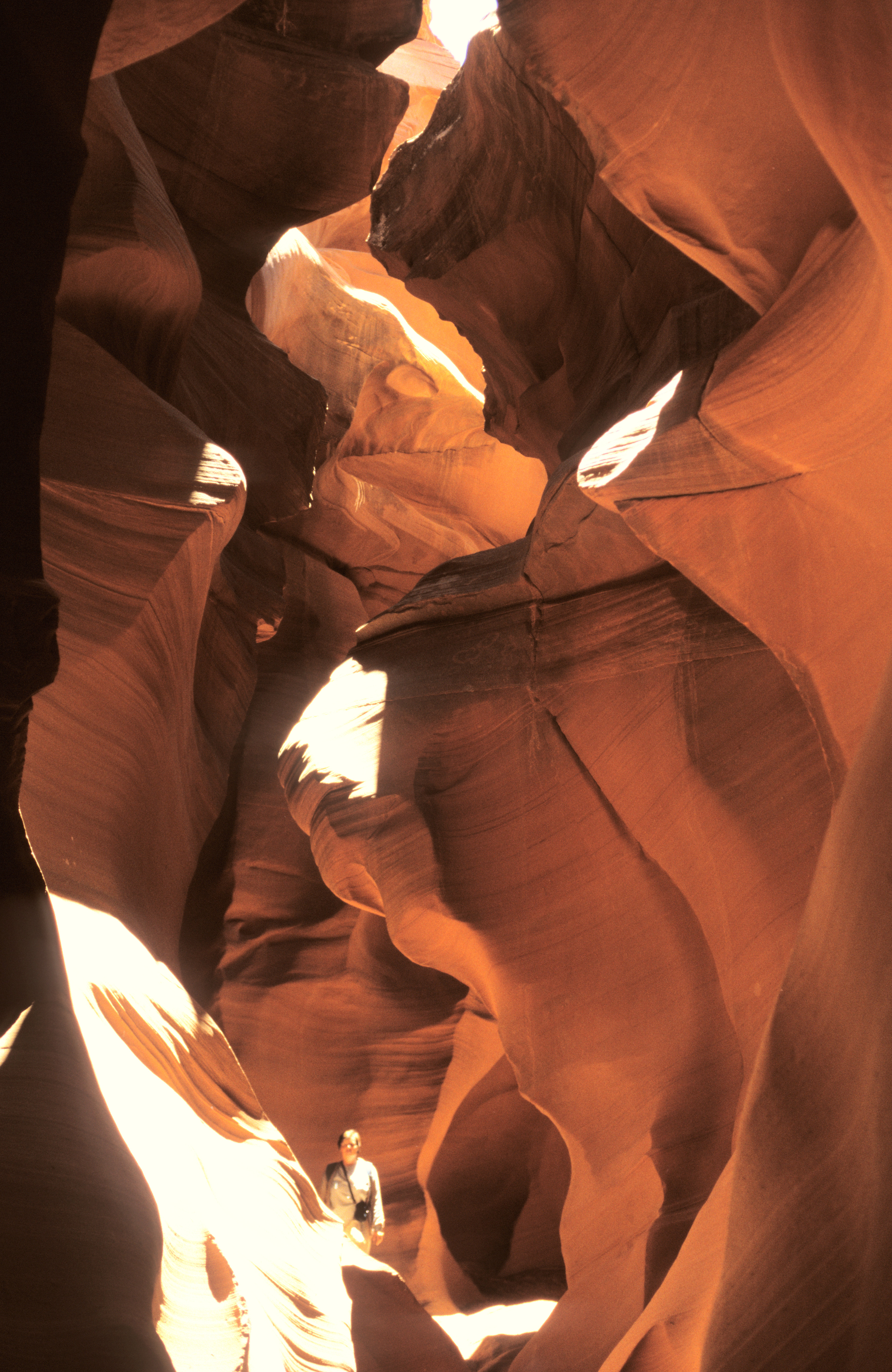 . It lies to the east of the town Page, within a Navajo reservation, and is managed by the Navajo people - this is why most guidebooks do not even mention it. There are actually two Antelope Canyons, Upper and Lower; the pictures show the Lower Canyon. It begins as an innocent and inconspicuous crack in sandstone rock, deep and wide just enough to hide your shoe. However, its bottom drops steeply and widens a little, so that after walking less than 100 meters away you find yourself in a crevasse , 1 to 3 meters wide and up to some 30 meters deep. Then you can continue for a few hundred meters and climb out on an artificial stairway. The unusual complicated sedimentation patterns on the walls of the canyon invite you to learn geology - you can read the sequence of tilted desert sediments alternating with horizontal river sediments. The canyon is a deadly trap during a flash flood, and indeed some 15 people drowned there in a single accident in 1997. This caused that security measures were introduced. Today, meteorological service is able to give advance warnings, and the managers of the canyon are prepared to evacuate all tourists within minutes of an alarm.
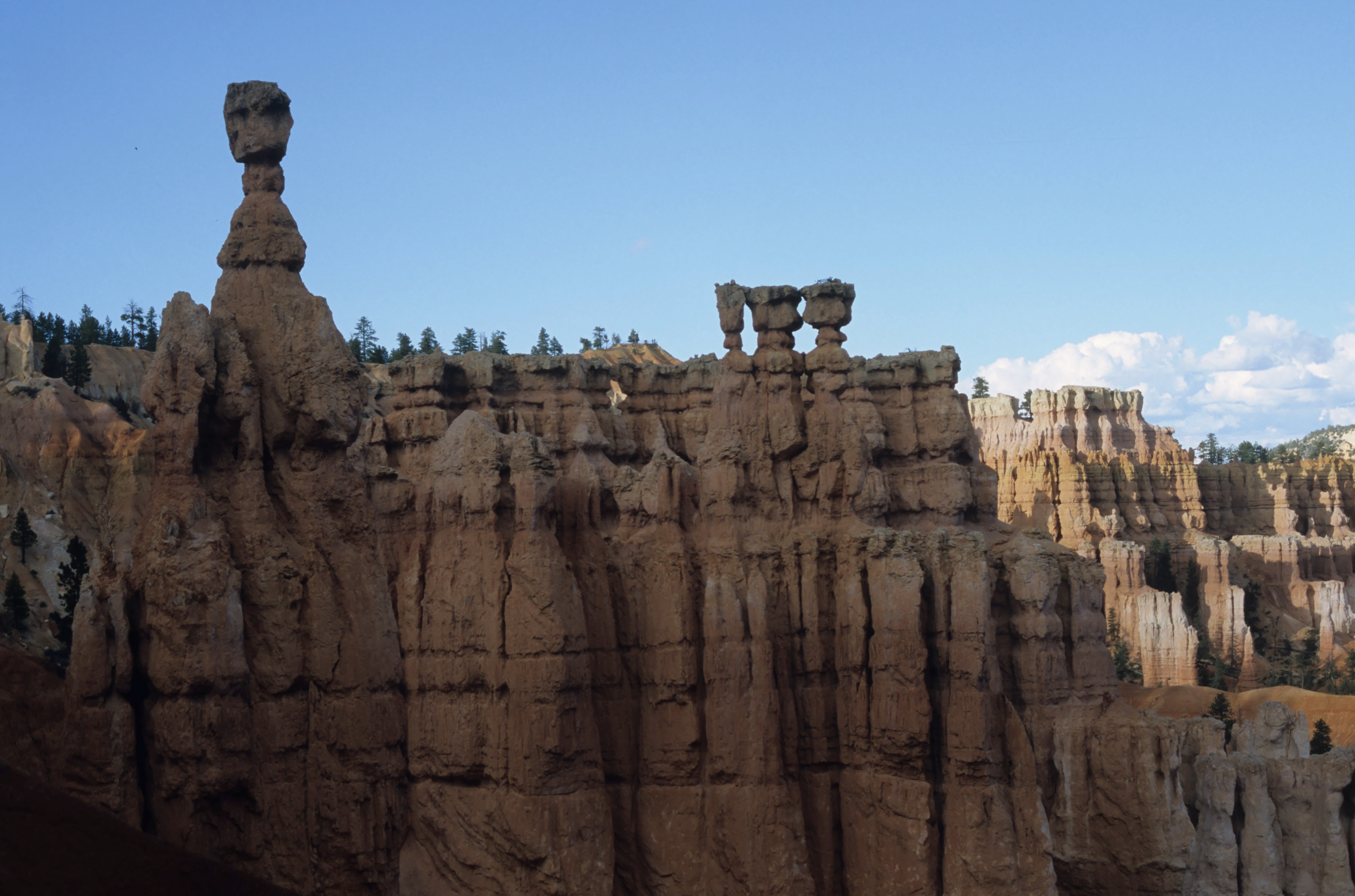
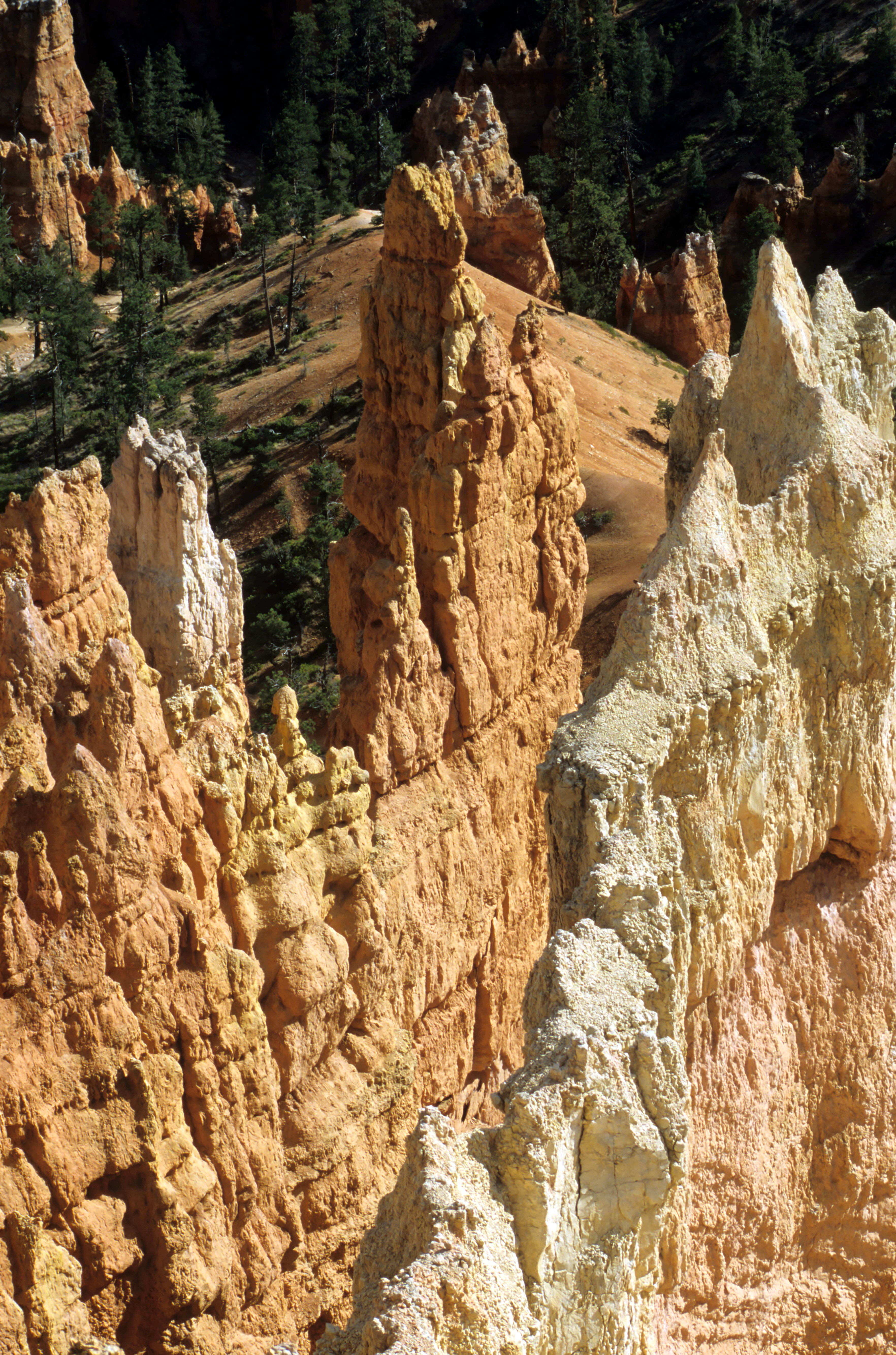
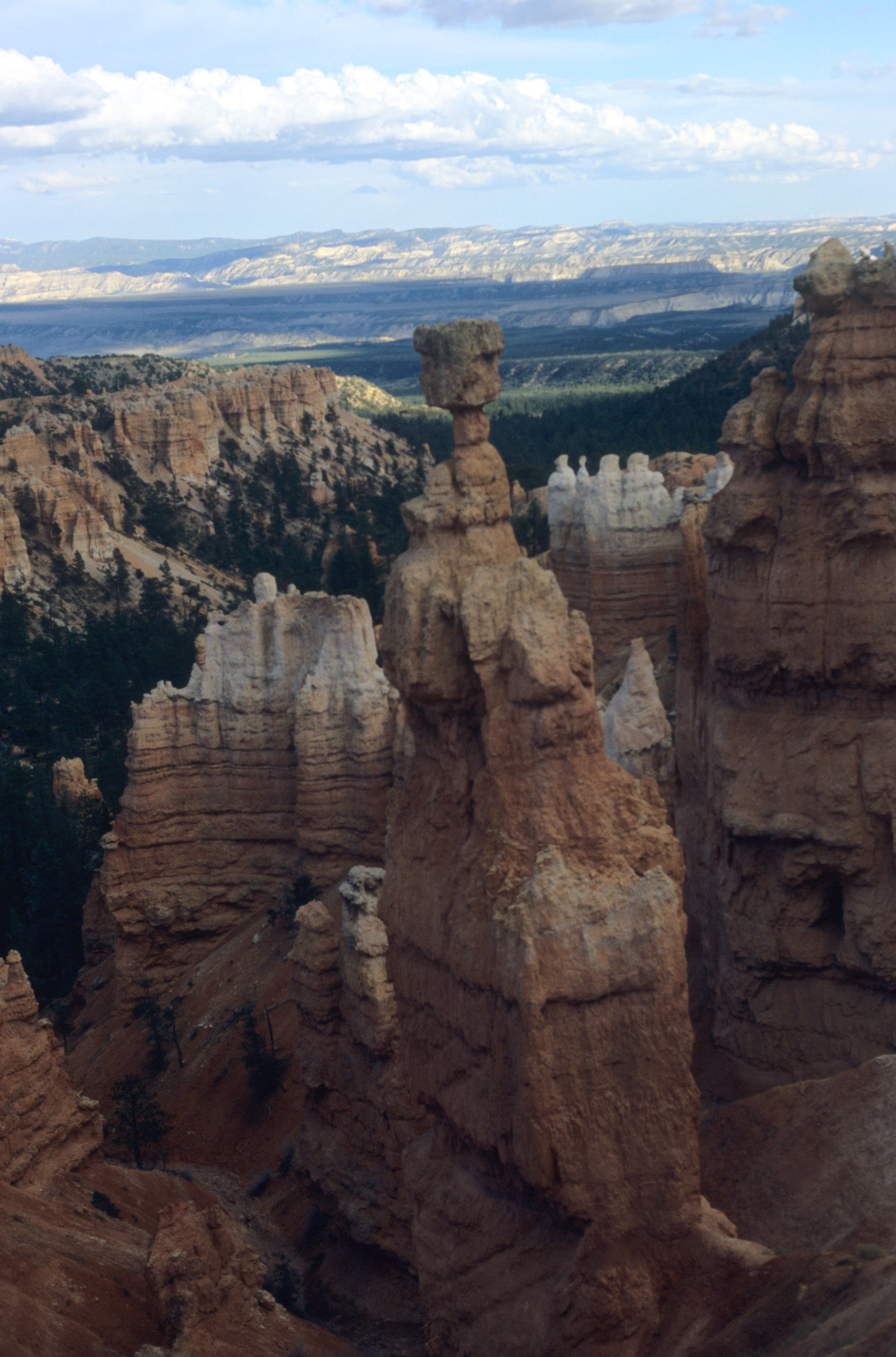
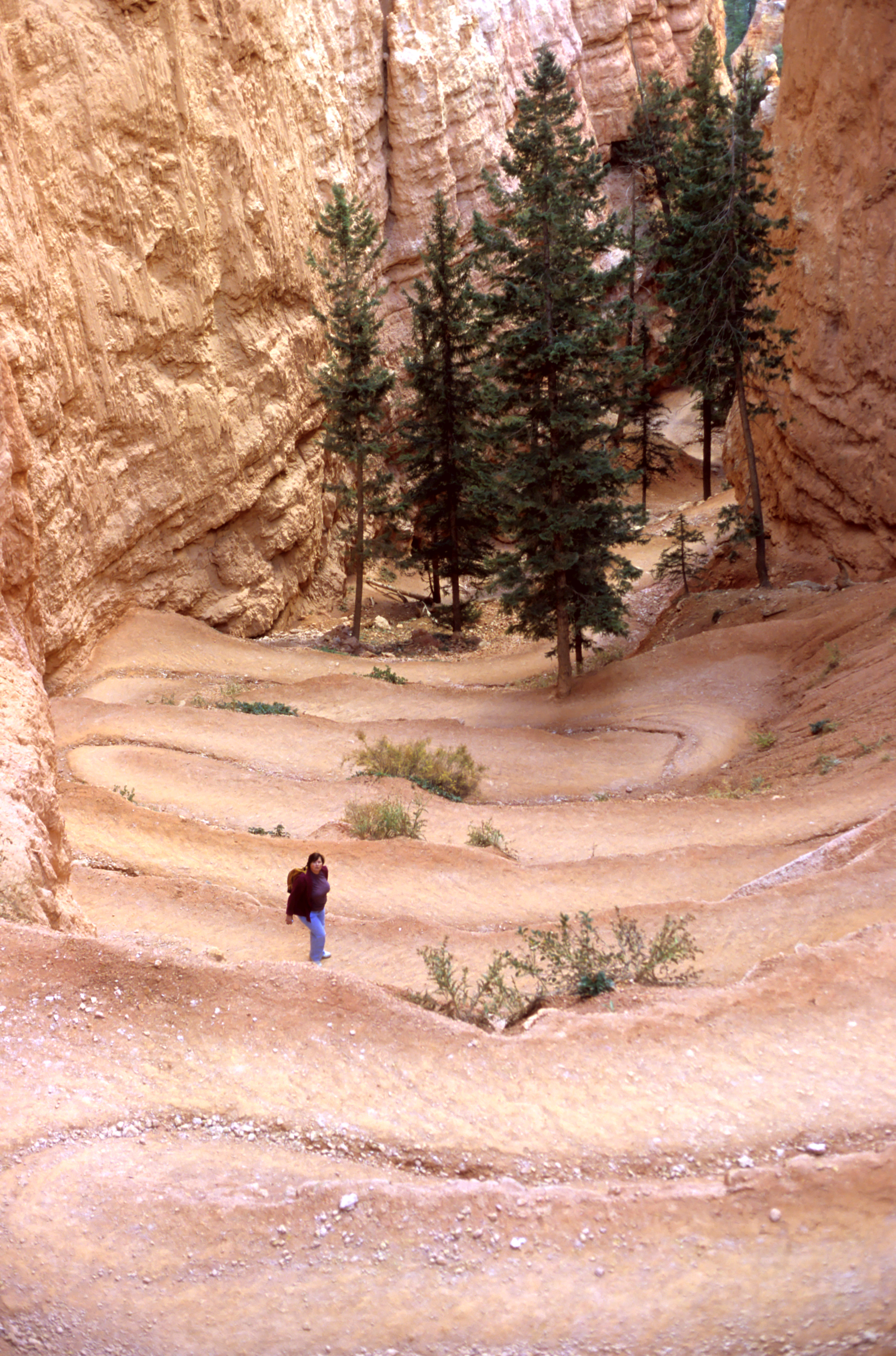
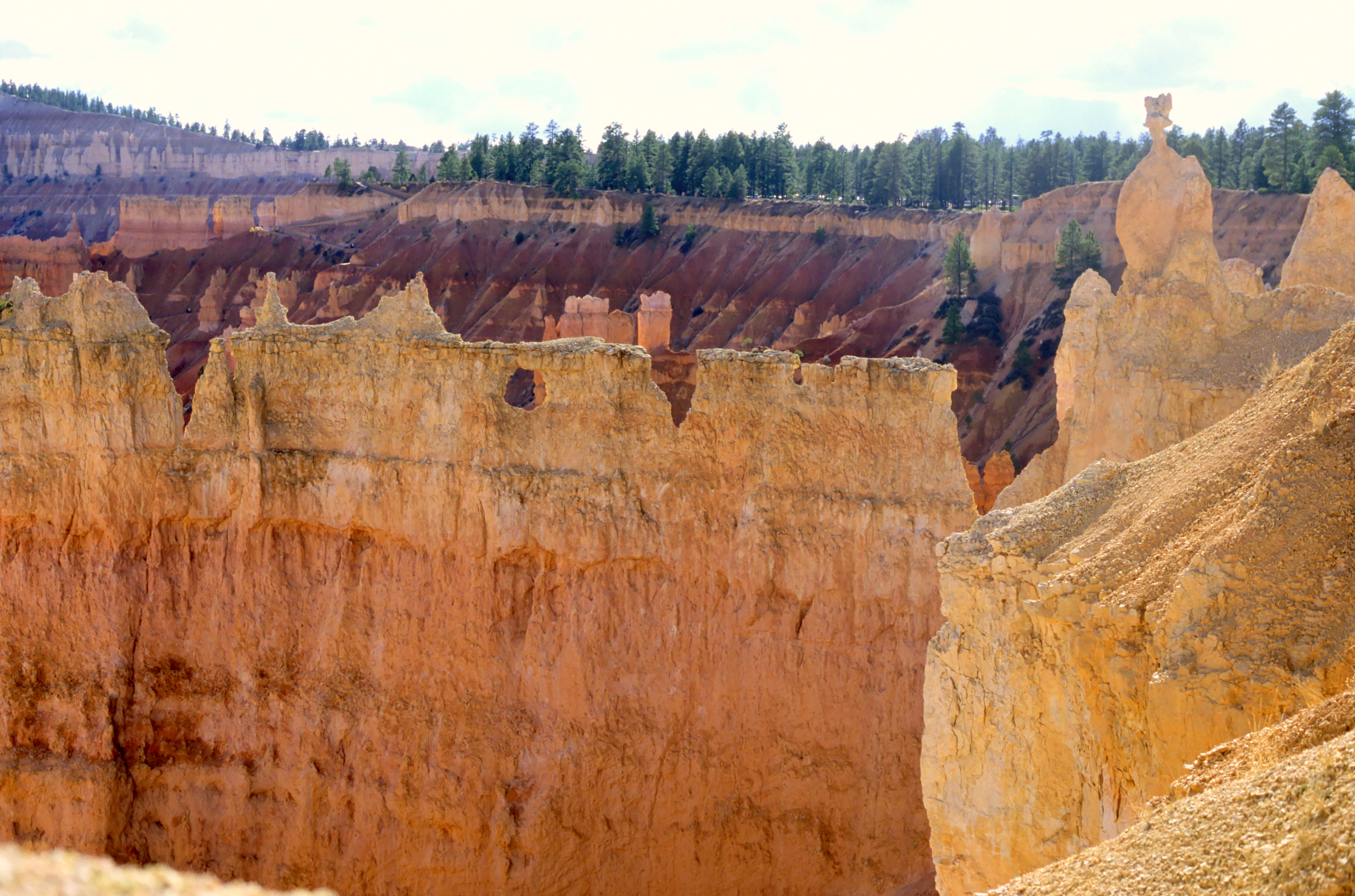
Impressive in a different way is the Bryce Canyon 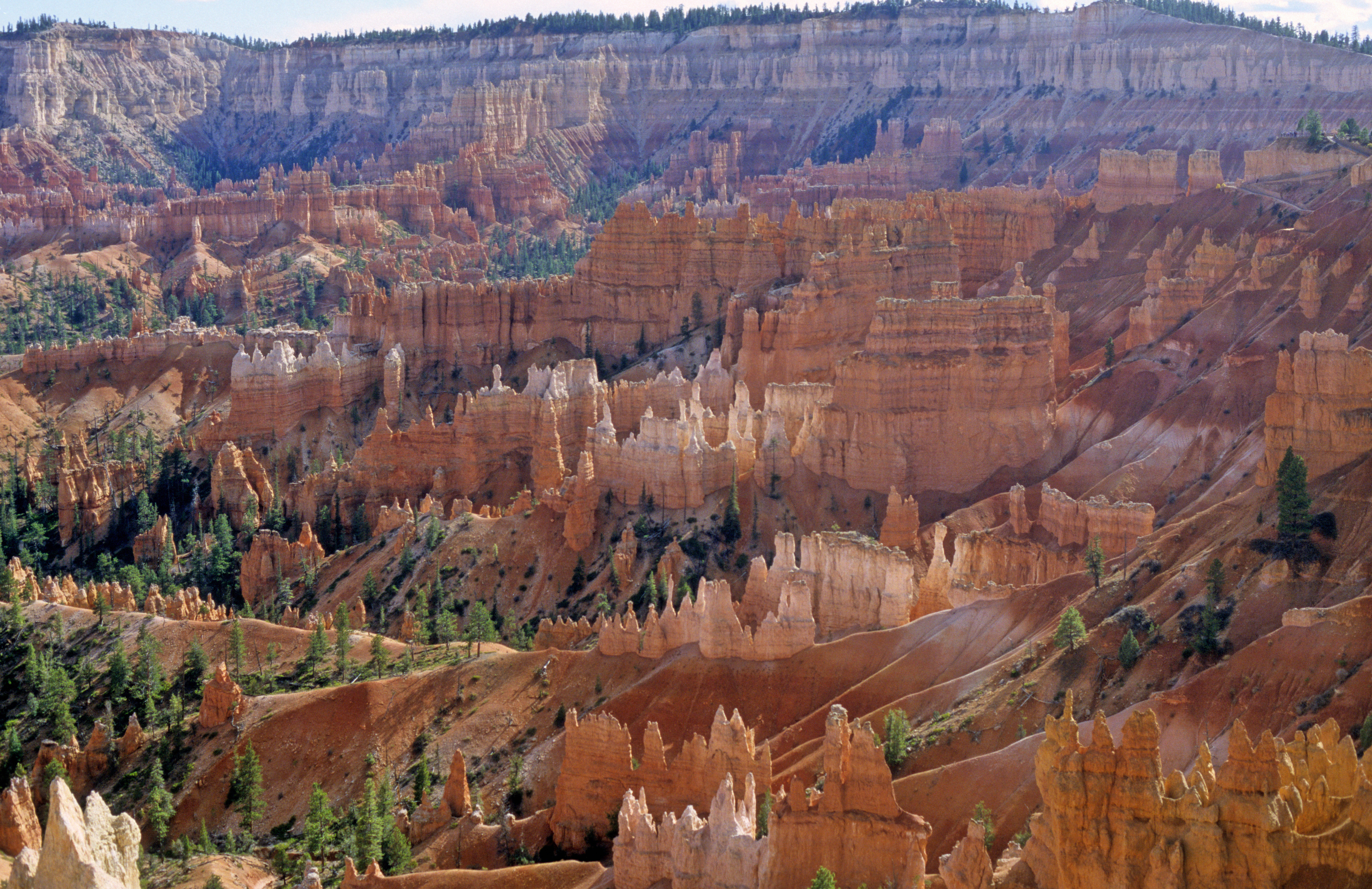 in Utah. This is a valley with many branches eroded in a rock that, from the point of view of chemistry, is limestone. However, unlike typical limestone, it was deposited in a shallow lake rather than in deep sea. Consequently, being much softer than limestone, the rock was carved by flowing water into unusual shapes, like in this or the following two pictures: picture 1 , picture 2 . A walk into the deep and steep crevasses like this and this one among the vertical walls is very impressive.
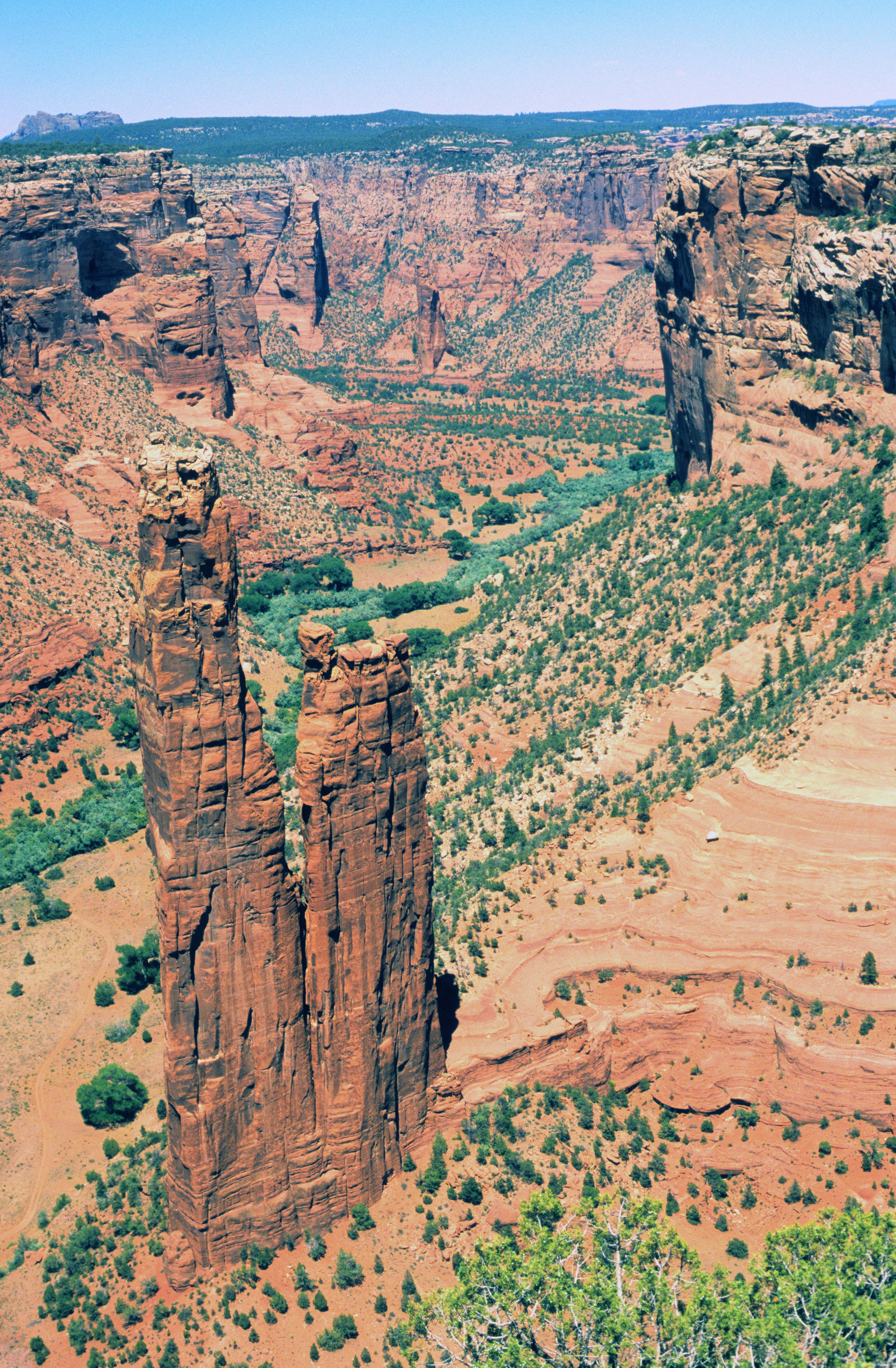
Quite unusual is the Canyon de Chelly 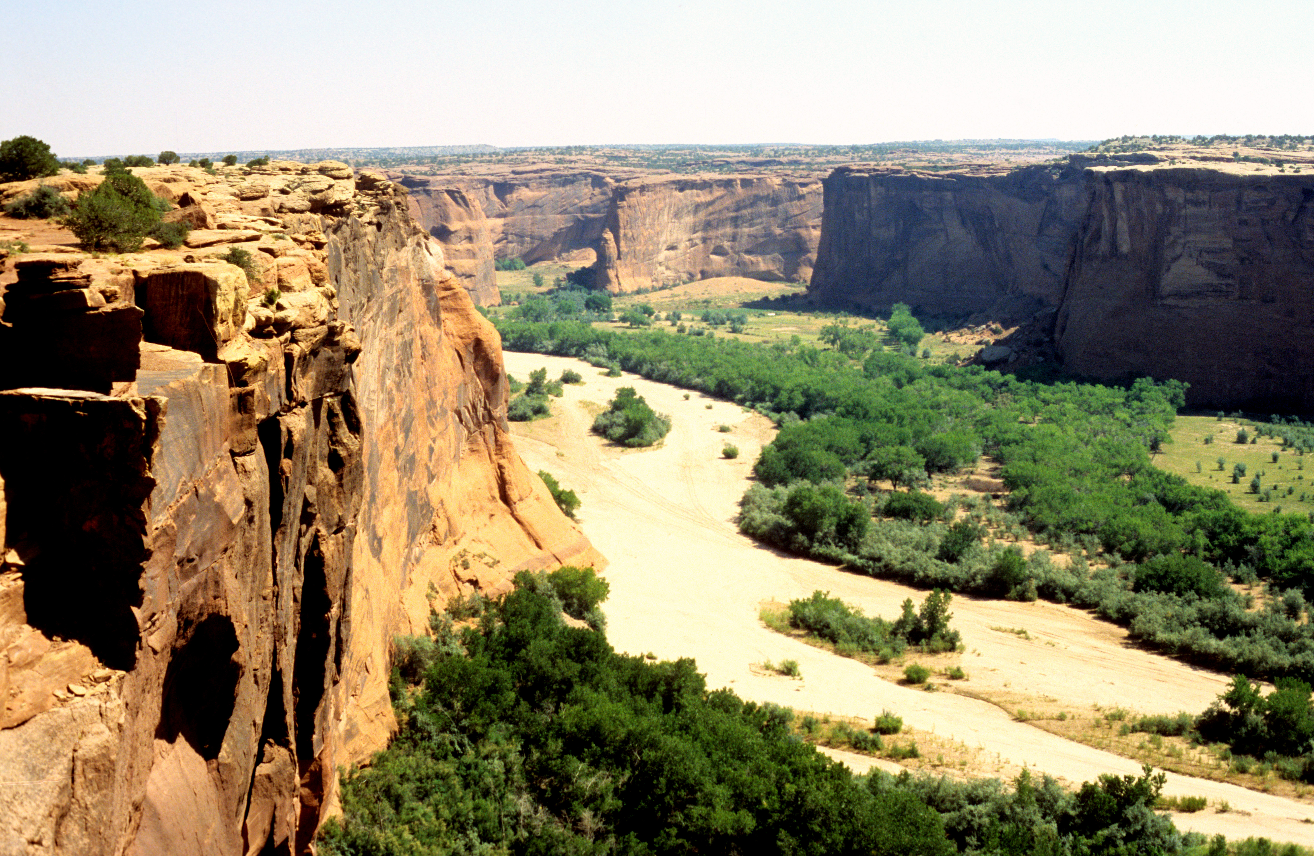 in north-eastern Arizona. It is carved into a semi-desert rocky plateau. Driving on the plateau, one unexpectedly comes to the edge of the canyon, whose green bottom looks like a valley in a paradise. It is hot and very dry, but the seasonal river that flows there in wet season leaves enough water in the ground that plants can live on it. The Navajo people who live in the canyon today do not wish to be visited by crowds of tourists, so going along the canyon bottom is allowed only in guided groups, in cars. (Actually, the canyon has many branches, so it would be quite possible to get lost without a guide.) Going alone is allowed only along a single trail , carved into the vertical sandstone walls of unusual colours and sediment patterns. The trail leads to the so-called White House , a large complex of buildings, built by the Askenazi Indians, who lived here some 800 years ago. Note the magnificent rocky wall above, some 300 meters high and overhung on almost all of its height. Another impressive object in the canyon is the Spider rock , called so because only spiders are reportedly able to climb it.
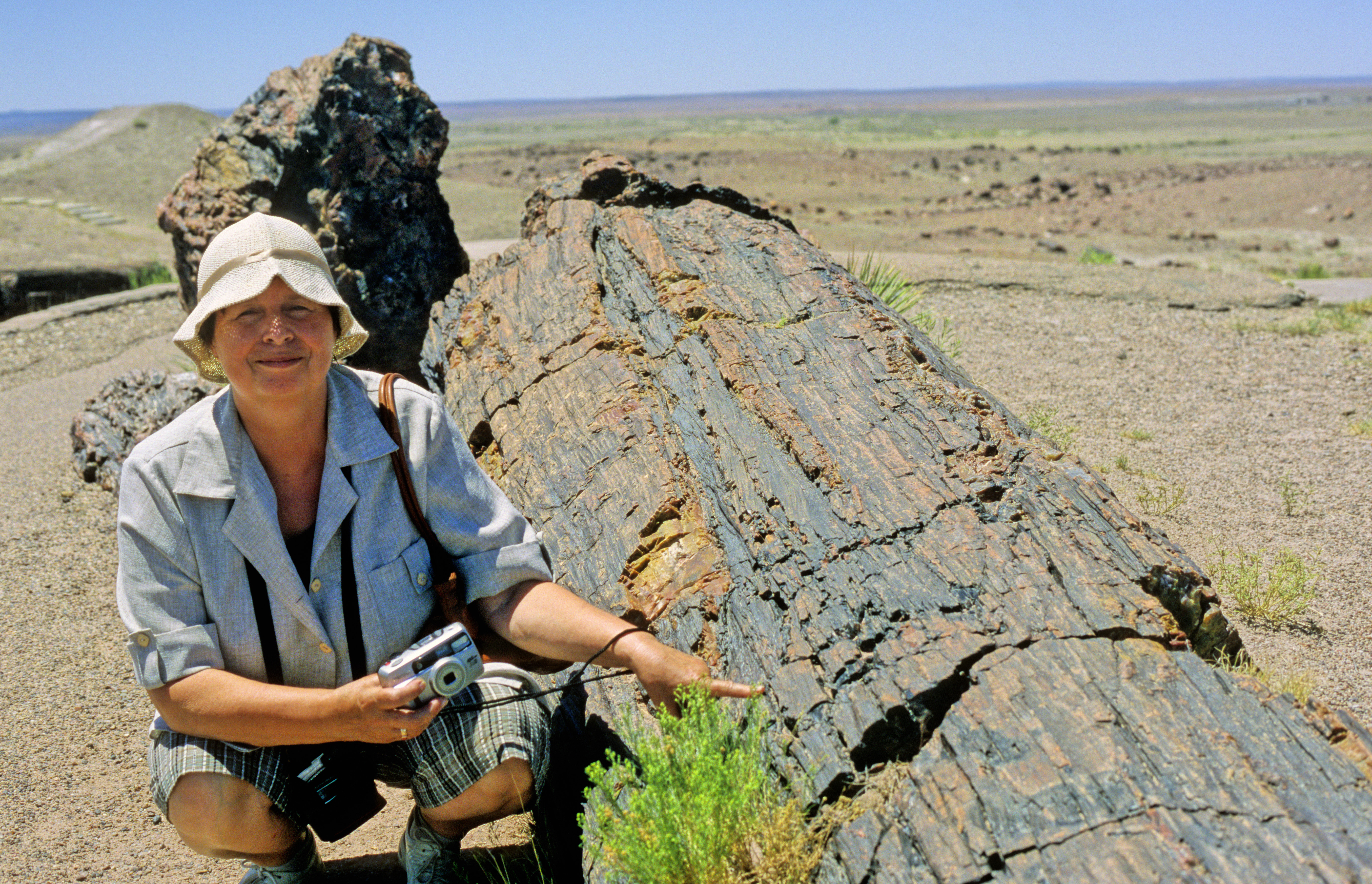
To the south from Canyon de Chelly, the Petrified Forest 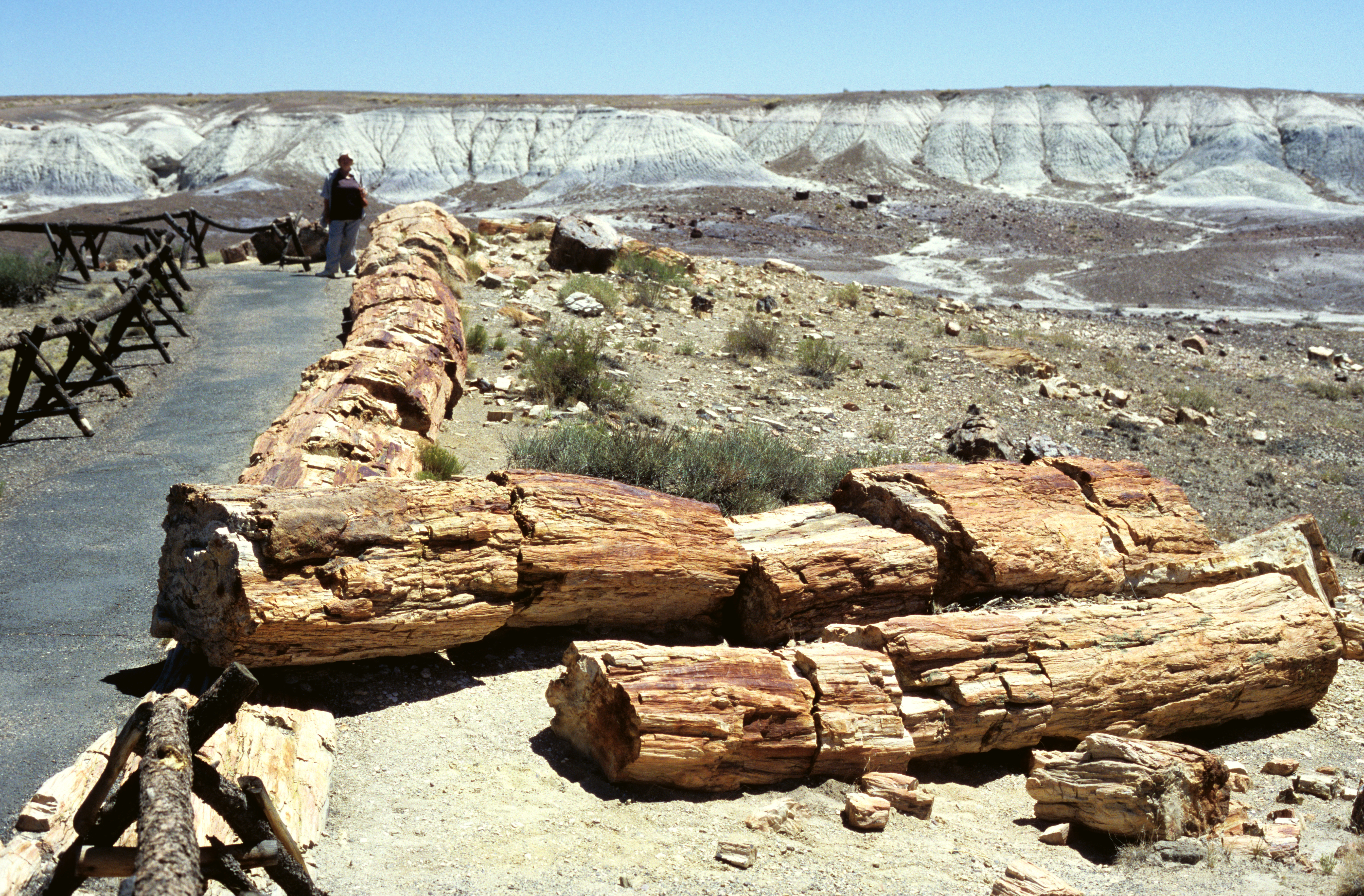 National Park is worth a visit. It is a place where many tree trunks were buried in river sediments several hundred million years ago. As the sediments solidified into rocks, water circulating within the rocks was very slowly and gradually dissolving and carrying away the cells of the trees, and depositing minerals in their place. The "petrified trees" are actually casts of the trees made in semi-precious stones, mainly agate. The bark , and even the internal structure of the tree trunks, is reflected in stone with astonishing precision, so that you can even count the tree rings.
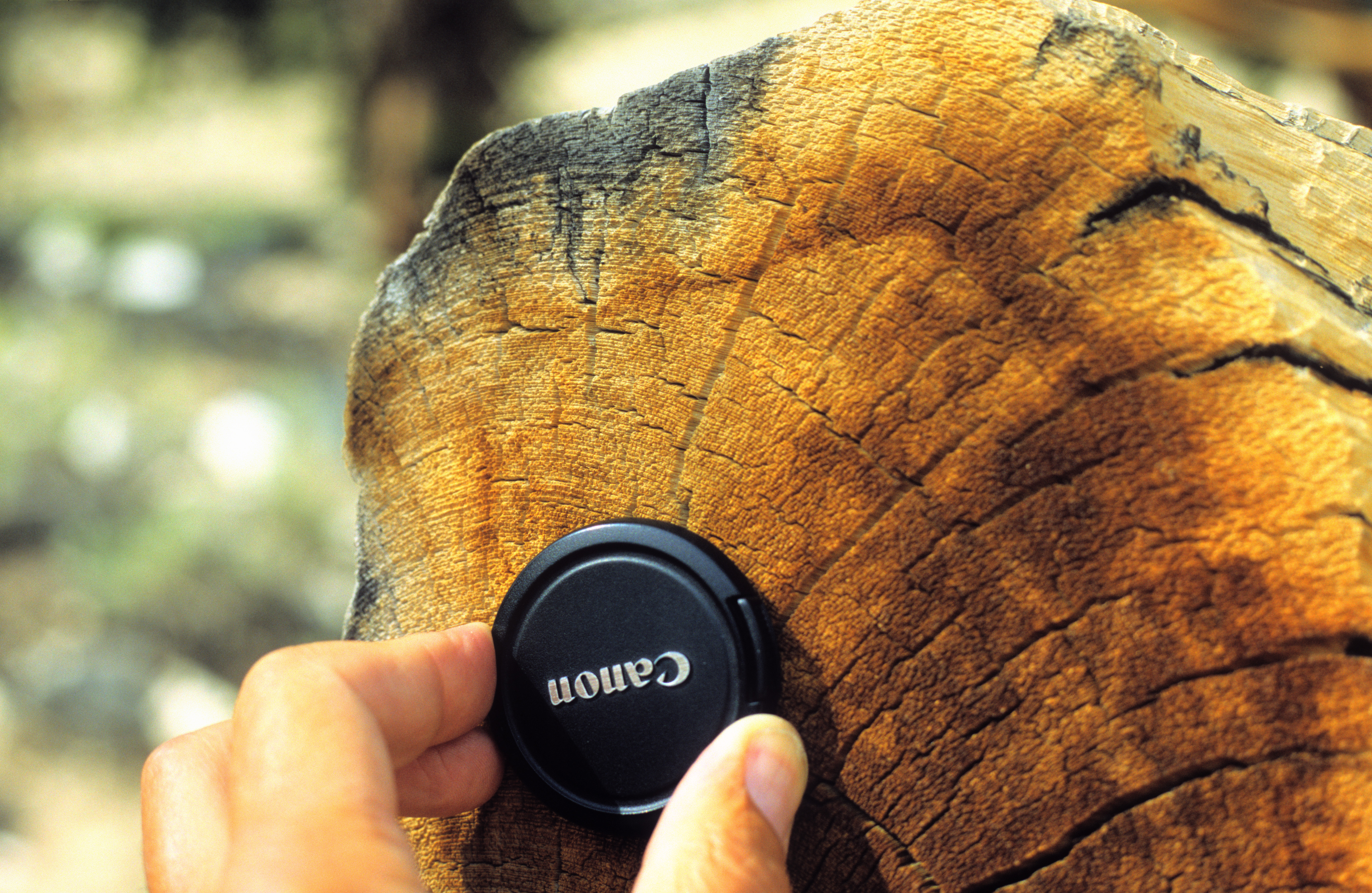
There are many more beautiful places in the USA that are worth seeing, too many to be all mentioned here. For this short selection I chose just two more. The first one is the White Mountains in California. Situated east of Yosemite, it is a place where bristlecone pines 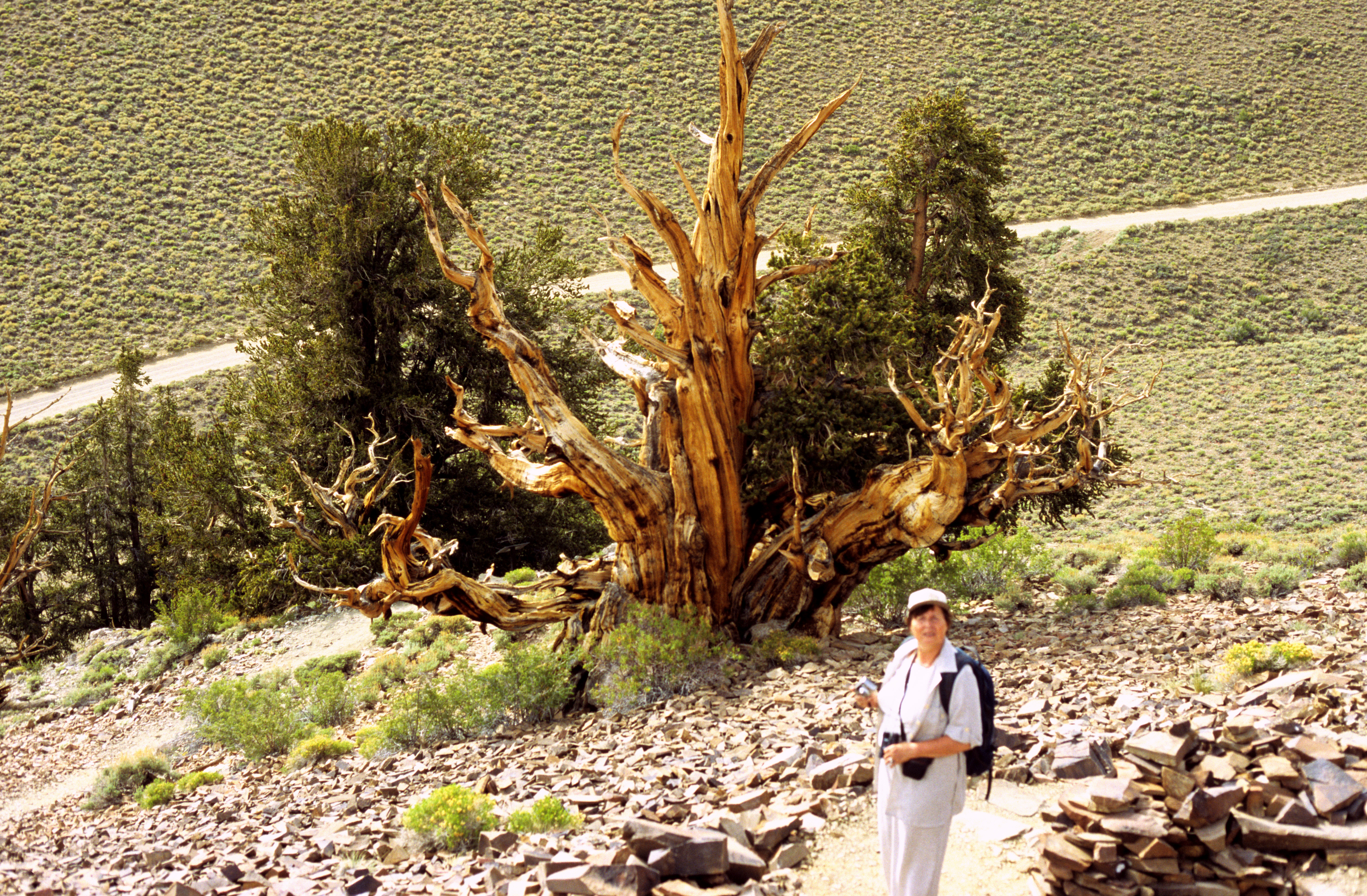 are to be admired. These are the longest-living trees on Earth. The oldest of them is about 4500 years old. (Park rangers will not tell you which one it is, and for a good reason: the record-loving and souvenir-collecting Americans would dismember it in one season.) 4000 years is for them an unremarkable average age. This tree , for example, lived for 3200 years before it fell in 1676. They are so durable because their wood is very hard and dense, see how tightly spaced are its rings . Ring patterns are so characteristic for various sequences of years that they can be matched in different trees. As a result, matching the patterns in a living tree to those that already fell, one can very precisely estimate the date when a dead tree fell. Matching ring patterns among fallen trees, one can go several thousand years back and make conclusions about the climate of those epochs. It is really impressive, how human mind can read such tricky clues!
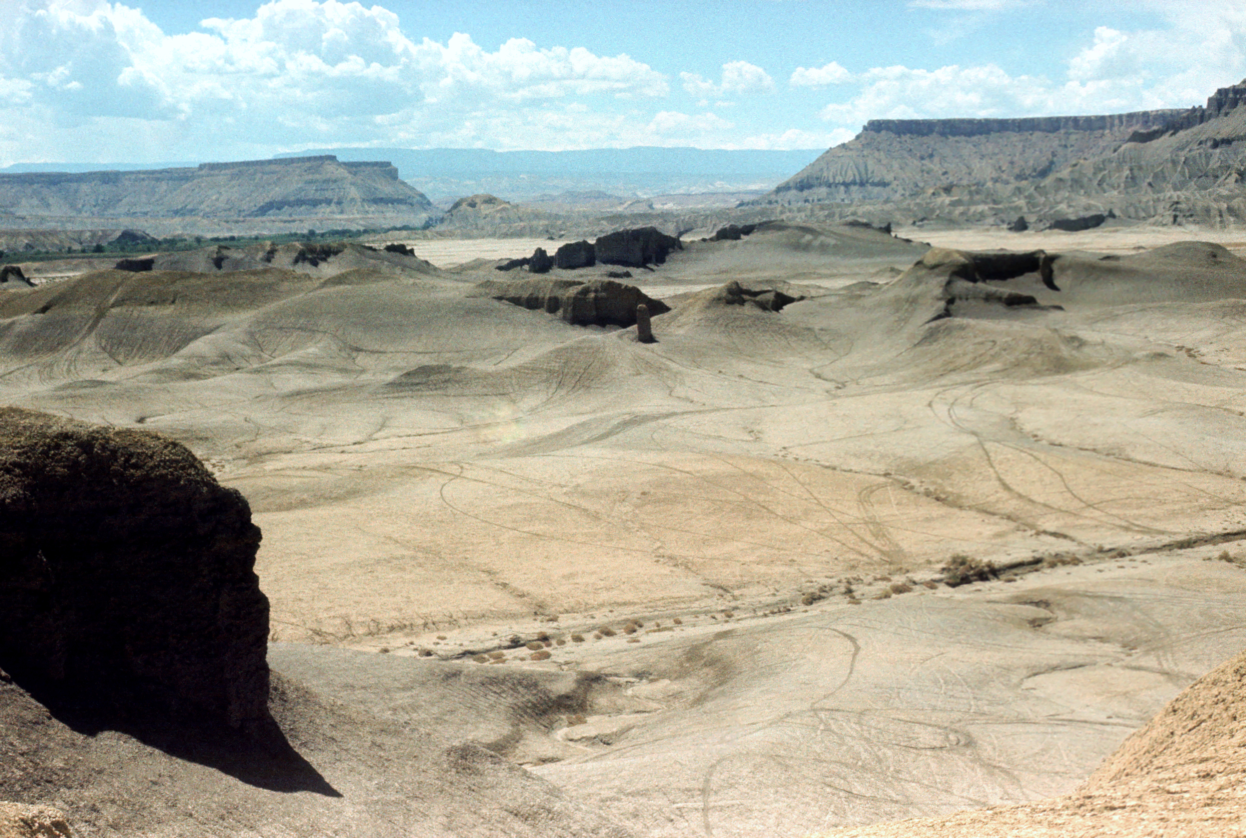
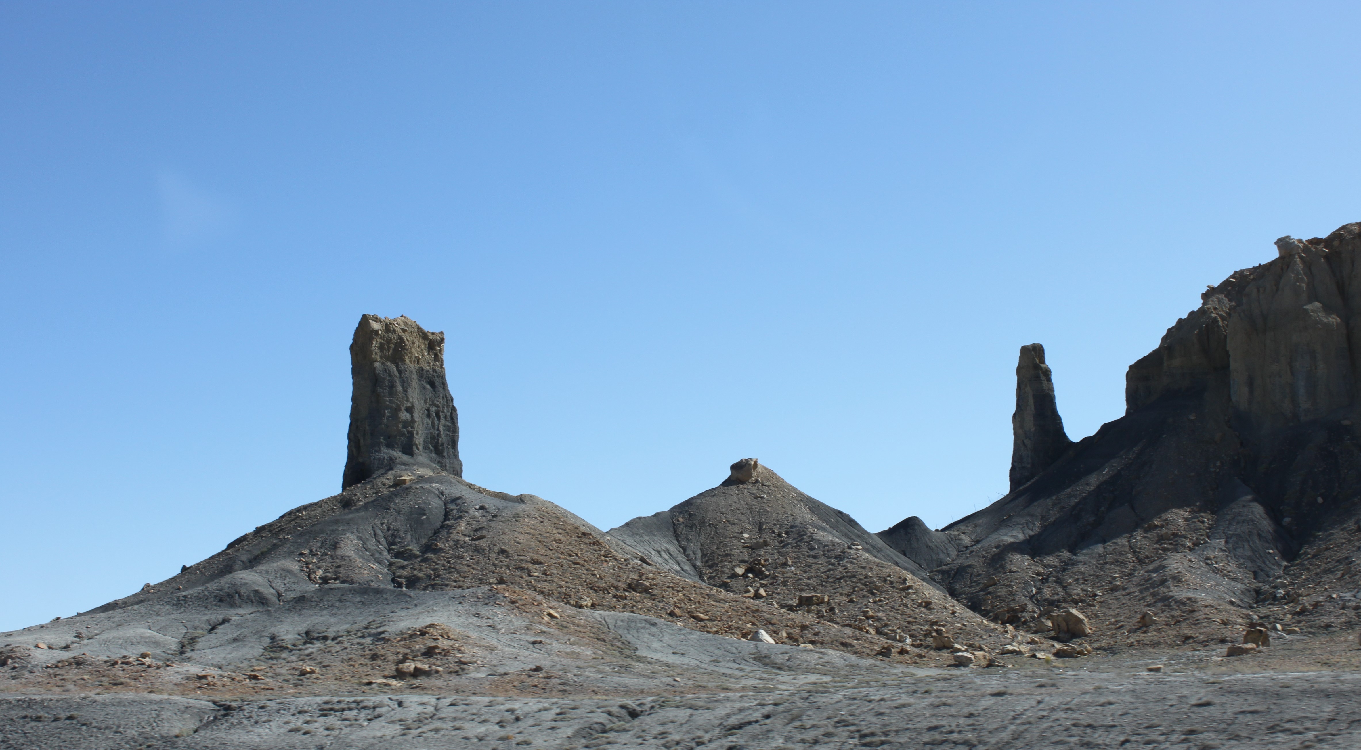
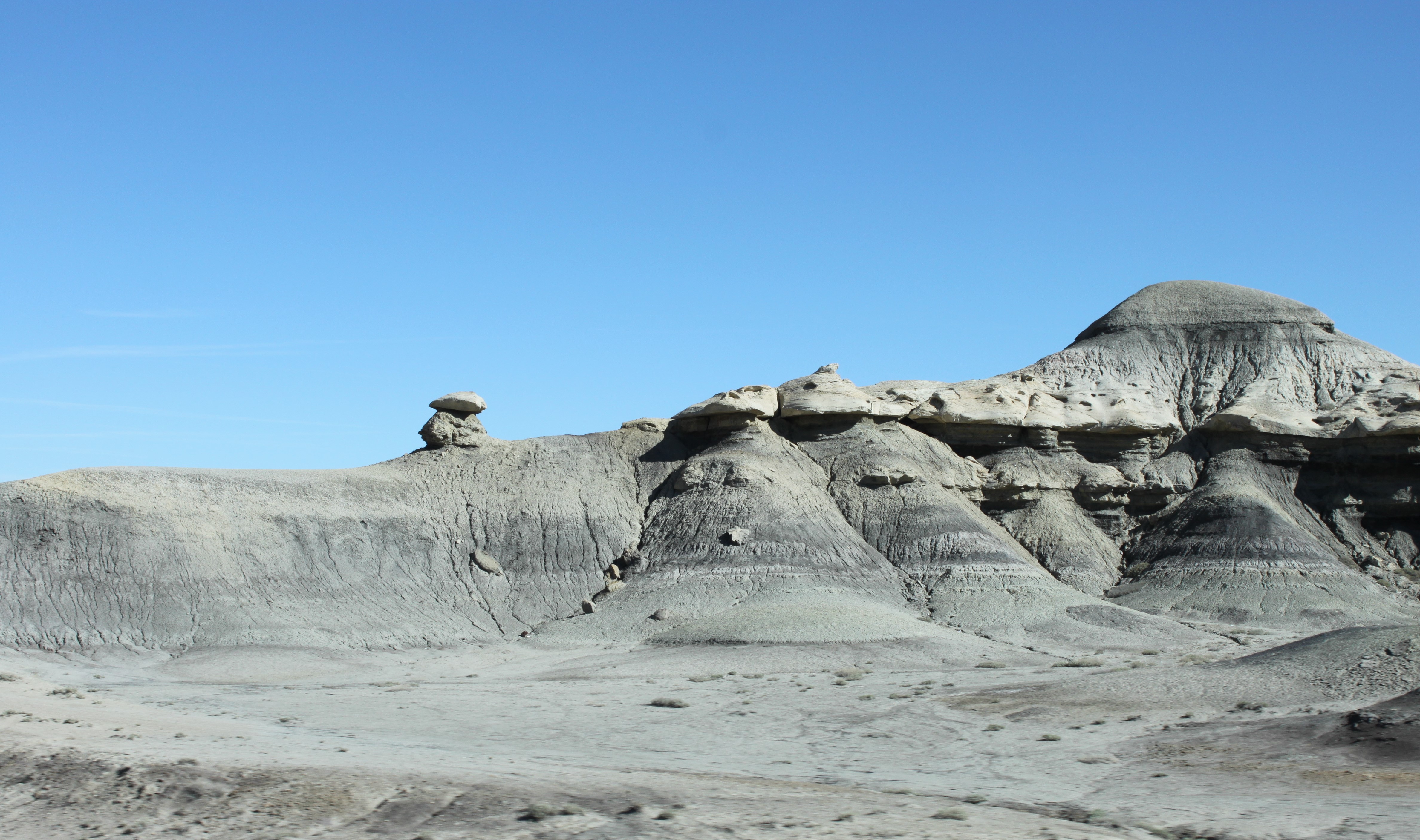
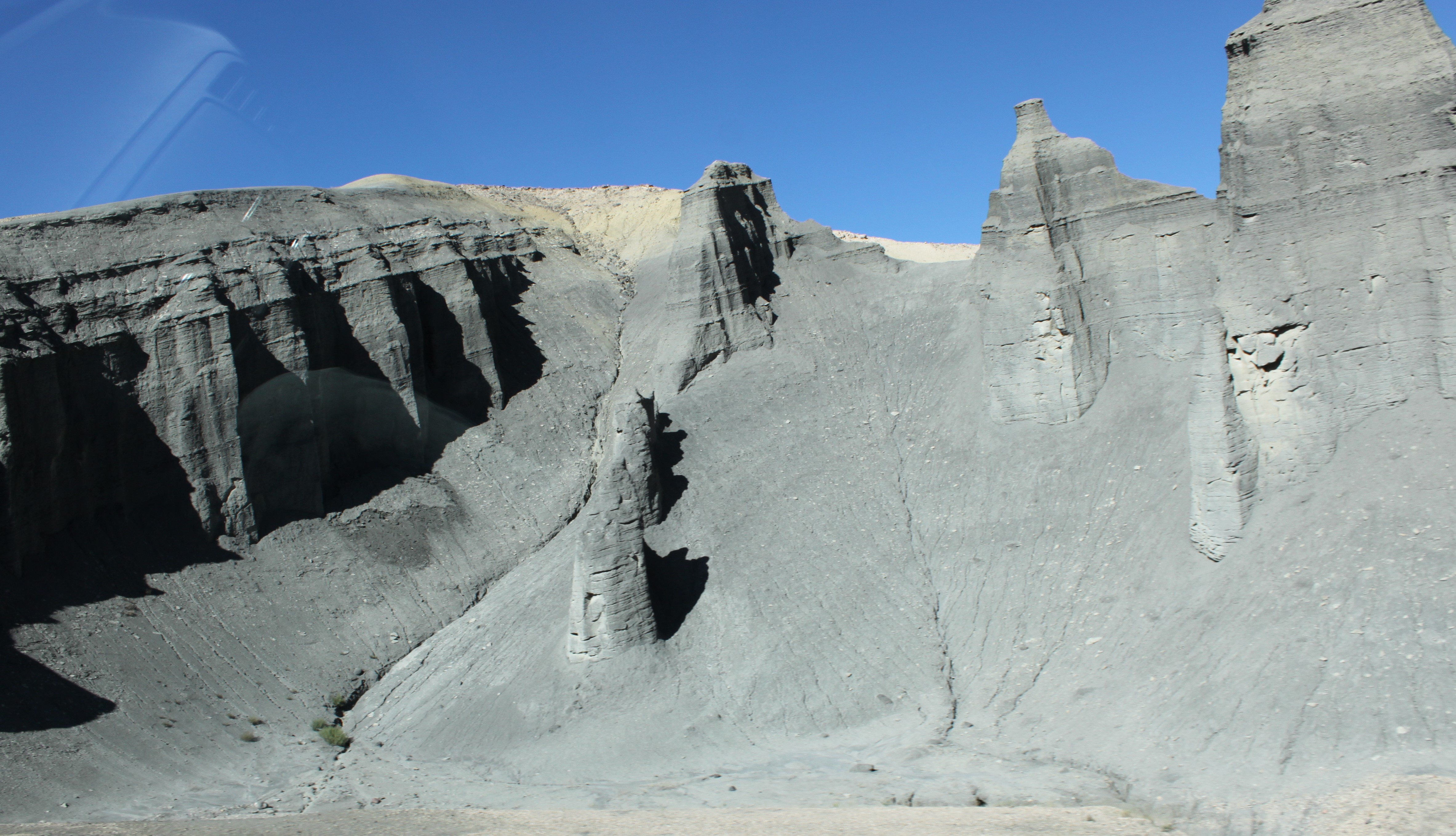
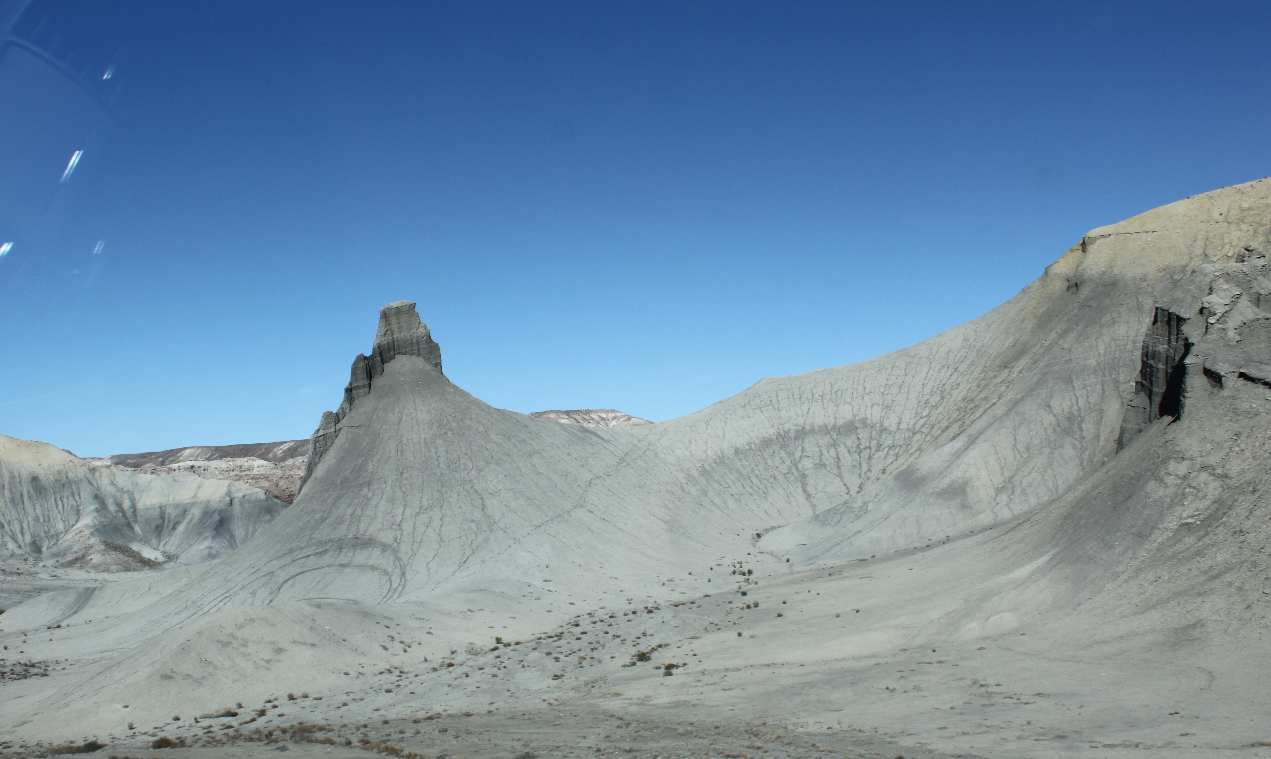
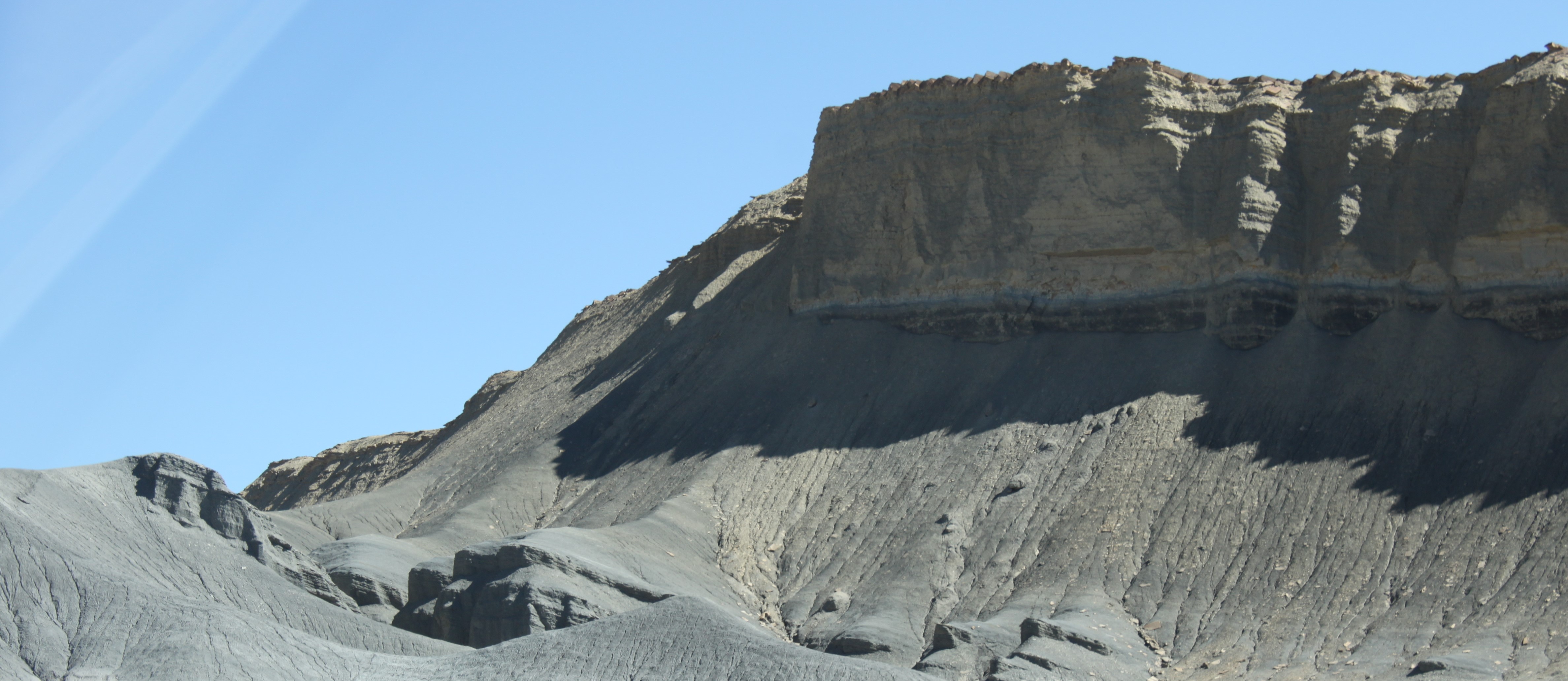
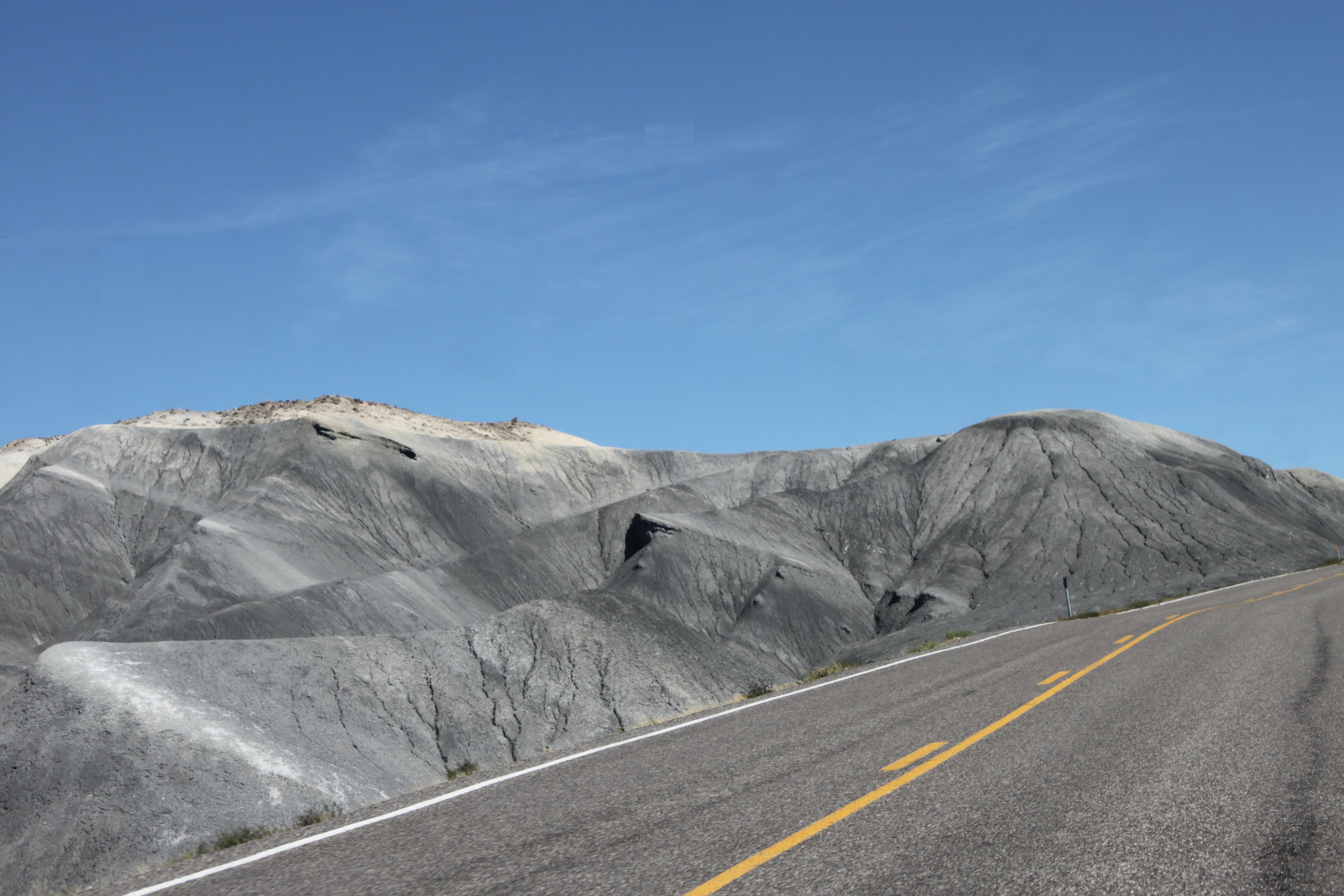
The most unusual of all places that we saw in the USA was San Rafael Reef 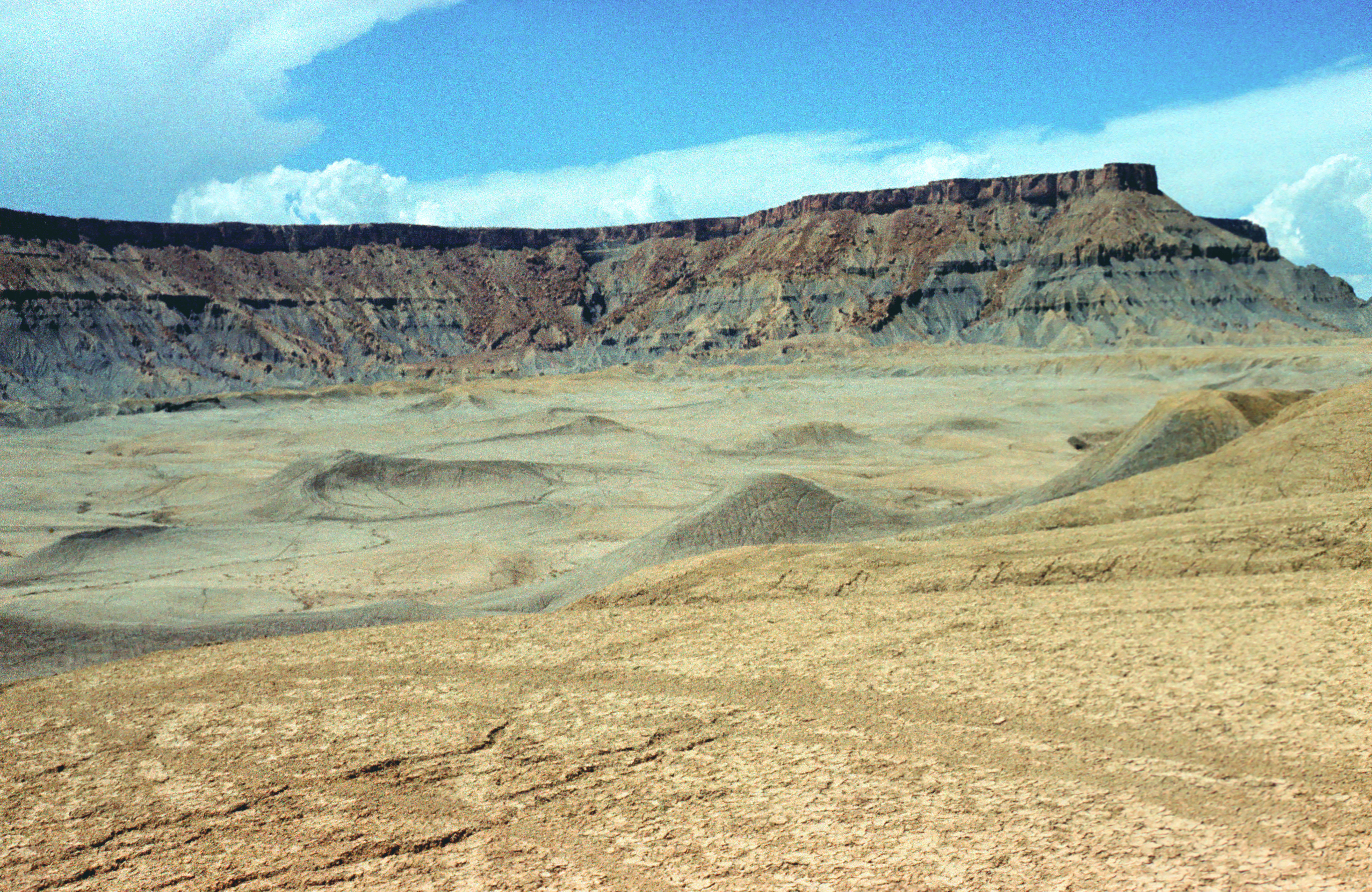 . It is situated in Utah, off the road \# 24 connecting the Capitol Reef National Park and the small village Hanksville. Strangely, it is not advertised in any of our guidebooks - we found it accidentally, just driving by it. It is a desert mostly covered by grey and black ash. There are areas where no plants are within sight and the landscape around looks quite like in the photographs taken on the Moon. By the first time, in 1989, we drove one or two kilometers on a dirt road off the main road \# 24, and then I walked a few hundred meters away to lose all traces of life from my eyeshot. This is where the title picture and this one were taken. The other pictures were taken in 2009 from road \# 24: picture 3 , picture 4 , picture 5 , picture 6 , picture 7 and picture 8 .
By this opportunity I must mention one weak point of the most popular variety of American (printed) tourist guides, the "Tour books" of the American Automobile Association (AAA). Whatever spectacular place they describe, it is listed under the name of the nearest town and not under its own name, even in the subject index. So, you will not find any entry on "White Mountains" in the AAA tour book on California; you must look up the entry on the town Big Pine. Similarly for the world-famous Meteor Crater in Arizona - to find its description, you must know that it lies near the village Winslow and look up the entry on Winslow in the tour book. This is not very reasonable; on two long trips through the USA I nearly missed both of those places and located them only after an extended detective search.
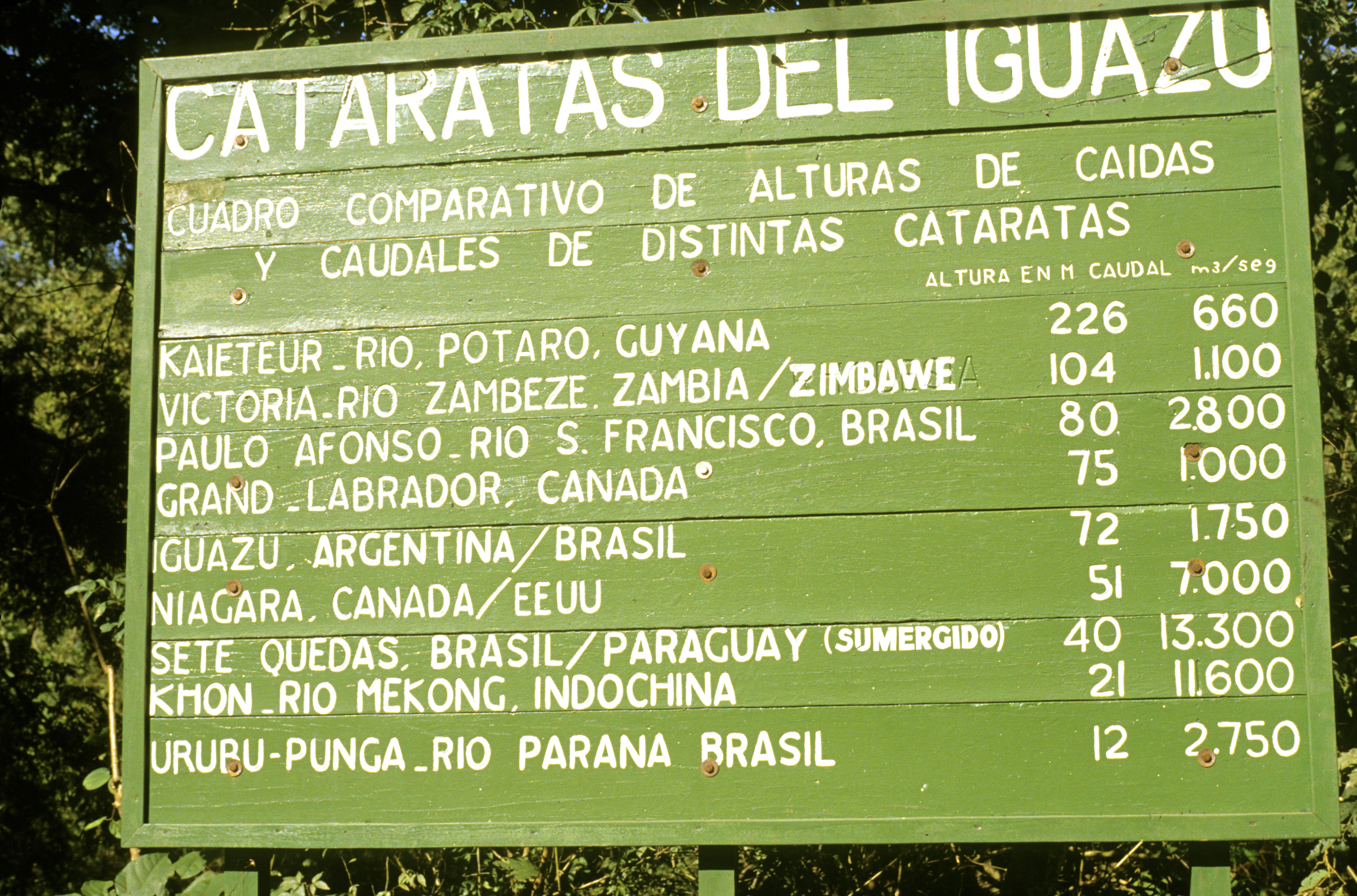
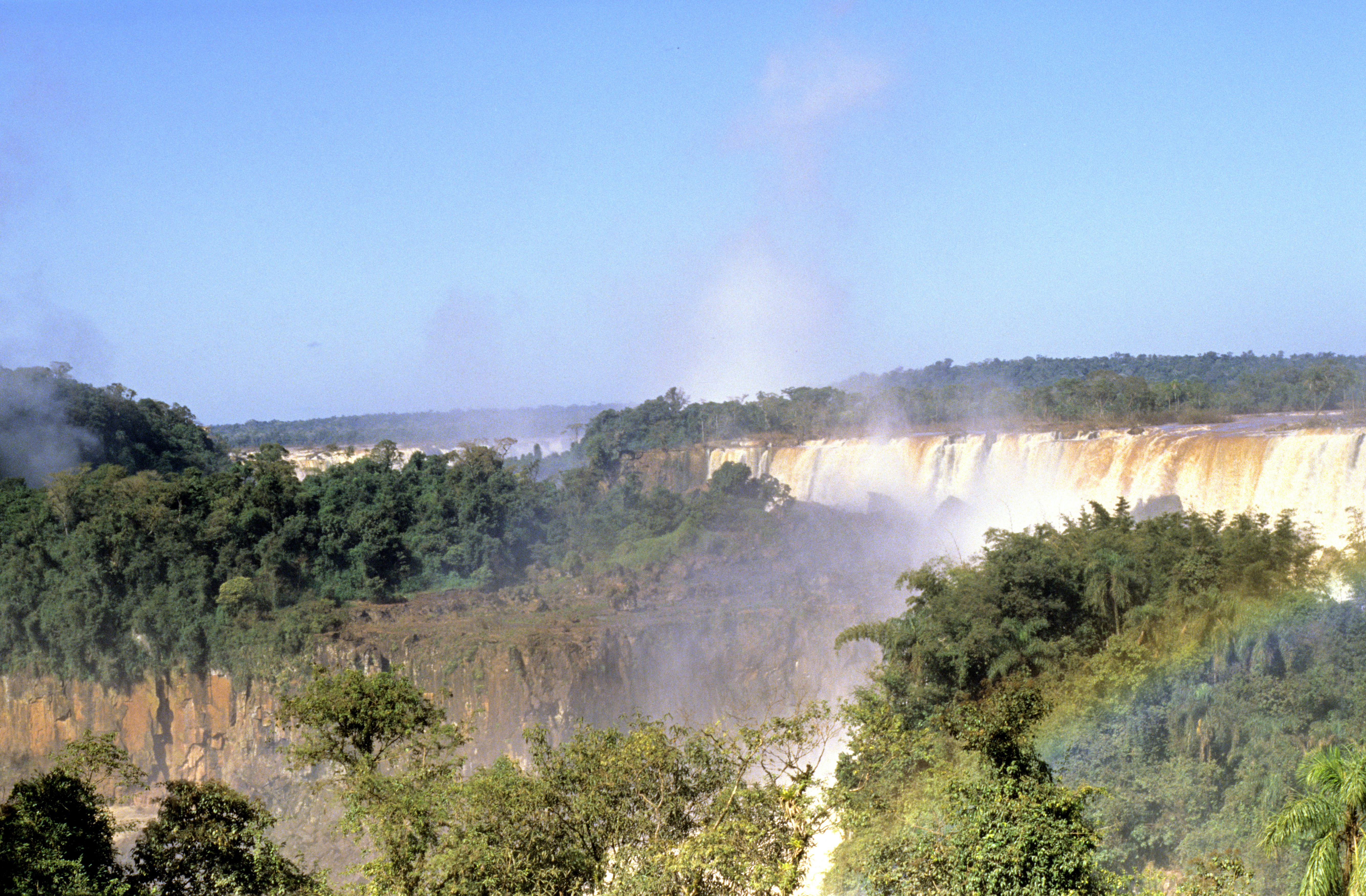
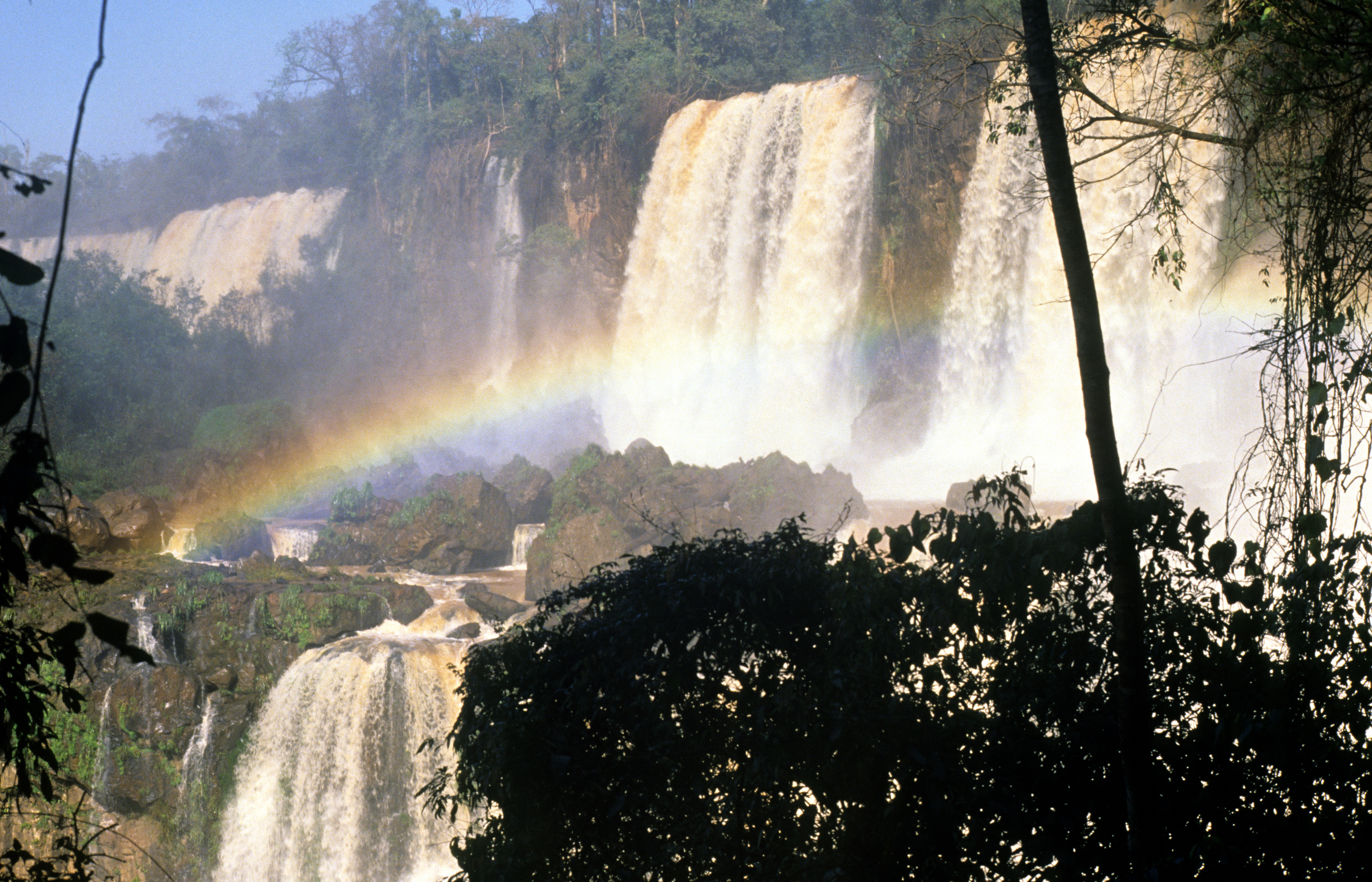
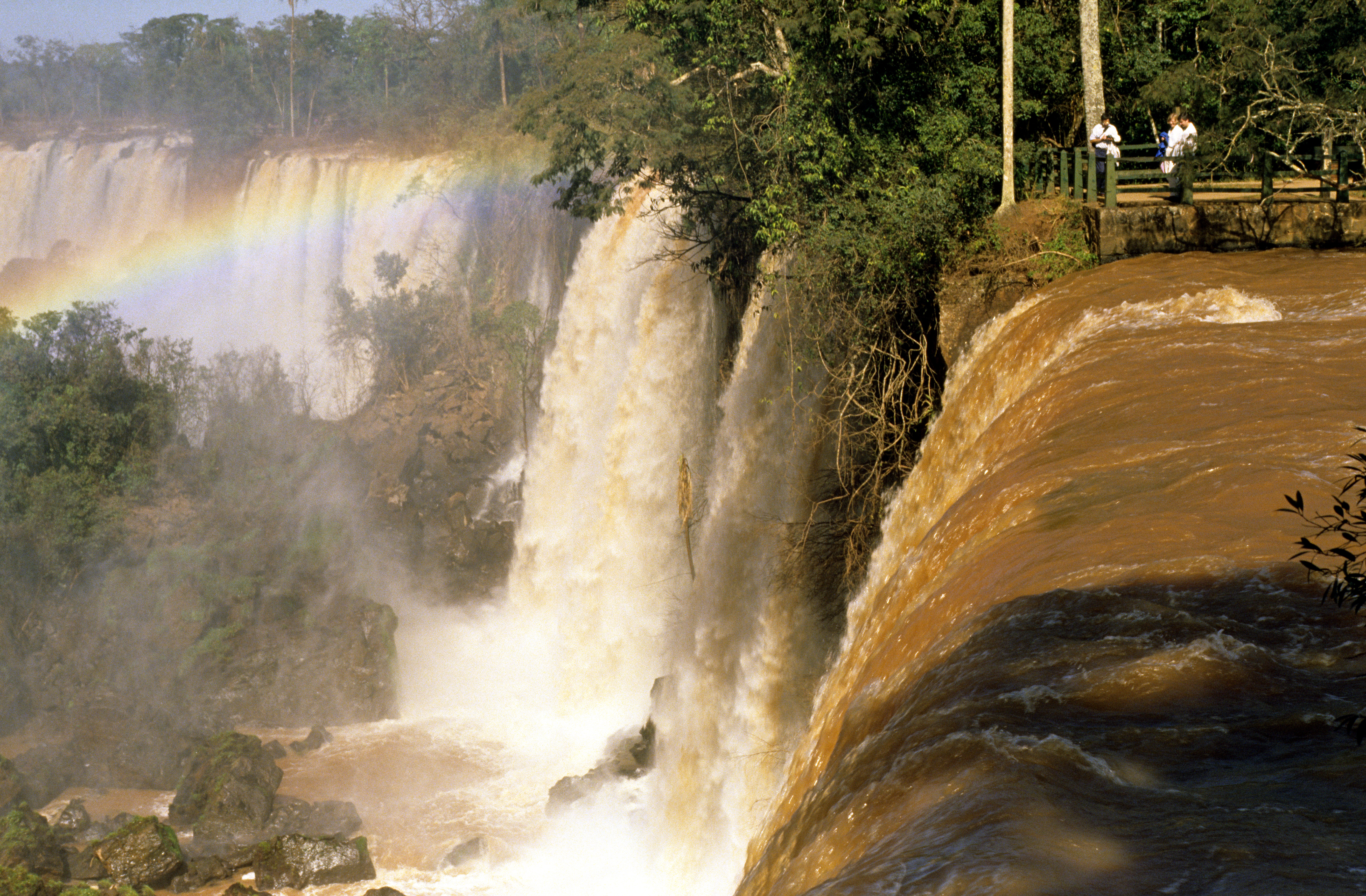
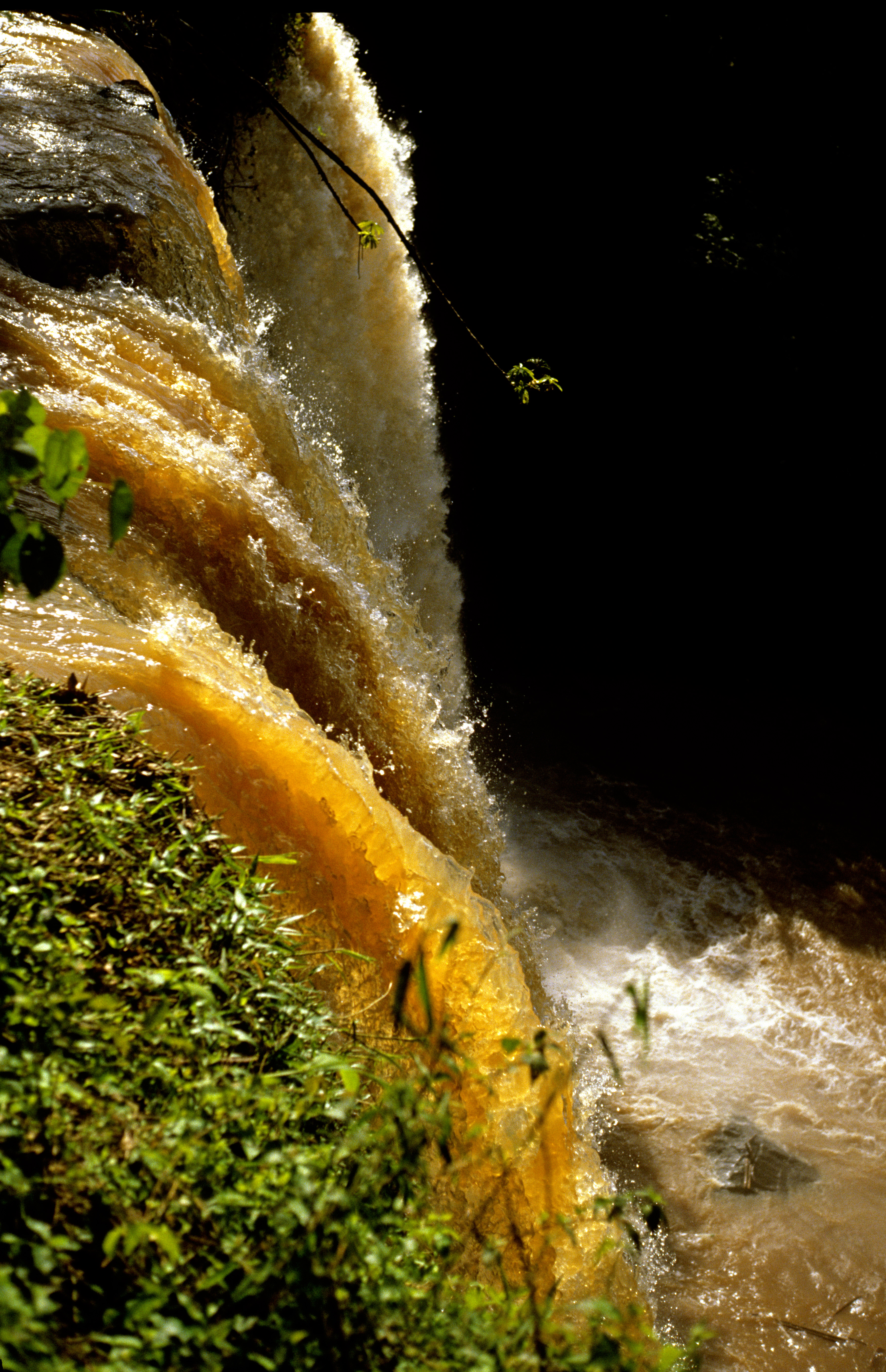
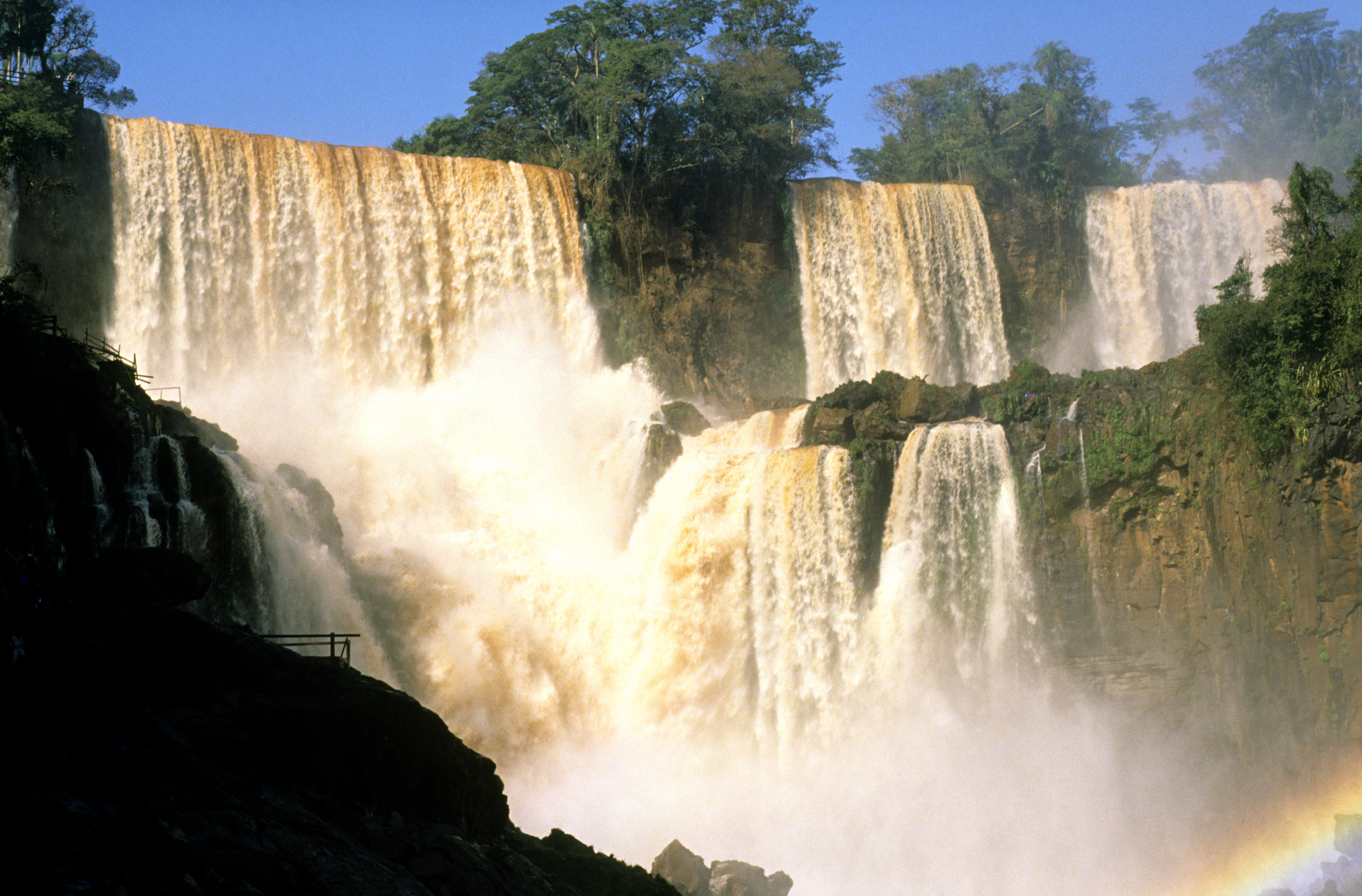
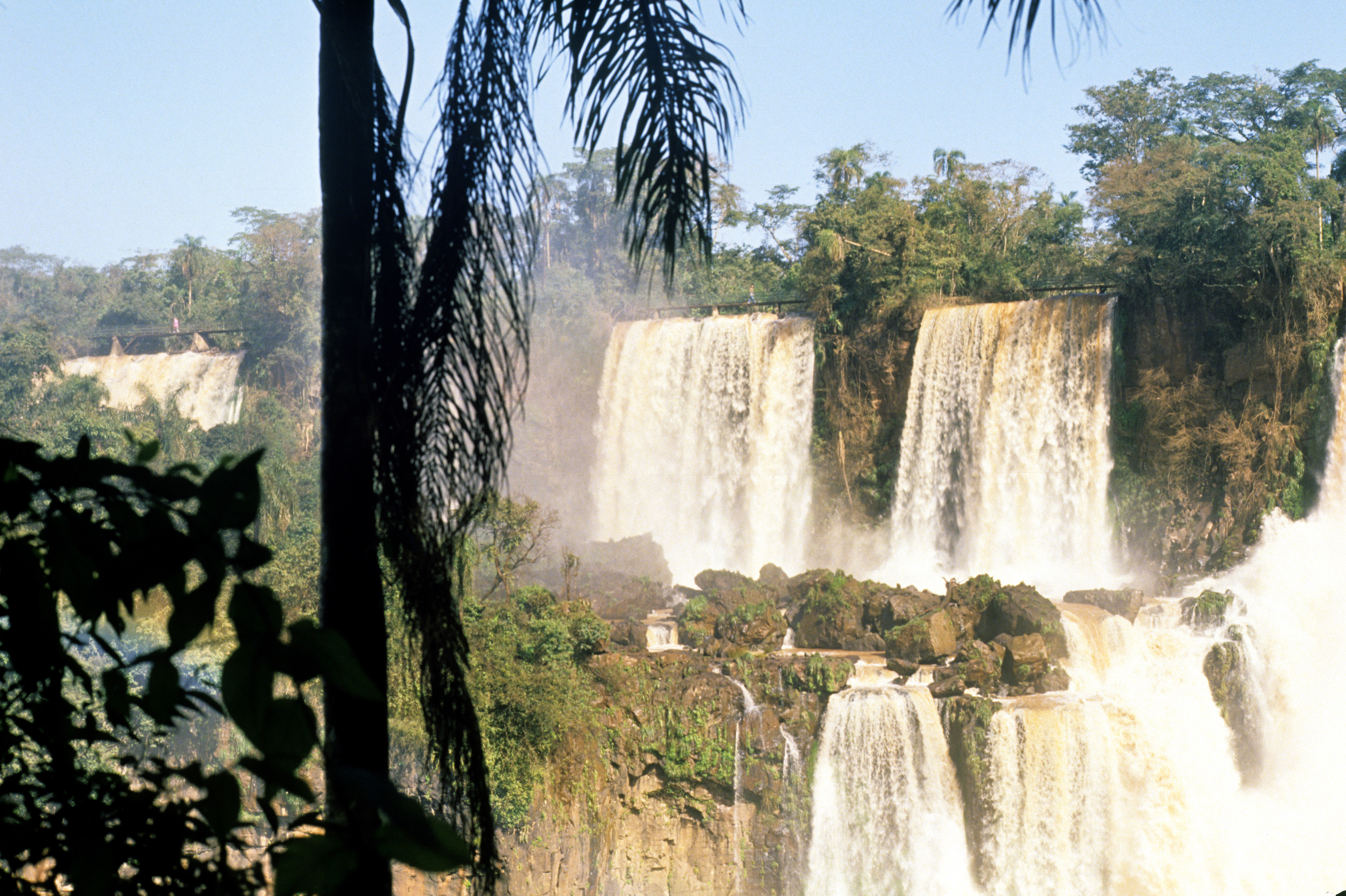
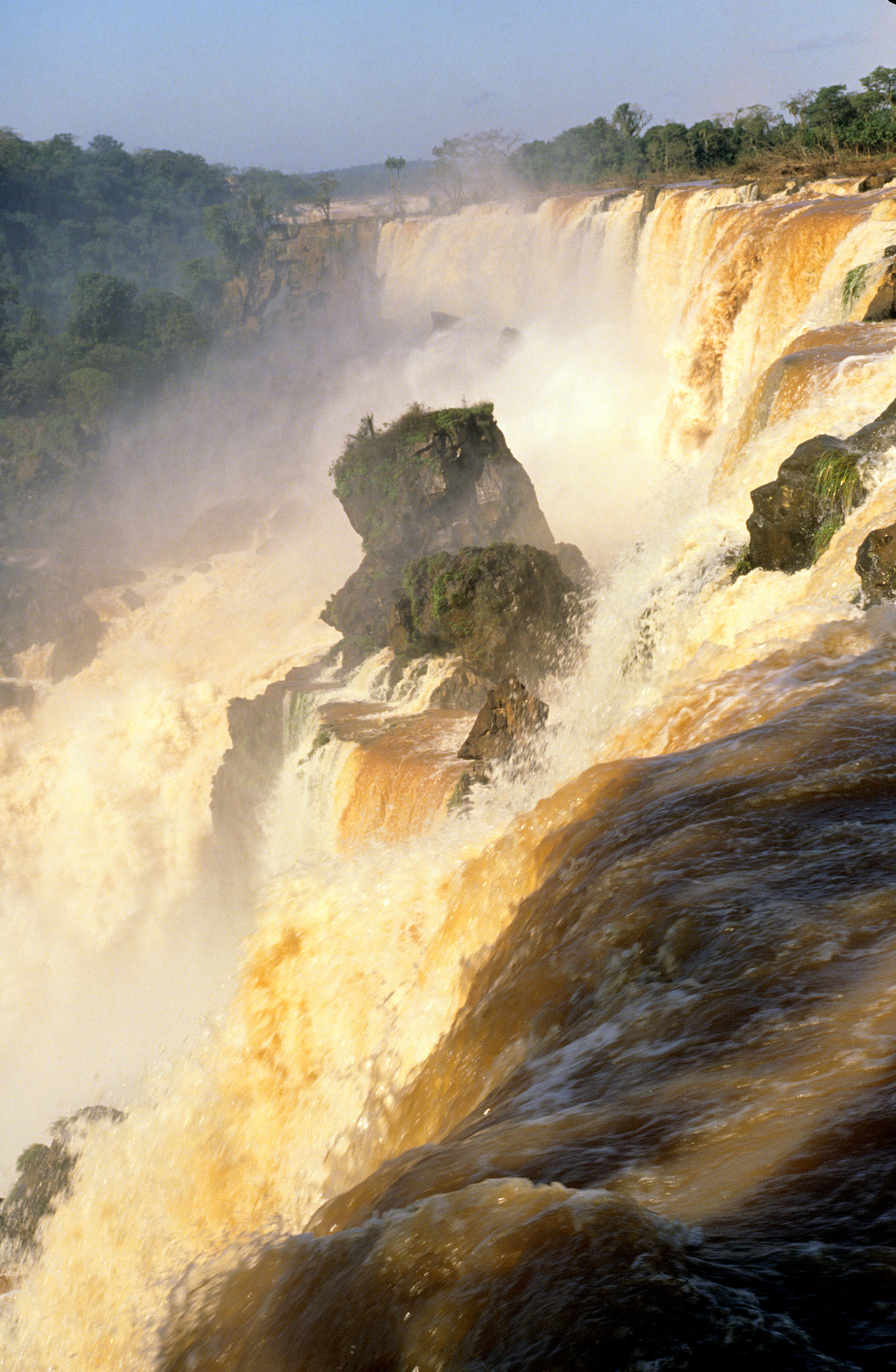
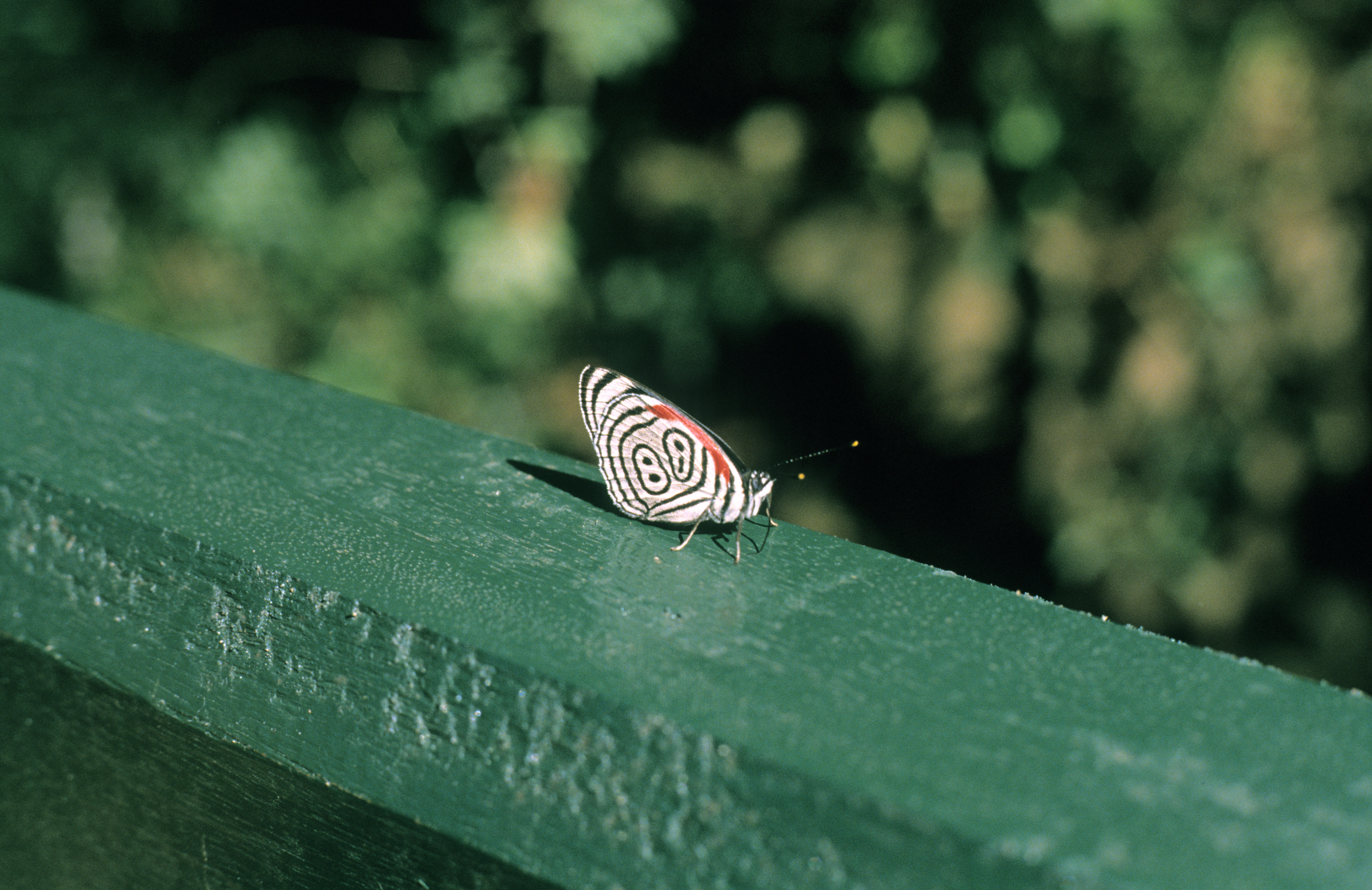
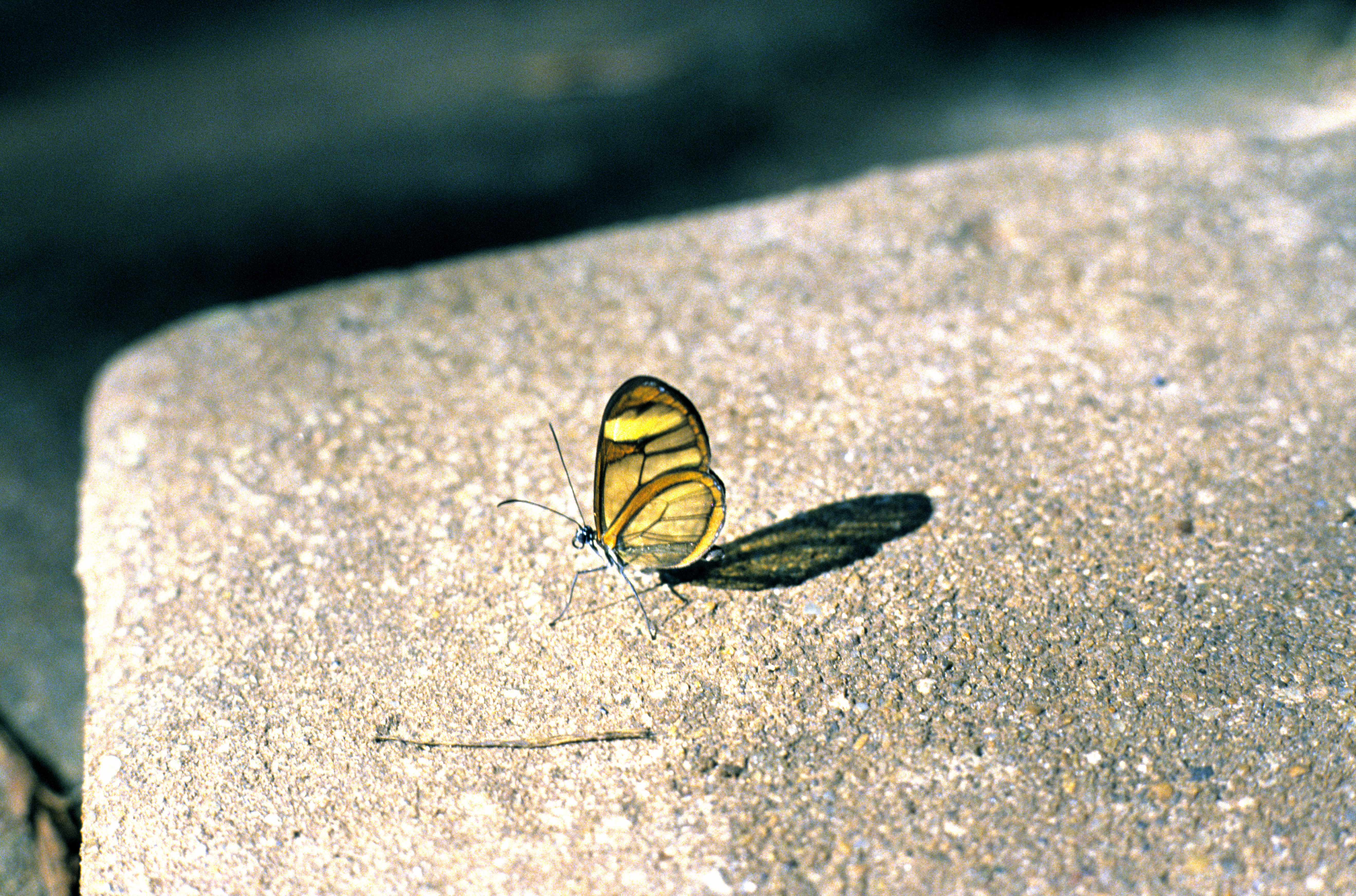
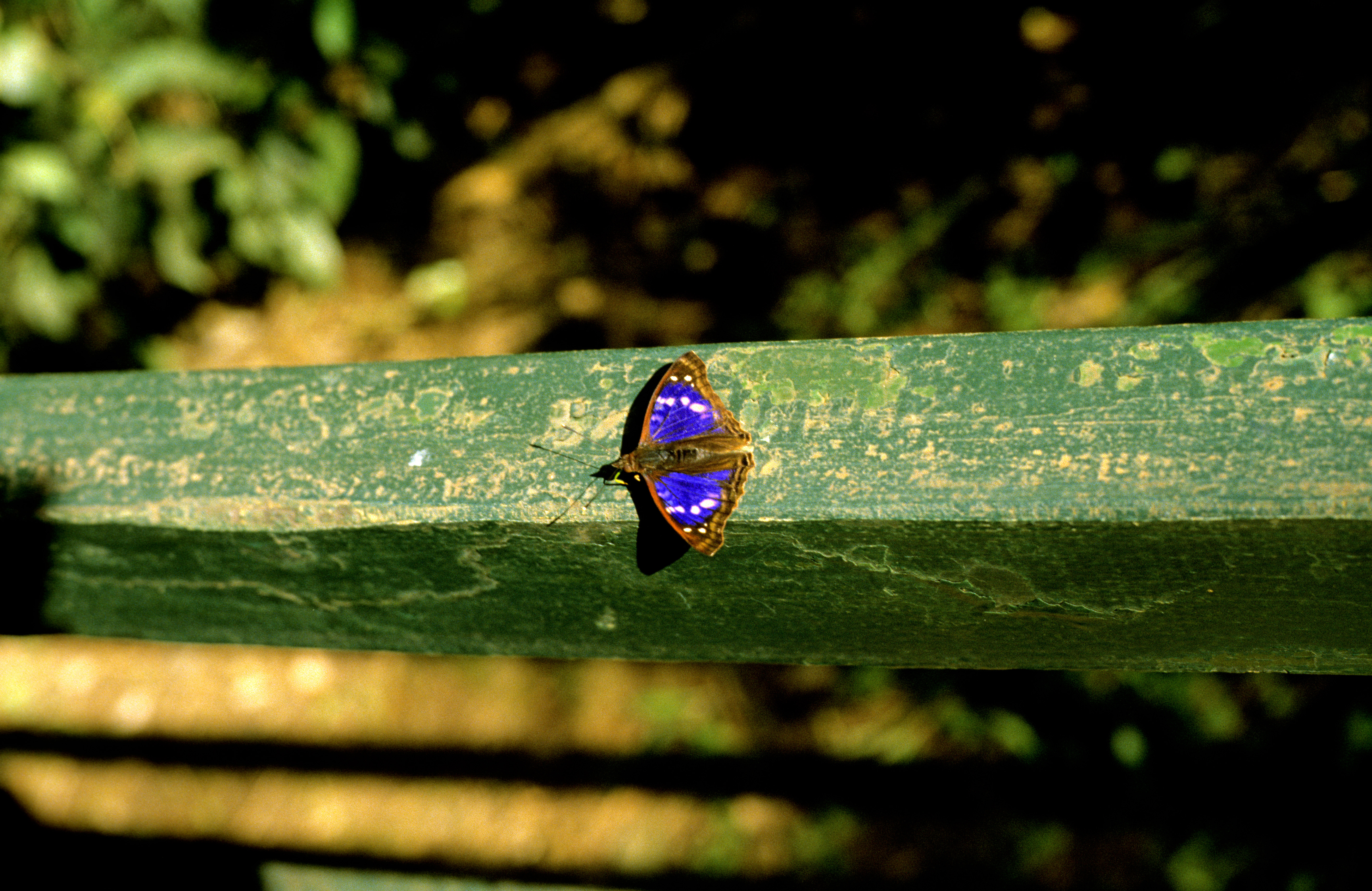
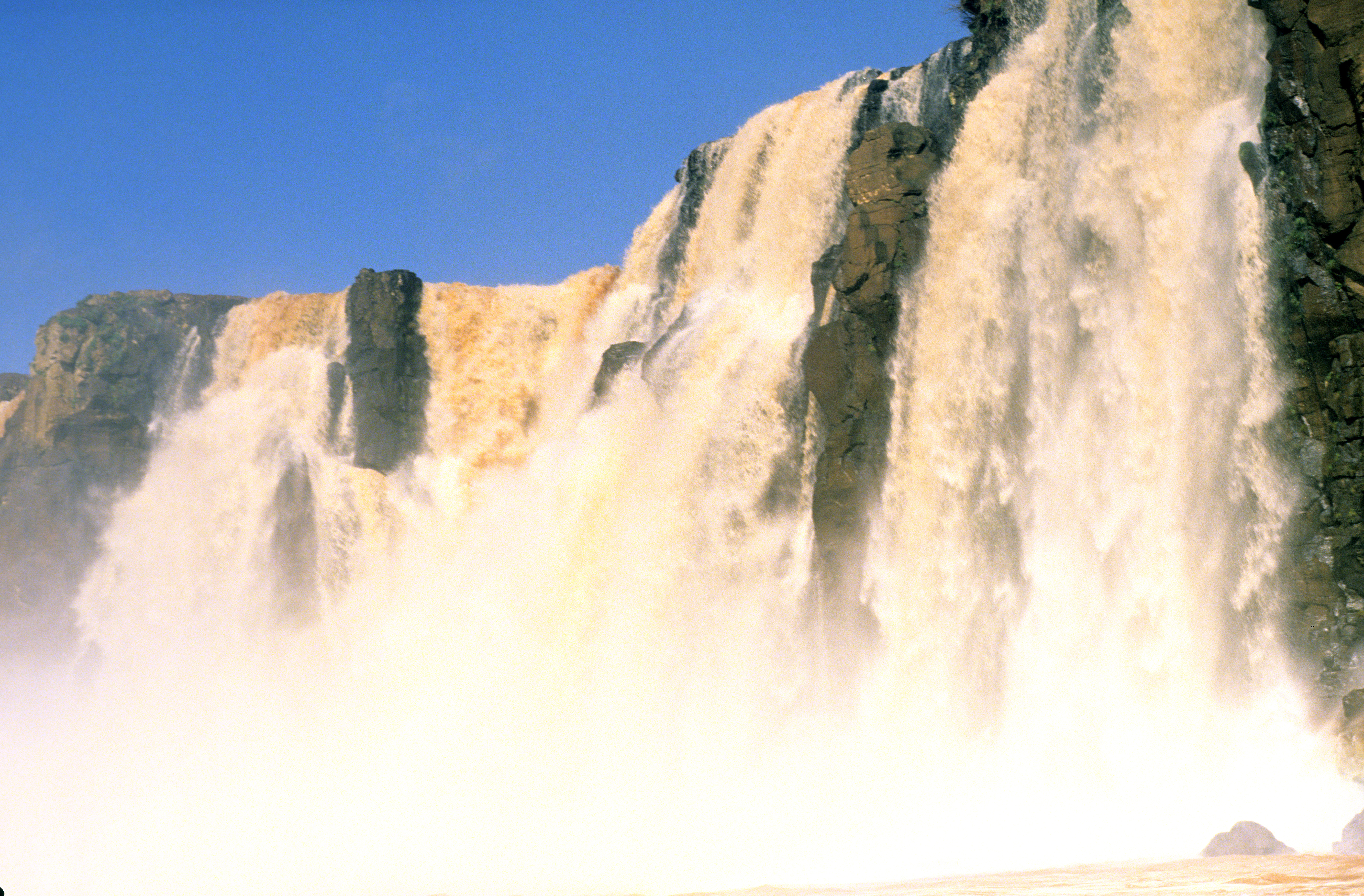
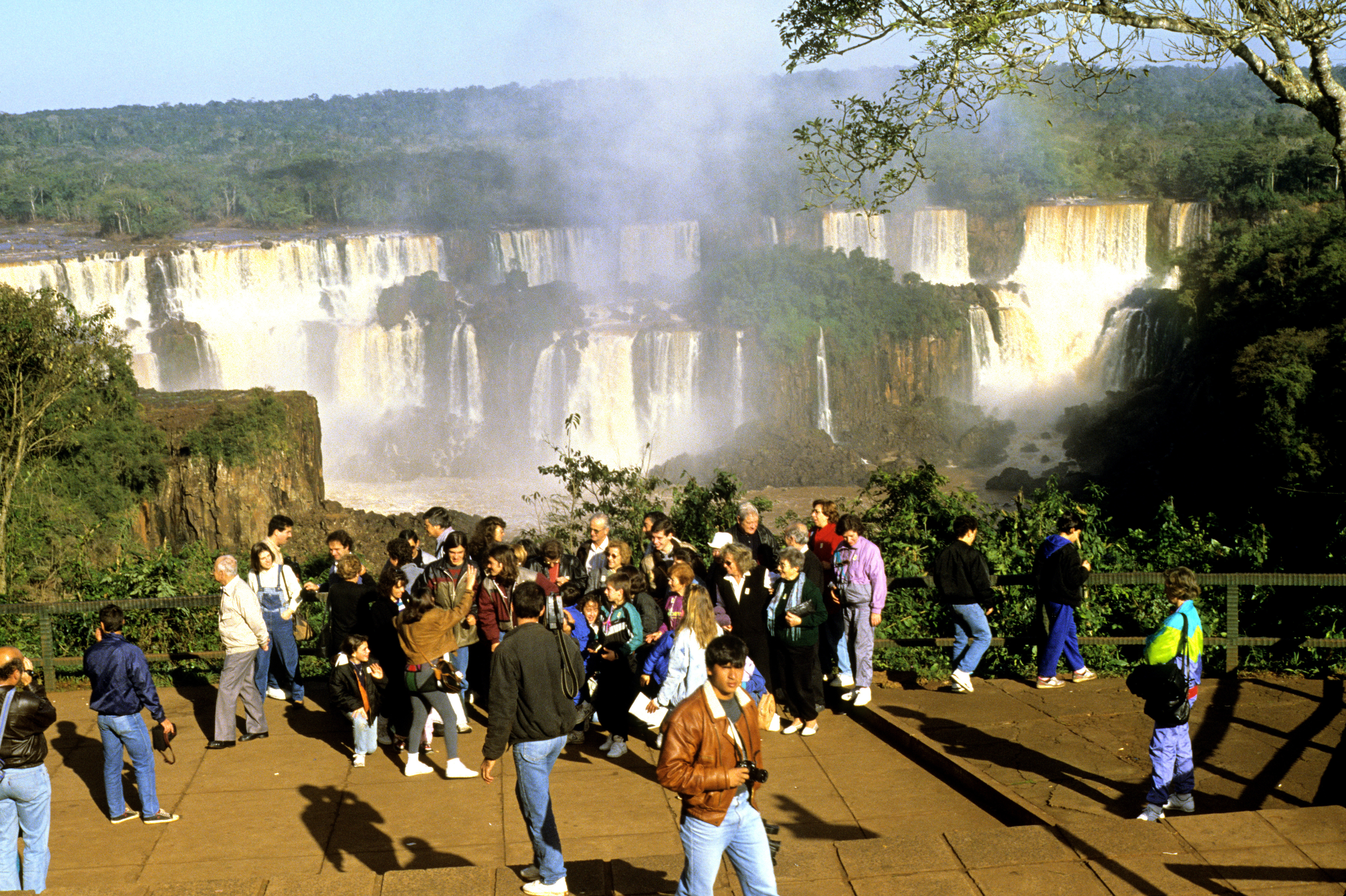
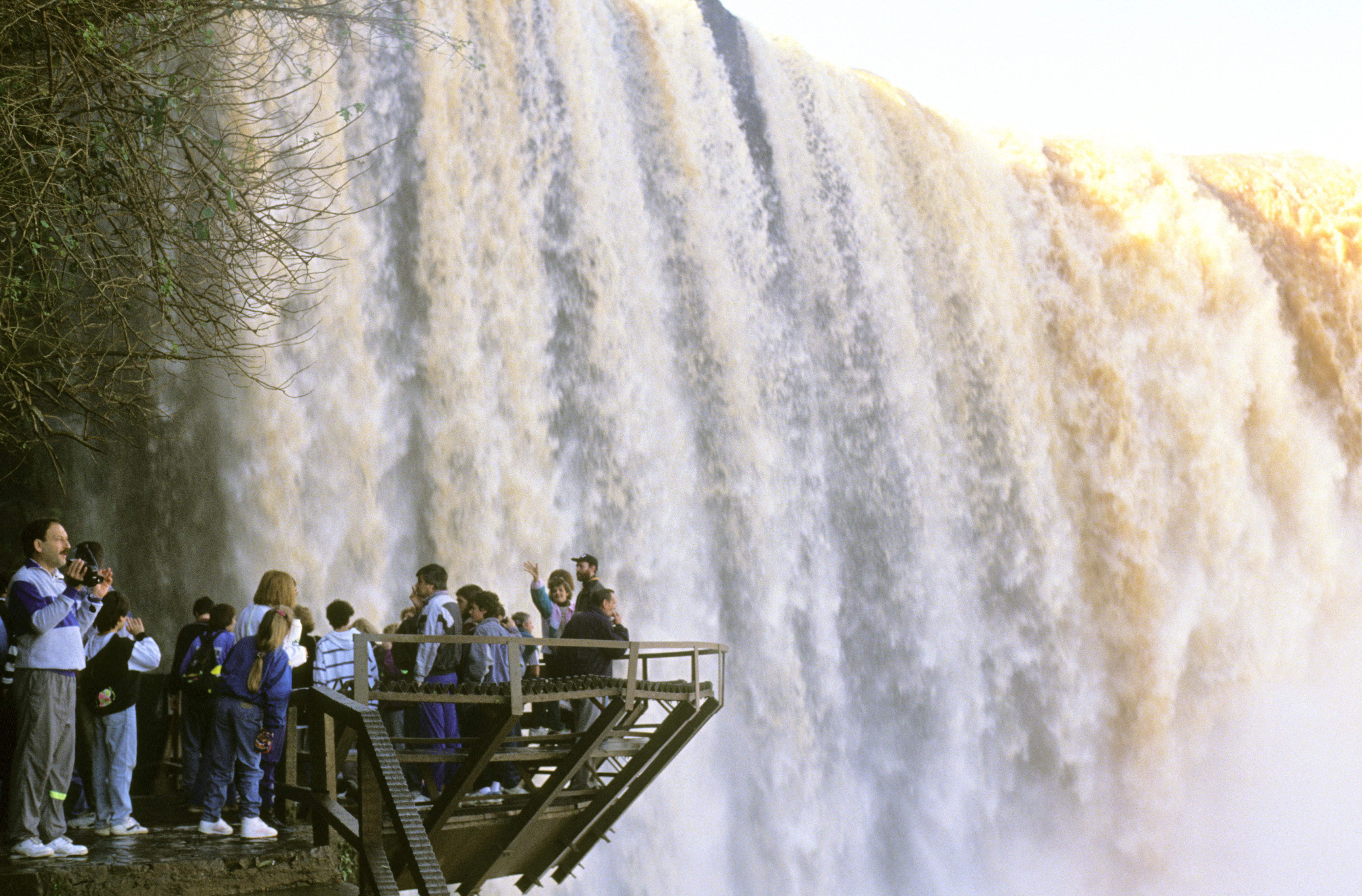
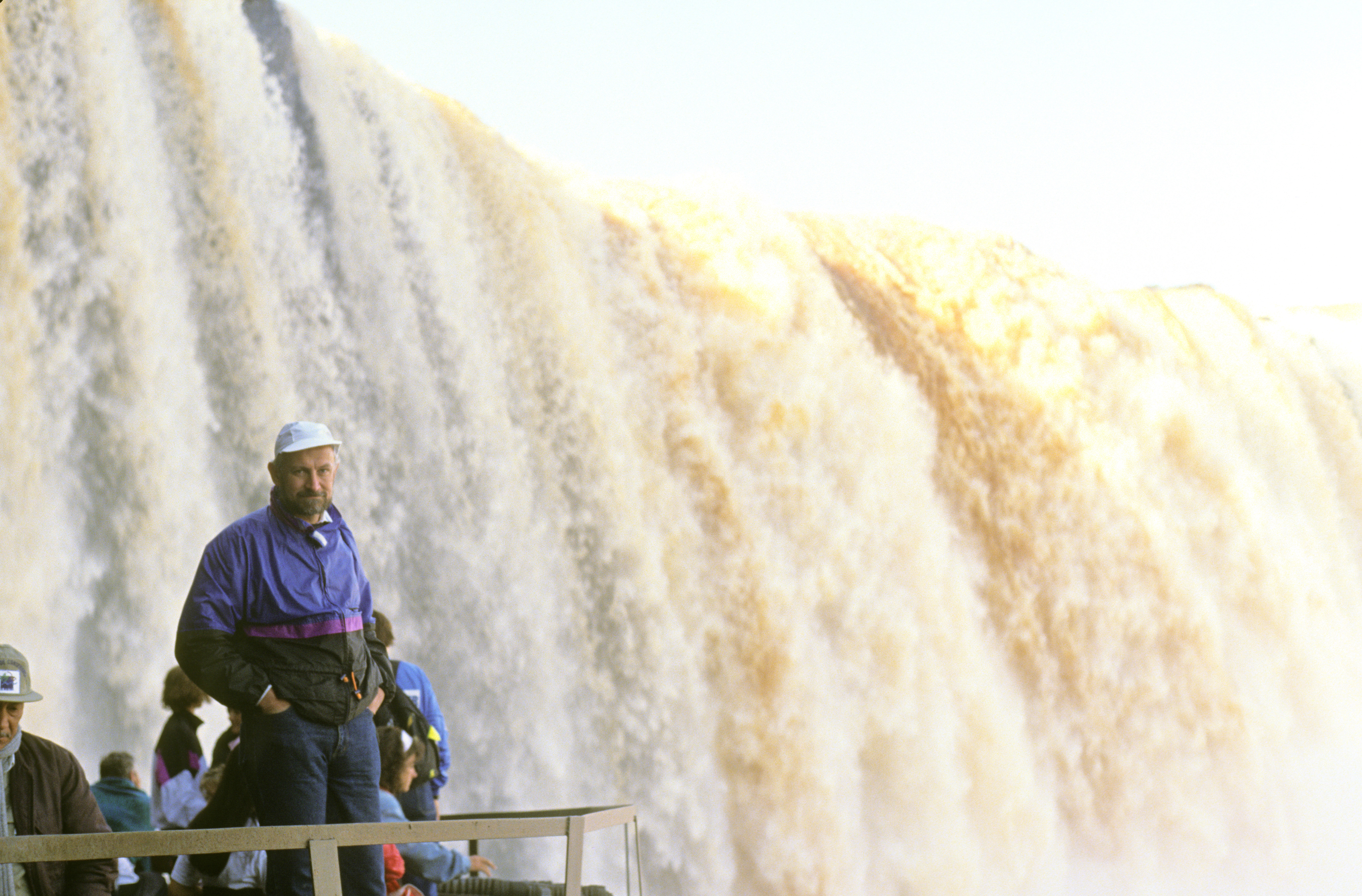
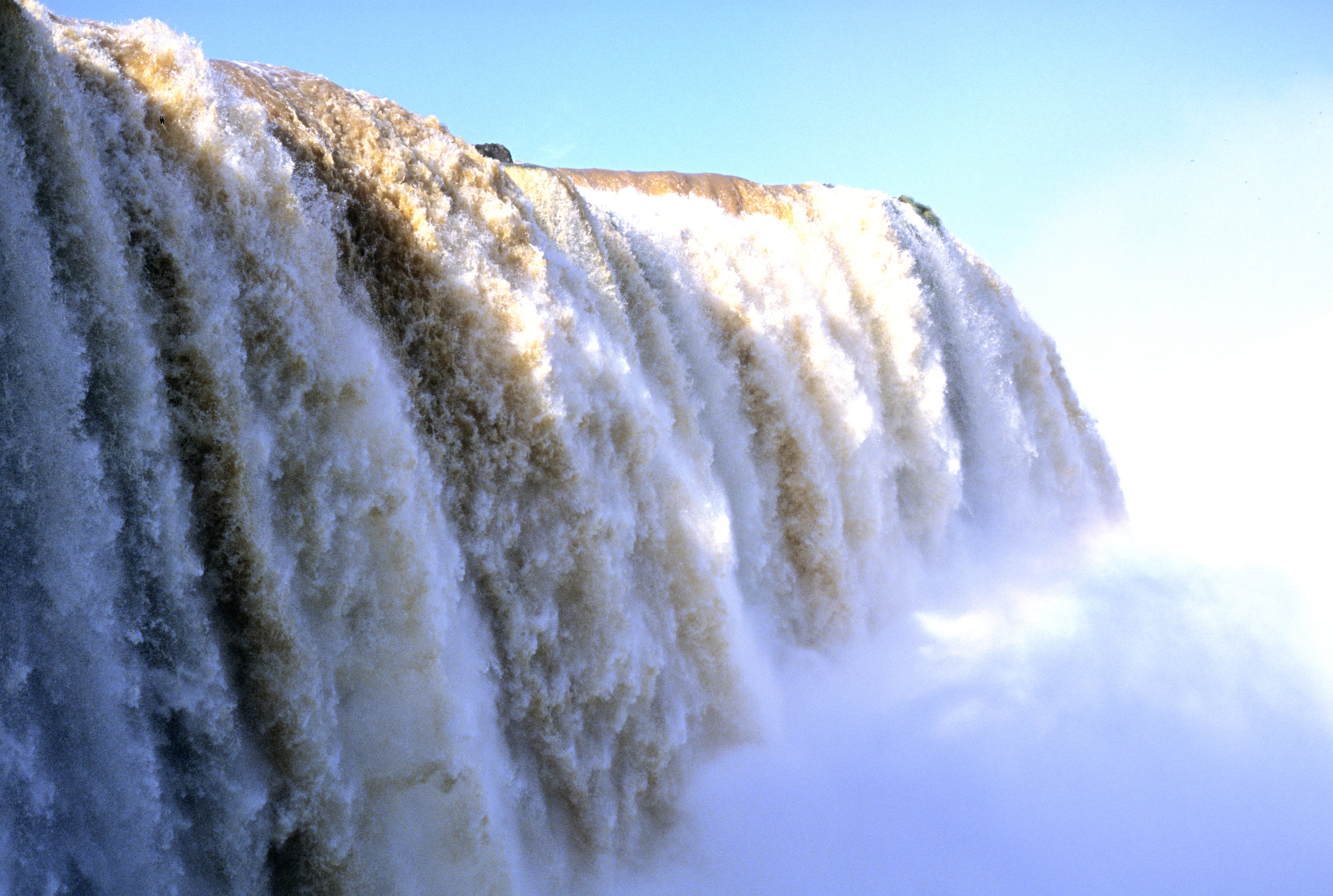
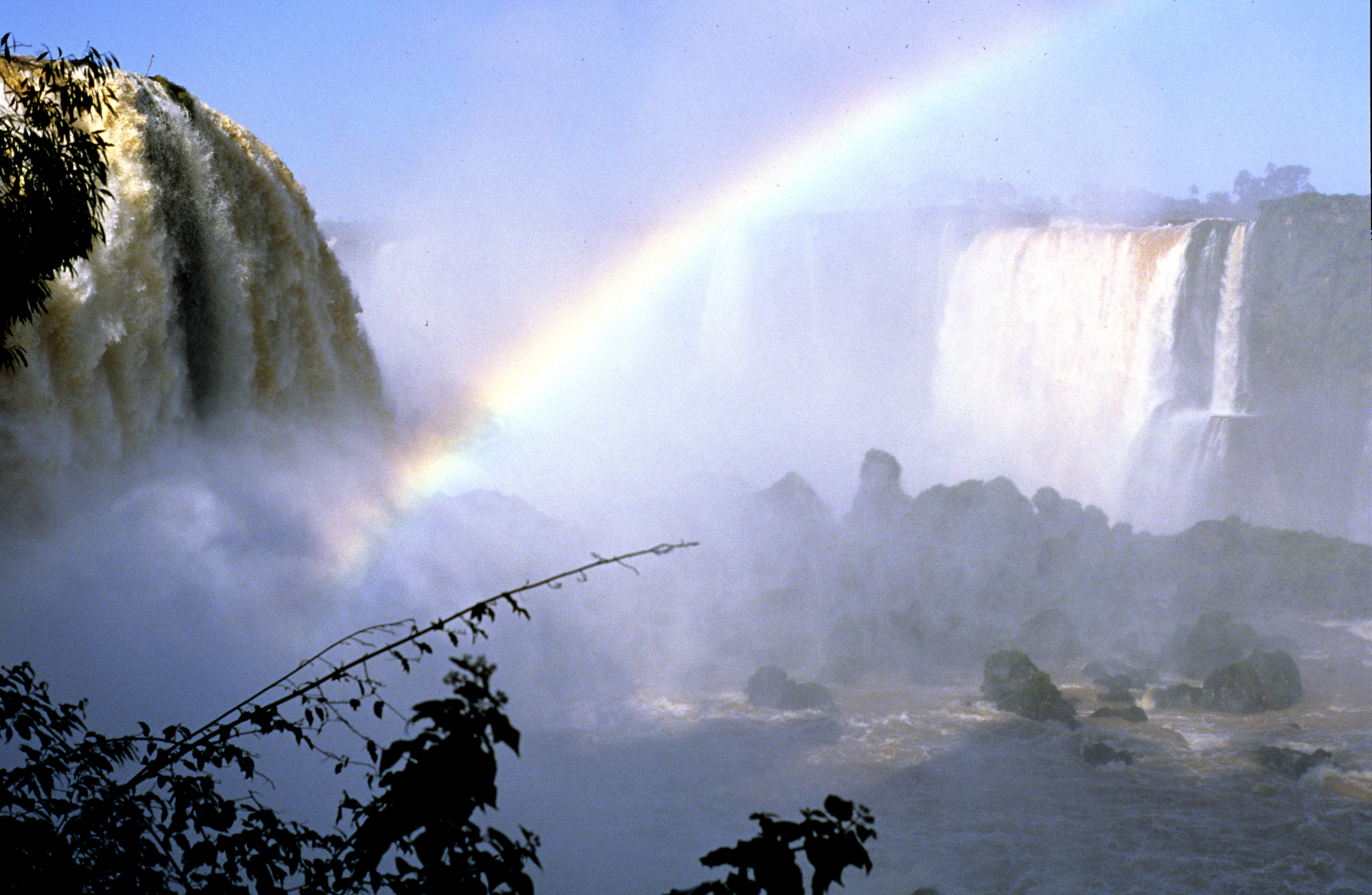
My modest web page will not do justice to South America. It surely has more magnificent attractions than I know about, but I had the opportunity to see just one of them - the Iguazu Waterfalls 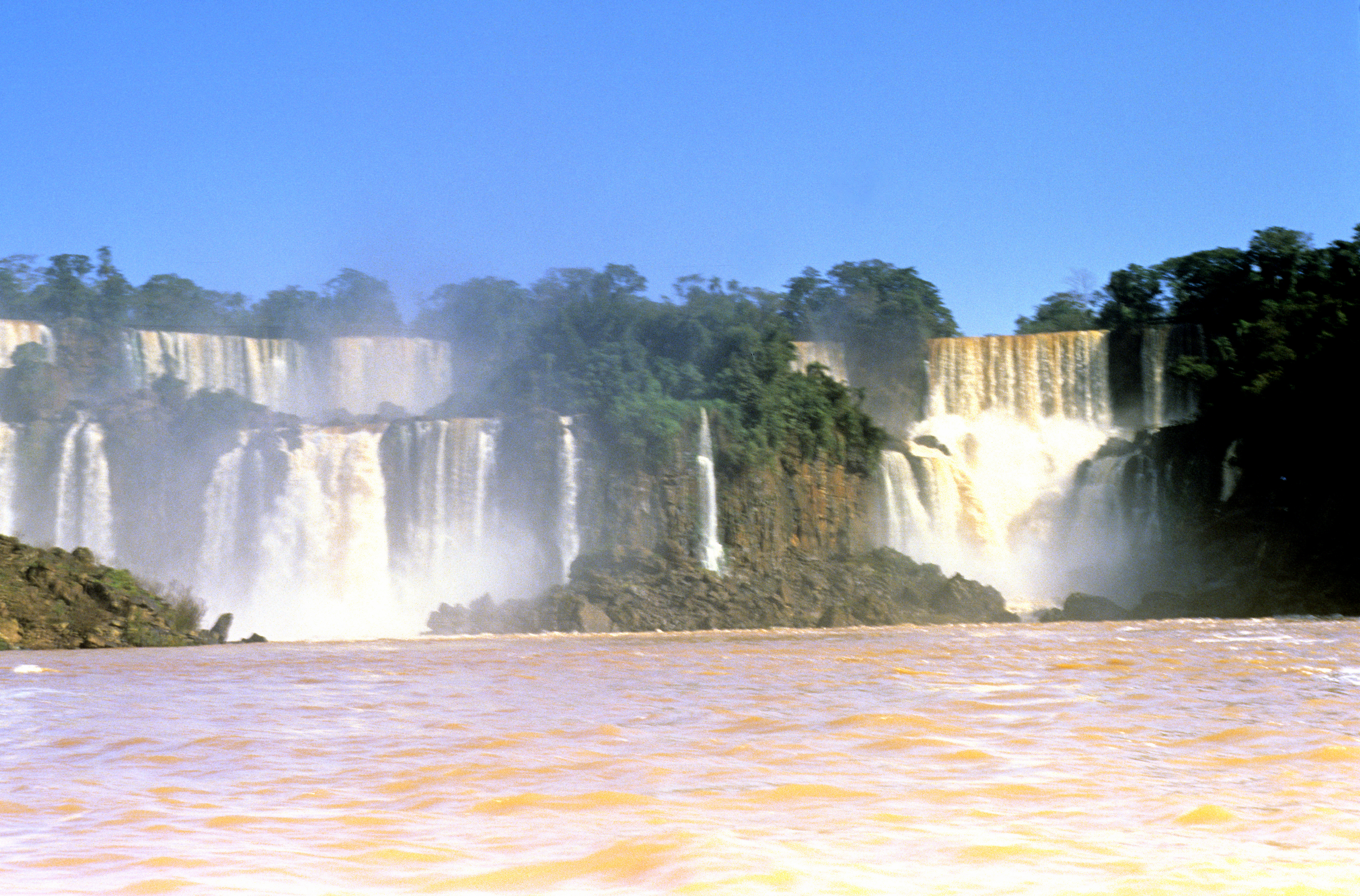 on the border between Brazil and Argentina (the photo shows a view from a boat on the river Iguazu below the falls). This is one of the largest and most famous waterfalls in the world; the geographical data about it and its comparison with other famous waterfalls can be read on the board placed at one point on the Argentinian side. It is actually a large group of waterfalls -- so wide that it cannot be seen all at once from any point. The next two pictures are my attempt to show as much of it as possible: here is the view on their eastern part , and here is the adjacent western part . (Near the falls the Iguazu river is winding like a snake; by the "western" part I mean the one clinging to the Argentinian side). There are several foot trails on that side that allow one to penetrate many picturesque sites and to see the falls from some interesting angles, for example from a dense forest at mid-height of the falls, from close above the edge or right along the edge. The amber colour of the water is not a permanent feature; just before I visited the place in July 1992 there were heavy rains that caused erosion more intensive than normal. A visitor is not isolated from the natural surroundings (like at the Niagara Falls, for example); on the contrary, the trails give access to some really remote corners , and the walking looks to be not perfectly safe in some places. Here is an example of a breathtaking view from close by , and here is a view showing the mighty fury of the water . It is also possible to visit, on unpaved natural paths, the surrounding jungle, either on foot or on a rented bicycle. The visit gives, among other things, an opportunity to see amazingly beautiful tropical buterflies, of which five specimens can be seen here , here , here , here and here . Down below, still on the Argentinian side, one can board a small boat and approach the falls on water. Views from the boat are shown in the first photo above, and also here . (Looking at the boats and at the way they are steered, I would not say the trip is guaranteed to be safe, but nothing better is available). In the nearby village, Puerto Iguazu, there are many tour companies that organise tours in small groups to visit the falls from the Brazilian side. The cross-border traffic is intensive and goes smoothly - no-one cares to inspect the documents of anybody. I myself had no Brazilian visa and did not even know that I needed one at that time. The views from there are also interesting, here is one example and here is another . An especially interesting view is from a balcony built close to the main fall; from there one can see another impressive example of water fury . Behind the water wall, seen in the picture, little birds have their nests. From time to time, one of them just hits the wall head on at high speed, to unexpectedly emerge from the watermass some time later. The last picture shows a swarm of birds circling the air space near the falls (the birds are the black points that look like dust on the surface of the picture).
when time permits.