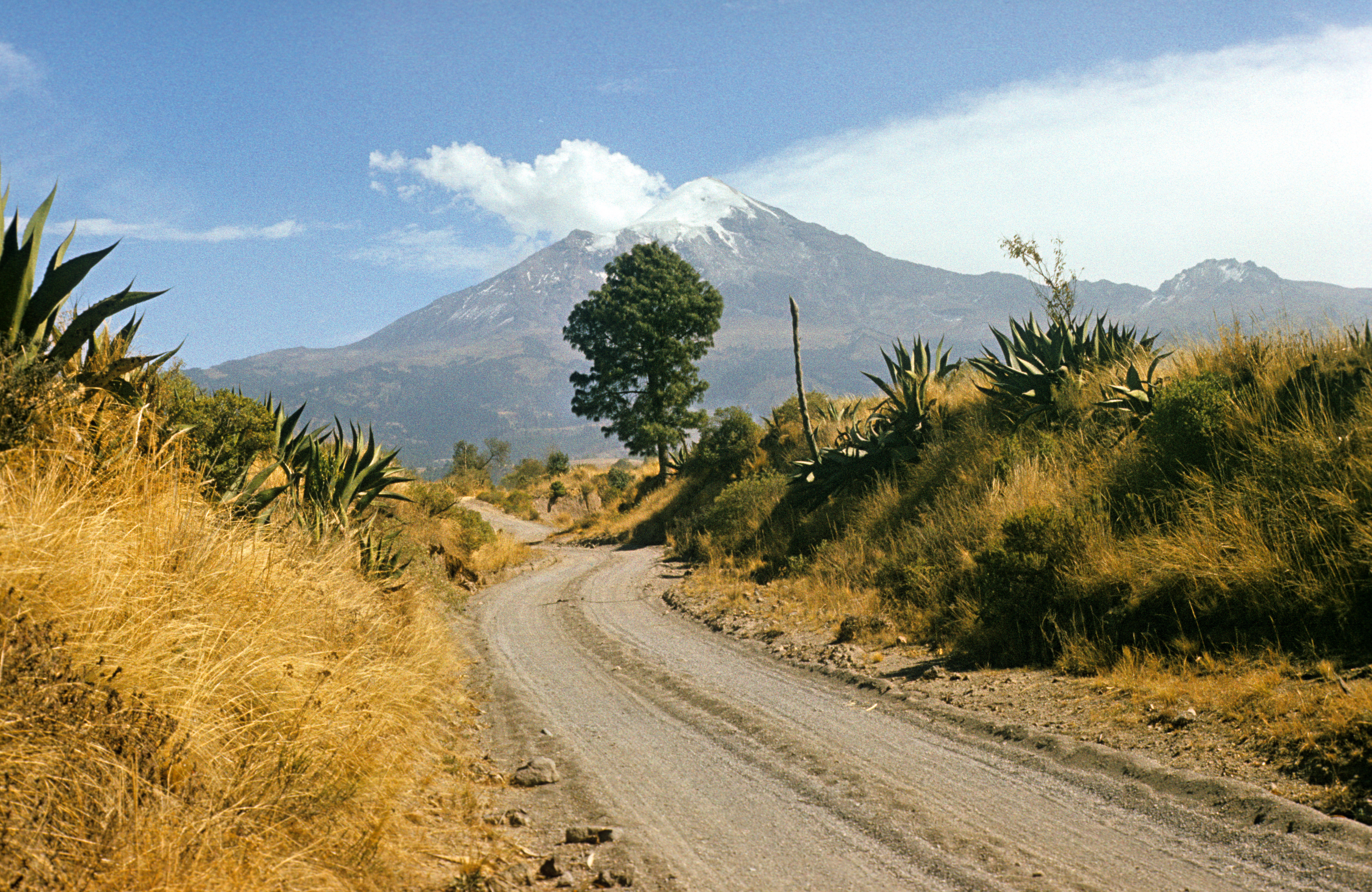
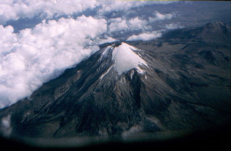
 (5675? meters), the highest mountain in Mexico. In the nahuatl language, the name means "Star mountain". It is better known under the Spanish name Pico de Orizaba. It is difficult to photograph from the ground because there are no other high mountains nearby that could serve as observing points. Because of its loneliness, it looks most magnificent when photographed from the air, the postcard picture is here
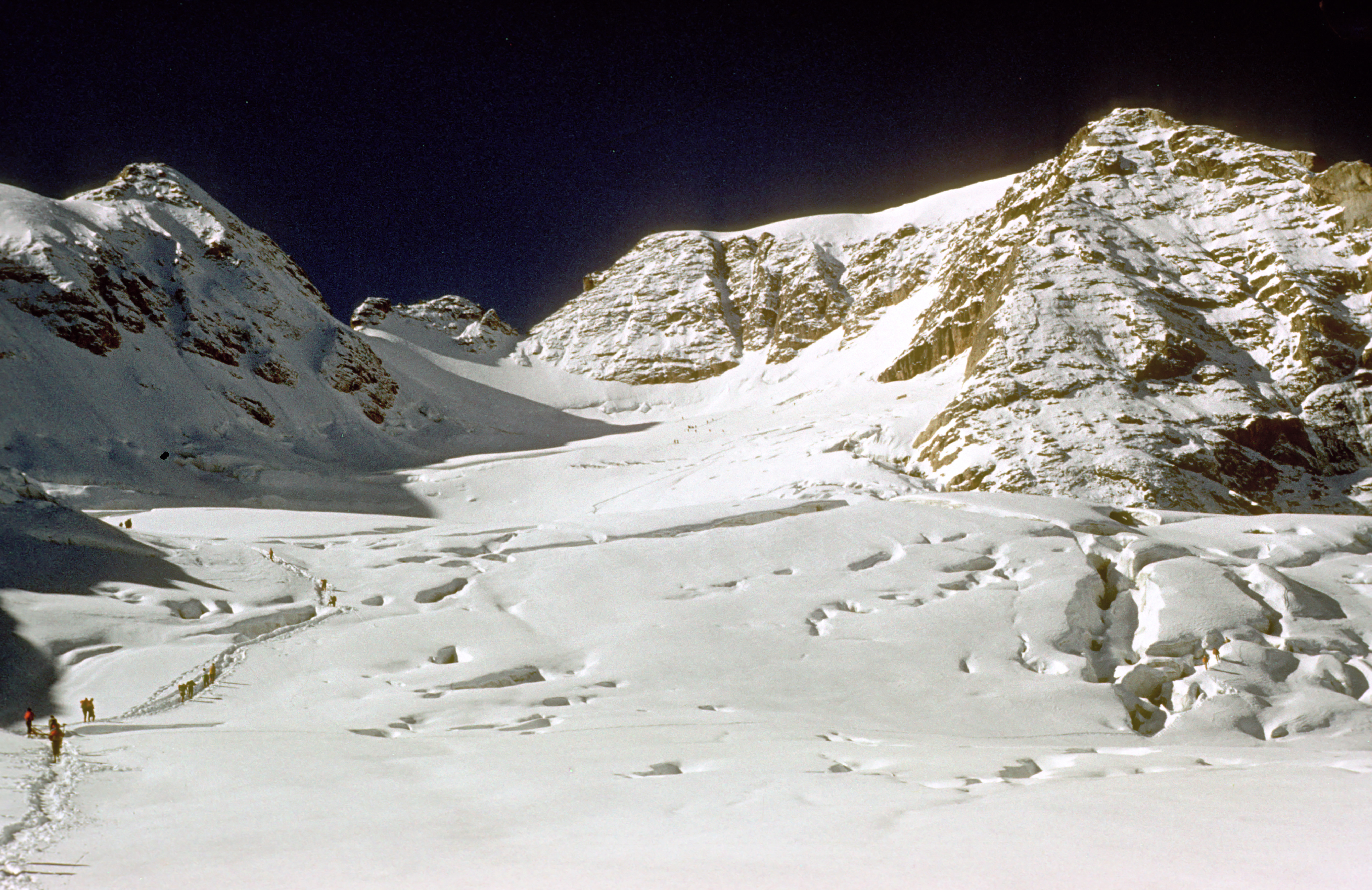
 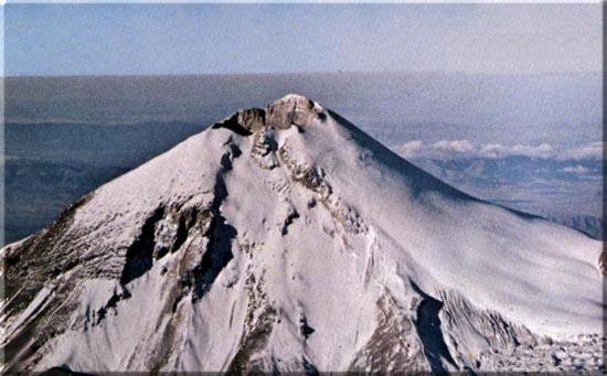 (picture copied from http://www.oreivatein.com/page/coverage/mexico/res/thesummit.jpg). The most convenient way up is along the glacier seen on the right -- on the north side. (On the south side there is no glacier, but volcanic ash that can suck away all your power before you get to any respectable height.) It seems that Citlal's exact altitude is not known to anybody; every source gives a different number. The number quoted here comes from the source I found most trustworthy (Jose L. Lorenzo, Los glaciares de Mexico).
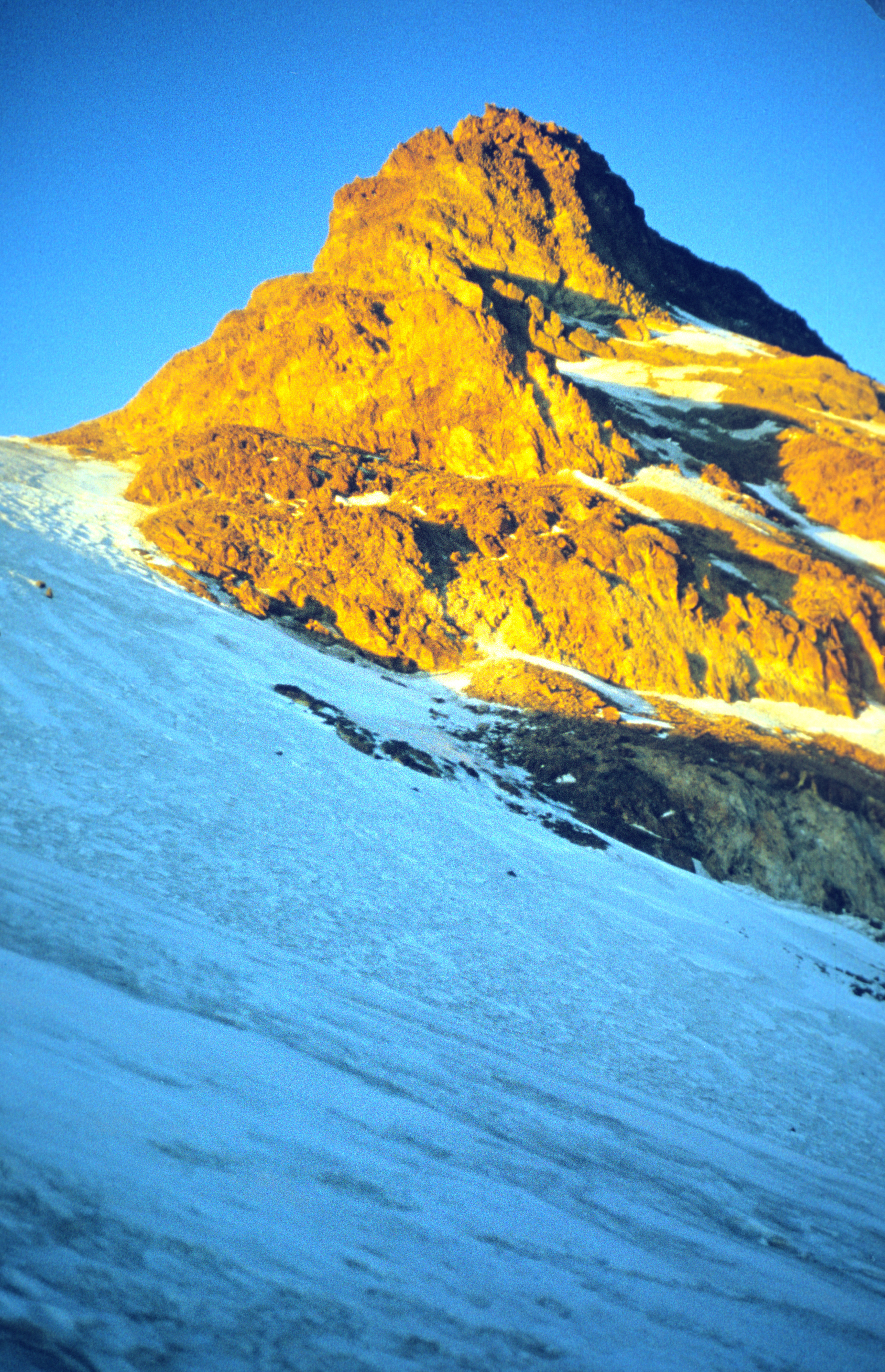
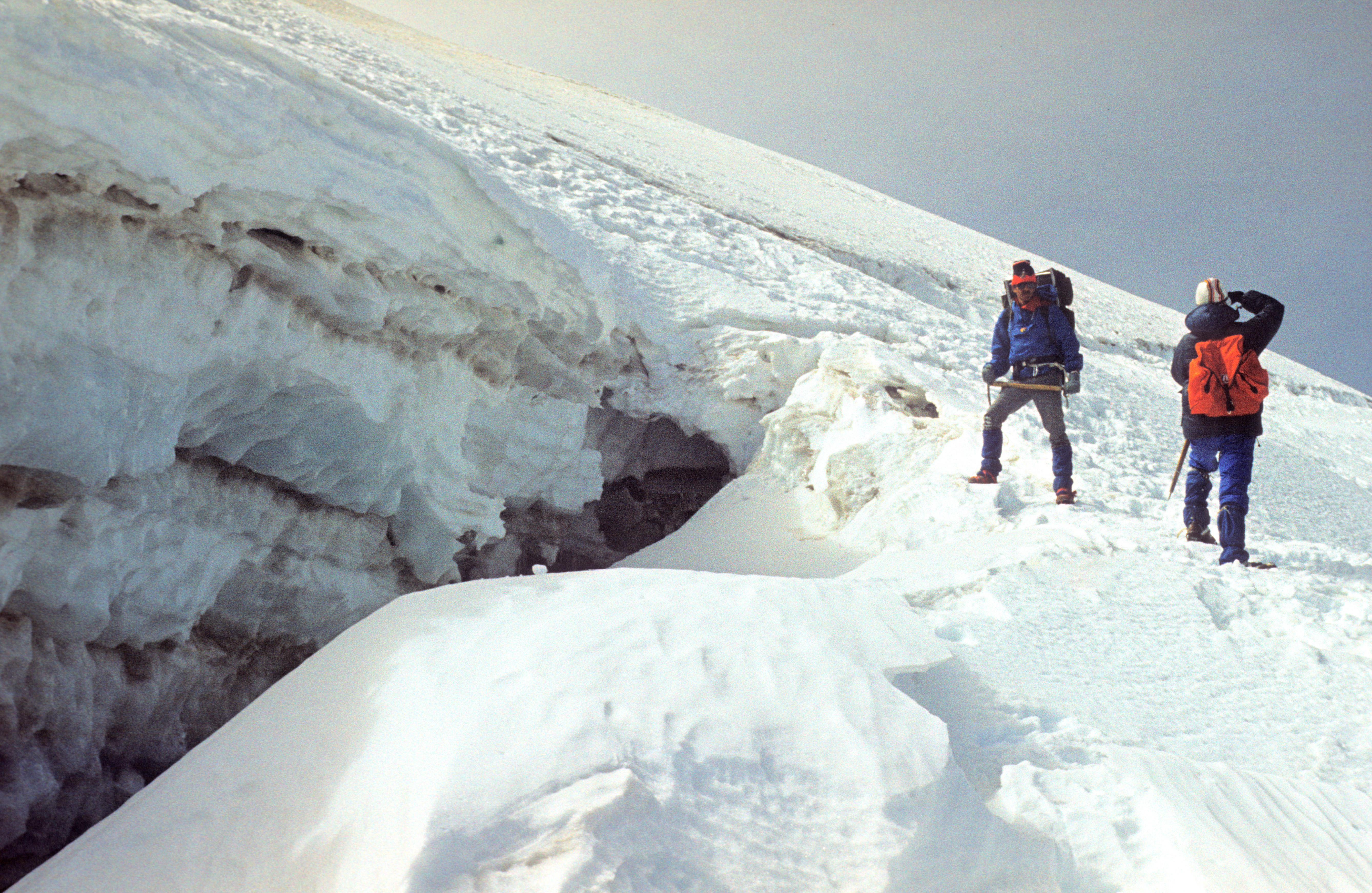
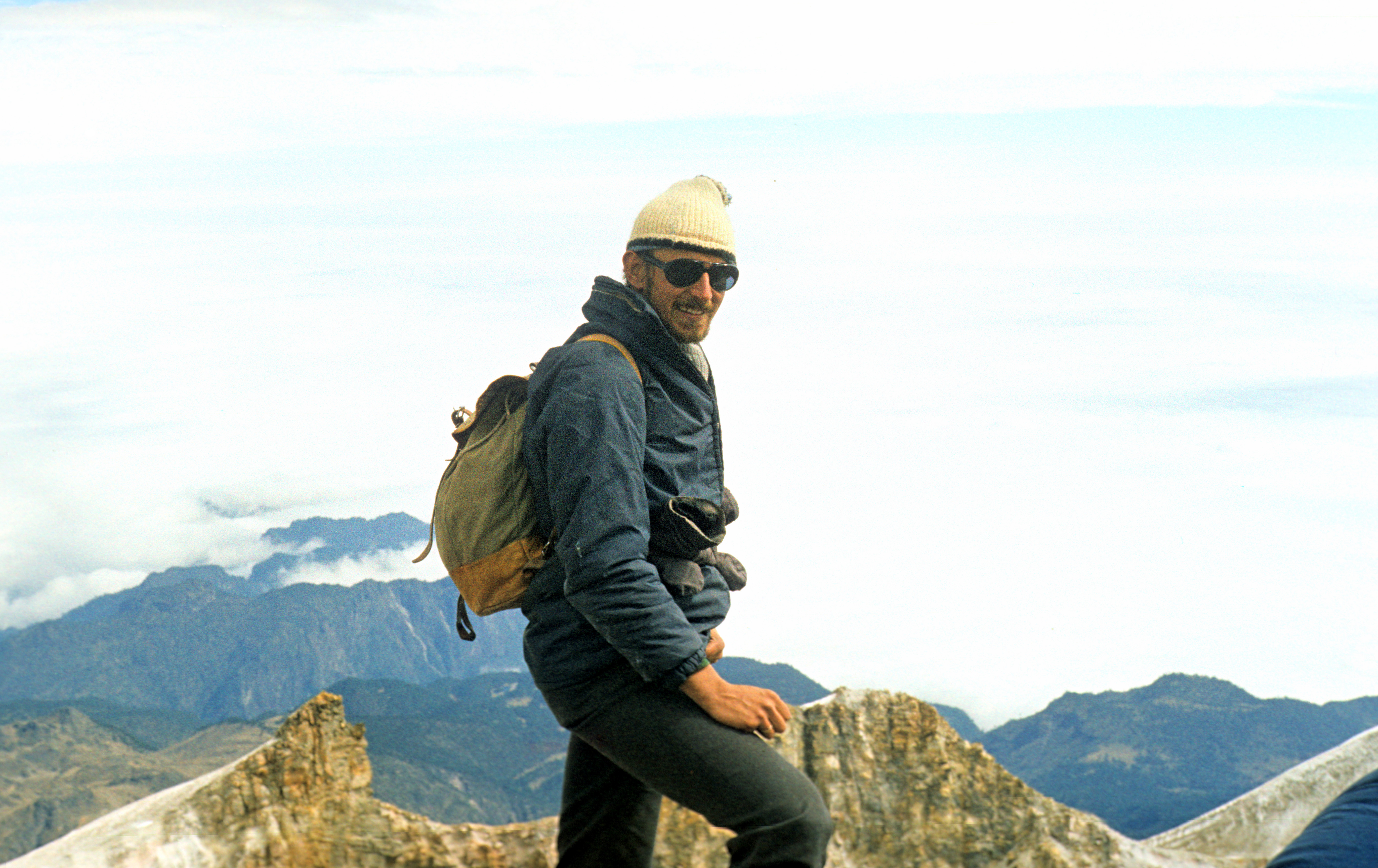
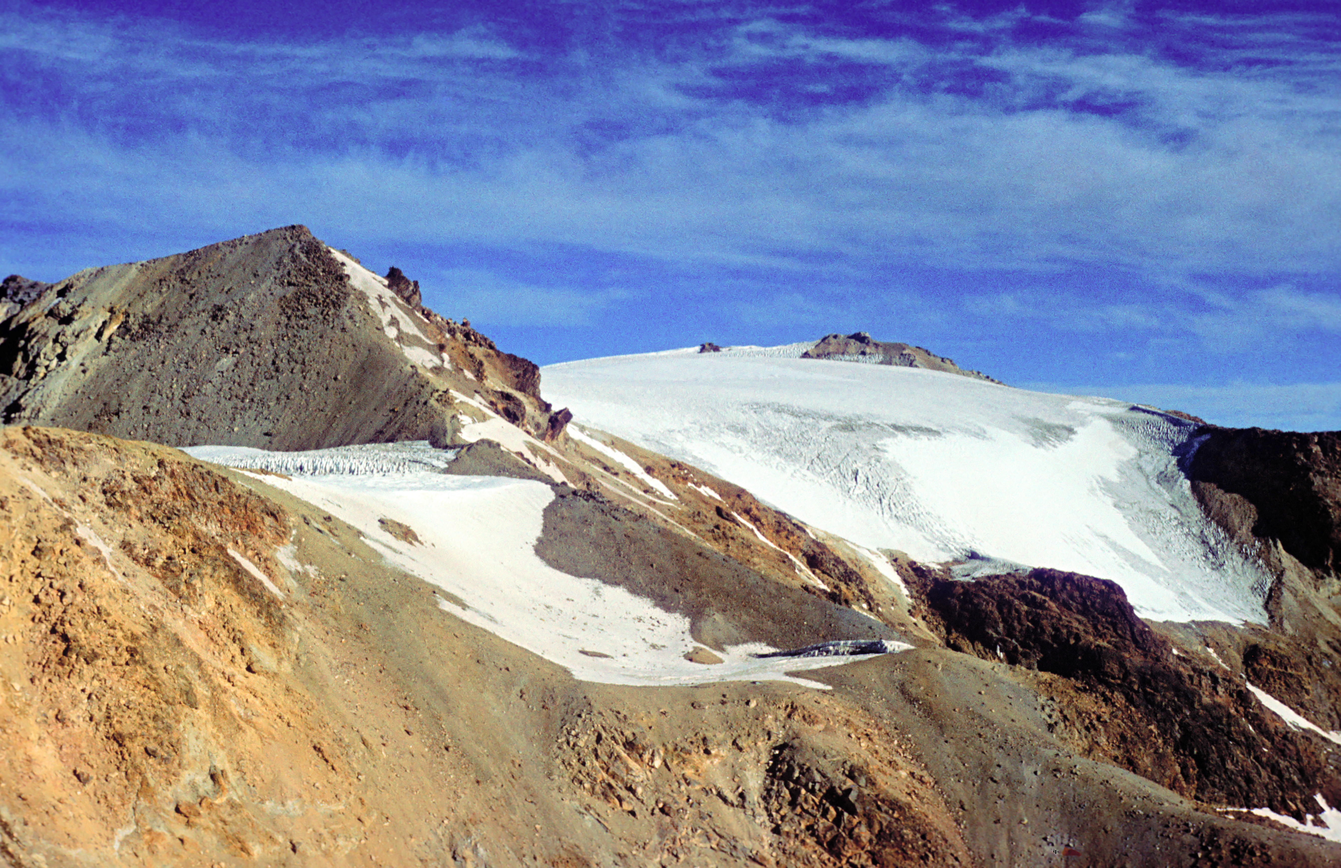
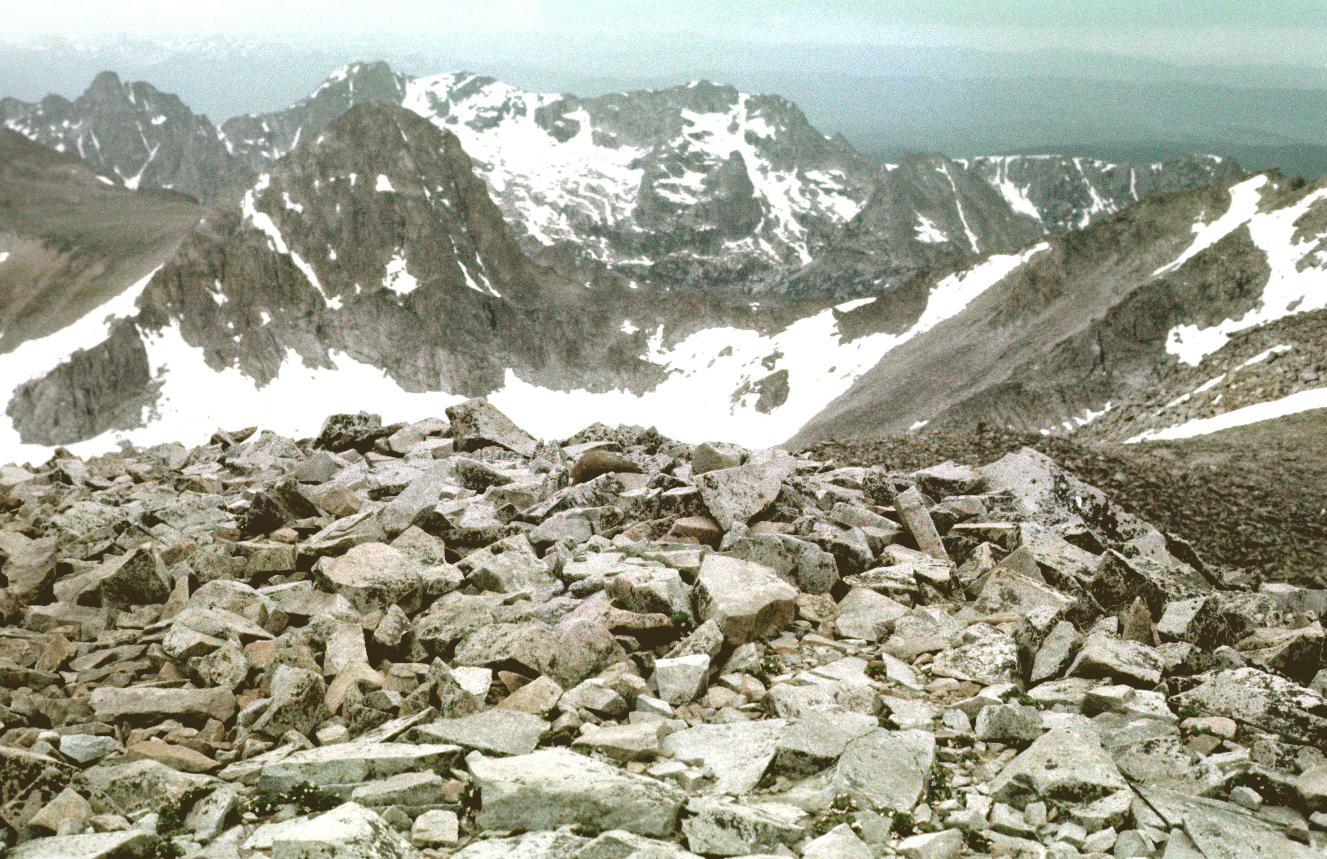
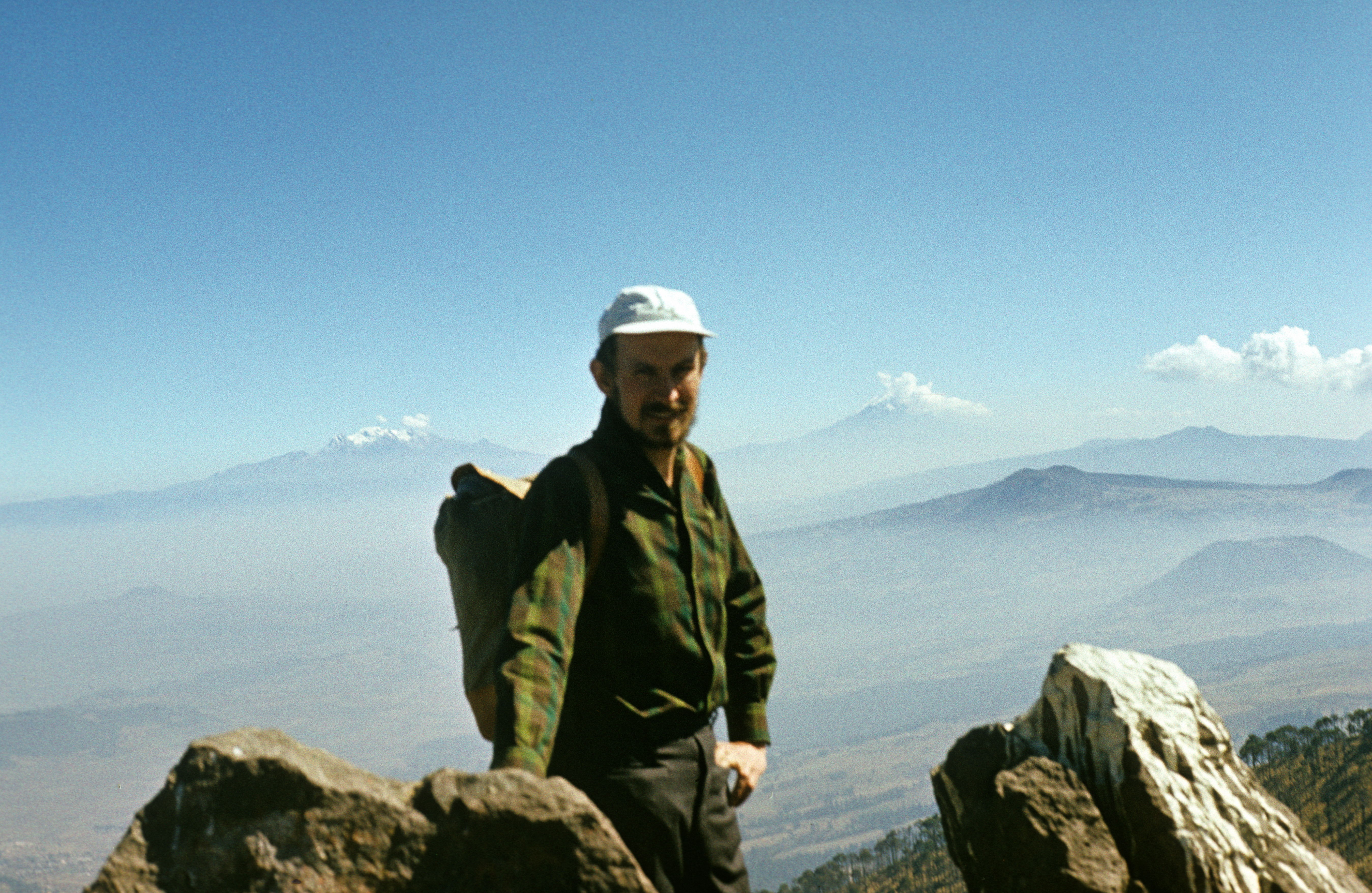
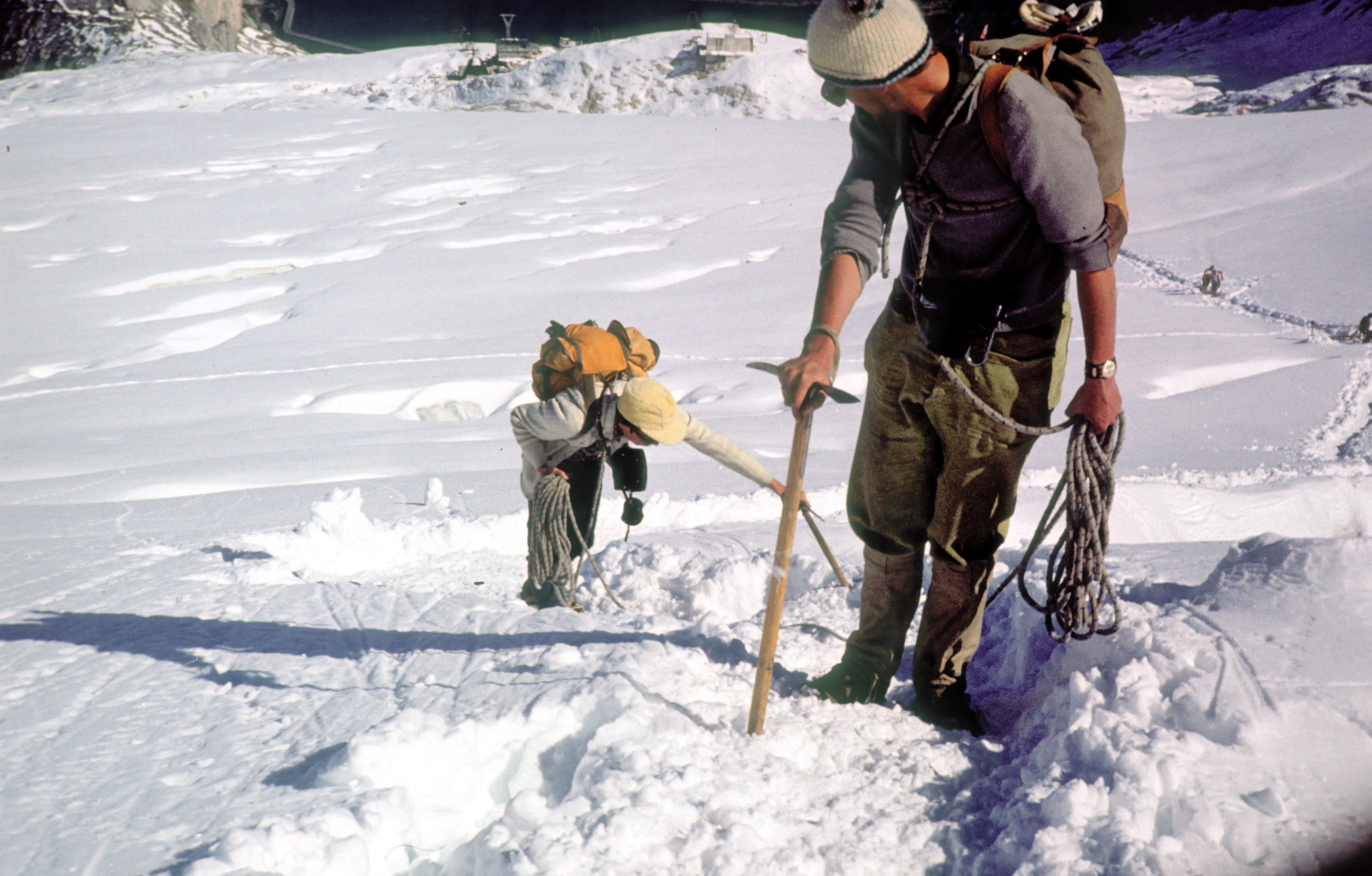
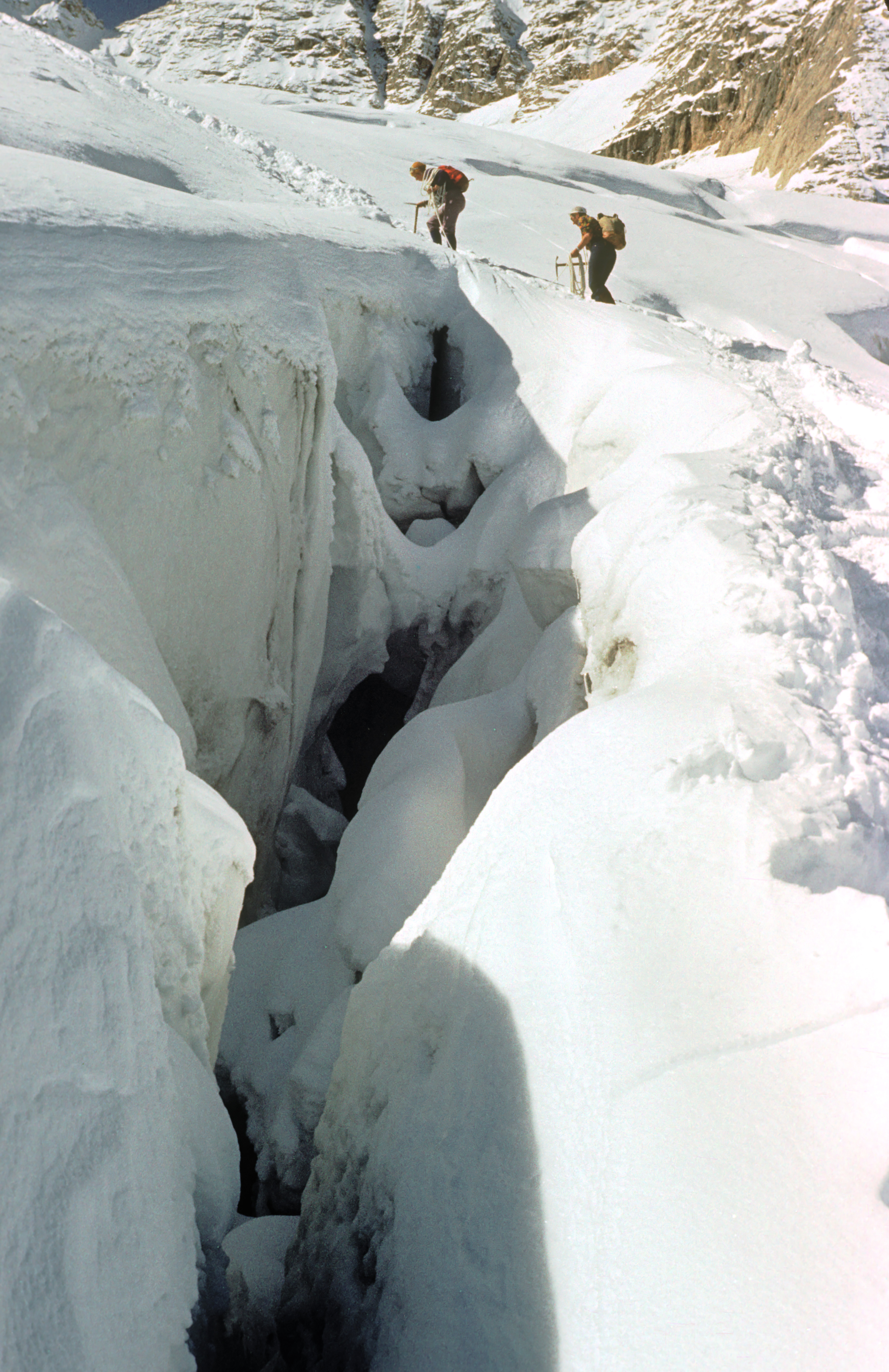
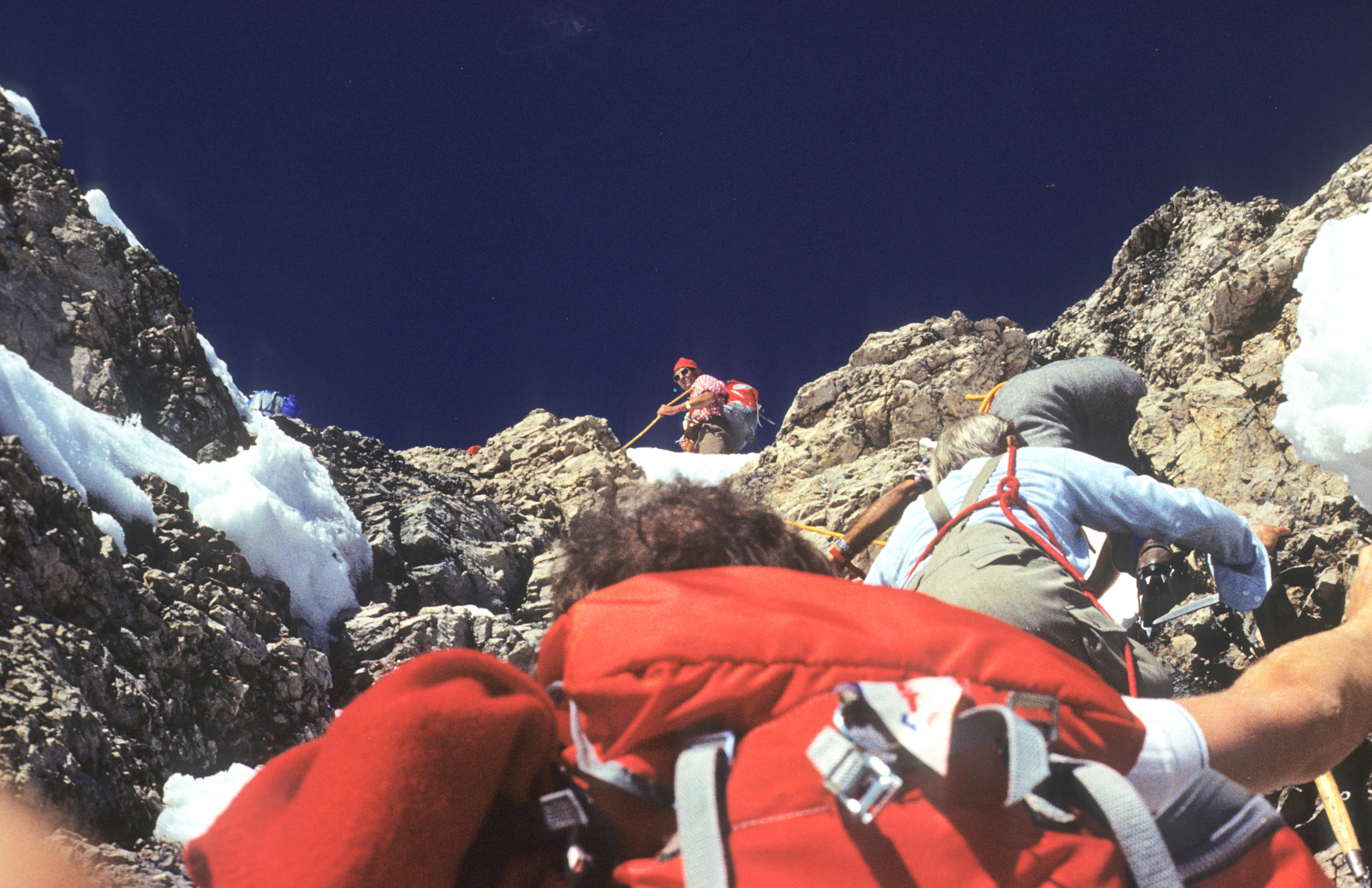
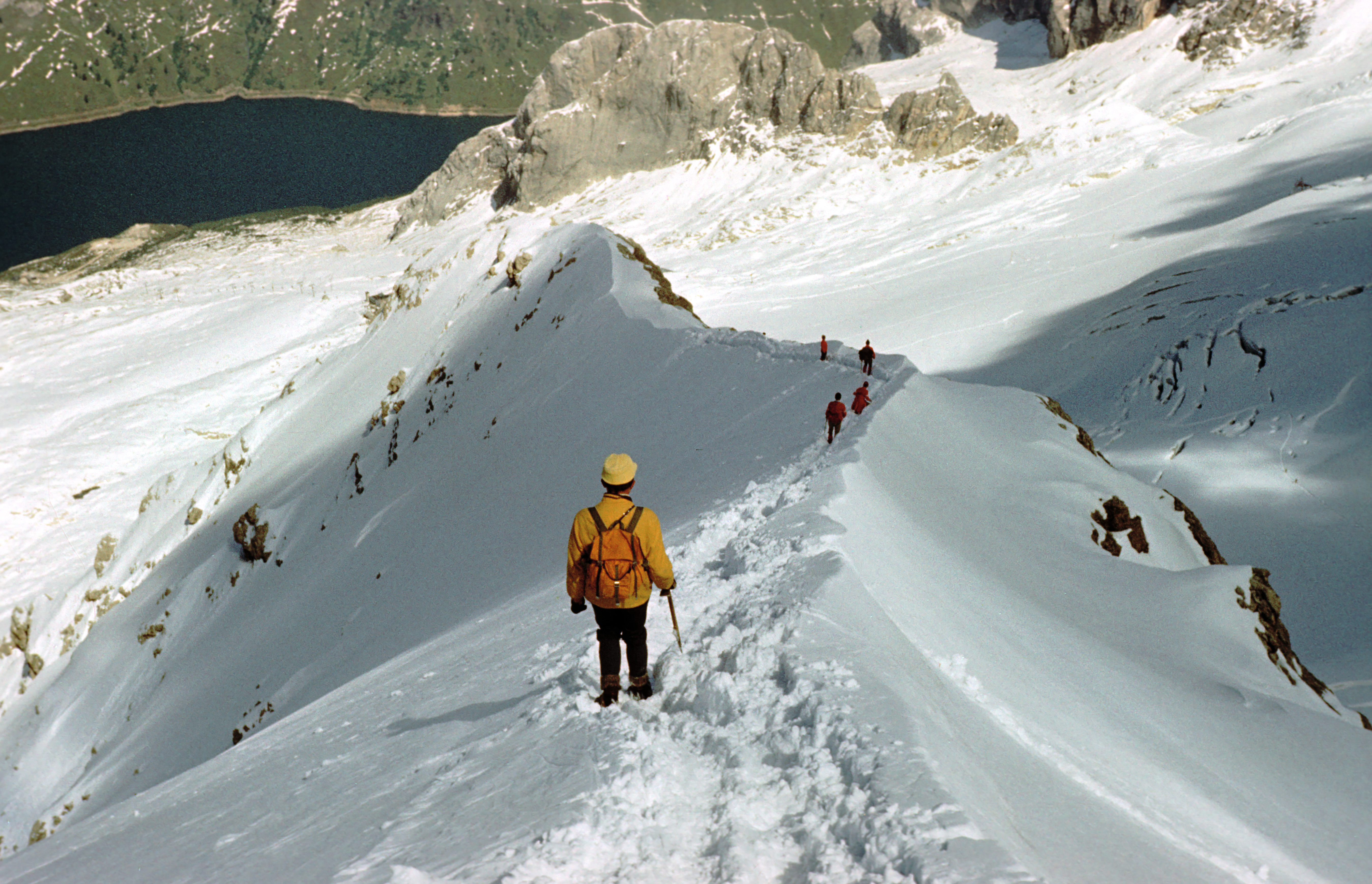
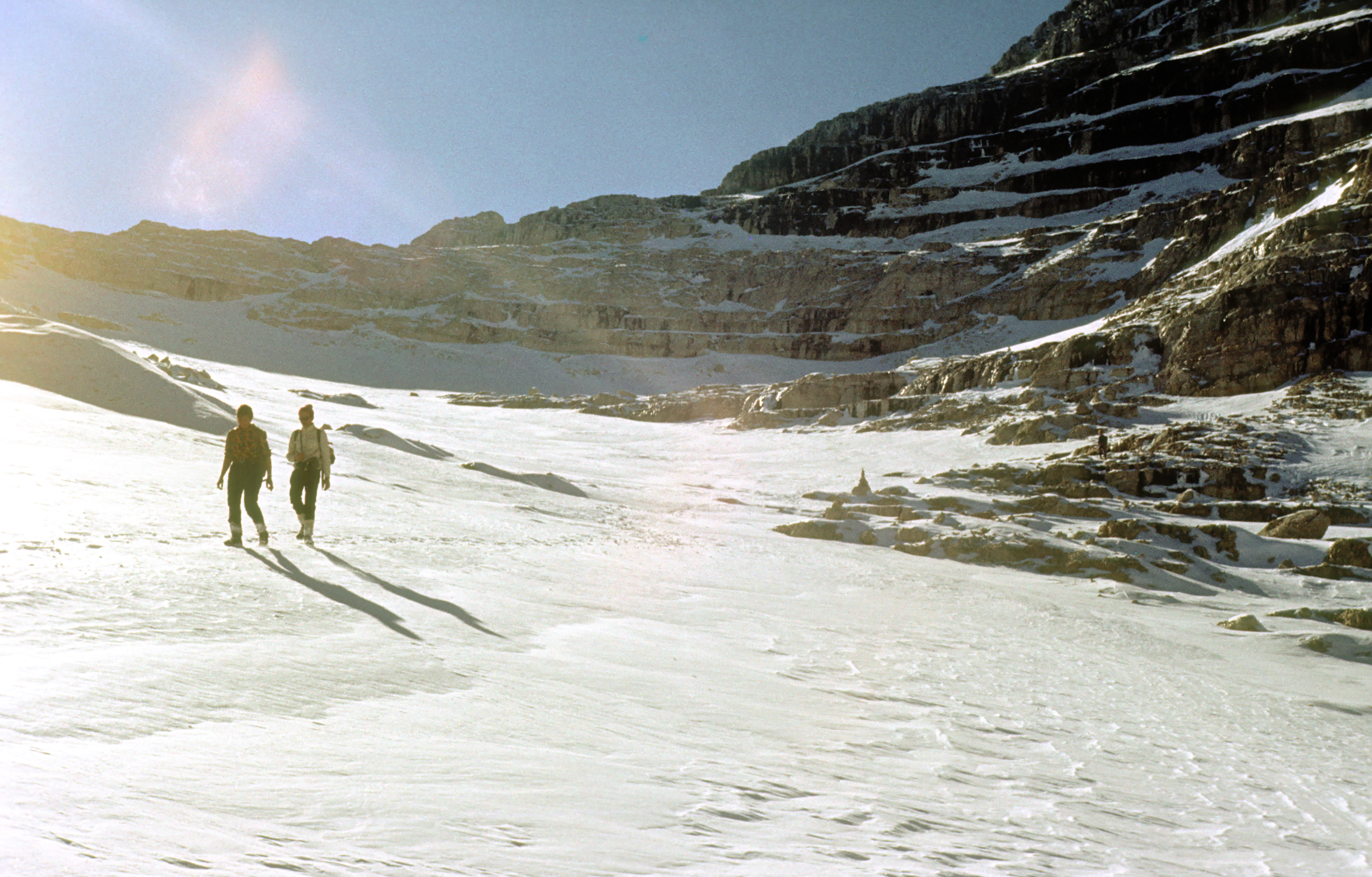
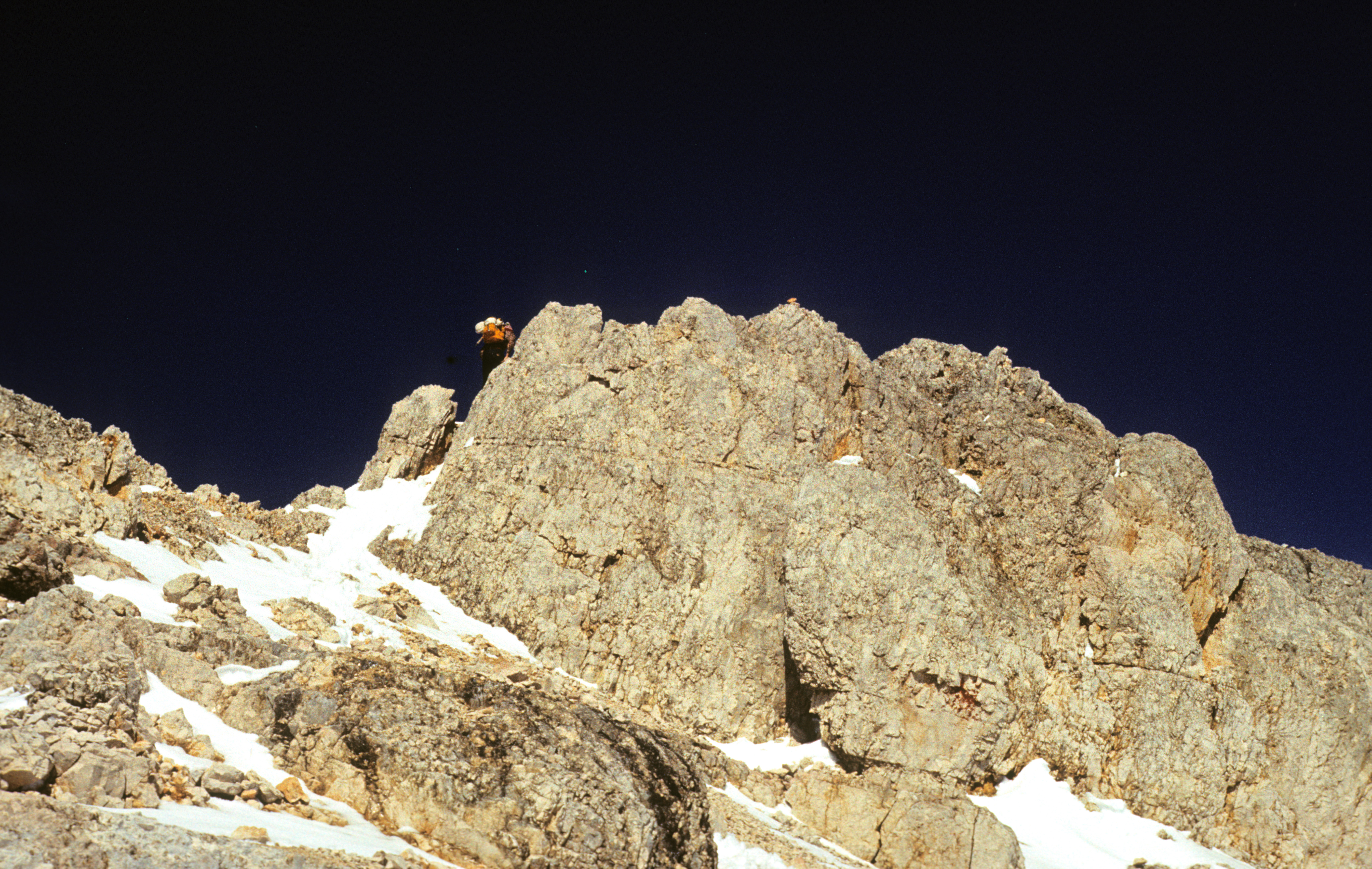
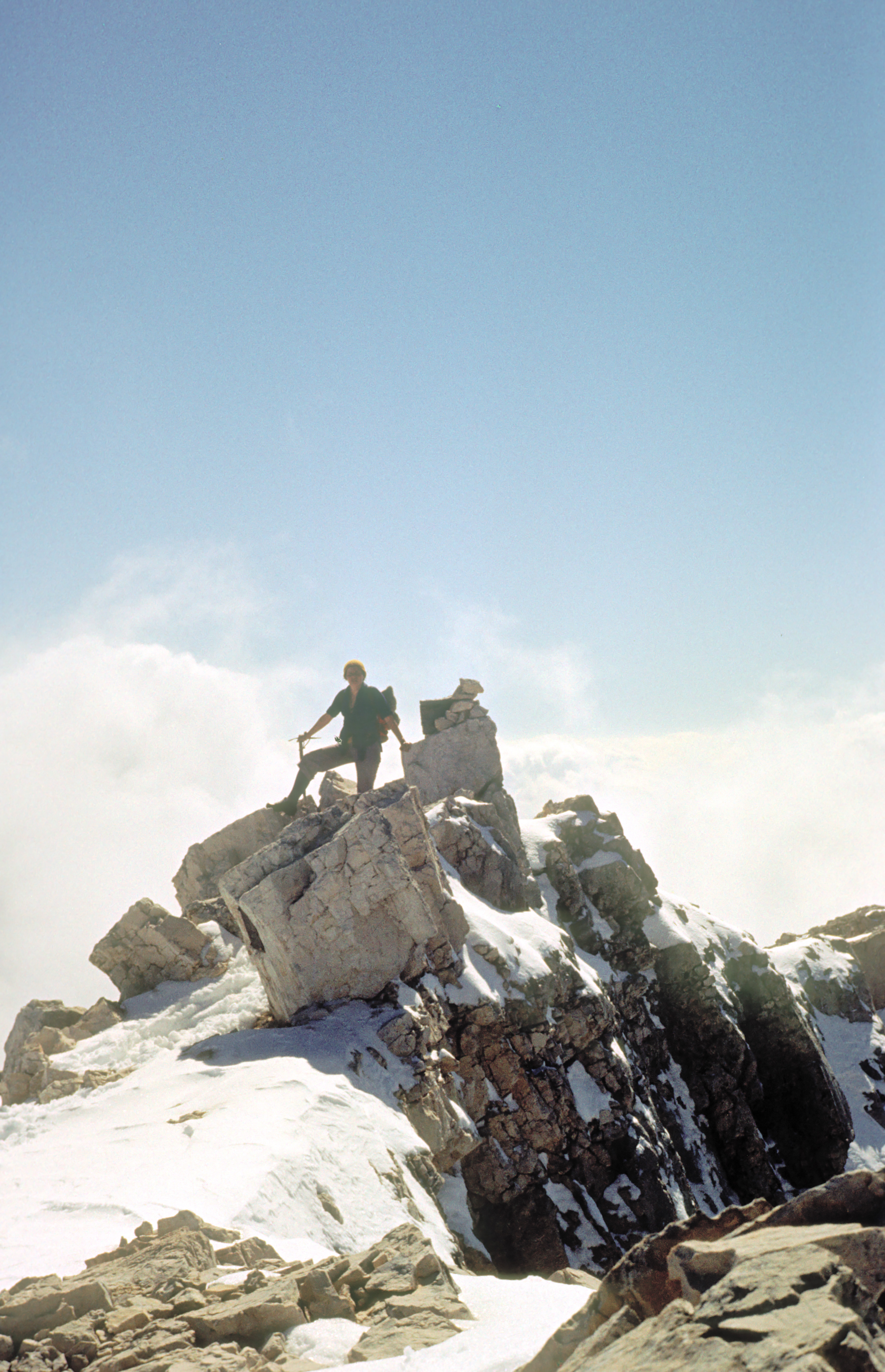
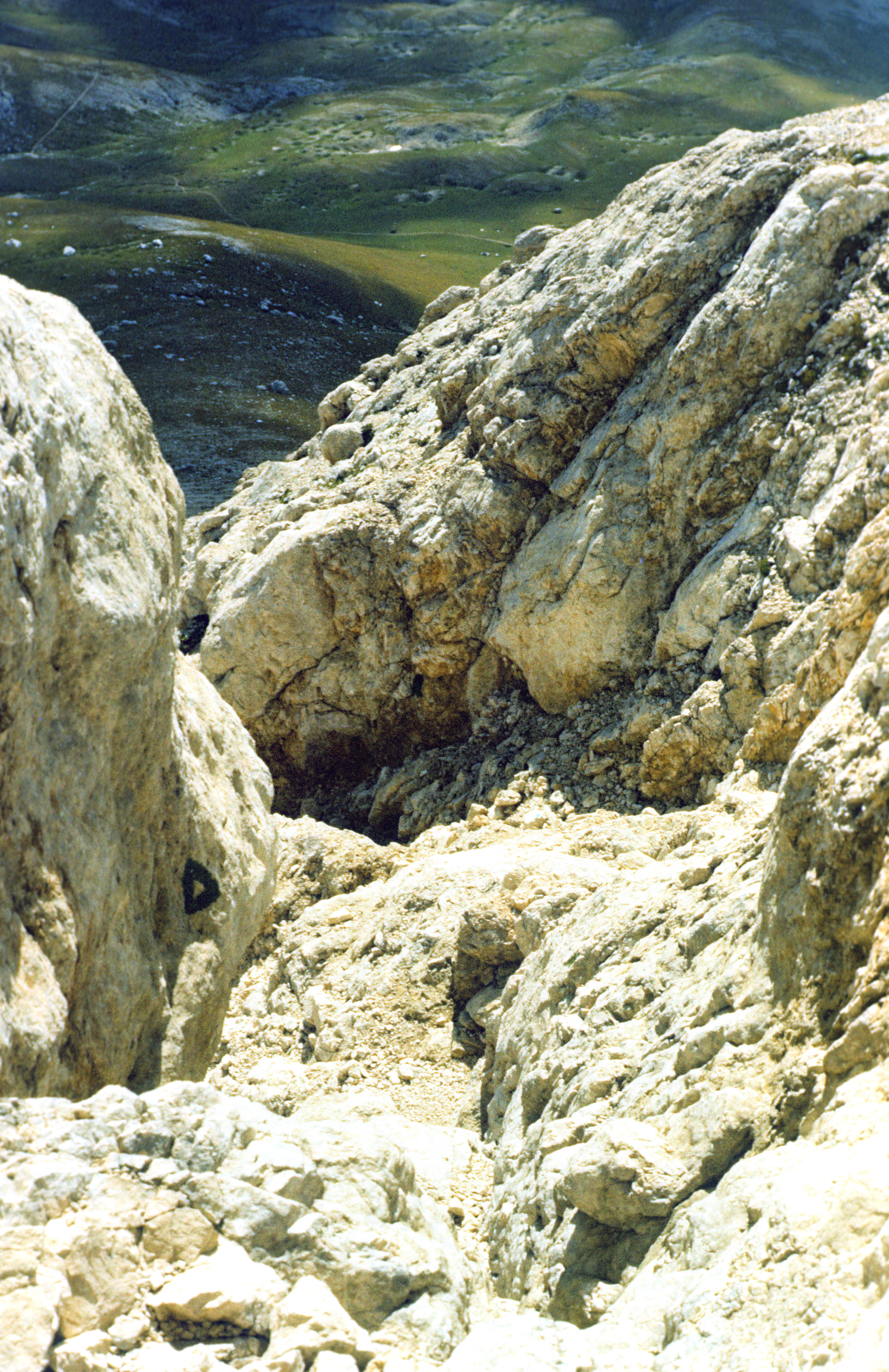
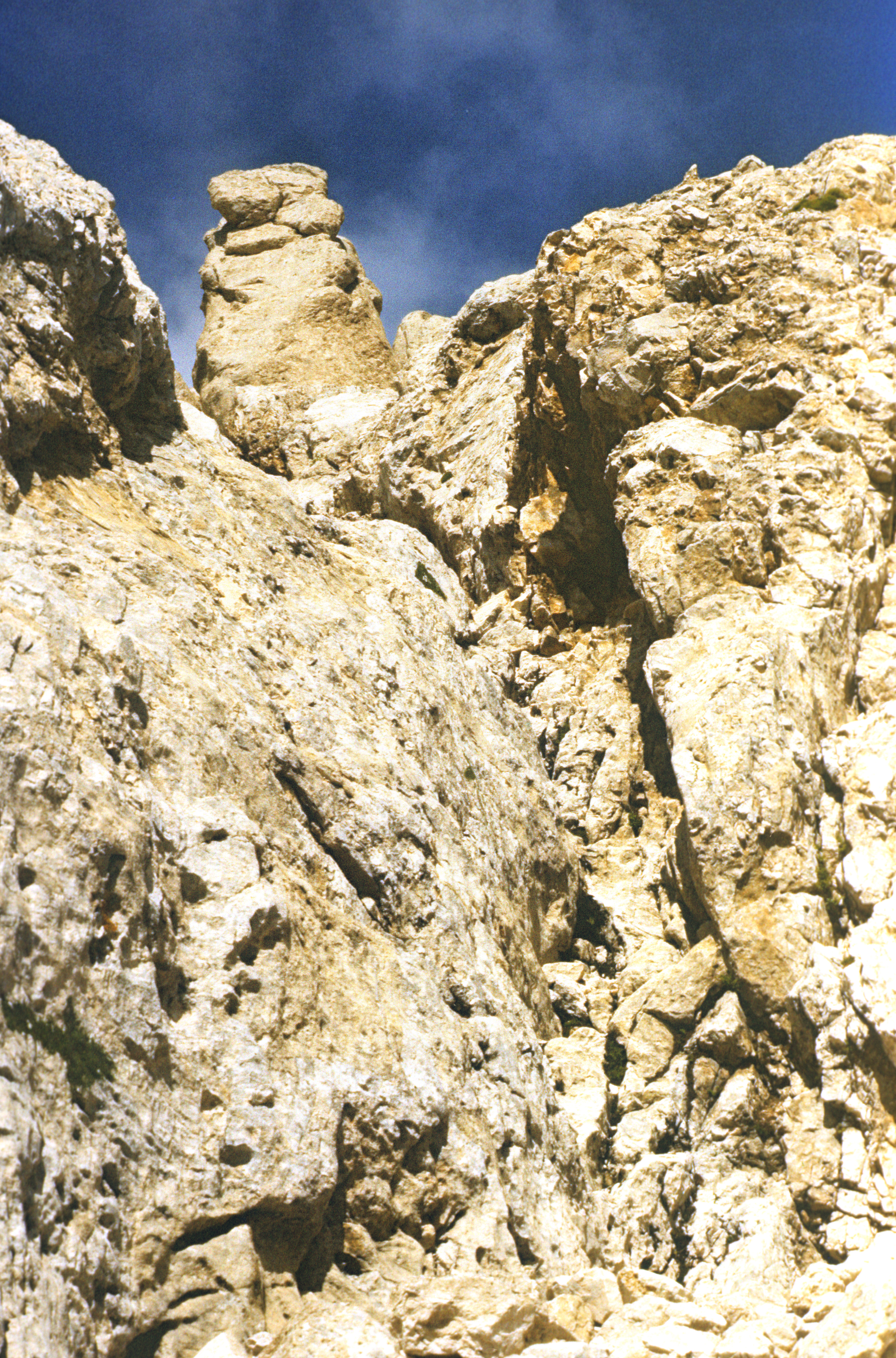
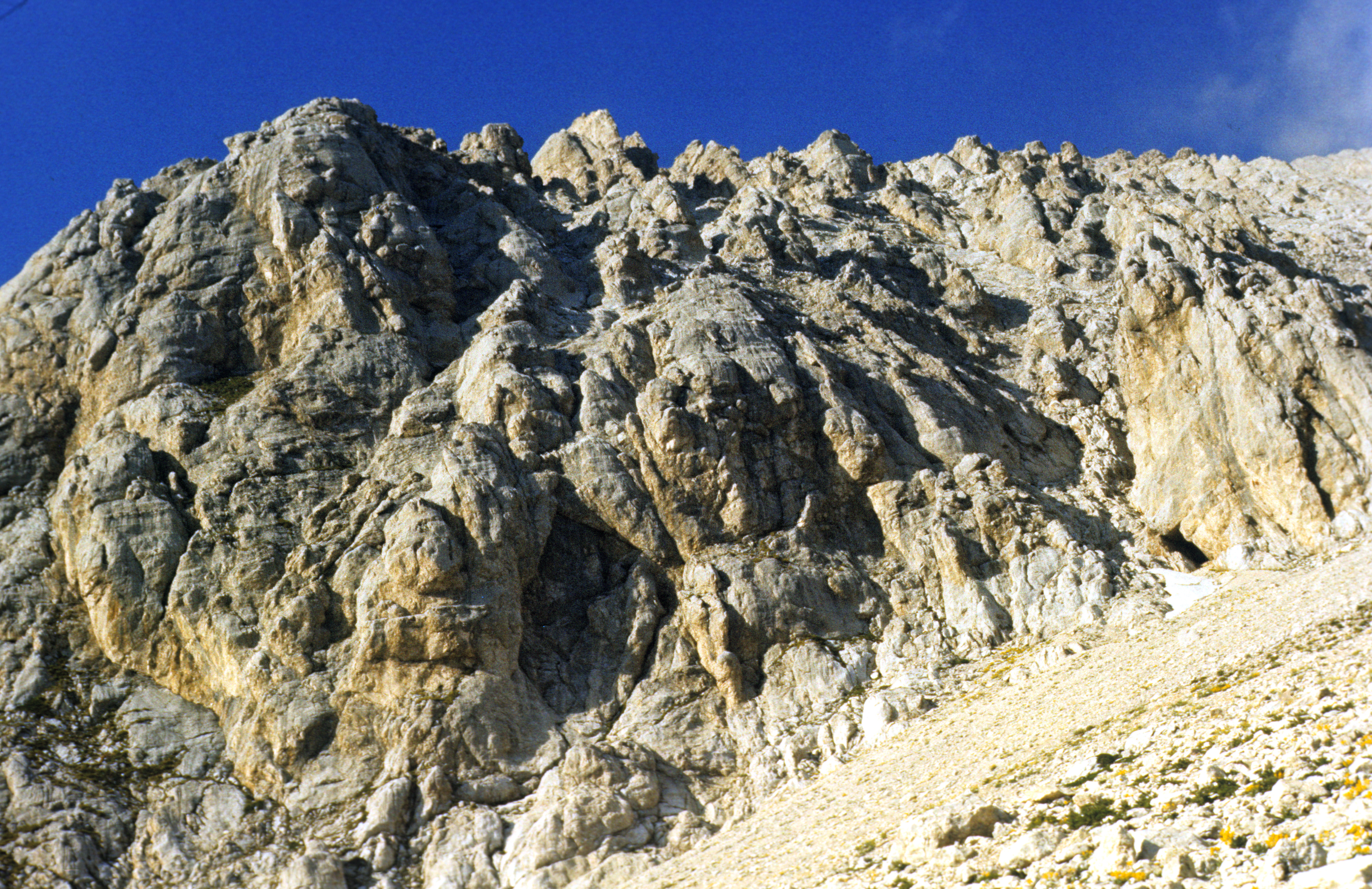
For a safe time reserve, the climb from the Piedra Grande hut (4300 meters) starts before sunrise. On the way up, one passes by a rocky mountain called Espolon del Oro ("Golden Spur"). Its altitude (5080 m) is quite respectable, but very few visitors take the extra time and effort to climb it (I did not). Still higher up, one has to cross a glacier crevasse . The view from the crater rim is breathtaking, but difficult to photograph -- the crater is huge (some 500 meters in diameter), deep (some 200 meters) and too near to be taken in as a whole. The rocks are vertical and dangerously fragile, so one has to stay safely away from the edge. In places, one can smell sulfur dioxide (rotten eggs in everyday language), but otherwise this old volcano is completely dead by today. There is not much of a view from the top of the mountain -- the rocks seen in the near background are on the opposite side of Citlal's crater, and the nearest mountain of comparable height (the Popocatepetl, see below) is nearly 150 kilometers away. Mountains of heights above 4000 meters look from there as if they were mere hills. The picture shows me on the top, in January 1978.
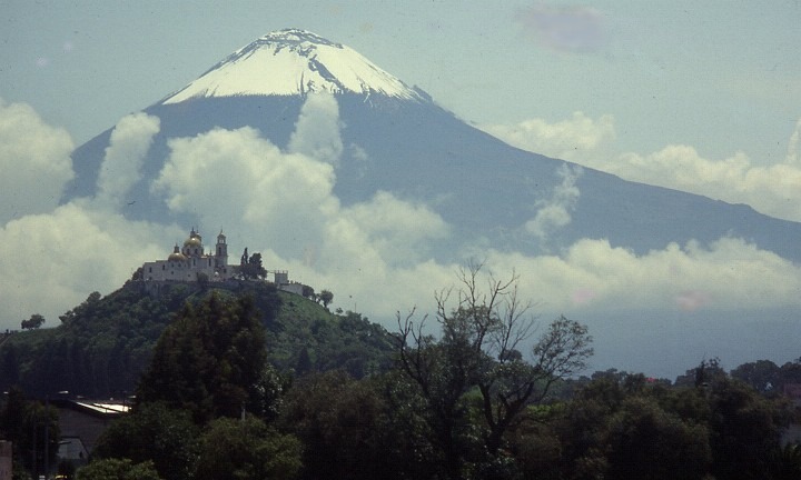
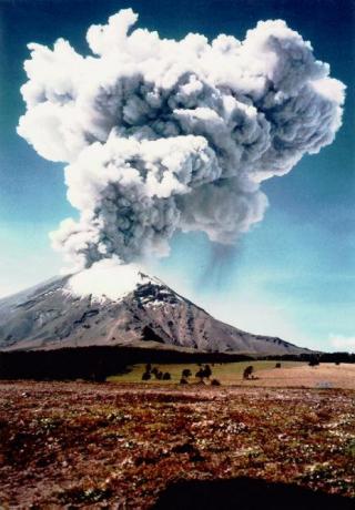
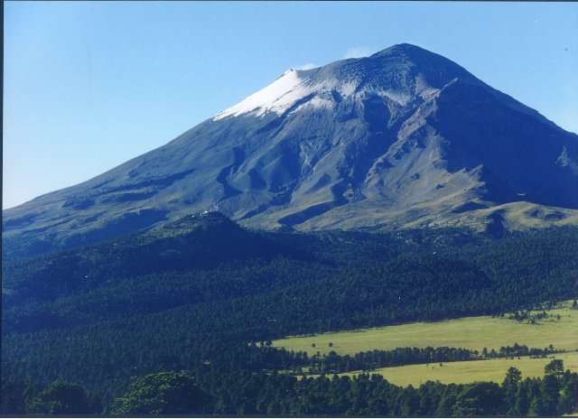
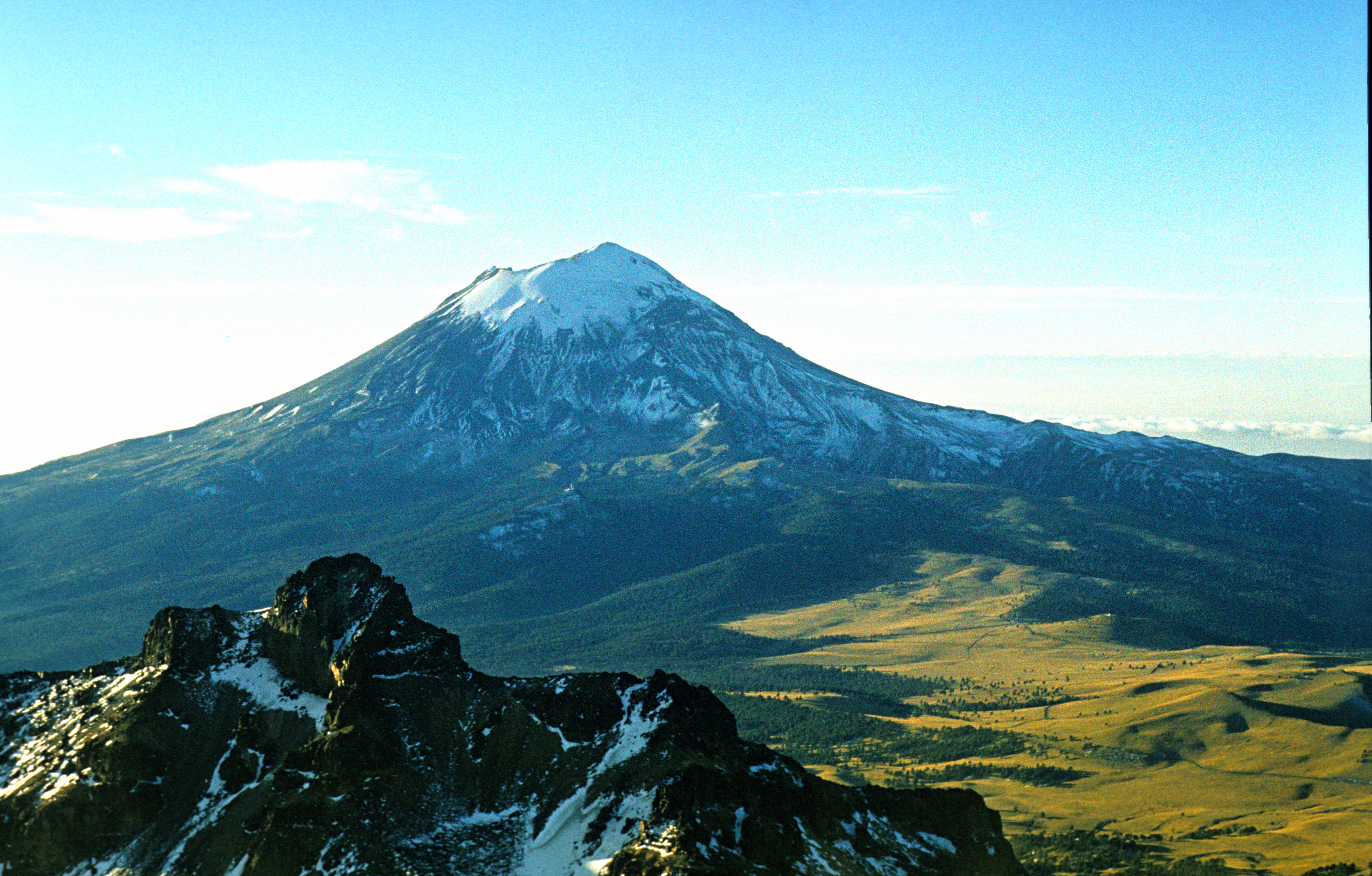
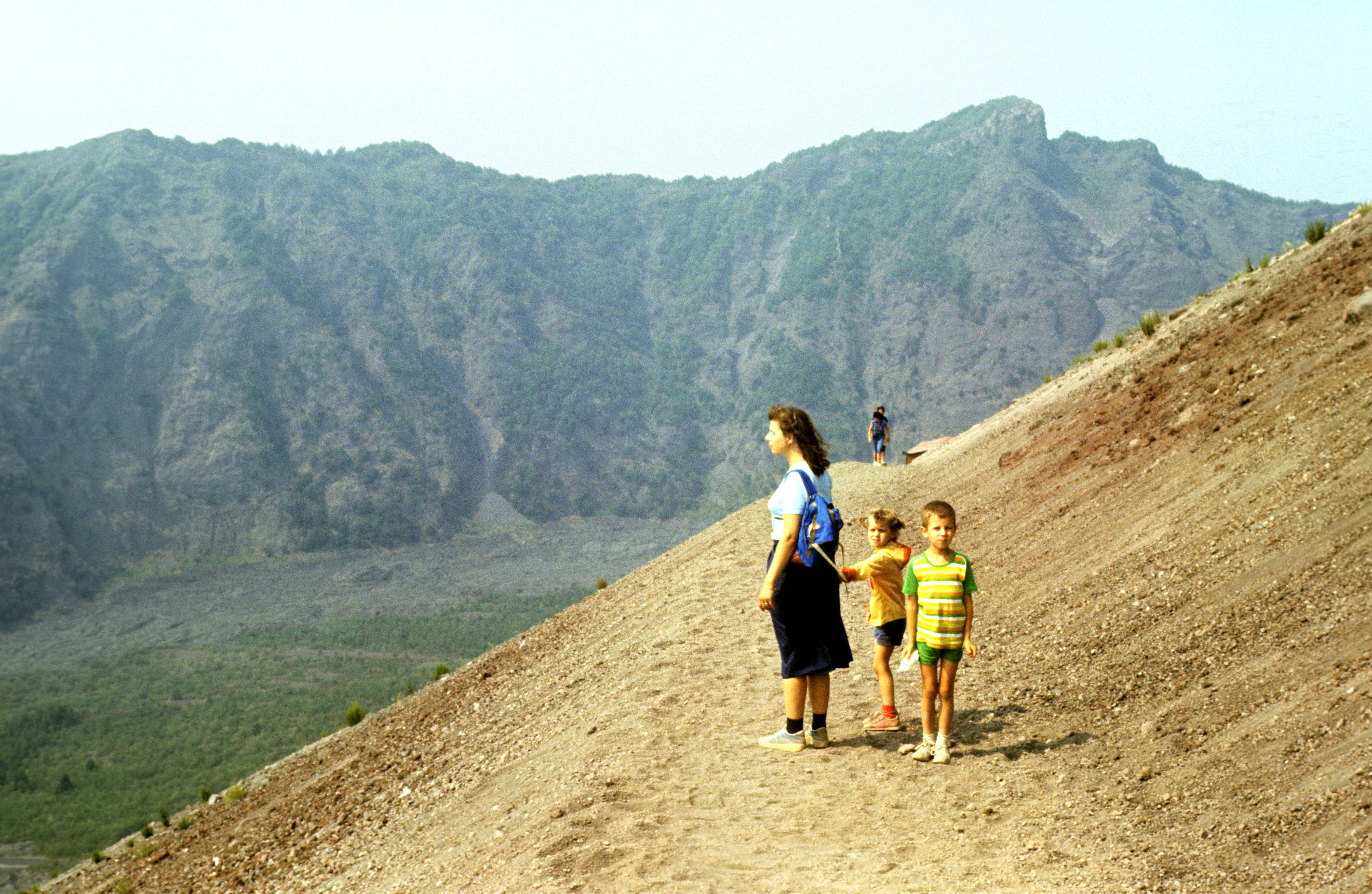
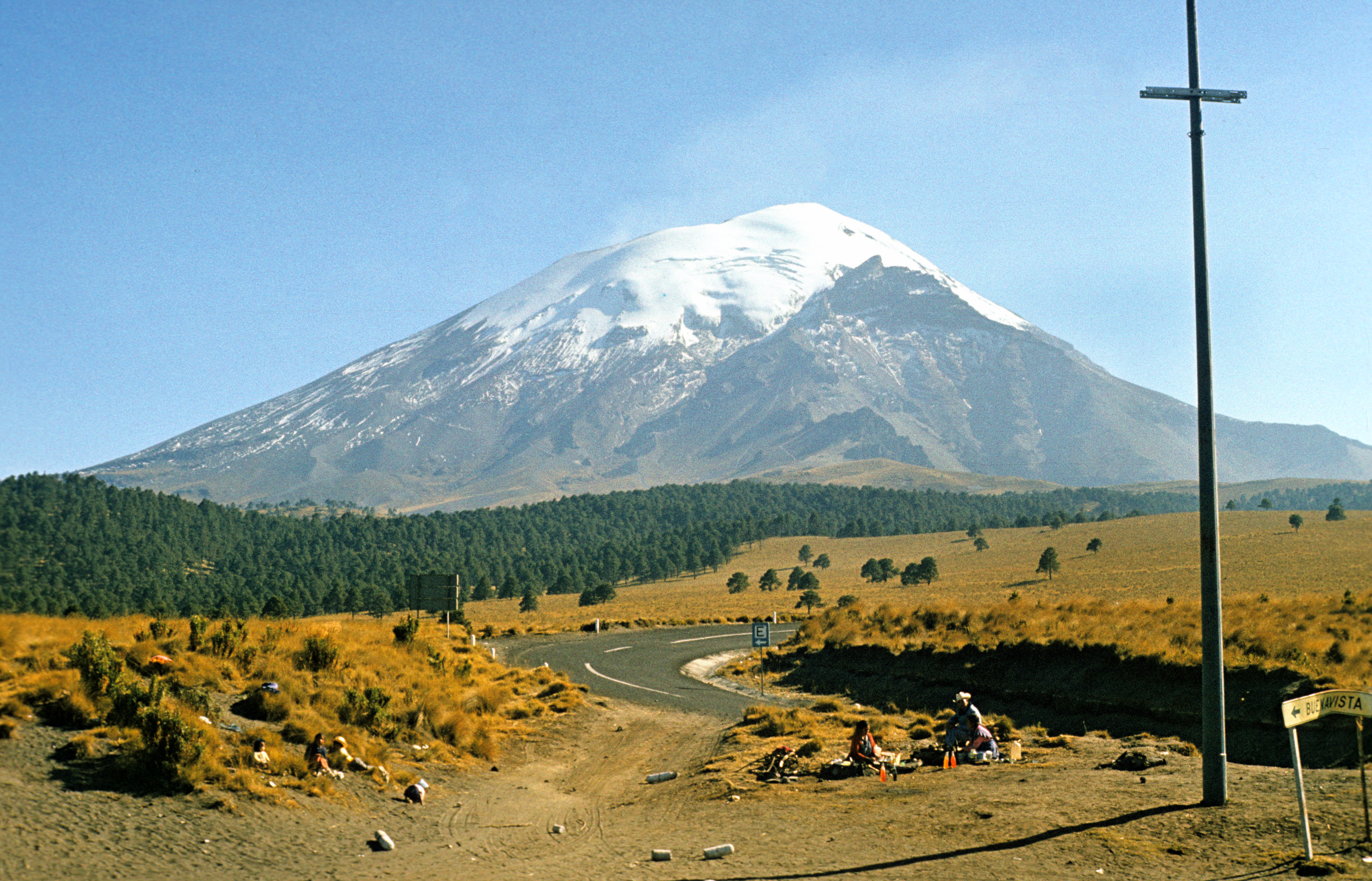 (5452 meters), sometimes (rarely) called by its Spanish name Cerro que Humea. The names mean "Smoking mountain". The second highest peak of Mexico, and the most beautiful of them. The picture shows it from Paso de Cortes (3611 meters), over which Popo rises some 1800 meters. A view from the air (from the north side) is shown here (picture copied from http://www.udlap.mx/~gisudla/Volcan/images/Popocatepetl.jpg). Another impressive view is from the surroundings of the town Puebla (picture copied from http://www.mexico-child-link.org/project-photos/Popo-11-7-1991.JPG). (The reason why I copied the picture from the internet is that one can rarely see Popo from the neighbourhood of Puebla -- because of the extremely polluted air there. On the picture taken by myself the mountains are barely seen through the smoke.) Popo's peak is about 3000 meters higher. The church seen in the foreground stands on top of an old pyramid near the town of Cholula (yes! the high hill is a man-made structure covered by sediments of many ages). The first photo shows how Popo had looked in its quiet years, prior to 1994. In December 1994, it suddenly awoke after several hundred years of quiet existence, and by today it often looks like this (picture copied from http://ccc.inaoep.mx/CIARP2004/popocatepetl.jpg) or like this (picture copied from http://www.volcano.org.cn/shijiehuoshan/images/Popocatepetl.jpg). Tourists are now not allowed to come close to it - this is dangerous. Because of the volcanic activity, Popo's once magnificent glacier seems to have disappeared or been covered by volcanic dust (picture copied from http://www.geocities.com/Yosemite/1464/imagenes/popocatepetl_amanecer.jpg).
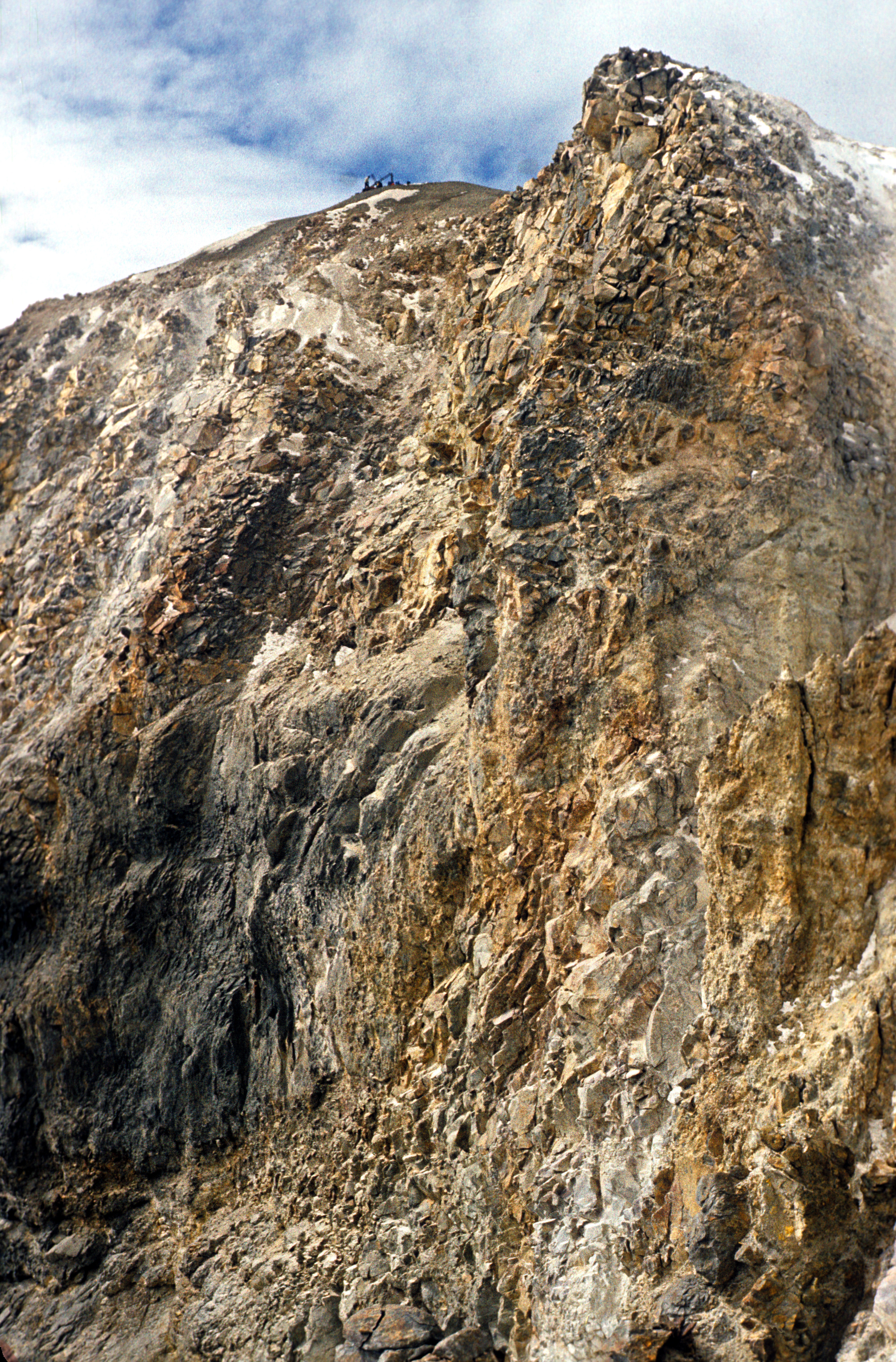
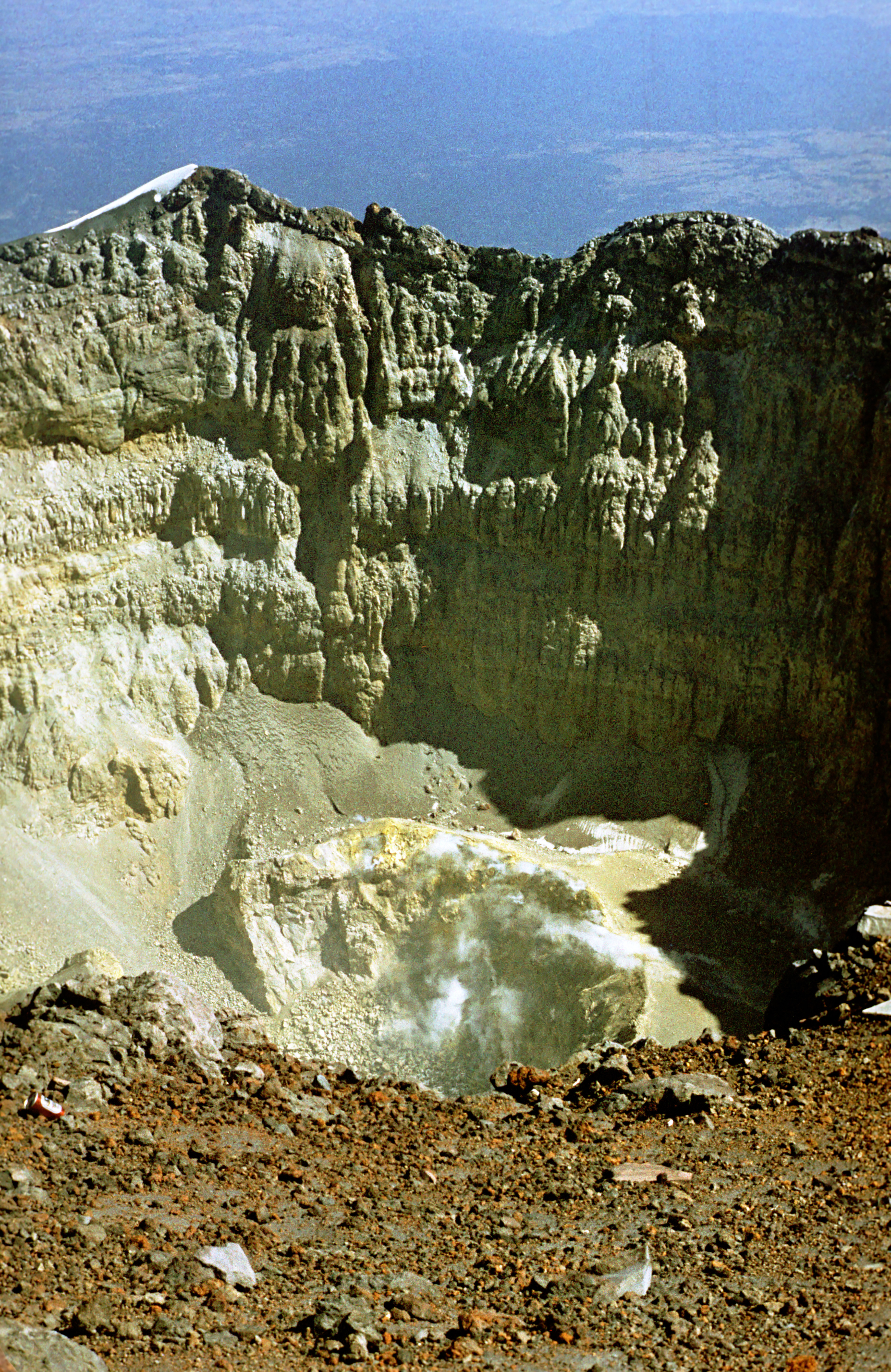
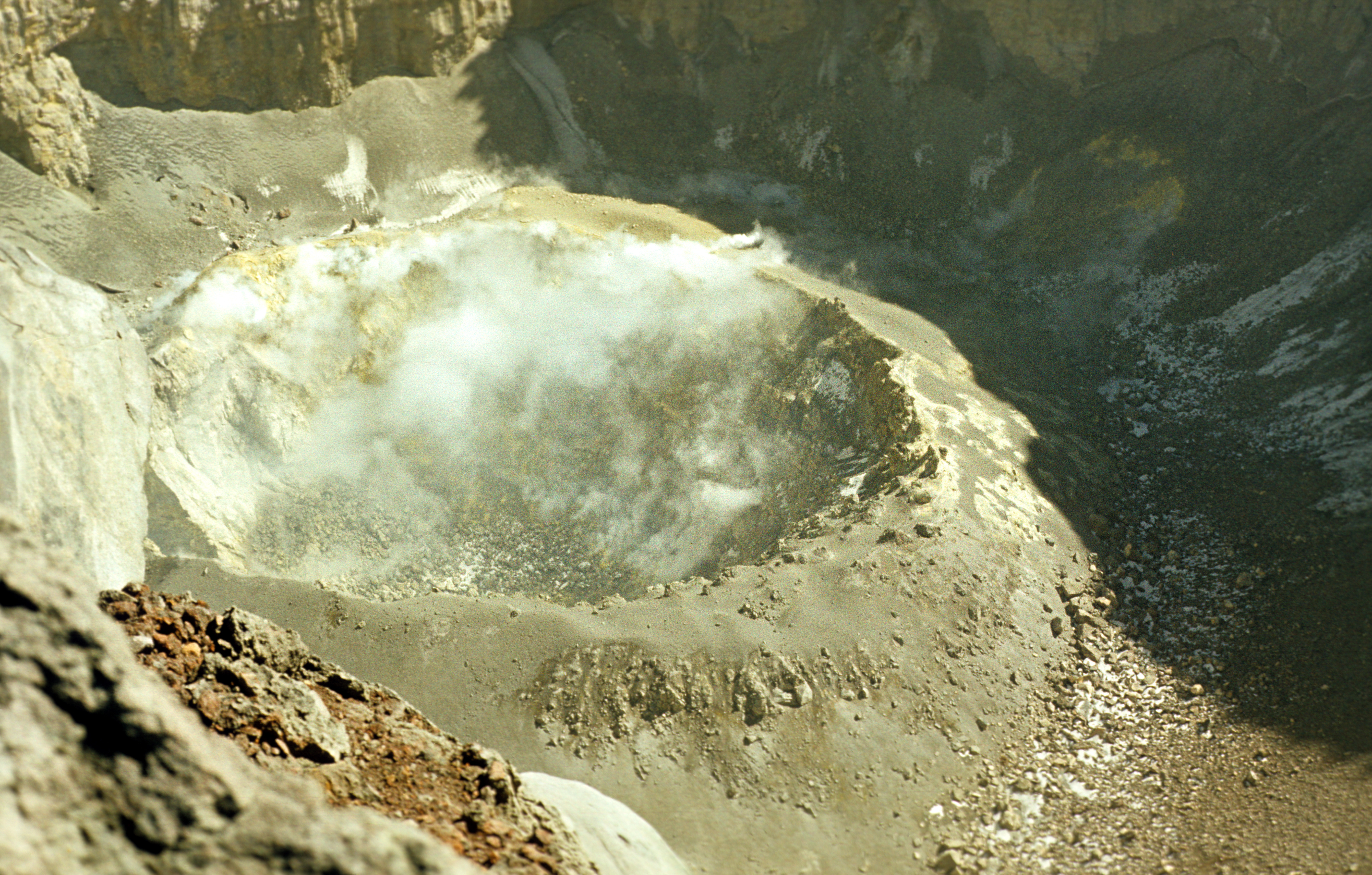
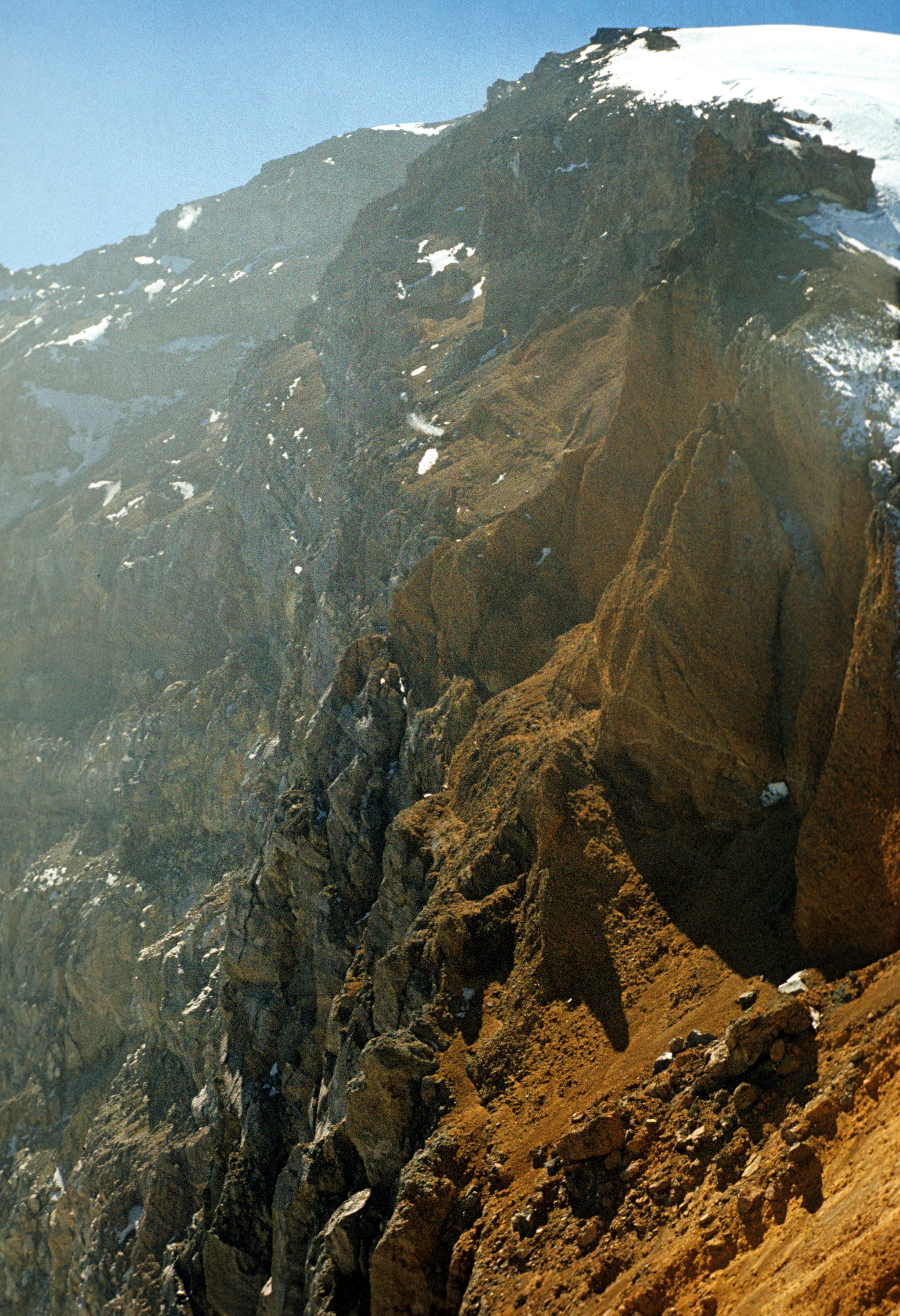
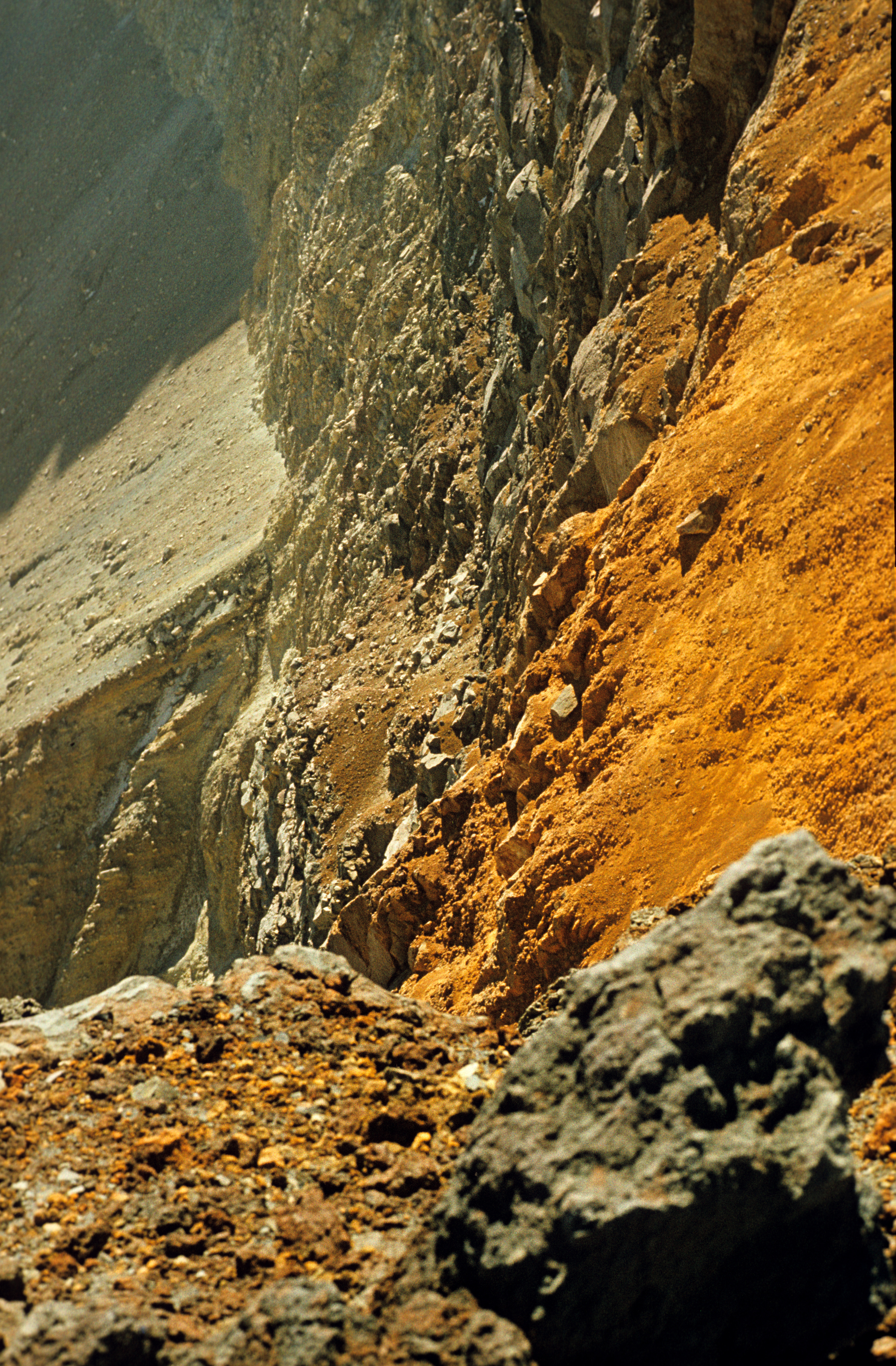
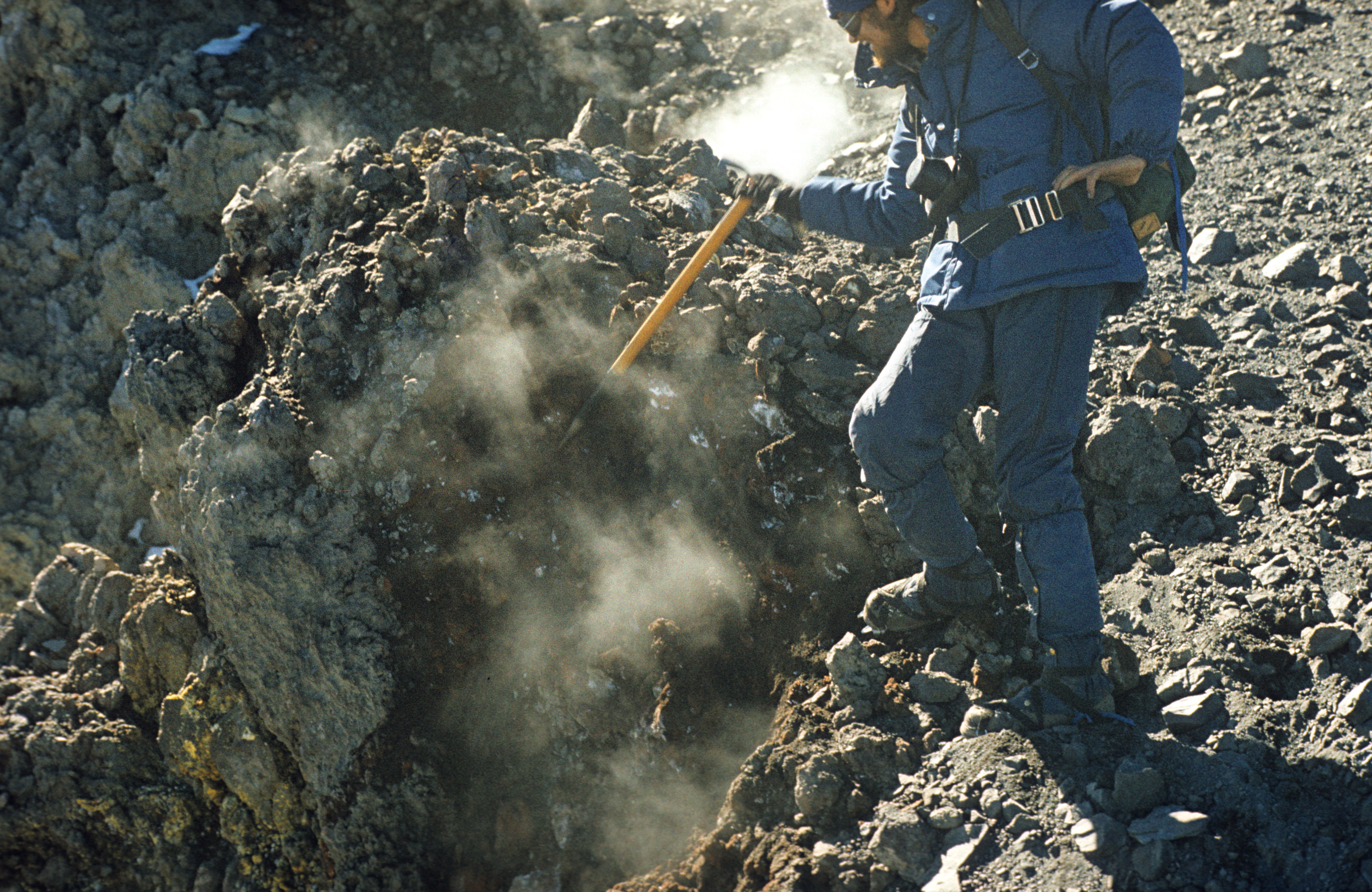
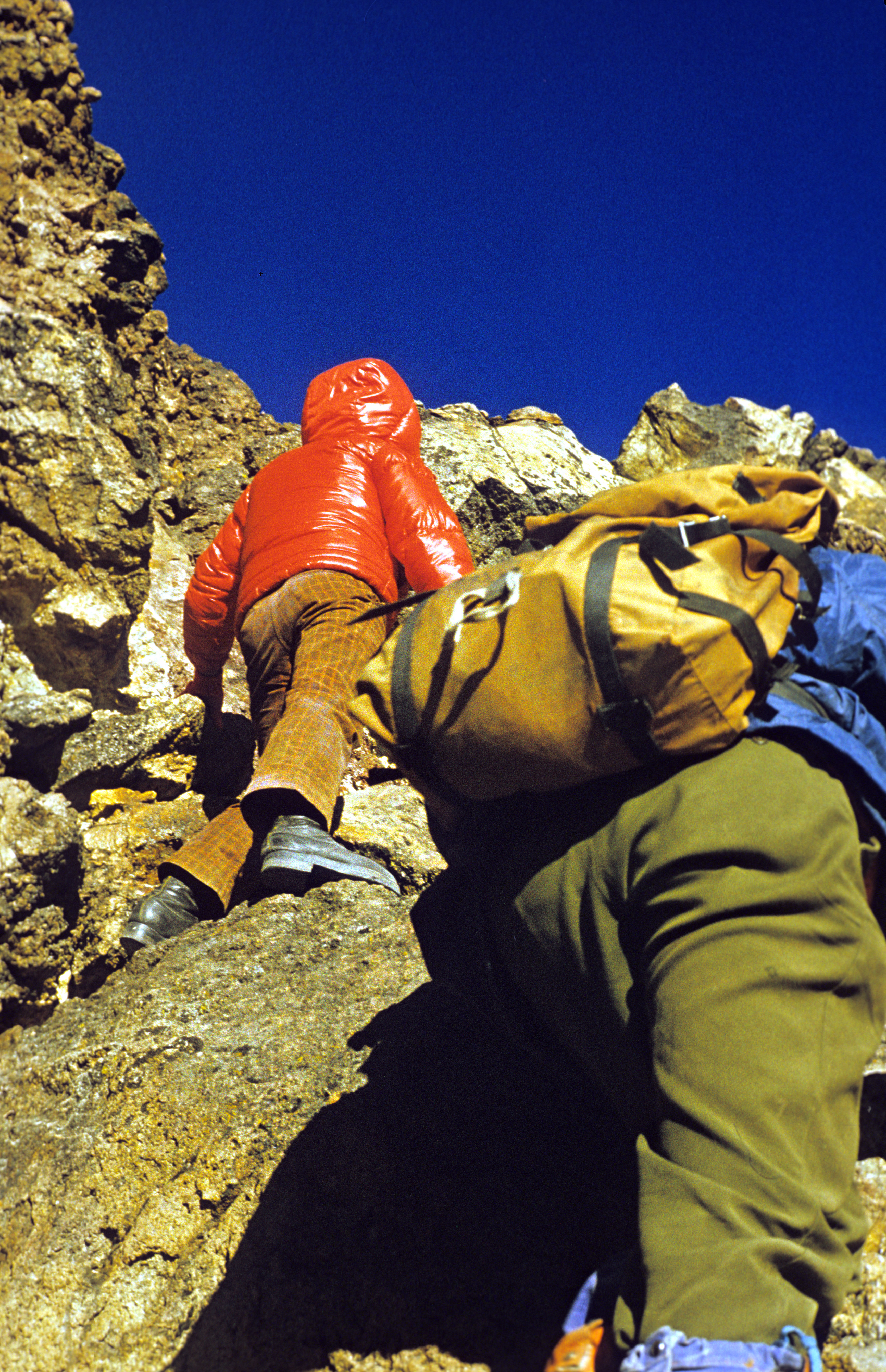
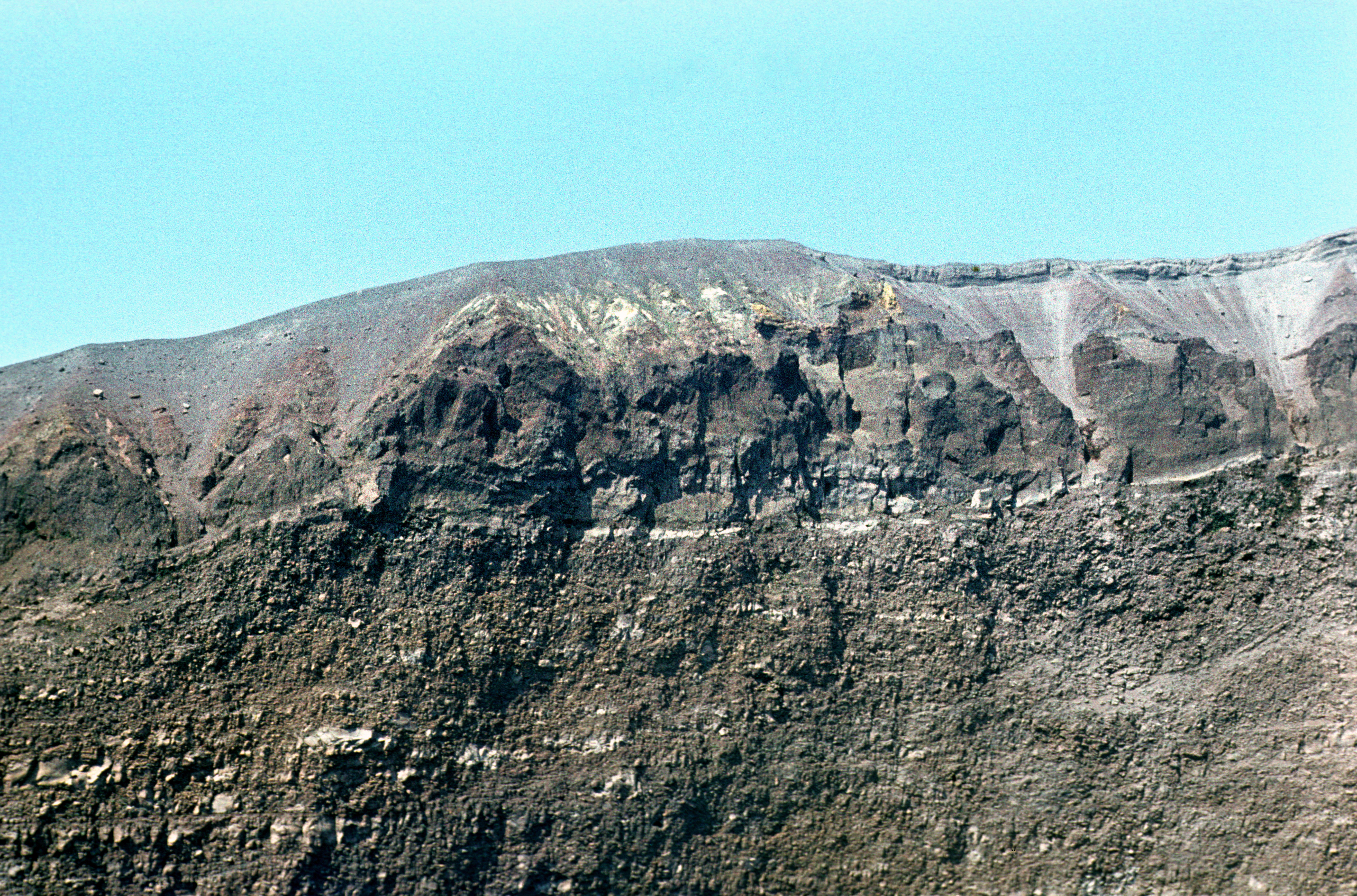
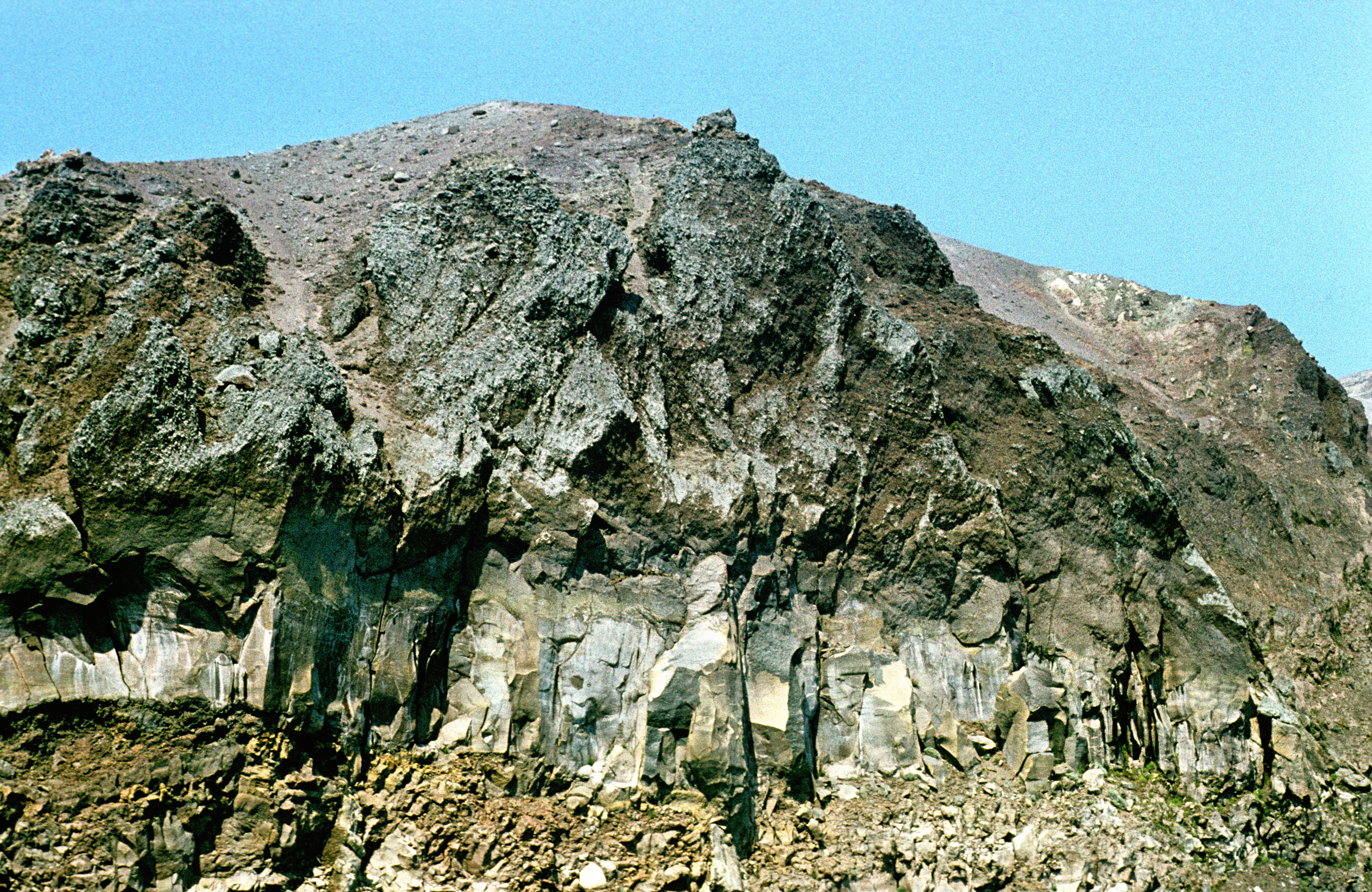
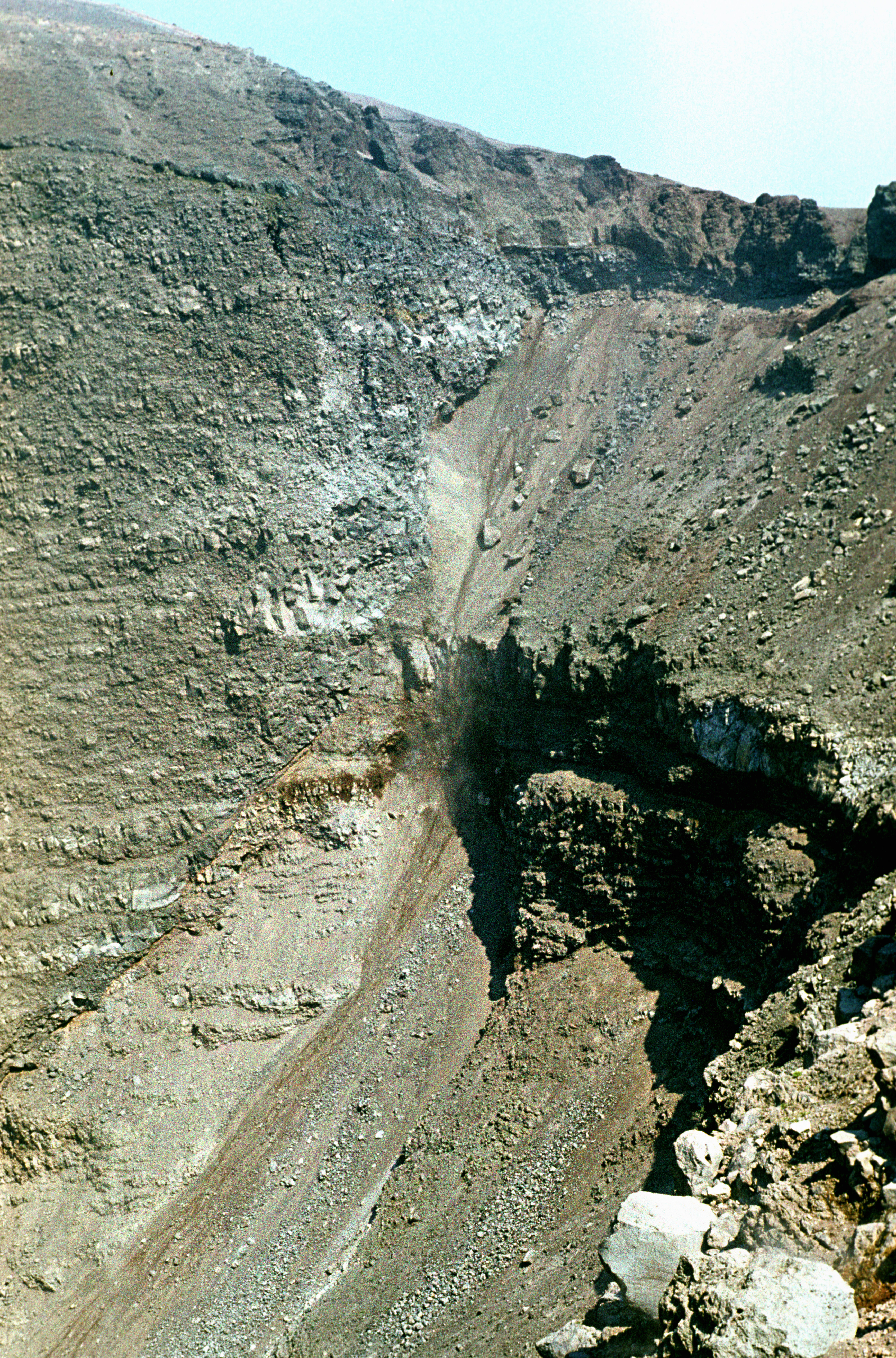
Back in 1977, when I was there, the crater rim and the top were safely accessible, and offered wonderful views into the crater, that is much deeper (about 500 meters from the top to the bottom) and larger than on Citlal. This is how the crater wall and bottom looked then, when viewed from the top. The smoking pot in the bottom, when viewed from the lowest point of the crater rim, looked like this ; note the difference in distance compared with the previous picture. The difference in height between the highest and the lowest point of the crater rim exceeds 200 meters. It was impossible to take the whole crater in one picture because of the small distance, the view along the crater rim toward the top, showing a piece of the crater wall, is shown here . Note that the ice and snow end on the rim -- they go up to the edge, but the hole emits enough heat to melt the ice and does not allow the glacier to expand into the crater. The rocks there come in many unusual colours, seen more clearly here . The rocks were warm and so fragile that they could be broken with bare hands, the gentleman seen in this picture is dismantling a rock with his ice axe (he is Craig Peer, then from California, one of my two companions on Popo). A broken rock would start to emit smoke copiously. Because of the fragile rocks and vertical walls, it would have been extremely dangerous to climb down into the crater; a descent would be possible only by rappelling (we did not try that).
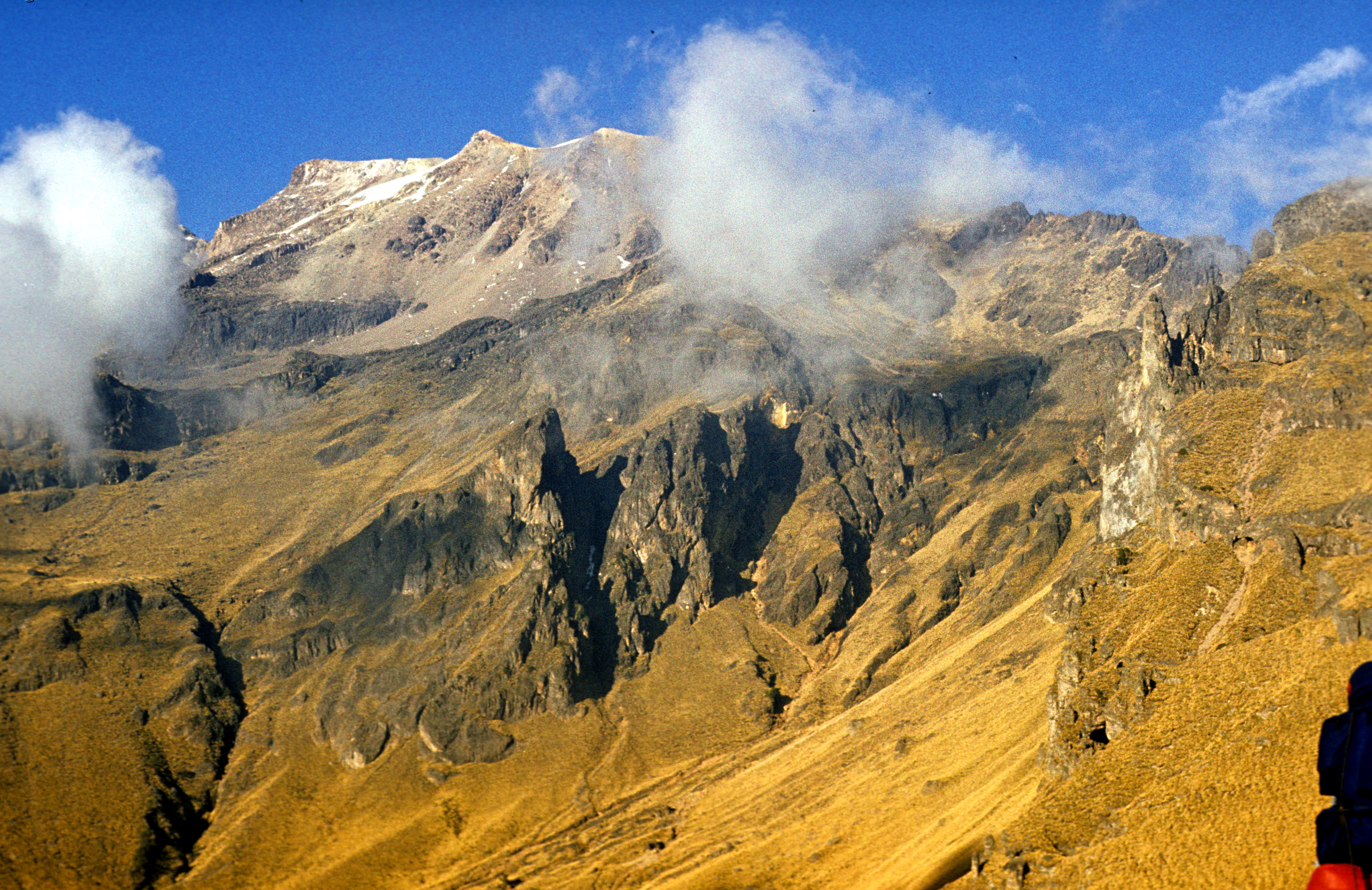
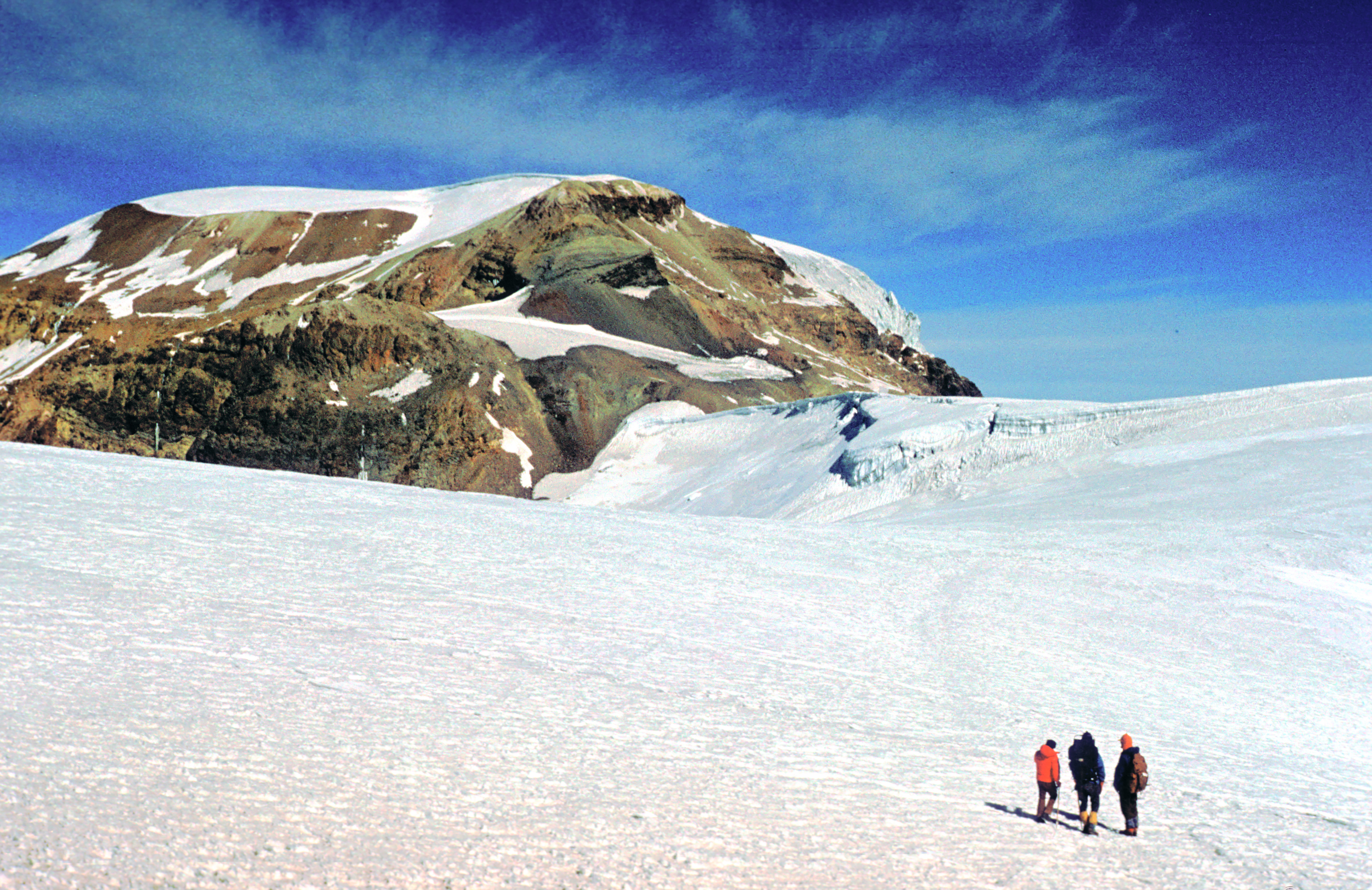
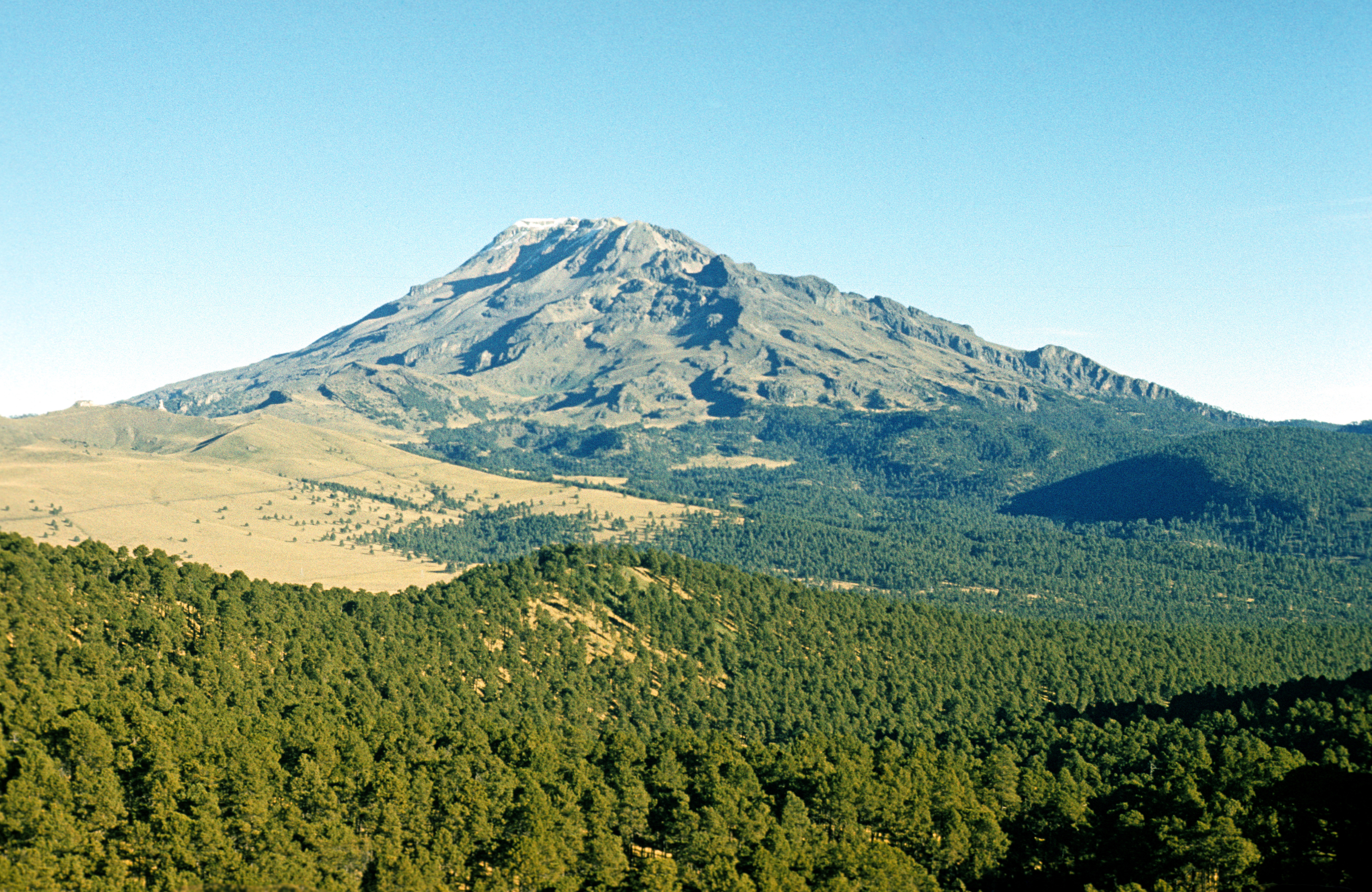 (5286 meters). Third highest mountain in Mexico. Its name means "sleeping woman" -- its profile reportedly reminds of a woman lying on her back (the picture shows "the woman" from the direction of her "feet", as seen from the slopes of Popocatepetl). A woman built in the same proportions would not look attractive... But the Spaniards happily followed that analogy and named various parts of the mountain after body-parts of a woman. Thus, the highest peak is, obviously, "the breast" (Pecho, the ice-covered flat top in the picture), the second highest (5146 meters, not visible) is "the head" (Cabeza), and the rocky horn with dark shade at the front end of the ridge is called "the feet" (Pies, 4741 meters); its nahuatl name is Amacuilecatl. Other body parts are represented, too, but are not visible in this picture. Ixta does not look impressive from afar, but it is large in area and complicated in its topography (see the view from under Amacuilecatl ), and quite interesting to climb. It is a neighbour of Popocatepetl -- it lies about 20 kilometers to the north of the latter, and is best accessible from Paso de Cortes. Offers some great views of Popo, like this one, with Amacuilecatl at the front. Although its glaciers are small in area, some of them have the form of icefields -- miniatures of those covering Greenland and Antarctica - where rivers of glacier ice flow in different directions away from a common source. Note the "nieves penitentes", little ice-towers, on the glacier at the left. Most famous from South American glaciers, they are present also here, albeit are much smaller (no higher than 50 cm).
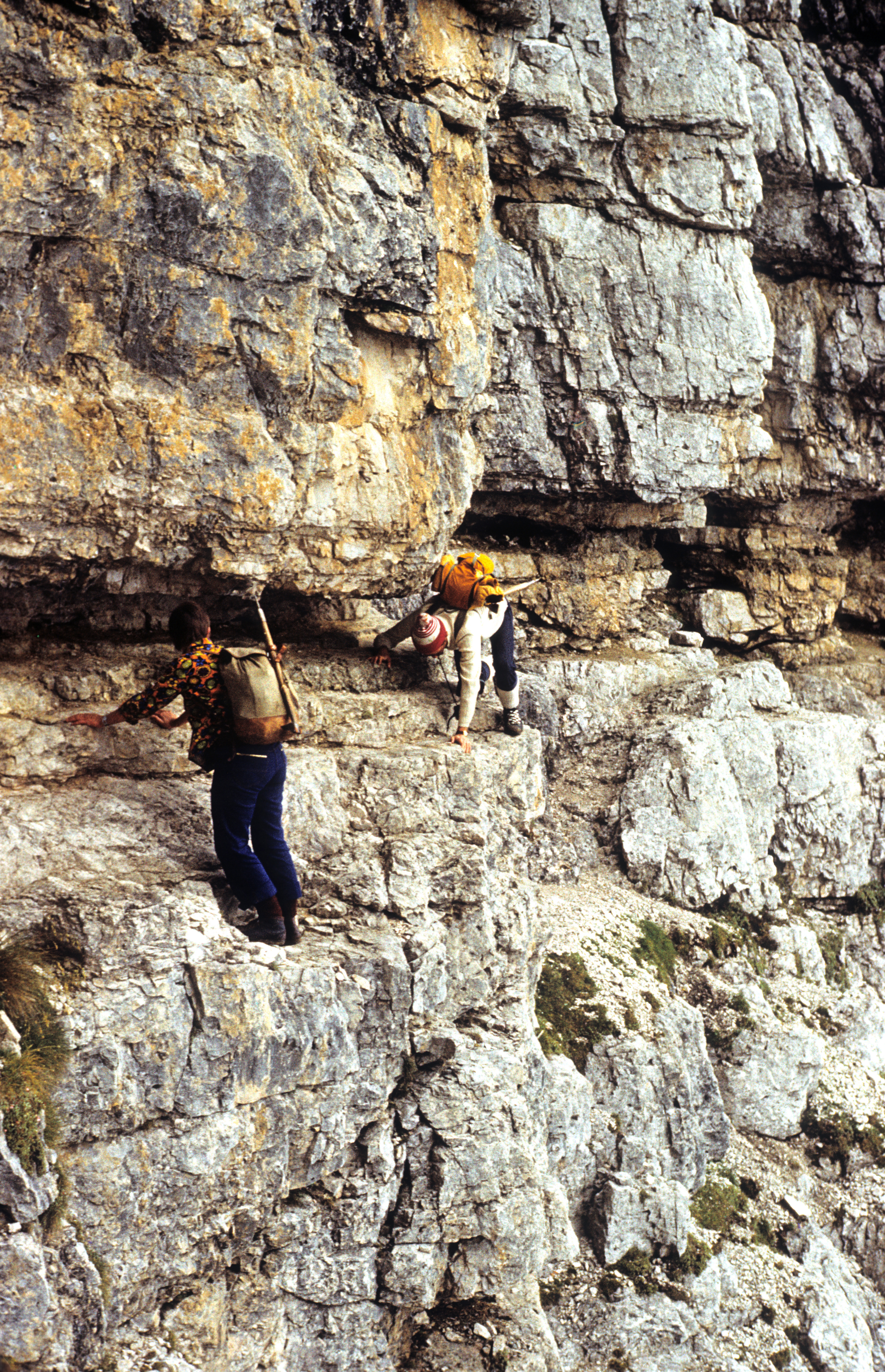
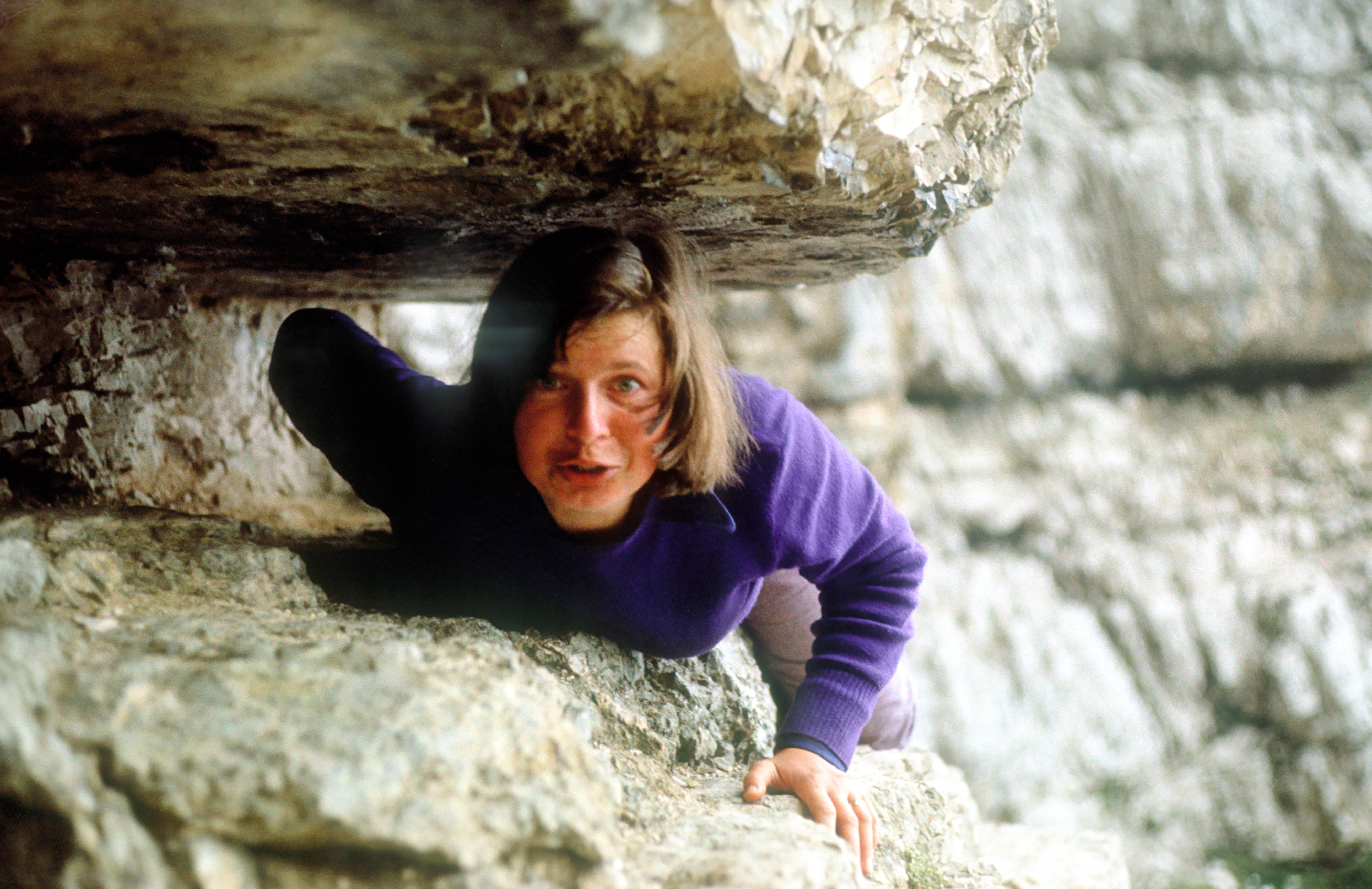
On the way up, there is some leisurely rock climbing . One of the glaciers covers the the top (i.e. the "breast"), and another one, also seen in the picture, lies on a plane below the top. The ridge leading up the "breast" has some colourful rocks. The climb is too long to be easily made in one day, although this would be possible for hikers in very good physical shape. Typically, one stays overnight in one of a few unmanned huts , like the one in the picture (me at right, my Mexican companion Jose Luis Gonzalez at left). The altitude of the hut (4800 meters, almost as high as Mont Blanc) may cause some headache for the climbers, but does no harm to mice or rats -- we have not seen them, but they brawl at night with so much noise that one wakes up several times.
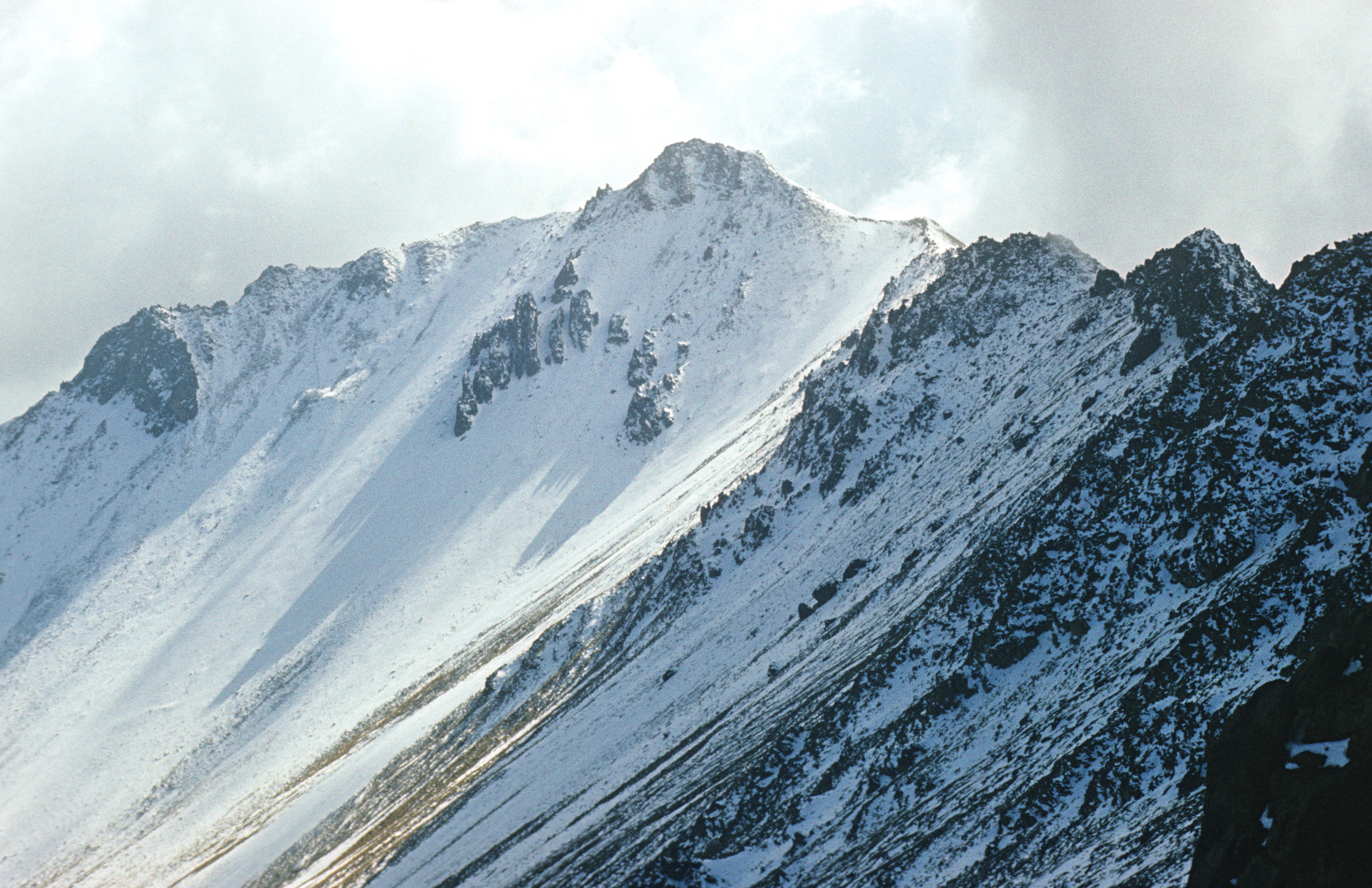
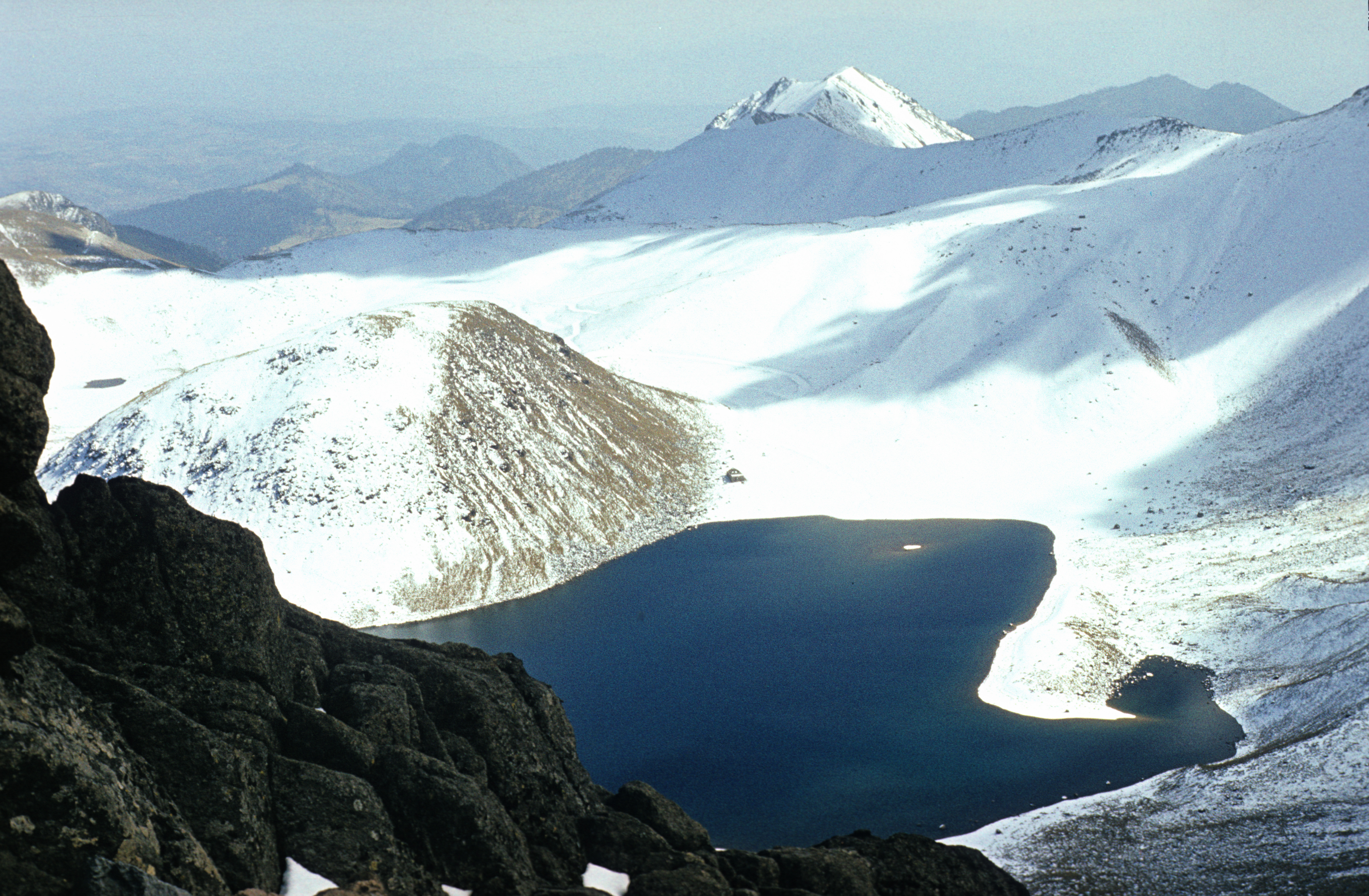
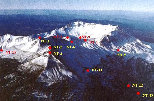
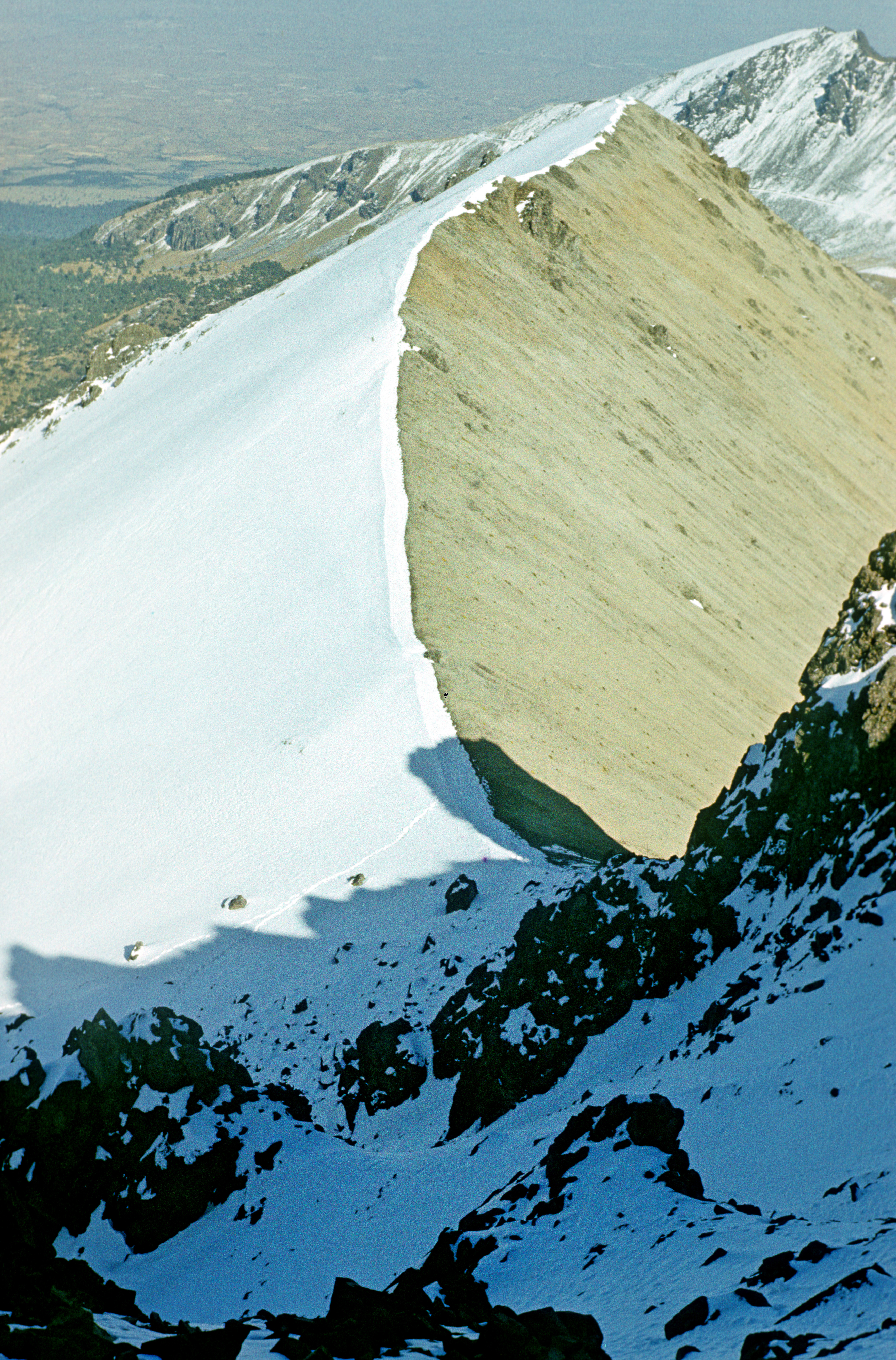
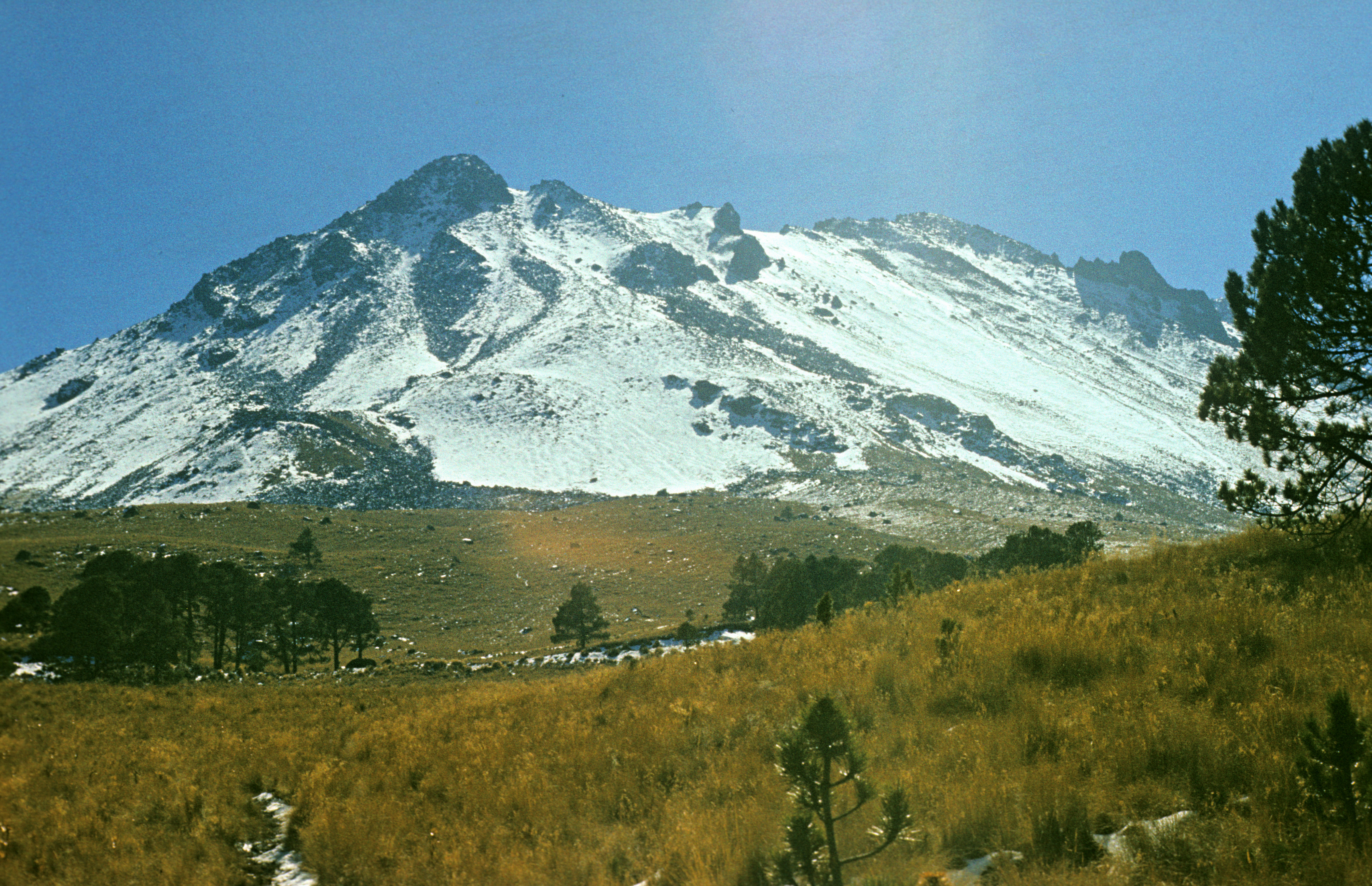 . Its main peak, with its 4704 meters, is commonly considered to be the fourth highest mountain in Mexico. (As could be seen from the text above, there are more than 3 peaks in Mexico that are higher than this. Among them is Ventorillo (5000 meters), a rocky spur at the foot of the Popocatepetl glacier. But they are mere secondary peaks within large massifs. Nevado de Toluca is the fourth highest among the well-defined isolated massifs, or so the conventional wisdom says.) Its nahuatl name, Zinantecatl (Naked Man), is apparently not known to most people. It has two peaks: Pico del Fraile, the highest point (the broad inconspicuous mountain in the background of the picture), and Pico de Aguila (4654 meters, at the forefront). The photo shows a view of the whole massif from the side of the tourist base which is the most convenient starting point (off the road Toluca -- Raices). As you can see, Pico del Fraile is hidden from view, and Pico de Aguila seems to be highest. I did make that mistake, and when I was on the ridge, I was too tired and had too little time to climb the highest point -- some 2 kilometers away, so I settled for the 4654 meters. This is how Pico del Fraile looks from Pico de Aguila. The whole massif is an old volcano whose crater rim was destroyed by erosion on 1/3 of its length, see the view from the ridge . The lowest point of the rim can be reached by car on a dirt road. Most pictures found in the internet were taken from there. A view from the air shows the topography better (picture copied from http://www.montero.org.mx/a21.jpg). The highest peak is in the center, farthest in the back, Pico de Aguila is the high peak at the right end of the ridge. There is some easy rock scrambling along the ridge , but otherwise the climb is without difficulties. The height, though, does require some prior acclimatisation that can be acquired while climbing lower mountains.
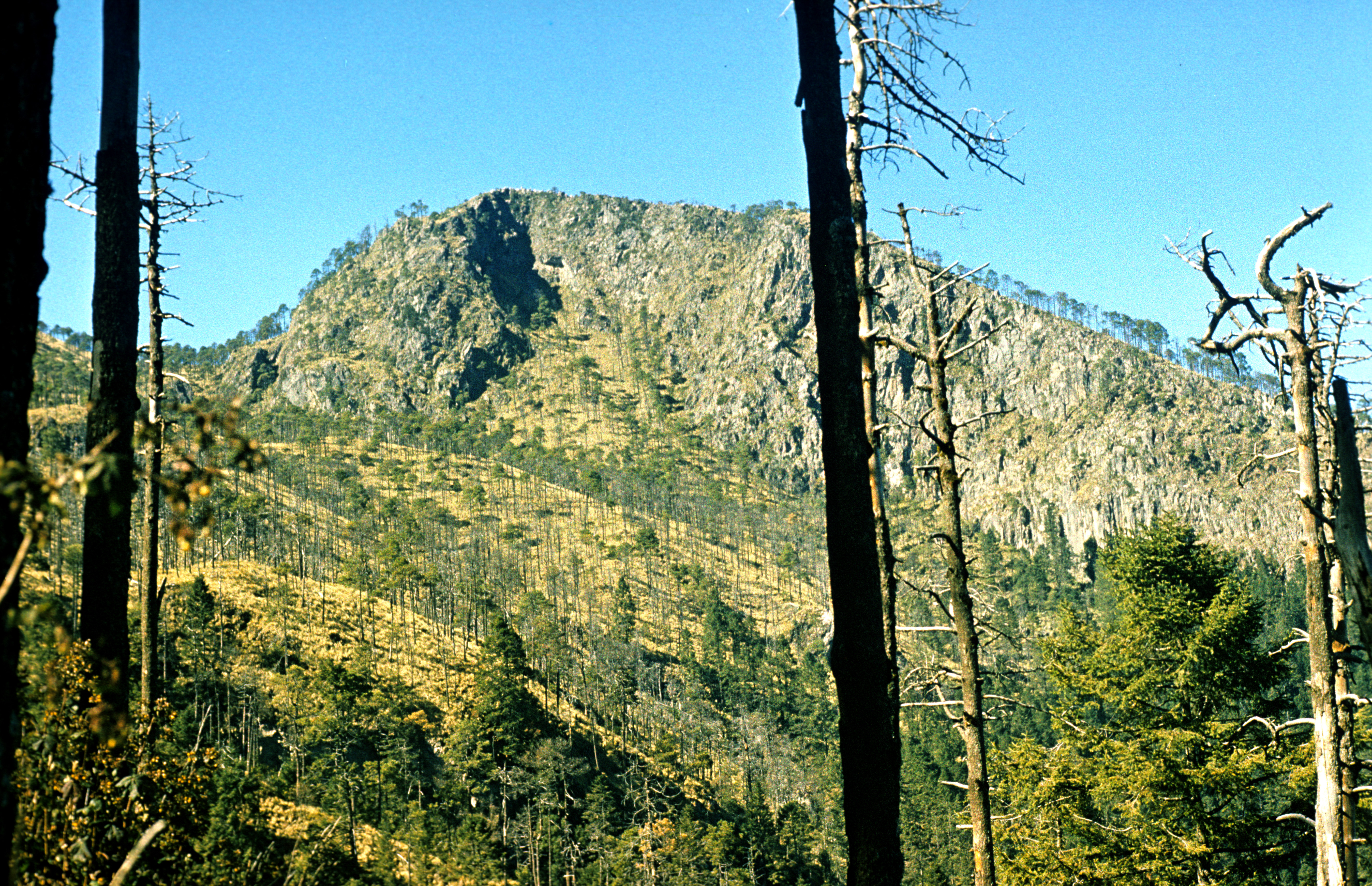
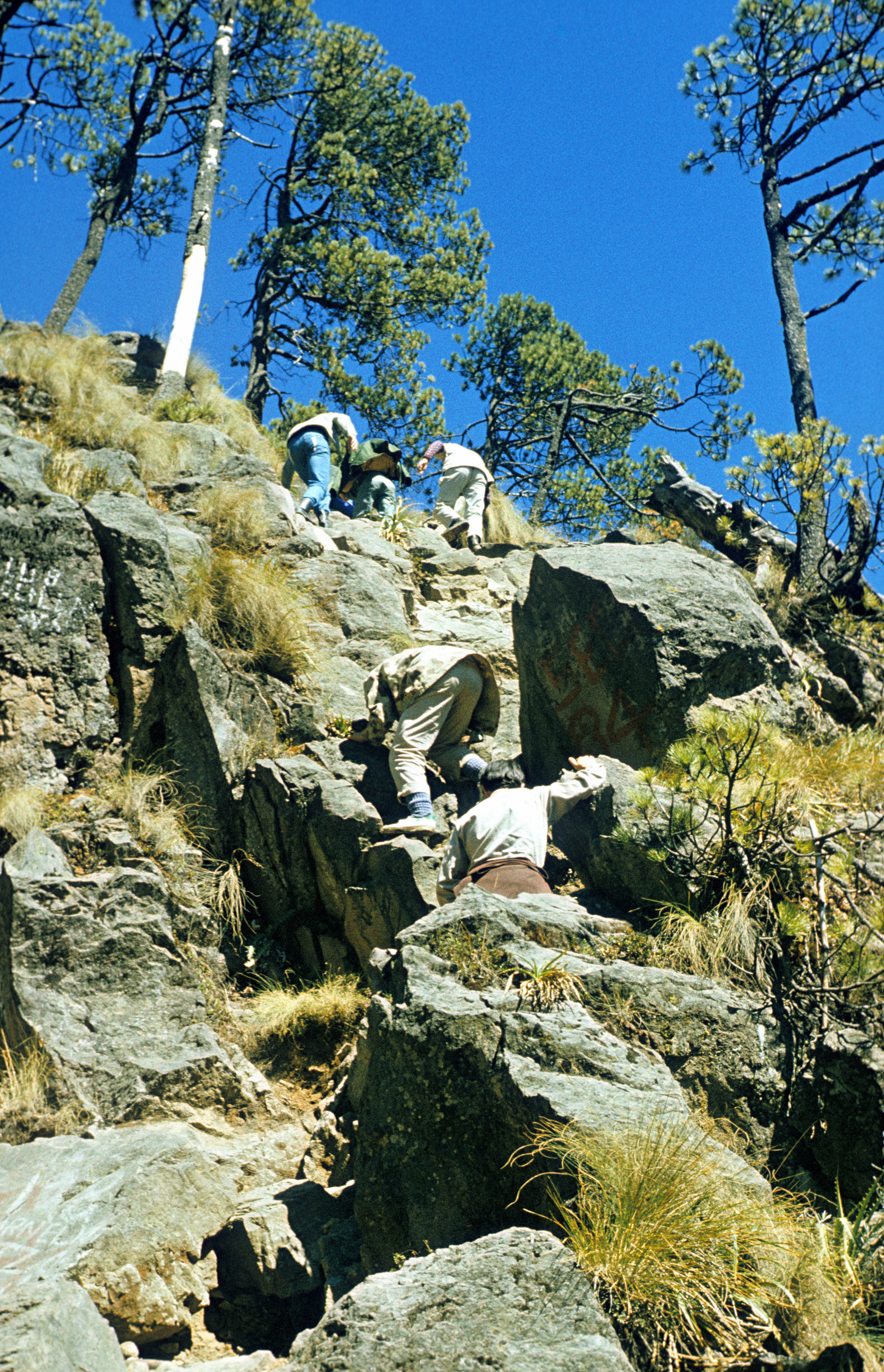 (3986 meters). This is a modest dome covered with forest almost to the very top, at the southern rim of the Mexico valley. The picture shows the second highest peak of the massif, Pico de Aguila, with an easily accessible rock on top -- it is more interesting to climb than the highest peak, Pico del Marquez , which is a gentle broad grassy dome. (I climbed Pico del Marquez, too, but no view from there was worthy of a picture.) Offers nice views of Popo (right) and Ixta (left) (myself in the foreground, in December 1977), and also of Nevado de Toluca . It is not remarkable for any reason, but, because of its proximity to the city of Mexico, was a convenient training ground to get acclimatisation. Thus it became my sixth highest mountain (chronologically, the first in Mexico).
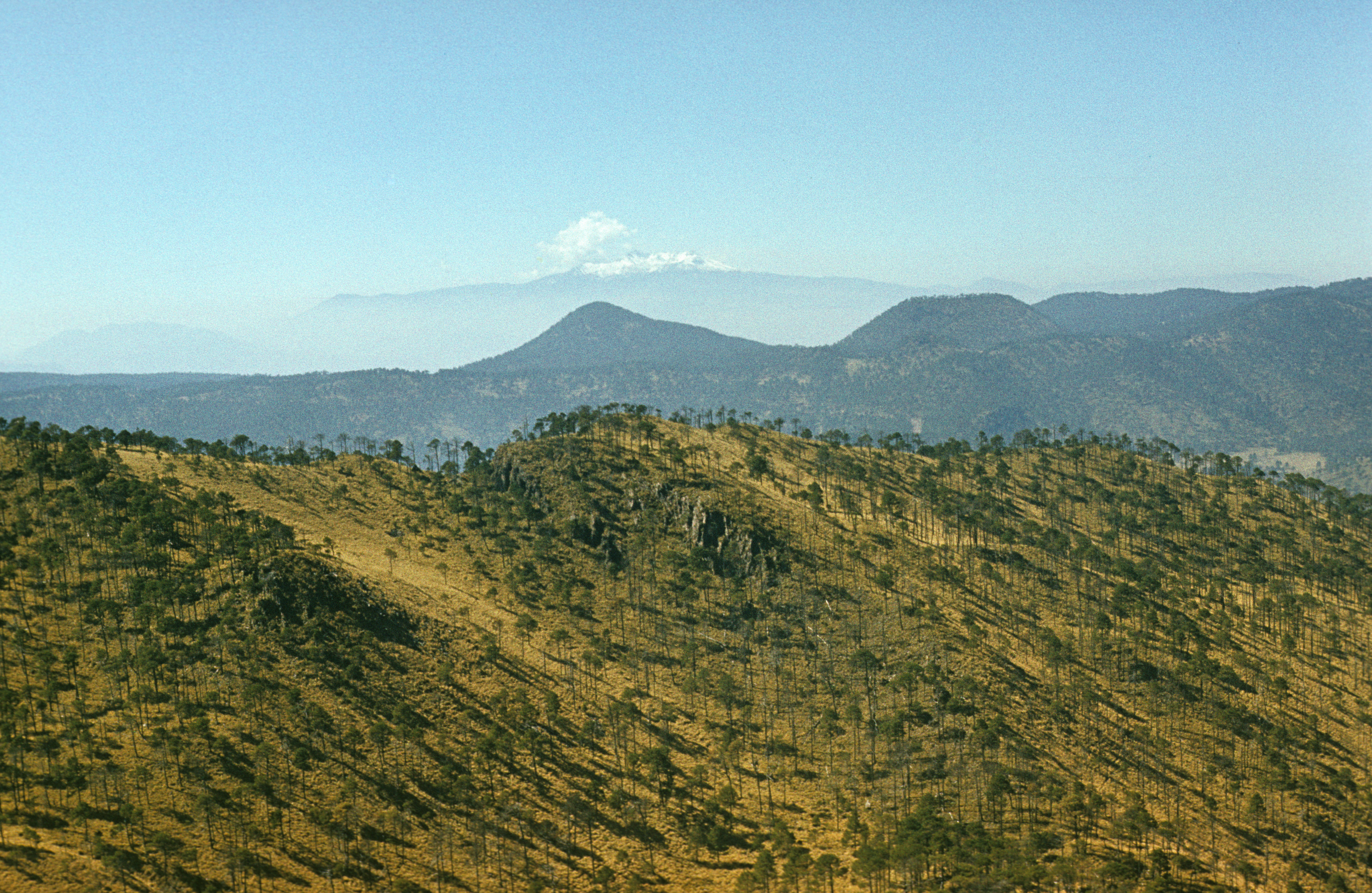
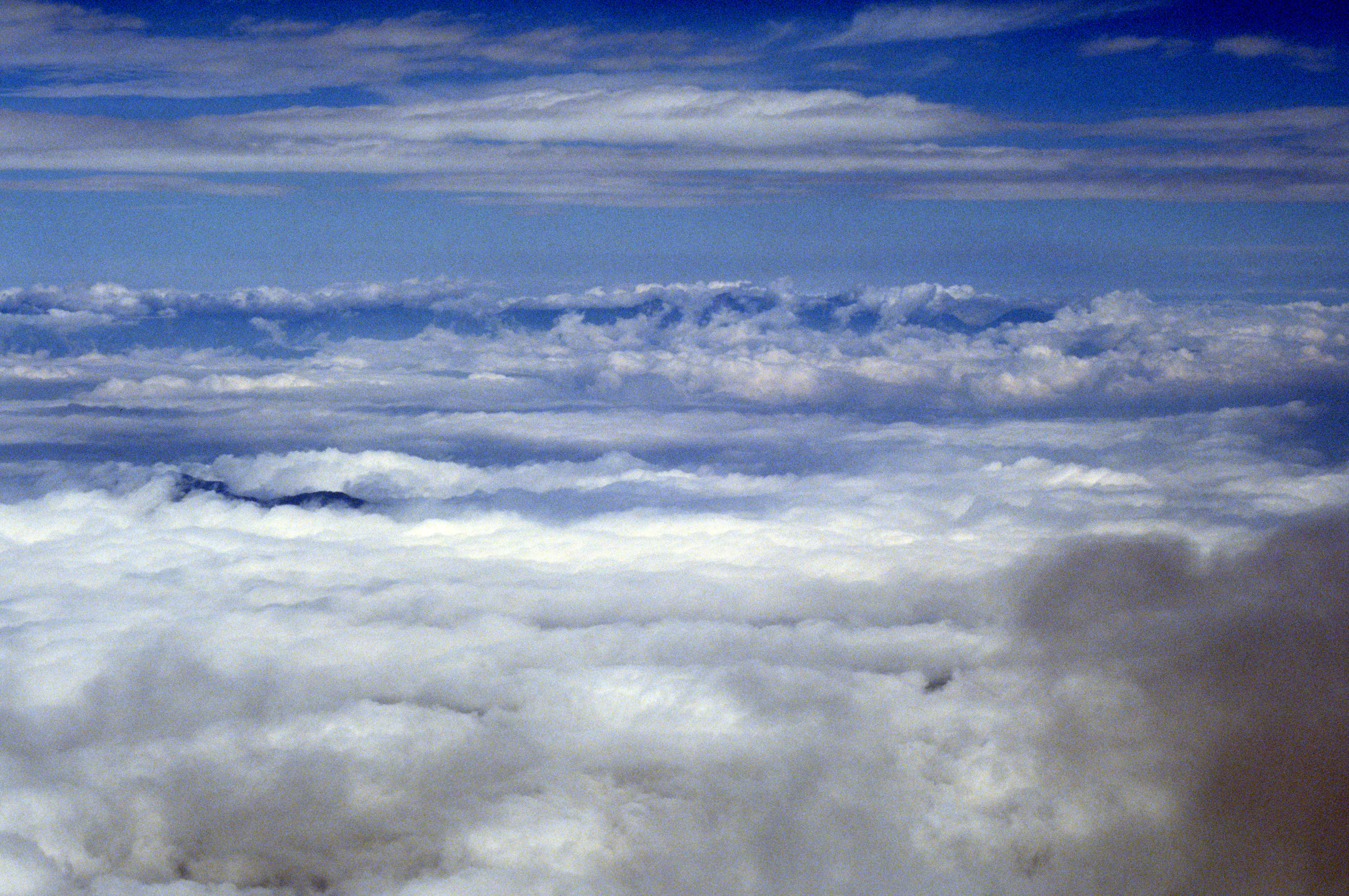
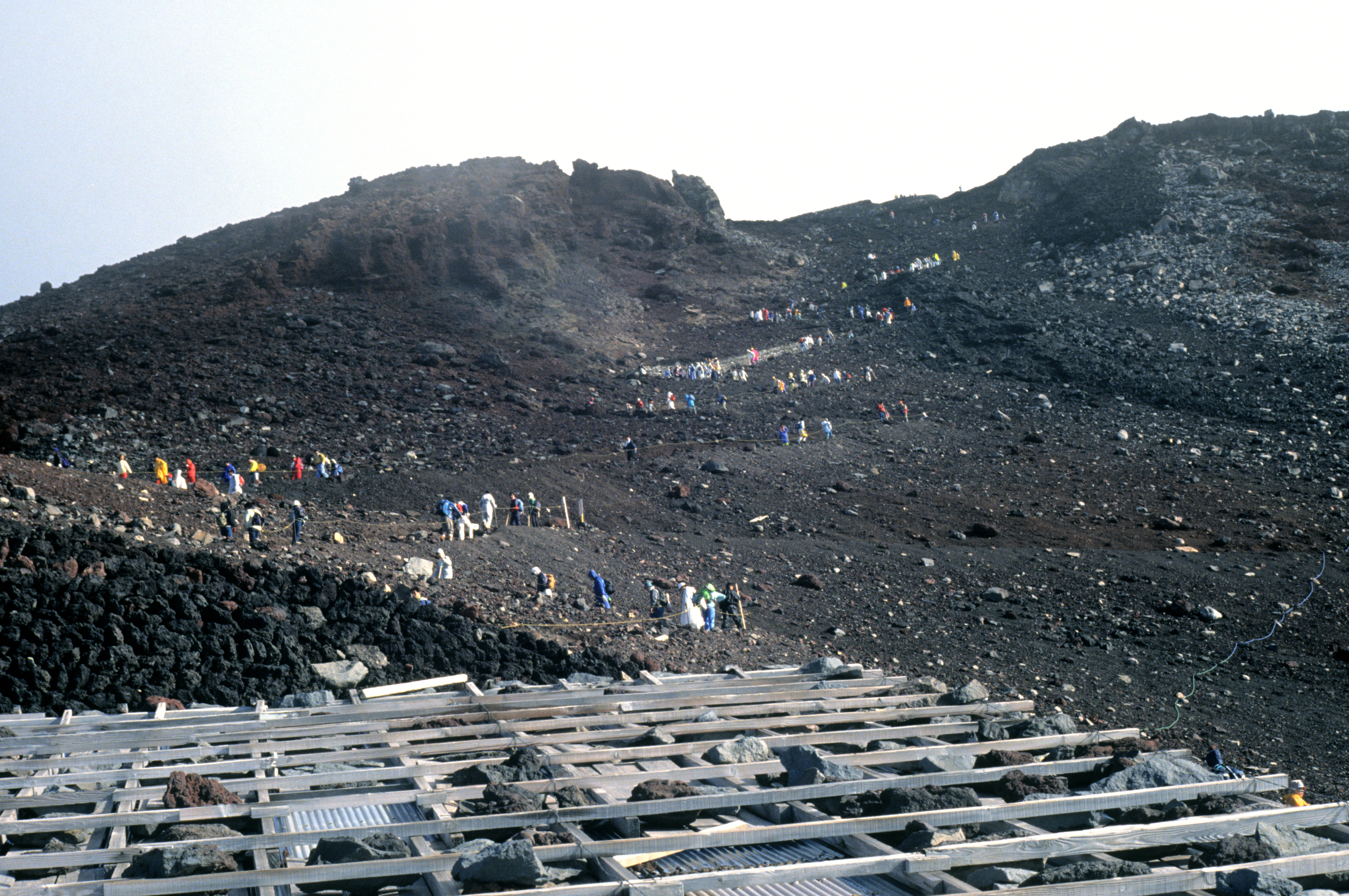
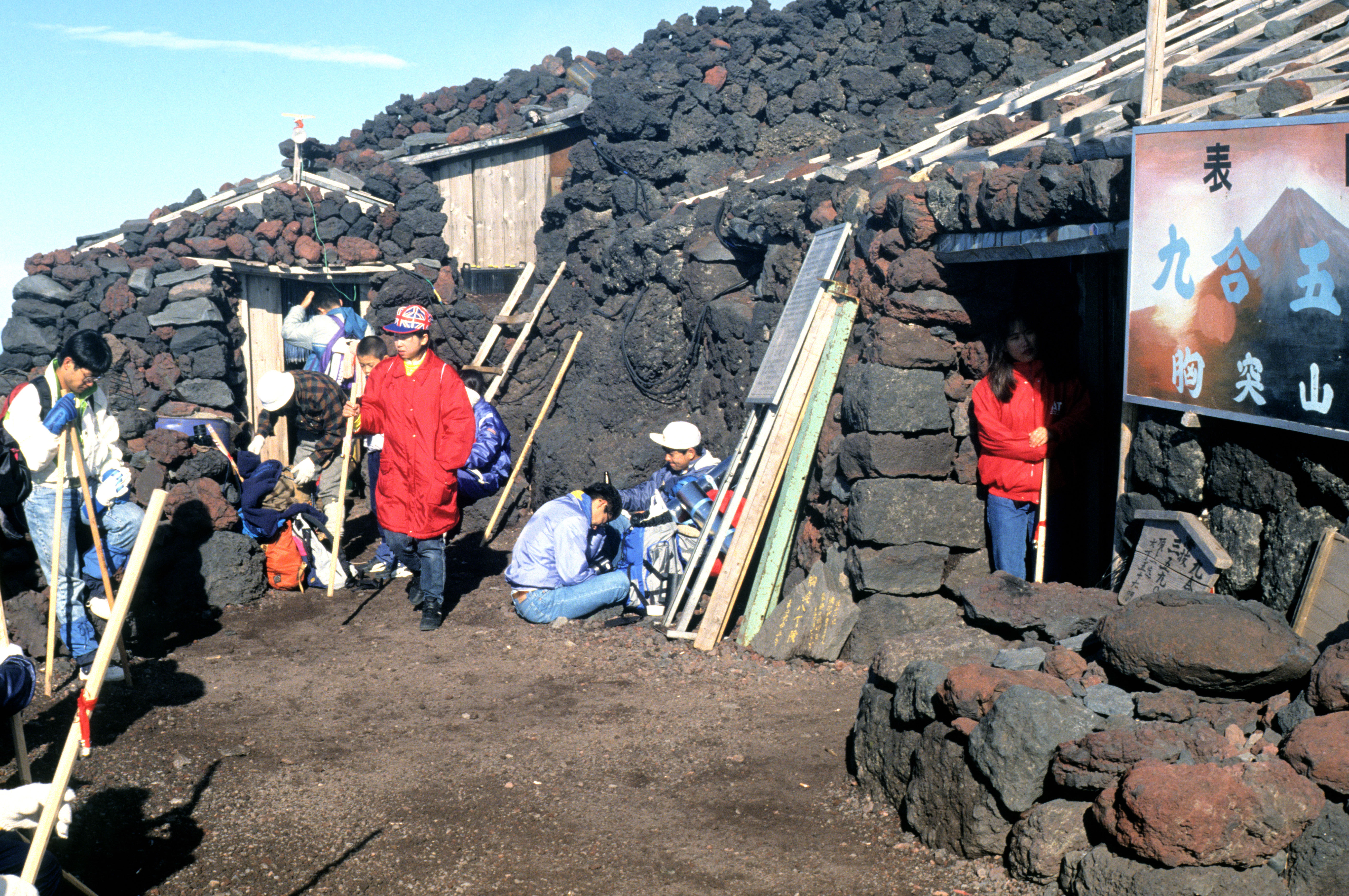
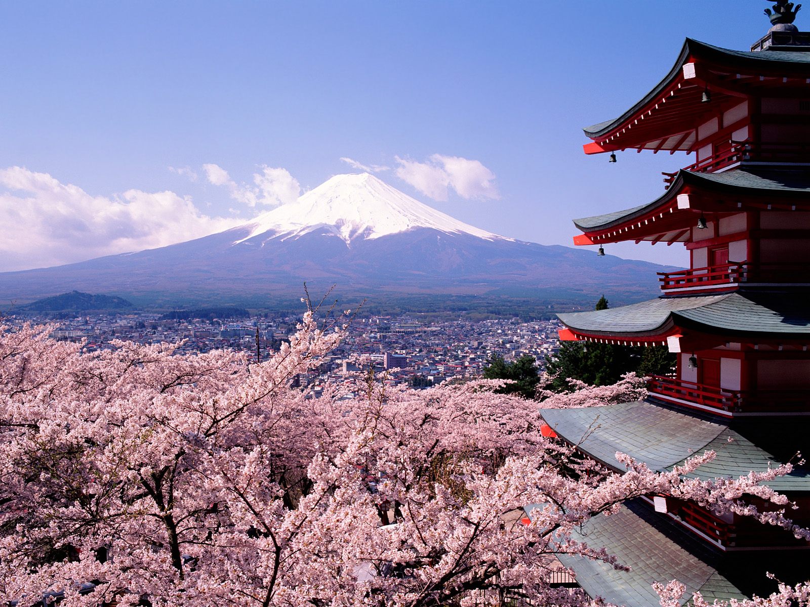 (3776 meters) (picture copied from http://willowsg1.free.fr/WallWorld1/Cherry%20Blossoms%20and%20Mount%20Fuji,%20Japan.jpg). It looks as great as in the picture only during springtime (the cherry blossoms in the foreground indicate that this should be April). During summer, the snow disappears completely, and most of the time the mountain is just a grey shade of a cone (summer weather in Japan is often rainy). Luckily, the clouds mostly stay low, and the upper part of the cone is in the sunlight, even when it rains down below. Most tourists want to get to the top before dawn, to see the sunrise, but it takes a lot of luck to see the ocean from there -- it is usually hidden below the clouds. The last hours and minutes before dawn are freezing! The next best thing to see are the peaks of the Japanese Alps , far to the south-west (seen in the picture far in the back, with some snow on the tops). In order to get to the top before sunrise, many people keep going up during the night. In fact, the procession of tourists never stops (the picture was taken just after sunrise, at the entrance to the hut where I stayed overnight, at the altitude of some 3200 meters). Note the gloomy dark volcanic rock. On the way up, there are many huts dug into the slopes, on different heights, so everyone can find his/her favourite one. There is a sufficient number of places in them, and they are quite comfortable, although the early birds who want to see the sunrise won't let you sleep through the whole night.
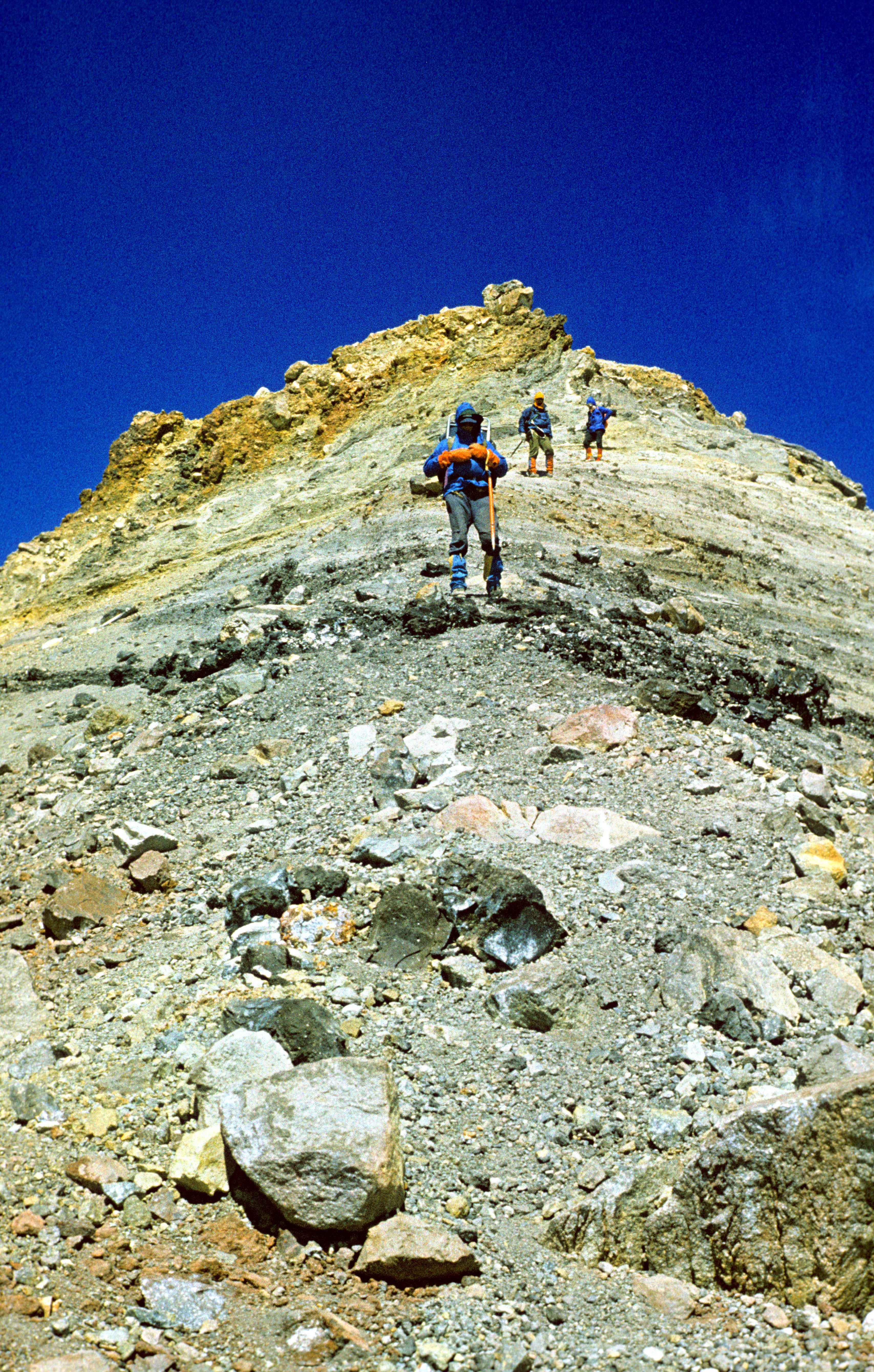
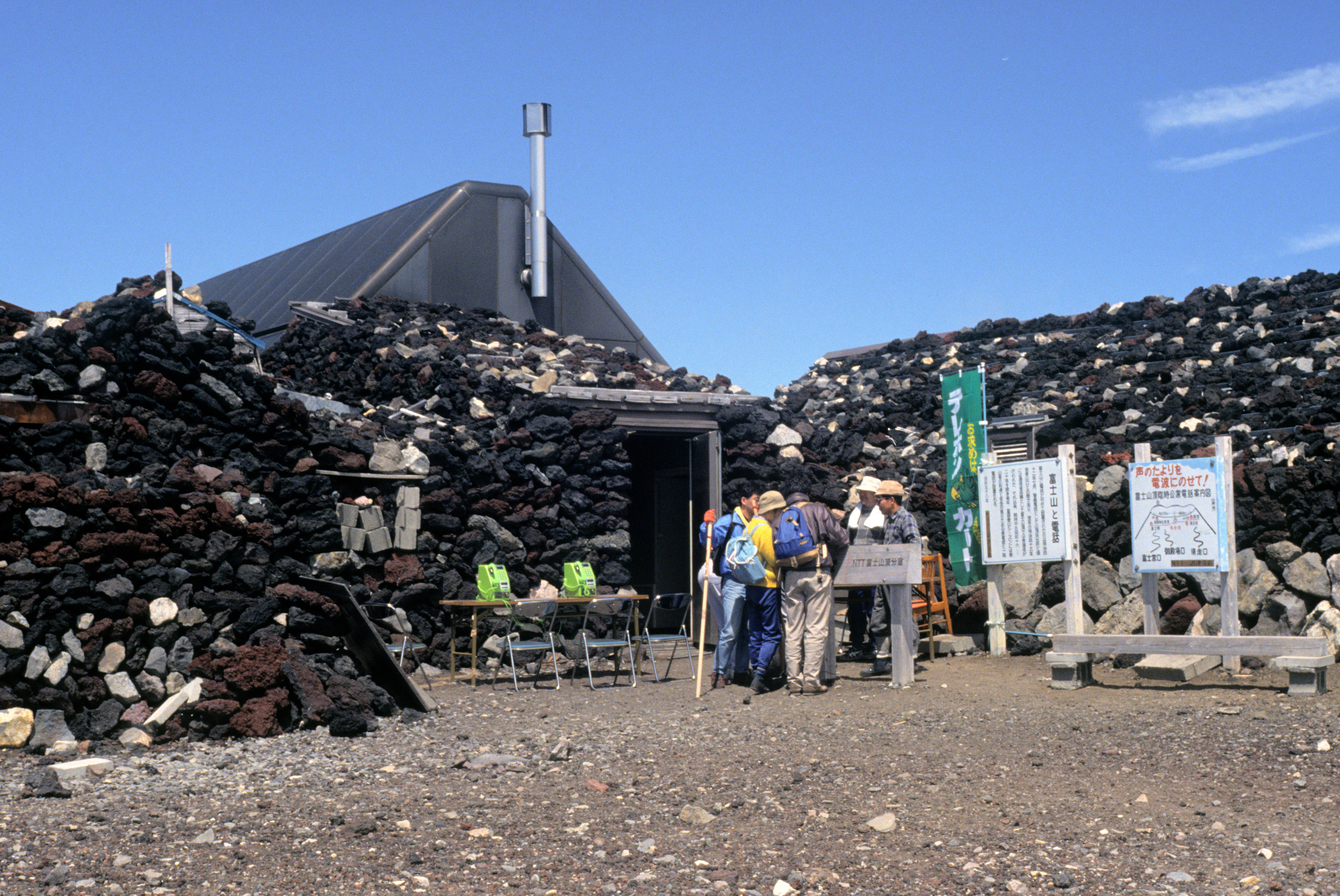
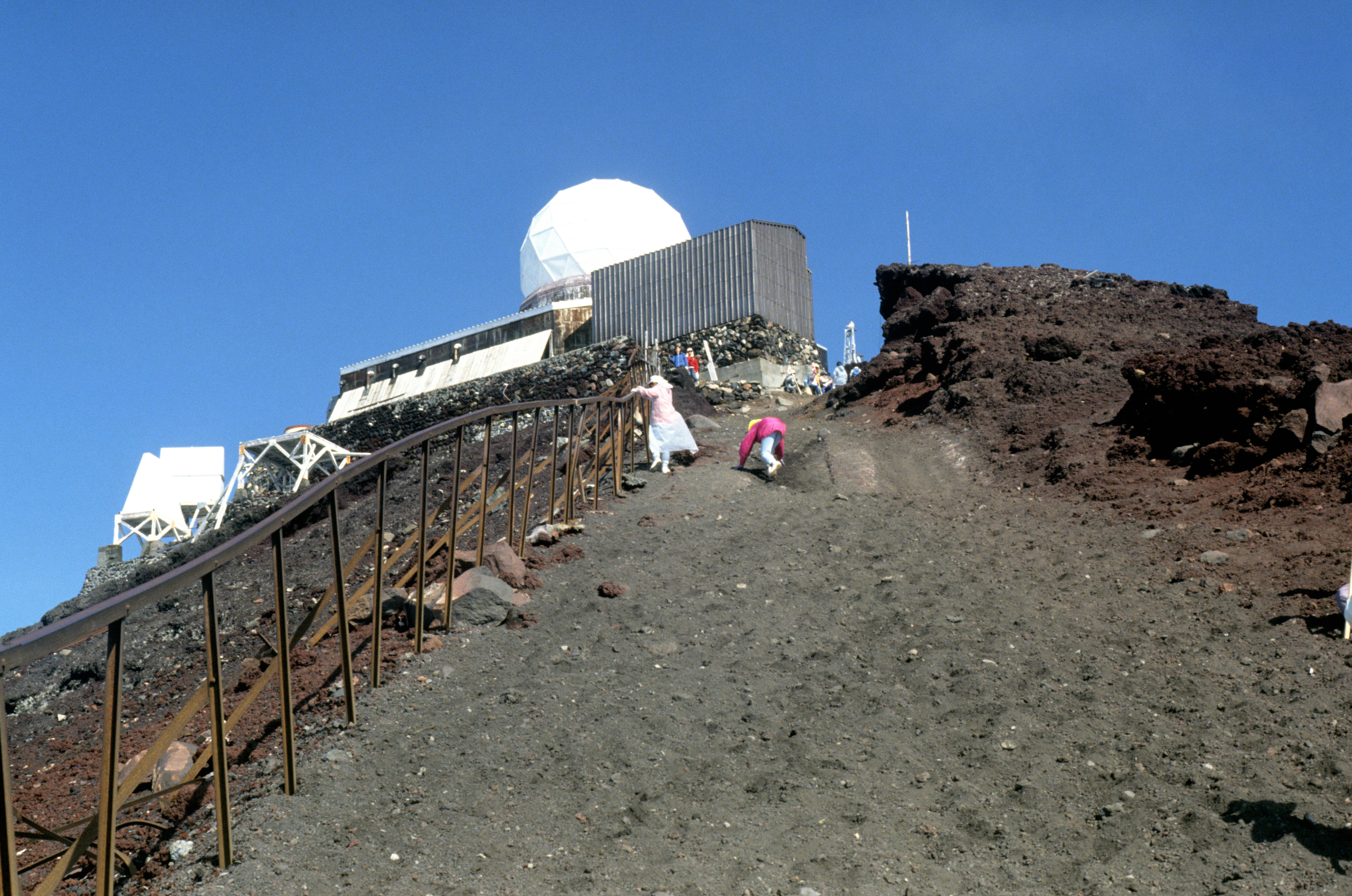
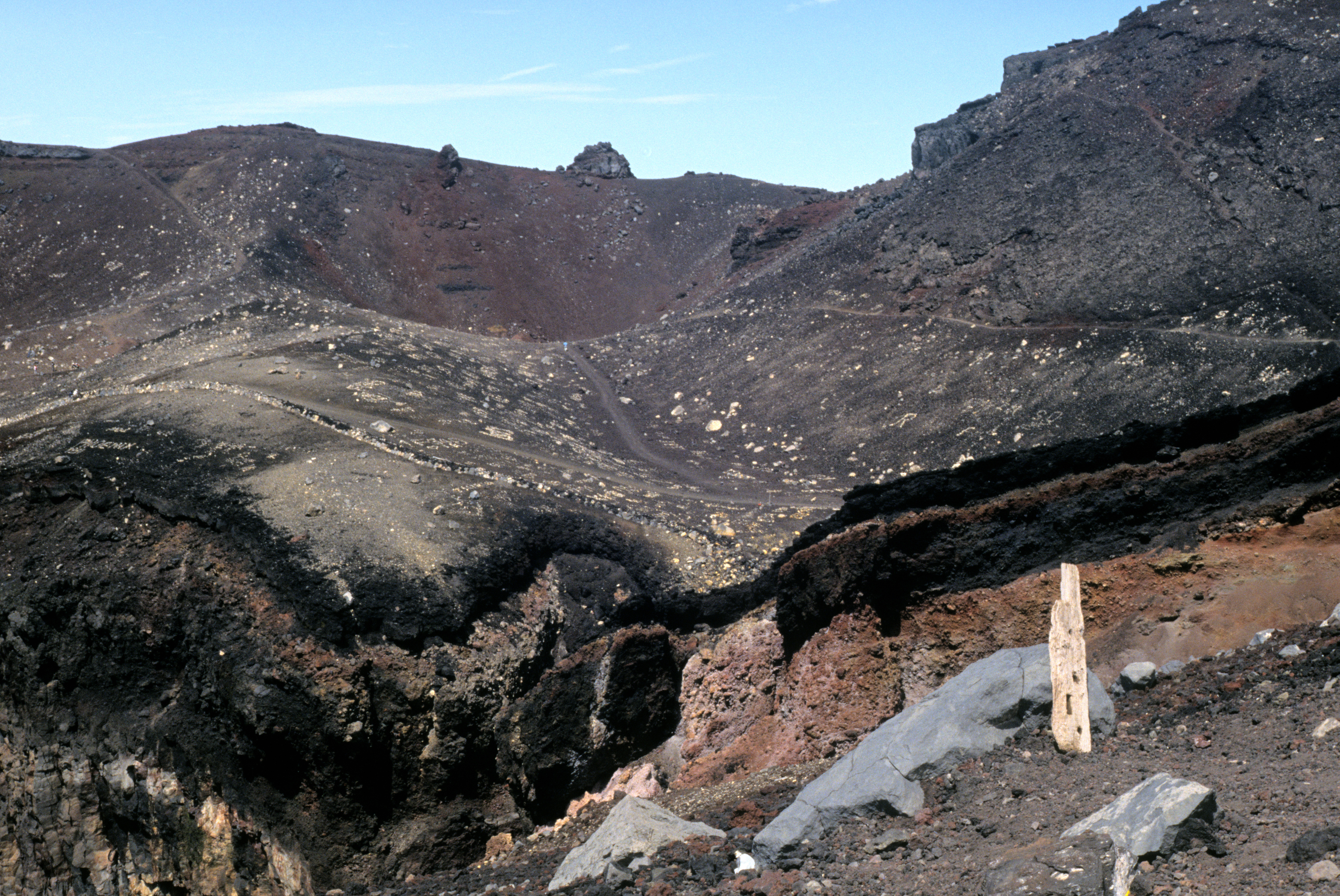
Where the eastern route reaches the edge of the crater, one finds oneself in the middle of something that looks like a village market . Right next to it is a telecommunications center , from where you can call your friends and family to consume the glory of the ascent instantly (note the two green phones in the centre of the picture). The highest point of the crater rim (on the south edge) is crowned with a meteorological observatory that offers an interesting view of the crater . It looks a bit similar to the upper surface of a candle, in which the stearine has been partly melted and burnt out, so that there is a deep hole in a smooth upper surface, here is the view from the north side of the crater. The crater is not very deep (200 meters maybe) and its inner slopes are not everywhere steep, so its bottom should be accessible. However, I was not sure if I had enough power left to climb back out on the loose rubble, and no-one of the crowd of tourists tried that, so I was afraid that going down might be a sacrilege (Fuji is a sacred mountain of the Japanese). Thus, I did not do it.
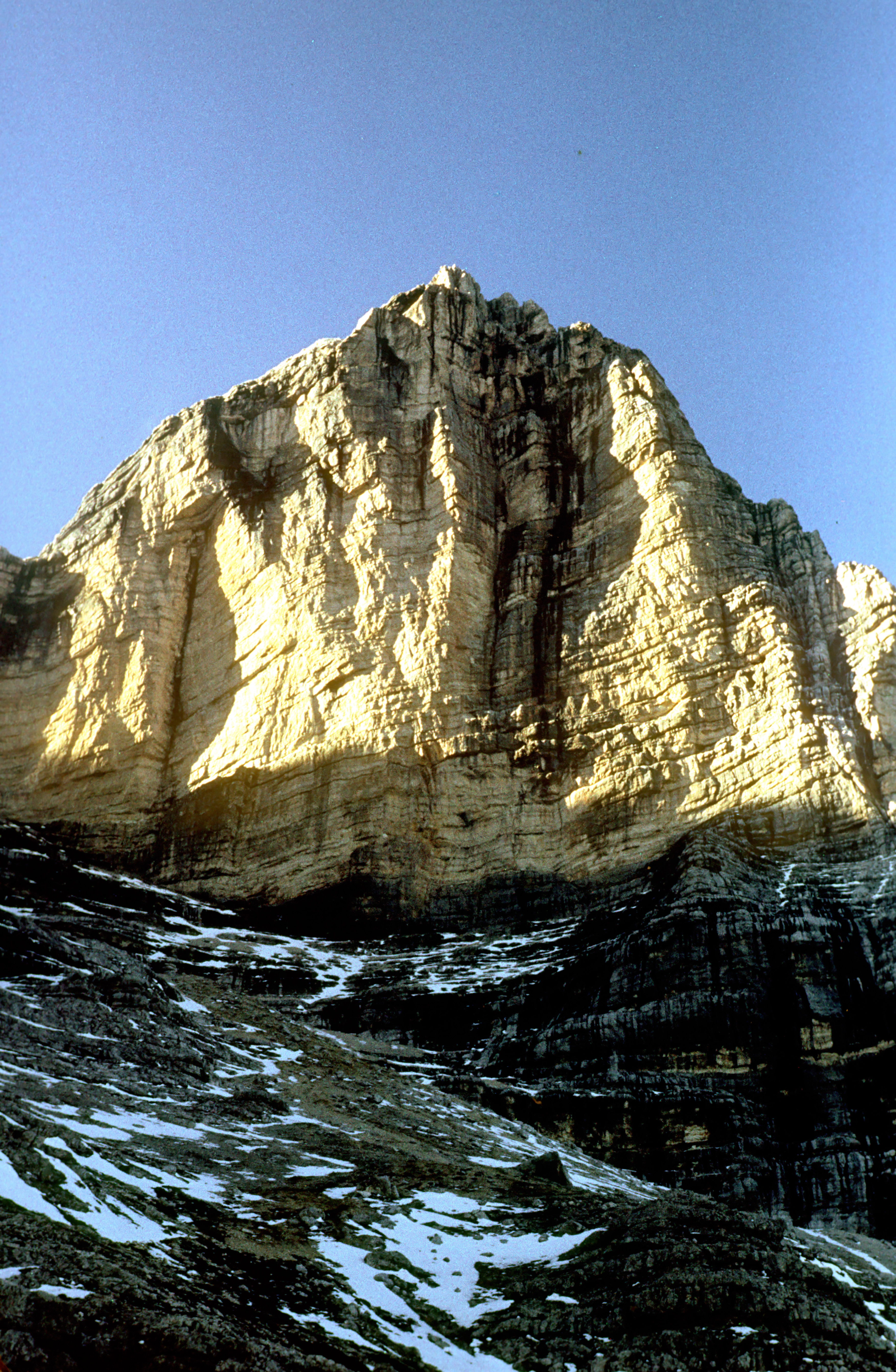
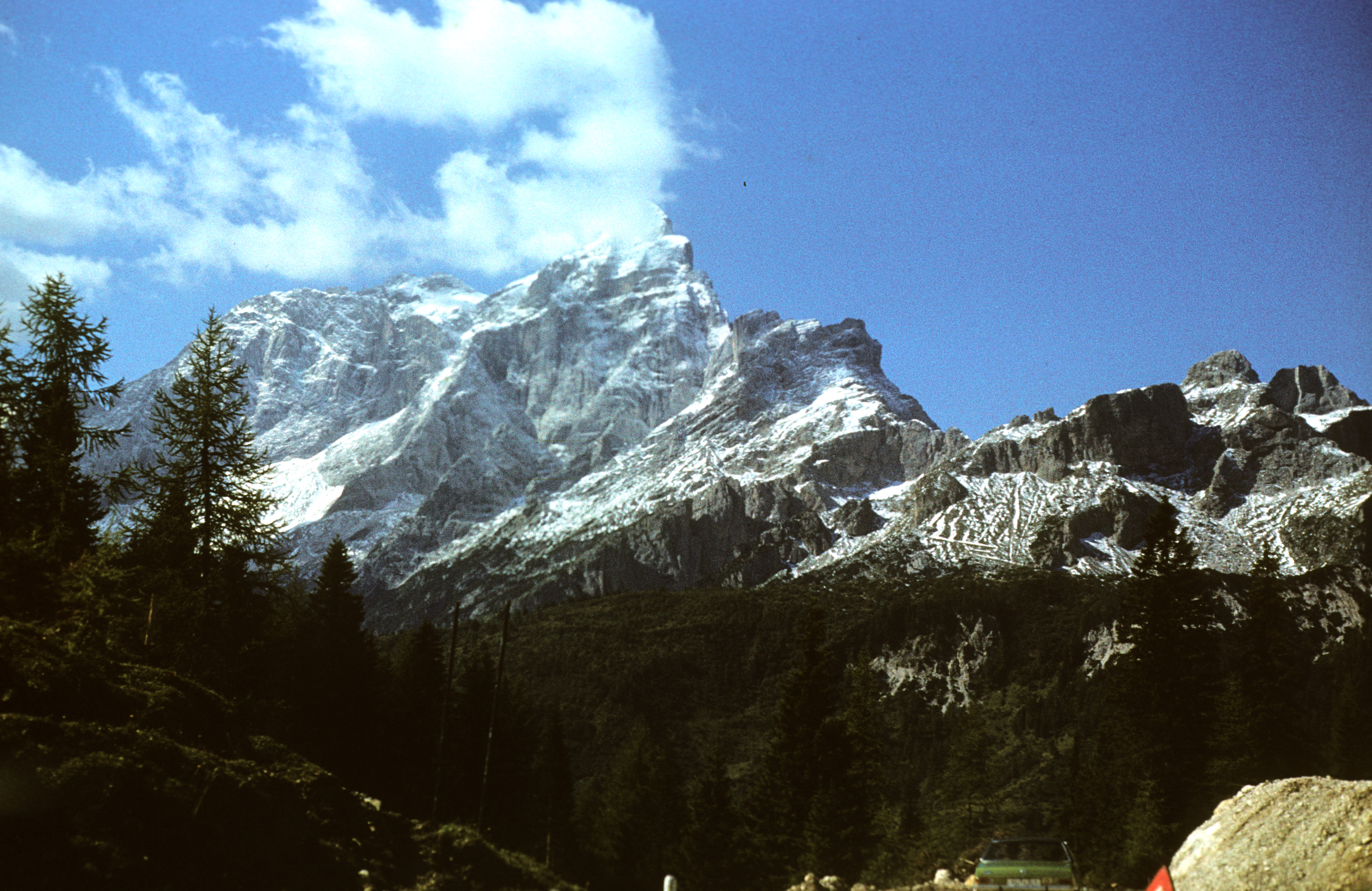
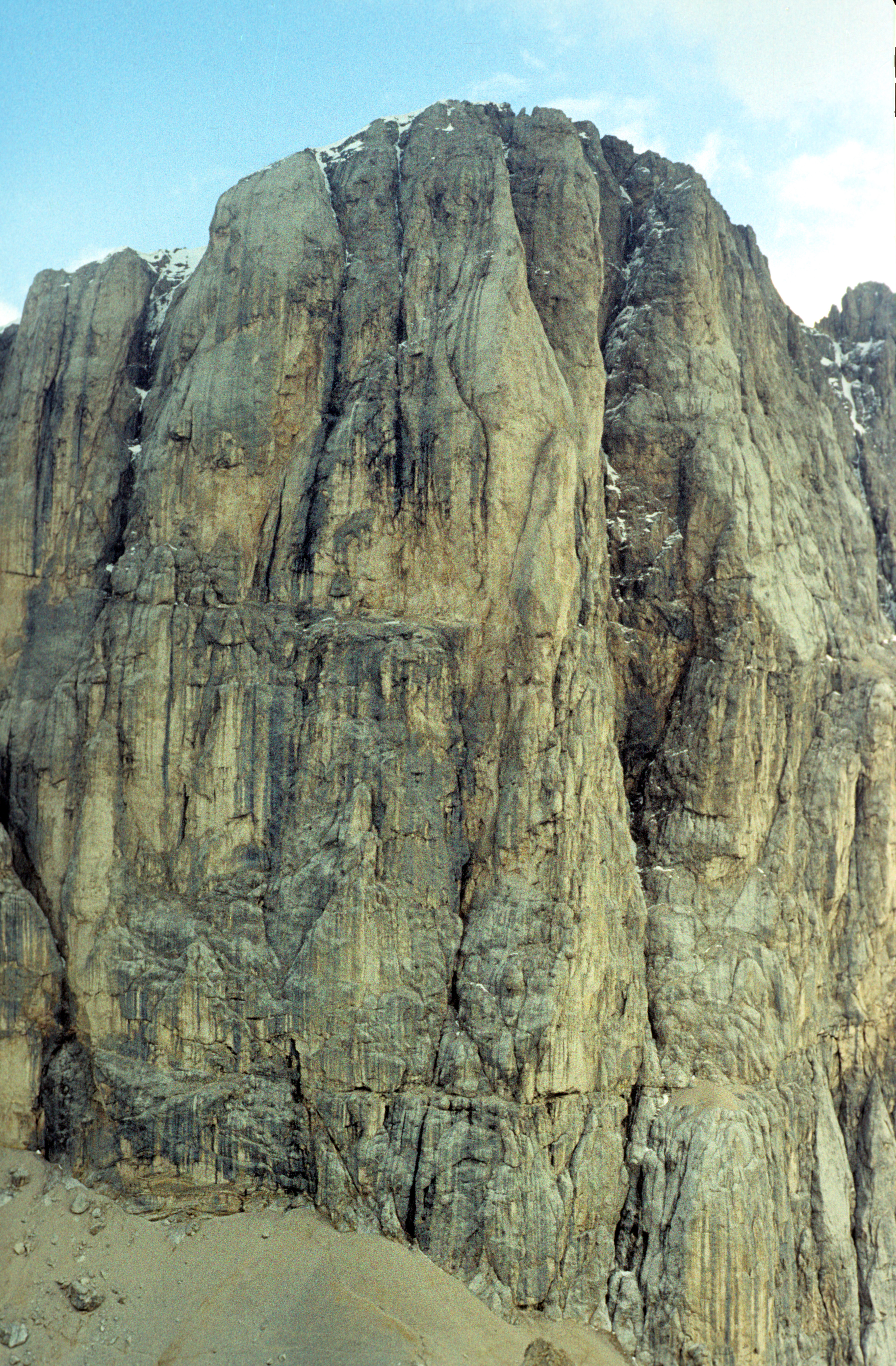
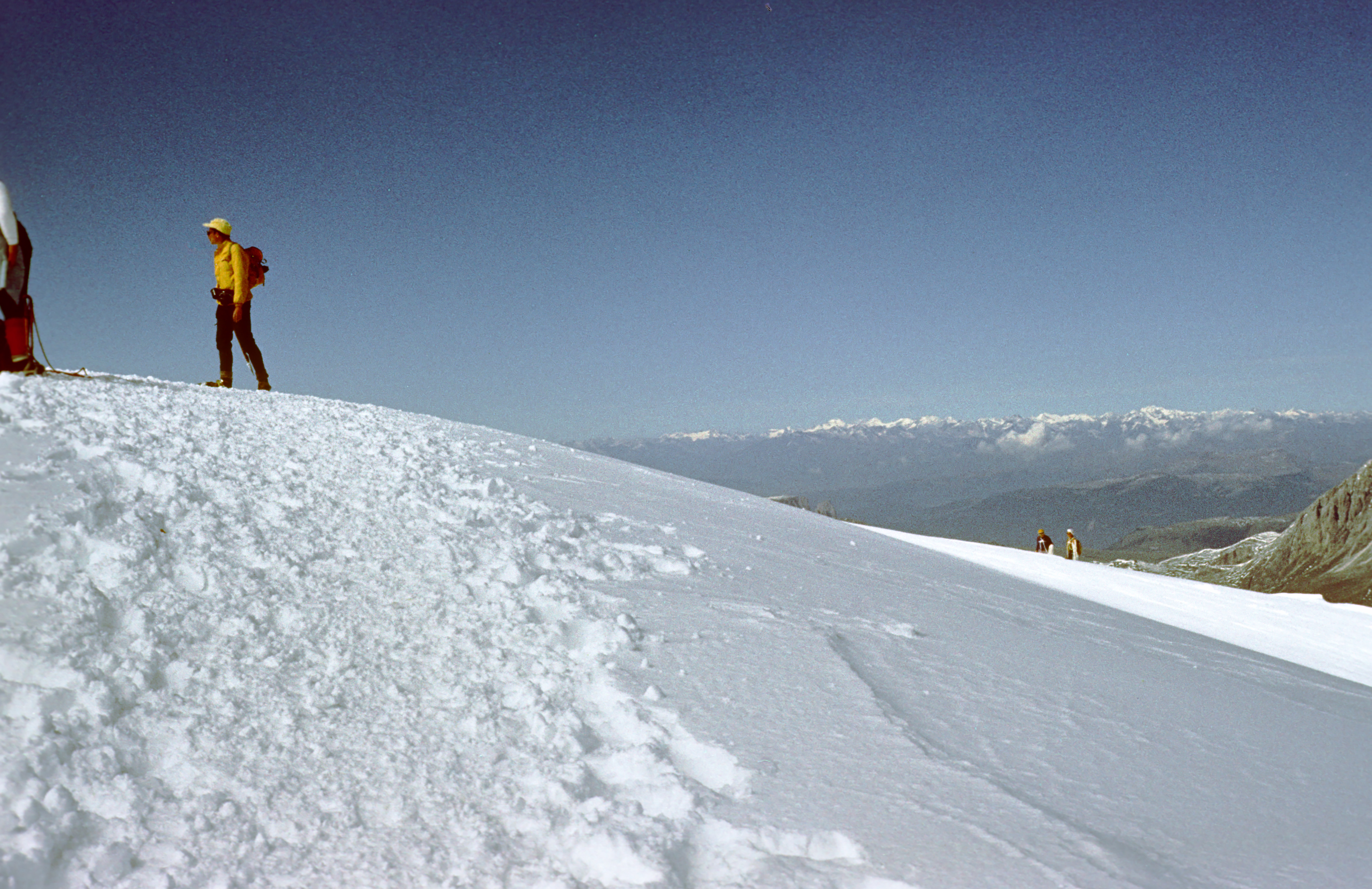
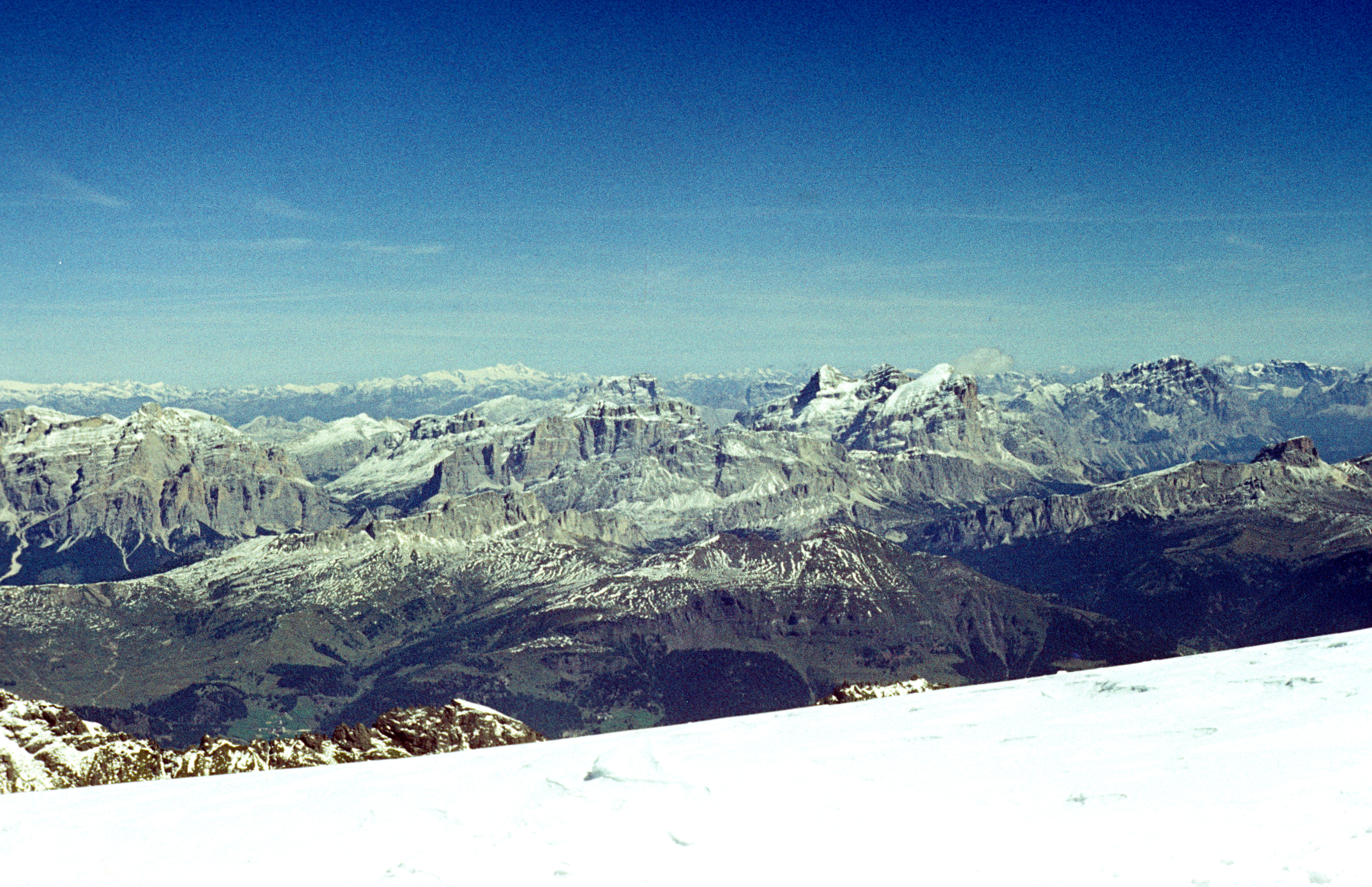
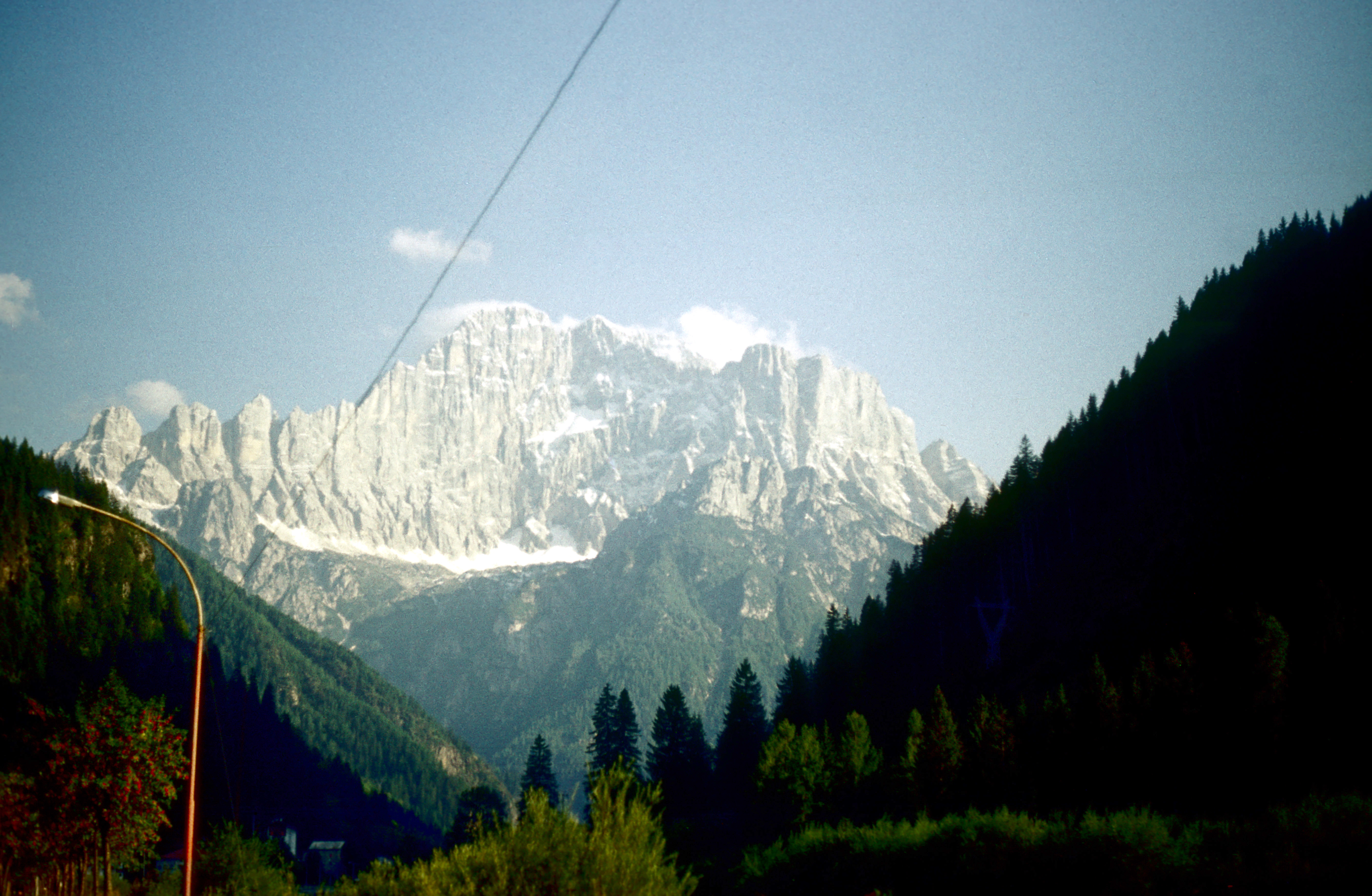
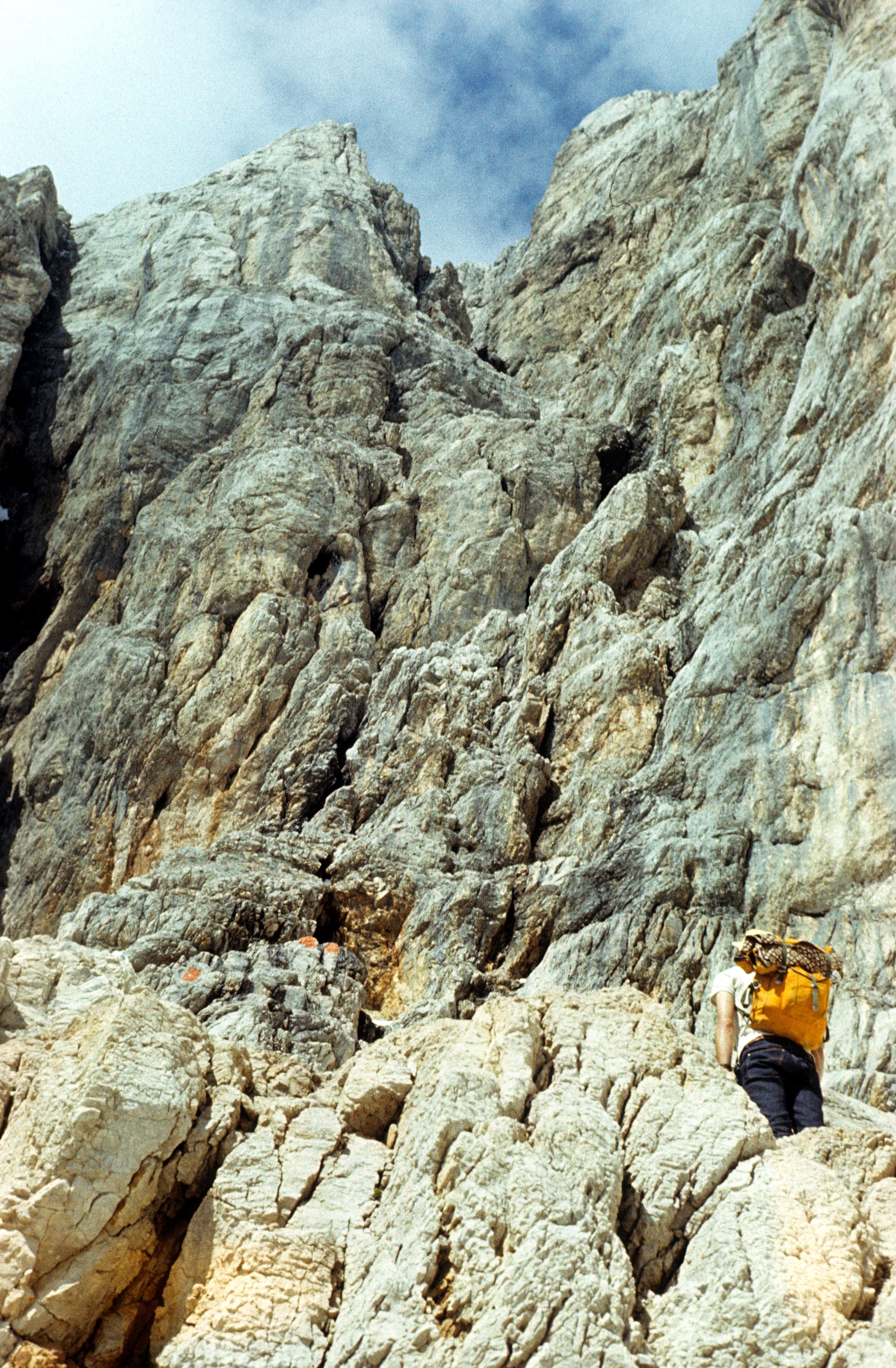
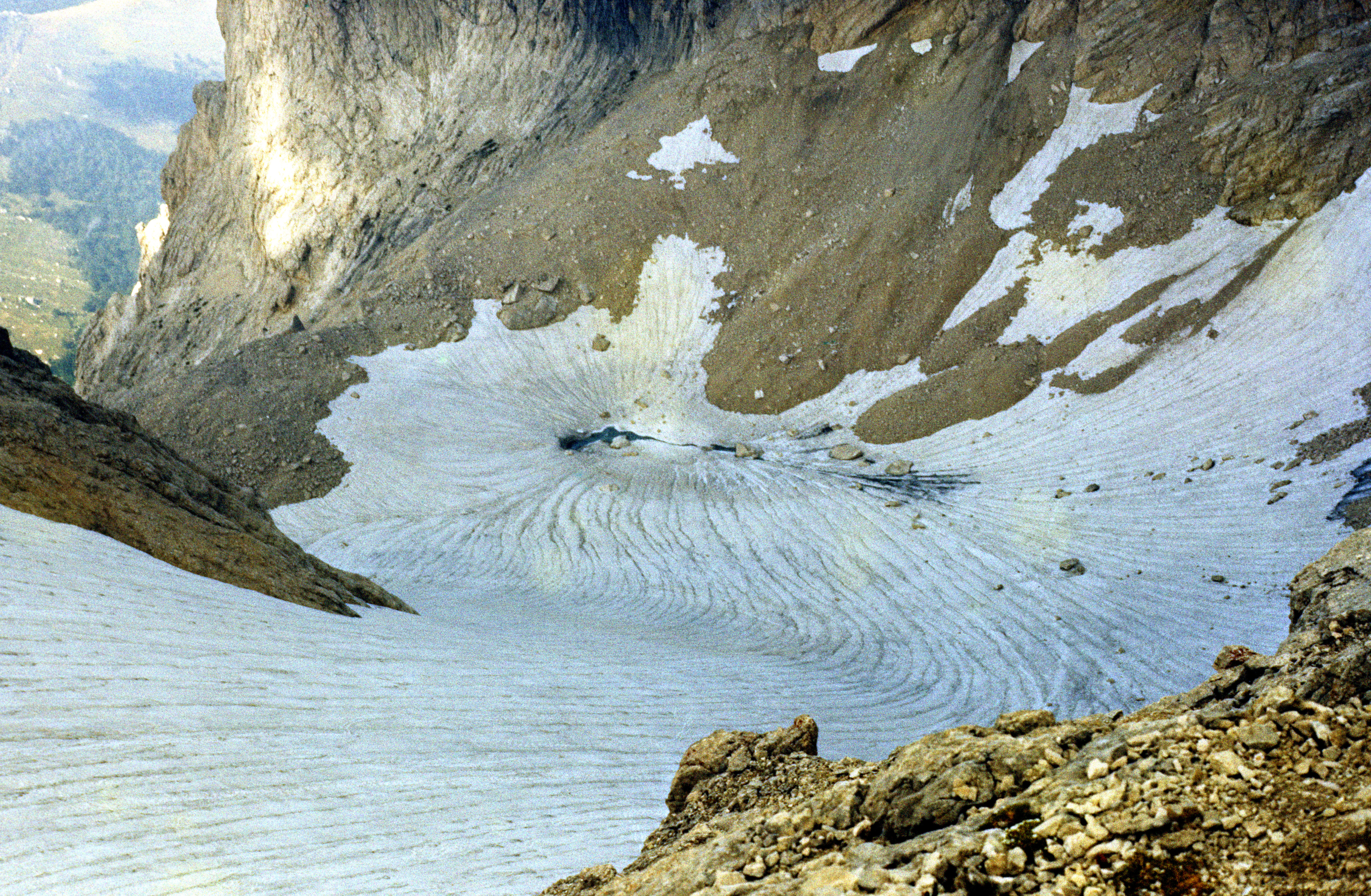
 (3344 meters), the highest peak of the Dolomites -- an Alpine range in northern Italy (the main peak Marmolada di Penia on the right, the secondary peak Marmolada di Rocca (3309 meters) on the left). Dolomites are popular among extreme climbers because of their smooth vertical rocky walls, such as the south face of Marmolada di Penia (picture taken from Cima Ombretta di Mezzo). However, they offer many interesting routes also for ordinary hikers. Marmolada is the only mountain in the Dolomites that has a fully developed glacier . The other Dolomites glaciers are rather inconspicuous -- small and so thin that they seem to be transparent. The photo shows me and my friend and companion of many hikes, Wies³aw KuŸmicz, on our ascent. The route crosses a few crevasses , then goes up a rocky gully (quite easy, as for the Dolomites at least), and finally on a smooth snow ridge to the top, which is just a broad dome covered with snow. The views from there are fabulous, at good weather you can see for tens of kilometers. In the center of this picture you can see the Grossglockner (3797 meters), the highest peak of Austria, some 90 kilometers away. The snow-covered peak 1/3 of the way from the right edge is Tofana di Rozes (3225 meters), another beautiful mountain popular among climbers and tourists.

