When dinosaurs roamed the Earth, at the location which are today fields under Kolan, there was a lake. Sediments of its bottom are today visible as coal layers under the ground. At the coast towards Velebit, 3-5 km away from the mine, one can find edges of the lignite layers:
In the fields under Kolan there were lots of open pits. Since there were no other coal mines nearby along the coast, it was used by private people and small companies. Factories along the coast north and south (e.g. Maraska in Zadar) were using it and coal was also transported further. In the village memory it is remembered that at the time of Napoleon occupation there was an unbroken line of mules from the mine to the Rogoza bay, where the coal was embarked and carried away.
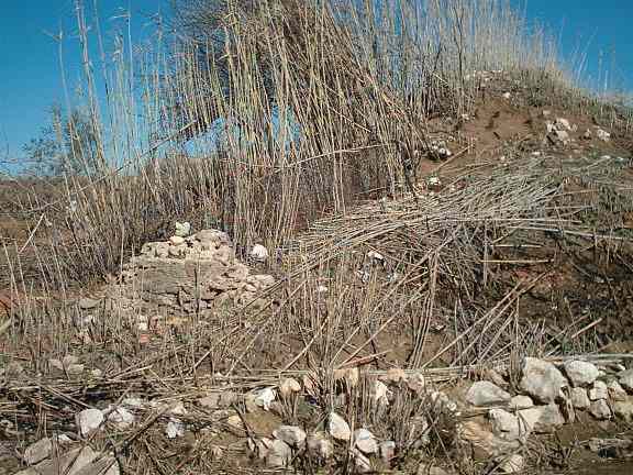
Of all of this, today are visible only piles of rubble taken out from the pits to reach the coal. Following the final closing of the mine after the WWII, pits were filled and closed because of the danger for people and cattle, and some small holes were used as garbage holes.
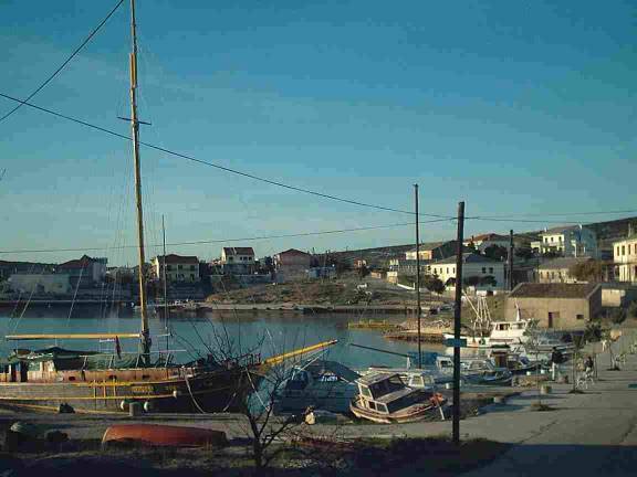
At the end of XIX ct., German (or Austro-Hungarian, the name of one of them was Gustav Hermann) engineers who worked previously in Suez, came to Kolan and organized a coal-mining company. They built a narrow-track railway across the fields and hills for the coal transport to the nearby small port Simuni. In Simuni there is a deep fiord ('Gaz'), and bigger ships can enter, which could not fit in the shallow Rogoza bay which was easier to reach down the Kolan fields. In Simuni is today an ACI marina. Here is my picture of this coastal village at the beginning of the Millenium:

Railways were for the Austro-Hungarian monarchy of the same importance as the Roman roads for the Roman Empire. So it not surprising that they entertained plans for a trans-coastal Adriatic railway. This would go from Trieste, the most important Austrian harbour, to Boka Kotorska, the most important strategic bight for the Monarchy, a location of it's Navy. From Trieste to Rijeka (Fiume, built by Hungary as its harbour, and connected to Budapest by the railway) the coastal railway would go through Istria peninsula, as it is today. From Rijeka it would go to island of Krk (then Veglia, in Italian) by ferry, and the same further, to Rab and Pag islands, where from it would go accross the bridge (actually built 70 yers later, see the main page here, but for cars, not trains) to Zadar (Zara). The coastal and island part was never realized. The line would furtherm go along the coast to Sibenik and Split, as it goes today, and then to Dubrovnik and Boka. Wet dreams of the dying Monarchy! But, completely unrelated to Monarchy's plans, Kolan had its 6.5 km of railway.
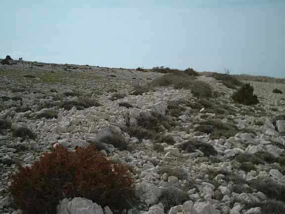
Traces of the Kolan-Simuni line are still visible in parts of the embankment and two bridges, one in ruins and another still complete:
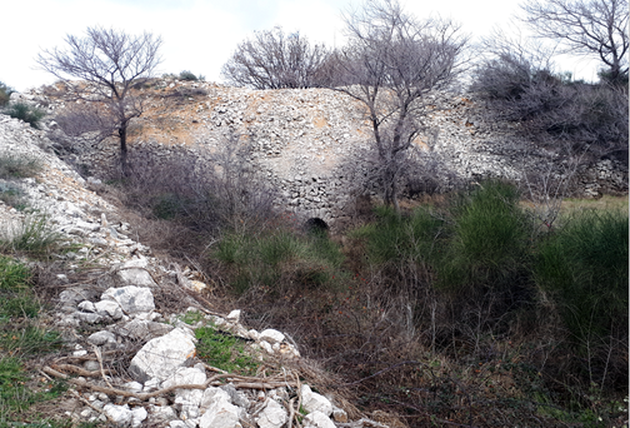
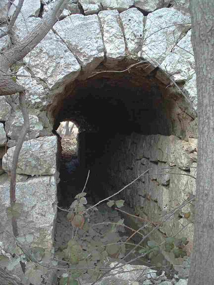
Under the preserved bridge there is a well built tunnel, with the year of the construction, 1909, inscribed above the entrance:
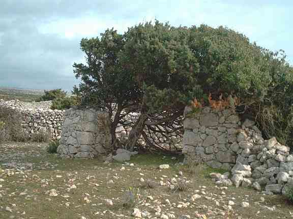
Where the railway was passing through the pastures, operator was opening and closing the door:
After the 1st World War the mining company was sold to the Italian "Sozzia Roma" ("Society Roma"), and in 1919 the railway has been changed with a cable-rail, so the railway was in use only for 10 years, 1909-1919. Remains of this cable-rail, the columns (used as a support in the roofs, or as the fence columns in the fields), and various metal parts can still be found in the pastures and fields. It is harder to find any traces of it in the terrain, and (surprisingly) there is no pictures or contemporary drawings of it for more proper documentation. I hope to find some of those-this is one of the motivations for this page, to collect material.
At the end of 1920s, the Italian company ceased to exist, but exploatation of the coal-mine continued privately, without a railway or cable-rail. Ox transport and later one truck on vater vapour (or gas from the burning wood?, still not clear data about it) were used to transport the coal down to the Sv. Duh beach, and then to the mainland, via Karlobag. Molo re-built in Sv. Duh camping site around year 2000 is a reminescence of the molo for the coal transport barges. After the WWII, the coal mine in Istria, in Rasa, was opened, and Kolan coal mine was not interesting any more. Locals-including my grandfather-were still digging and selling it for the few years.
Today, nor coal-mine, nor cable- or railway existence are known to the most of the people visiting Pag island. It is not marked in any way. Even lots of the local people do not know about their existence. However, it is an interesting-and surprising-addition to the thoughts about the pitoresque landscape of Pag. When I first heard about it at the end of the XX ct. I decided to include it in my webpage-which, at about year 2000 actually showed to be one of the first webpages about Pag island and, as far as I know, the first about Kolan. This first version about the rail was first_kolanrail.html
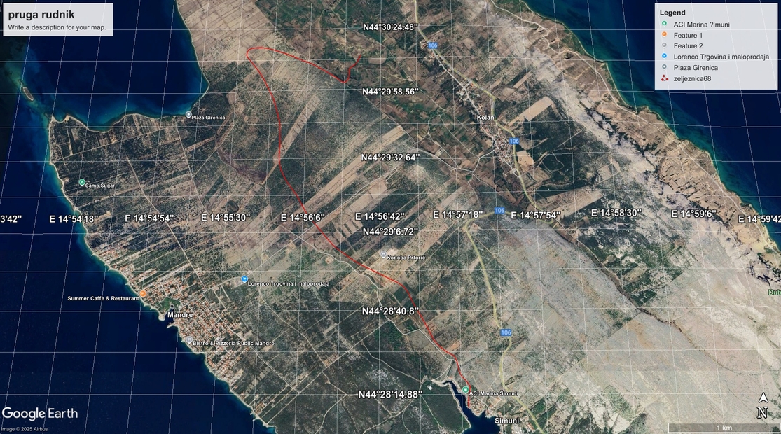
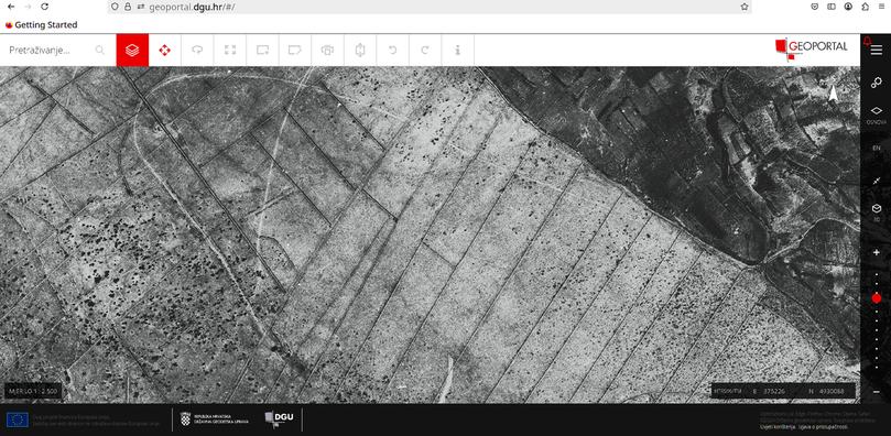
It showed to be harder than I expected to find the complete track line.Pastures, buildings and roads intervened. From the Kolan fild upwards the hill the railway line was still visible, but from the southern side, only small patches remained. In the April 2025, my Kolan neighbor I. G. pointed to me the photographic record from 1968 on geoportal.dgu.hr, where the railway line was still well visible-thanks to the lack of development and vegetation. It is incredible to see how much of vegetation (mostly somina=Juniperus phoenicea, locally called "sobina", probably because of similarity to the similar Juniperus sabina) covered the pastures which at 1968 were mostly bare stone.
Here is the screenshot of the highest part of the railway, visible as the bow-shaped curved line, where the tracks changed the direction after reaching the top:
Up to my knowledge, the thin red line I made is the first detailed reconstruction of the path of this railway line through the pastures towards its end in the harbor: